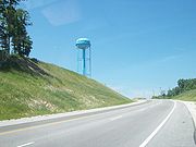
Kentucky Route 101
Encyclopedia
Kentucky Route 101 is a north–south highway traversing three counties in South Central Kentucky
.
near the community of Rhoda in Edmonson County
.
A little over four miles (6 km) from its beginning, KY 101 passes into Warren County
. It cojoins with U.S. 31-W
for less than a mile before splitting on a southern course that takes it through the center of Smiths Grove
. Just south of Smiths Grove, KY 101 intersects with I-65
at the Exit 38 interchange.
KY 101 then continues on for less than a mile before intersecting with the cojoined U.S. 68
/KY 80.
Shortly after passing through the Three Forks community, KY 101 passes into Allen County
. The route intersects with U.S. 31-E
, just north of Scottsville
before reaching its terminus at KY 100 near downtown.

Kentucky
The Commonwealth of Kentucky is a state located in the East Central United States of America. As classified by the United States Census Bureau, Kentucky is a Southern state, more specifically in the East South Central region. Kentucky is one of four U.S. states constituted as a commonwealth...
.
Route description
KY 101 starts at a junction with KY 259Kentucky Route 259
Kentucky Route 259 is a state highway that traverses five counties in West-Central Kentucky.-Route description:Starting at a junction with KY 144 in Meade County, 259 soon crosses into Breckinridge County. The highway passes through Hardinsburg before bridging Rough River Lake.KY 259 then passes...
near the community of Rhoda in Edmonson County
Edmonson County, Kentucky
Edmonson County is a county located in the U.S. state of Kentucky. It was formed in 1826. As of 2007, the population was 11,978. It is included in the Bowling Green Metropolitan Statistical Area. Its county seat is Brownsville...
.
A little over four miles (6 km) from its beginning, KY 101 passes into Warren County
Warren County, Kentucky
Warren County is a county located in the U.S. state of Kentucky, specifically the Pennyroyal Plateau and Western Coal Fields regions. It is included in the Bowling Green, Kentucky, Metropolitan Statistical Area. The population was 113,792 in the 2010 Census. The county seat is Bowling Green...
. It cojoins with U.S. 31-W
U.S. Route 31W
U.S. Route 31W is the westernmost of two parallel routes for U.S. Route 31 from Nashville, Tennessee to Louisville, Kentucky. At one time, it split with U.S...
for less than a mile before splitting on a southern course that takes it through the center of Smiths Grove
Smiths Grove, Kentucky
Smiths Grove is a city in Warren County, Kentucky, United States. The population was 784 at the 2000 census. It is included in the Bowling Green, Kentucky Metropolitan Statistical Area.- Geography :Smiths Grove is located at ....
. Just south of Smiths Grove, KY 101 intersects with I-65
Interstate 65
Interstate 65 is a major Interstate Highway in the United States. The southern terminus is located at an intersection with Interstate 10 in Mobile, Alabama, and its northern terminus is at an interchange with Interstate 90 , U.S. Route 12, and U.S...
at the Exit 38 interchange.
KY 101 then continues on for less than a mile before intersecting with the cojoined U.S. 68
U.S. Route 68
U.S. Route 68 is an east–west United States highway that runs for from northwest Ohio to western Kentucky. The highway's western terminus is at U.S. Route 62 in Reidland, Kentucky. Its eastern terminus is at Interstate 75 in Findlay, Ohio...
/KY 80.
Shortly after passing through the Three Forks community, KY 101 passes into Allen County
Allen County, Kentucky
Allen County is a county located in the U.S. state of Kentucky. As of 2010, the population is 19,956. Its county seat is Scottsville, Kentucky. The county is named for Colonel John Allen, who was killed at the Battle of Frenchtown, Michigan during the War of 1812. Allen County is a prohibition or...
. The route intersects with U.S. 31-E
U.S. Route 31E
U.S. Route 31E is the easternmost of two parallel routes for U.S. Highway 31 from Nashville, Tennessee, to Louisville, Kentucky. U.S. Route 31E is the easternmost of two parallel routes for U.S. Highway 31 from Nashville, Tennessee, to Louisville, Kentucky. U.S. Route 31E is the easternmost of two...
, just north of Scottsville
Scottsville, Kentucky
Scottsville is a city in and the county seat of Allen County, Kentucky, United States. The population was 4,327 at the 2000 census.-Geography:Scottsville is located at ....
before reaching its terminus at KY 100 near downtown.


