

Kentucky Route 259
Encyclopedia
Kentucky Route 259 is a 79.853 miles (128.5 km) state highway that traverses five counties in West-Central Kentucky
.
, 259 soon crosses into Breckinridge County
. The highway passes through Hardinsburg
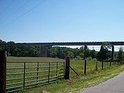
before bridging Rough River Lake
.
KY 259 then passes into Grayson County
, serving as a main road through the city of Leitchfield
. The route intersects the Western Kentucky Parkway just south of Leitchfield, then continues on, crossing into Edmonson County
just south of the Anneta community.
KY 259 skirts the border of Nolin Lake State Park before continuing southward. The route bridges the Green River
just north of Brownsville
. KY 259 then continues on through the city, continuing on a southerly track until it turns southeast at the Rhoda community, and traveling through Pig
. The route then continues on until it enters Warren County
just south of Rocky Hill
.
KY 259 traverses I-65
by way of an overpass before reaching its southern terminus at U.S. 68
in Hays.
 KY 259 conjoins with many other highways along its course.
Kentucky
The Commonwealth of Kentucky is a state located in the East Central United States of America. As classified by the United States Census Bureau, Kentucky is a Southern state, more specifically in the East South Central region. Kentucky is one of four U.S. states constituted as a commonwealth...
.
Route description
Starting at a junction with KY 144 in Meade CountyMeade County, Kentucky
As of the census of 2000, there were 26,349 people, 9,470 households, and 7,396 families residing in the county. The population density was . There were 10,293 housing units at an average density of...
, 259 soon crosses into Breckinridge County
Breckinridge County, Kentucky
As of the census of 2000, there were 18,648 people, 7,324 households, and 5,309 families residing in the county. The population density was . There were 9,890 housing units at an average density of...
. The highway passes through Hardinsburg
Hardinsburg, Kentucky
Hardinsburg is a city in Breckinridge County, Kentucky, United States. The population was 2,345 at the 2000 census. It is the county seat of Breckinridge County. By Kentucky state law, it is classified as a fifth class city...
before bridging Rough River Lake
Rough River Lake
Rough River Lake is a reservoir in Breckinridge, Grayson, and Hardin counties in Kentucky. It was impounded from the Rough River in 1959 by the United States Army Corps of Engineers. It is the primary attraction of Rough River Dam State Resort Park....
.
KY 259 then passes into Grayson County
Grayson County, Kentucky
Grayson County is a county located in the U.S. state of Kentucky. It was formed in 1810. As of 2000, the population was 24,053. Its county seat is Leitchfield. The county is named for William Grayson , a Revolutionary War colonel and a prominent Virginia political figure...
, serving as a main road through the city of Leitchfield
Leitchfield, Kentucky
As of the census of 2000, there were 6,139 people, 2,485 households, and 1,615 families residing in the city. The population density was . There were 2,797 housing units at an average density of . The racial makeup of the city was 96.63% White, 1.56% African American, 0.26% Native American, 0.18%...
. The route intersects the Western Kentucky Parkway just south of Leitchfield, then continues on, crossing into Edmonson County
Edmonson County, Kentucky
Edmonson County is a county located in the U.S. state of Kentucky. It was formed in 1826. As of 2007, the population was 11,978. It is included in the Bowling Green Metropolitan Statistical Area. Its county seat is Brownsville...
just south of the Anneta community.
KY 259 skirts the border of Nolin Lake State Park before continuing southward. The route bridges the Green River
Green River (Kentucky)
The Green River is a tributary of the Ohio River that rises in Lincoln County in south-central Kentucky. Tributaries of the Green River include the Barren River, the Nolin River, the Pond River and the Rough River...
just north of Brownsville
Brownsville, Kentucky
Brownsville is a city in and the county seat of Edmonson County, Kentucky, United States. The population is 1,000 at the 2000 census. It is included in the Bowling Green, Kentucky Metropolitan Statistical Area...
. KY 259 then continues on through the city, continuing on a southerly track until it turns southeast at the Rhoda community, and traveling through Pig
Pig, Kentucky
Pig is an unincorporated community in southern Edmonson County, Kentucky, United States. Pig is generally referred to as the area near KY 422, strecthing from the road's southern end at US 31-W, north along KY 259 towards Rhoda and KY 70 towards Brownsville...
. The route then continues on until it enters Warren County
Warren County, Kentucky
Warren County is a county located in the U.S. state of Kentucky, specifically the Pennyroyal Plateau and Western Coal Fields regions. It is included in the Bowling Green, Kentucky, Metropolitan Statistical Area. The population was 113,792 in the 2010 Census. The county seat is Bowling Green...
just south of Rocky Hill
Rocky Hill, Kentucky
Rocky Hill is an unincorporated community in Edmonson County, Kentucky, United States, located south of Mammoth Cave National Park. It is part of the Bowling Green, Kentucky Metropolitan Statistical Area.-History:...
.
KY 259 traverses I-65
Interstate 65
Interstate 65 is a major Interstate Highway in the United States. The southern terminus is located at an intersection with Interstate 10 in Mobile, Alabama, and its northern terminus is at an interchange with Interstate 90 , U.S. Route 12, and U.S...
by way of an overpass before reaching its southern terminus at U.S. 68
U.S. Route 68
U.S. Route 68 is an east–west United States highway that runs for from northwest Ohio to western Kentucky. The highway's western terminus is at U.S. Route 62 in Reidland, Kentucky. Its eastern terminus is at Interstate 75 in Findlay, Ohio...
in Hays.
- US 60U.S. Route 60U.S. Route 60 is an east–west United States highway, running from the Atlantic Ocean on the east coast in Virginia to western Arizona. Despite the final "0" in its number, indicating a transcontinental designation, the 1926 route formerly ended in Springfield, Missouri, at its intersection...
from just south of Hardinsburg to Harned. - KY 79Kentucky Route 79Kentucky Route 79 originates at a junction with US 431 in downtown Russellville in Logan County. The route continues through Morgantown, Caneyville, Short Creek, Cannons Point, Harned, and Irvington, to terminate at the Ohio River near Brandenburg in Meade County, where, after crossing the Matthew E...
from Harned to a split east of Hinton Hills. - KY 70Kentucky Route 70Kentucky Route 70 is a long east-east state highway that originates at a junction with US 60 in Smithland in Livingston County, just east of the Ohio River. The route continues through the counties of Crittenden, Caldwell, Hopkins, Muhlenberg, Butler, Edmonson, Barren, Barren, Metcalfe, Green,...
from the Riverhill community to the southern part of BrownsvilleBrownsville, KentuckyBrownsville is a city in and the county seat of Edmonson County, Kentucky, United States. The population is 1,000 at the 2000 census. It is included in the Bowling Green, Kentucky Metropolitan Statistical Area...
.