
Edmonson County, Kentucky
Encyclopedia
Edmonson County is a county located in the U.S. state
of Kentucky
. It was formed in 1826. As of 2007, the population was 11,978. It is included in the Bowling Green
Metropolitan Statistical Area
. Its county seat
is Brownsville
. The county is named for Captain John Edmonson (1764–1813), a veteran of the American Revolutionary War
who was killed at the Battle of Frenchtown
during the War of 1812
. The sale of alcohol is currently prohibited
in Edmonson County.
of 2000, there were 11,644 people, 4,648 households, and 3,462 families residing in the county. The population density
was 38 /sqmi. There were 6,104 housing units at an average density of 20 /sqmi. The racial makeup of the county was 98.39% White
, 0.58% Black
or African American
, 0.44% Native American
, 0.07% Asian
, 0.06% from other races
, and 0.46% from two or more races. 0.56% of the population were Hispanic
or Latino
of any race.
There were 4,648 households out of which 31.80% had children under the age of 18 living with them, 62.20% were married couples
living together, 8.90% had a female householder with no husband present, and 25.50% were non-families. 22.40% of all households were made up of individuals and 9.60% had someone living alone who was 65 years of age or older. The average household size was 2.47 and the average family size was 2.88.
In the county the population was spread out with 23.60% under the age of 18, 9.00% from 18 to 24, 27.80% from 25 to 44, 25.30% from 45 to 64, and 14.40% who were 65 years of age or older. The median age was 38 years. For every 100 males there were 92.50 females. For every 100 males age 18 and over, there were 89.33 females.
The median income for a household in the county was $25,413, and the median income for a family was $31,843. Males had a median income of $26,770 versus $17,158 for females. The per capita income
for the county was $14,480. About 14.20% of families and 18.40% of the population were below the poverty line, including 25.50% of those under age 18 and 21.00% of those age 65 or over.
 There are currently four public schools operating as part of the Edmonson County School System. They are Kyrock Elementary (in the Kyrock community in northern Edmonson County), South Edmonson Elementary (near the Chalybeate community in southern Edmonson County), the Edmonson County Fifth/Sixth Grade Center and Edmonson County Middle/High School
(both in Brownsville
).
KY 70
is the primary west to east route, traversing the width of the county.
KY 259
enters Edmonson County at the border with Grayson County
, near the town of Bee Spring
. The highway continues on, bridging the Green River
(the only bridge over the river in Edmonson County), before intersecting with KY 101
. KY 259 then branches off in a southeastern direction while KY 101 continues as the main north-south route through the county, exiting into Warren County
just south of the community of Chalybeate
.
Additionally, KY 185
is a north-south route connecting Bowling Green
with points in Grayson County
and points north which lie between I-65
(which goes from Bowling Green to Elizabethtown
and Louisville
) and the William H. Natcher Parkway
from Bowling Green to Owensboro
; it enters Edmonson County near the community of Roundhill and passes north paralleling the Edmonson County - Butler County line before entering Grayson County south of Reedy.
I-65
passes through the southeastern tip of the county, but has no interchanges allowing access to the road. I-65 parallels the older US 31-W
, which runs through a small southeastern portion of the county.
, which usually draws almost 2 million visitors a year. The park includes in its area roughly a fourth of the County.
Located mostly in the northern part of Edmonson County, the Nolin Lake area was incorporated as a Kentucky State Park
in 2001 and offers fishing and other recreational opportunities.
On March 6, 2007, MTV wrote an article titled "Who's Joining The Army" in which they stated Edmonson County has the highest Army enlistment rate of any county in the United States.
Forks of the River, Kentucky| Forks
U.S. state
A U.S. state is any one of the 50 federated states of the United States of America that share sovereignty with the federal government. Because of this shared sovereignty, an American is a citizen both of the federal entity and of his or her state of domicile. Four states use the official title of...
of Kentucky
Kentucky
The Commonwealth of Kentucky is a state located in the East Central United States of America. As classified by the United States Census Bureau, Kentucky is a Southern state, more specifically in the East South Central region. Kentucky is one of four U.S. states constituted as a commonwealth...
. It was formed in 1826. As of 2007, the population was 11,978. It is included in the Bowling Green
Bowling Green, Kentucky
Bowling Green is the third-most populous city in the state of Kentucky after Louisville and Lexington, with a population of 58,067 as of the 2010 Census. It is the county seat of Warren County and the principal city of the Bowling Green, Kentucky Metropolitan Statistical Area with an estimated 2009...
Metropolitan Statistical Area
Bowling Green metropolitan area
The Bowling Green Metropolitan Statistical Area, as defined by the United States Census Bureau, is an area consisting of two counties in Kentucky, anchored by the city of Bowling Green...
. Its county seat
County seat
A county seat is an administrative center, or seat of government, for a county or civil parish. The term is primarily used in the United States....
is Brownsville
Brownsville, Kentucky
Brownsville is a city in and the county seat of Edmonson County, Kentucky, United States. The population is 1,000 at the 2000 census. It is included in the Bowling Green, Kentucky Metropolitan Statistical Area...
. The county is named for Captain John Edmonson (1764–1813), a veteran of the American Revolutionary War
American Revolutionary War
The American Revolutionary War , the American War of Independence, or simply the Revolutionary War, began as a war between the Kingdom of Great Britain and thirteen British colonies in North America, and ended in a global war between several European great powers.The war was the result of the...
who was killed at the Battle of Frenchtown
Battle of Frenchtown
The Battle of Frenchtown, also known as the Battle of the River Raisin or the River Raisin Massacre, was a series of conflicts that took place from January 18–23, 1813 during the War of 1812...
during the War of 1812
War of 1812
The War of 1812 was a military conflict fought between the forces of the United States of America and those of the British Empire. The Americans declared war in 1812 for several reasons, including trade restrictions because of Britain's ongoing war with France, impressment of American merchant...
. The sale of alcohol is currently prohibited
Dry county
A dry county is a county in the United States whose government forbids the sale of alcoholic beverages. Some prohibit off-premises sale, some prohibit on-premises sale, and some prohibit both. Hundreds of dry counties exist across the United States, almost all of them in the South...
in Edmonson County.
Geography
According to the 2000 census, the county has a total area of 308.01 square miles (797.7 km²), of which 302.62 square miles (783.8 km²) (or 98.25%) is land and 5.39 square miles (14 km²) (or 1.75%) is water.Adjacent counties
- Grayson CountyGrayson County, KentuckyGrayson County is a county located in the U.S. state of Kentucky. It was formed in 1810. As of 2000, the population was 24,053. Its county seat is Leitchfield. The county is named for William Grayson , a Revolutionary War colonel and a prominent Virginia political figure...
(north) - Hart CountyHart County, KentuckyHart County is a county located in the U.S. state — or, more correctly, "Commonwealth" — of Kentucky. It was formed in 1819. , the population was 17,445. Its county seat is Munfordville. The county is named for Captain Nathaniel G. S. Hart, a Kentucky militia officer in the War of 1812...
(east) - Barren CountyBarren County, KentuckyAs of the census of 2000, there were 38,033 people, 15,346 households, and 10,941 families residing in the county. The population density was . There were 17,095 housing units at an average density of...
(southeast) - Warren CountyWarren County, KentuckyWarren County is a county located in the U.S. state of Kentucky, specifically the Pennyroyal Plateau and Western Coal Fields regions. It is included in the Bowling Green, Kentucky, Metropolitan Statistical Area. The population was 113,792 in the 2010 Census. The county seat is Bowling Green...
(southwest) - Butler CountyButler County, KentuckyButler County is a county located in the US state of Kentucky. It was formed in 1810, becoming Kentucky's 53rd county. As of 2000, the population was 13,010. Its county seat is Morgantown, Kentucky. Butler is a prohibition or dry county.- History :...
(west)
Demographics
As of the censusCensus
A census is the procedure of systematically acquiring and recording information about the members of a given population. It is a regularly occurring and official count of a particular population. The term is used mostly in connection with national population and housing censuses; other common...
of 2000, there were 11,644 people, 4,648 households, and 3,462 families residing in the county. The population density
Population density
Population density is a measurement of population per unit area or unit volume. It is frequently applied to living organisms, and particularly to humans...
was 38 /sqmi. There were 6,104 housing units at an average density of 20 /sqmi. The racial makeup of the county was 98.39% White
Race (United States Census)
Race and ethnicity in the United States Census, as defined by the Federal Office of Management and Budget and the United States Census Bureau, are self-identification data items in which residents choose the race or races with which they most closely identify, and indicate whether or not they are...
, 0.58% Black
Race (United States Census)
Race and ethnicity in the United States Census, as defined by the Federal Office of Management and Budget and the United States Census Bureau, are self-identification data items in which residents choose the race or races with which they most closely identify, and indicate whether or not they are...
or African American
Race (United States Census)
Race and ethnicity in the United States Census, as defined by the Federal Office of Management and Budget and the United States Census Bureau, are self-identification data items in which residents choose the race or races with which they most closely identify, and indicate whether or not they are...
, 0.44% Native American
Race (United States Census)
Race and ethnicity in the United States Census, as defined by the Federal Office of Management and Budget and the United States Census Bureau, are self-identification data items in which residents choose the race or races with which they most closely identify, and indicate whether or not they are...
, 0.07% Asian
Race (United States Census)
Race and ethnicity in the United States Census, as defined by the Federal Office of Management and Budget and the United States Census Bureau, are self-identification data items in which residents choose the race or races with which they most closely identify, and indicate whether or not they are...
, 0.06% from other races
Race (United States Census)
Race and ethnicity in the United States Census, as defined by the Federal Office of Management and Budget and the United States Census Bureau, are self-identification data items in which residents choose the race or races with which they most closely identify, and indicate whether or not they are...
, and 0.46% from two or more races. 0.56% of the population were Hispanic
Race (United States Census)
Race and ethnicity in the United States Census, as defined by the Federal Office of Management and Budget and the United States Census Bureau, are self-identification data items in which residents choose the race or races with which they most closely identify, and indicate whether or not they are...
or Latino
Race (United States Census)
Race and ethnicity in the United States Census, as defined by the Federal Office of Management and Budget and the United States Census Bureau, are self-identification data items in which residents choose the race or races with which they most closely identify, and indicate whether or not they are...
of any race.
There were 4,648 households out of which 31.80% had children under the age of 18 living with them, 62.20% were married couples
Marriage
Marriage is a social union or legal contract between people that creates kinship. It is an institution in which interpersonal relationships, usually intimate and sexual, are acknowledged in a variety of ways, depending on the culture or subculture in which it is found...
living together, 8.90% had a female householder with no husband present, and 25.50% were non-families. 22.40% of all households were made up of individuals and 9.60% had someone living alone who was 65 years of age or older. The average household size was 2.47 and the average family size was 2.88.
In the county the population was spread out with 23.60% under the age of 18, 9.00% from 18 to 24, 27.80% from 25 to 44, 25.30% from 45 to 64, and 14.40% who were 65 years of age or older. The median age was 38 years. For every 100 males there were 92.50 females. For every 100 males age 18 and over, there were 89.33 females.
The median income for a household in the county was $25,413, and the median income for a family was $31,843. Males had a median income of $26,770 versus $17,158 for females. The per capita income
Per capita income
Per capita income or income per person is a measure of mean income within an economic aggregate, such as a country or city. It is calculated by taking a measure of all sources of income in the aggregate and dividing it by the total population...
for the county was $14,480. About 14.20% of families and 18.40% of the population were below the poverty line, including 25.50% of those under age 18 and 21.00% of those age 65 or over.
Education
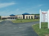
Edmonson County High School
Edmonson County High School is a four year high school located in Brownsville, Kentucky, USA. It is the only high school serving the Edmonson County School system.-History:The current Edmonson County High School was completed in 1981...
(both in Brownsville
Brownsville, Kentucky
Brownsville is a city in and the county seat of Edmonson County, Kentucky, United States. The population is 1,000 at the 2000 census. It is included in the Bowling Green, Kentucky Metropolitan Statistical Area...
).
Transportation
There are two main routes that form the major transportation corridors through Edmonson County. There are no traffic lights in the county.KY 70
Kentucky Route 70
Kentucky Route 70 is a long east-east state highway that originates at a junction with US 60 in Smithland in Livingston County, just east of the Ohio River. The route continues through the counties of Crittenden, Caldwell, Hopkins, Muhlenberg, Butler, Edmonson, Barren, Barren, Metcalfe, Green,...
is the primary west to east route, traversing the width of the county.
KY 259
Kentucky Route 259
Kentucky Route 259 is a state highway that traverses five counties in West-Central Kentucky.-Route description:Starting at a junction with KY 144 in Meade County, 259 soon crosses into Breckinridge County. The highway passes through Hardinsburg before bridging Rough River Lake.KY 259 then passes...
enters Edmonson County at the border with Grayson County
Grayson County, Kentucky
Grayson County is a county located in the U.S. state of Kentucky. It was formed in 1810. As of 2000, the population was 24,053. Its county seat is Leitchfield. The county is named for William Grayson , a Revolutionary War colonel and a prominent Virginia political figure...
, near the town of Bee Spring
Bee Spring, Kentucky
Bee Spring is an unincorporated community in northern Edmonson County, Kentucky, United States. The population of the community's ZCTA was 1,335 at the 2000 census. It is part of the Bowling Green, Kentucky Metropolitan Statistical Area....
. The highway continues on, bridging the Green River
Green River (Kentucky)
The Green River is a tributary of the Ohio River that rises in Lincoln County in south-central Kentucky. Tributaries of the Green River include the Barren River, the Nolin River, the Pond River and the Rough River...
(the only bridge over the river in Edmonson County), before intersecting with KY 101
Kentucky Route 101
Kentucky Route 101 is a north–south highway traversing three counties in South Central Kentucky.-Route description:KY 101 starts at a junction with KY 259 near the community of Rhoda in Edmonson County....
. KY 259 then branches off in a southeastern direction while KY 101 continues as the main north-south route through the county, exiting into Warren County
Warren County, Kentucky
Warren County is a county located in the U.S. state of Kentucky, specifically the Pennyroyal Plateau and Western Coal Fields regions. It is included in the Bowling Green, Kentucky, Metropolitan Statistical Area. The population was 113,792 in the 2010 Census. The county seat is Bowling Green...
just south of the community of Chalybeate
Chalybeate Springs, Kentucky
Chalybeate Springs is an unincorporated area in Edmonson County, Kentucky, United States, near the Warren County line. At the turn of the 20th century, the location of the springs was a popular resort. All that remained of the resort by 2010 was an old spring house.-External links:*...
.
Additionally, KY 185
Kentucky Route 185
Kentucky Route 185 is a north–south state highway traversing four counties in south-central Kentucky.-Route description:Route 185 begins at a junction with the cojoined US 68/KY 80 just north of downtown Bowling Green....
is a north-south route connecting Bowling Green
Bowling Green, Kentucky
Bowling Green is the third-most populous city in the state of Kentucky after Louisville and Lexington, with a population of 58,067 as of the 2010 Census. It is the county seat of Warren County and the principal city of the Bowling Green, Kentucky Metropolitan Statistical Area with an estimated 2009...
with points in Grayson County
Grayson County, Kentucky
Grayson County is a county located in the U.S. state of Kentucky. It was formed in 1810. As of 2000, the population was 24,053. Its county seat is Leitchfield. The county is named for William Grayson , a Revolutionary War colonel and a prominent Virginia political figure...
and points north which lie between I-65
Interstate 65
Interstate 65 is a major Interstate Highway in the United States. The southern terminus is located at an intersection with Interstate 10 in Mobile, Alabama, and its northern terminus is at an interchange with Interstate 90 , U.S. Route 12, and U.S...
(which goes from Bowling Green to Elizabethtown
Elizabethtown, Kentucky
Elizabethtown is a city in and the county seat of Hardin County, Kentucky, United States. The population was 28,531 at the 2010 census, making it the eleventh-largest city in the state...
and Louisville
Louisville, Kentucky
Louisville is the largest city in the U.S. state of Kentucky, and the county seat of Jefferson County. Since 2003, the city's borders have been coterminous with those of the county because of a city-county merger. The city's population at the 2010 census was 741,096...
) and the William H. Natcher Parkway
William H. Natcher Parkway
The Wiliam H. Natcher Green River Parkway is a limited-access freeway from Bowling Green, Kentucky to Owensboro, Kentucky. The Natcher is one of nine highways that are part of Kentucky's parkway system. Conceived as the "Owensboro-Bowling Green Parkway," it was instead named the Green River...
from Bowling Green to Owensboro
Owensboro, Kentucky
Owensboro is the fourth largest city by population in the U.S. state of Kentucky. It is the county seat of Daviess County. It is located on U.S. Route 60 about southeast of Evansville, Indiana, and is the principal city of the Owensboro, Kentucky, Metropolitan Statistical Area. The city's...
; it enters Edmonson County near the community of Roundhill and passes north paralleling the Edmonson County - Butler County line before entering Grayson County south of Reedy.
I-65
Interstate 65
Interstate 65 is a major Interstate Highway in the United States. The southern terminus is located at an intersection with Interstate 10 in Mobile, Alabama, and its northern terminus is at an interchange with Interstate 90 , U.S. Route 12, and U.S...
passes through the southeastern tip of the county, but has no interchanges allowing access to the road. I-65 parallels the older US 31-W
U.S. Route 31
U.S. Route 31 is a long north–south highway connecting northern Michigan to southern Alabama, with its northern terminus at Interstate 75 near Mackinaw City, Michigan, and southern terminus at the combined U.S. Route 90 & U.S. Route 98 at Spanish Fort, Alabama...
, which runs through a small southeastern portion of the county.
Attractions
The biggest tourist attraction in Edmonson County is Mammoth Cave National ParkMammoth Cave National Park
Mammoth Cave National Park is a U.S. National Park in central Kentucky, encompassing portions of Mammoth Cave, the longest cave system known in the world. The official name of the system is the Mammoth-Flint Ridge Cave System for the ridge under which the cave has formed. The park was established...
, which usually draws almost 2 million visitors a year. The park includes in its area roughly a fourth of the County.
Located mostly in the northern part of Edmonson County, the Nolin Lake area was incorporated as a Kentucky State Park
State park
State parks are parks or other protected areas managed at the federated state level within those nations which use "state" as a political subdivision. State parks are typically established by a state to preserve a location on account of its natural beauty, historic interest, or recreational...
in 2001 and offers fishing and other recreational opportunities.
Media
Edmonson County is served by a weekly newspaper, the Edmonson News. The paper is sometimes referred to by its nickname, "the Gimlet", and carries the slogan "It Bores In". The paper has a circulation number of 3,704.On March 6, 2007, MTV wrote an article titled "Who's Joining The Army" in which they stated Edmonson County has the highest Army enlistment rate of any county in the United States.
Cities and towns
- Bee SpringBee Spring, KentuckyBee Spring is an unincorporated community in northern Edmonson County, Kentucky, United States. The population of the community's ZCTA was 1,335 at the 2000 census. It is part of the Bowling Green, Kentucky Metropolitan Statistical Area....
- Big ReedyBig Reedy, KentuckyBig Reedy is an unincorporated community in the northwest corner of Edmonson County, Kentucky, United States, near the county lines of Grayson County and Butler County...
- BrownsvilleBrownsville, KentuckyBrownsville is a city in and the county seat of Edmonson County, Kentucky, United States. The population is 1,000 at the 2000 census. It is included in the Bowling Green, Kentucky Metropolitan Statistical Area...
- Cedar SpringCedar Spring, KentuckyCedar Spring is an unincorporated community in Edmonson County, Kentucky, United States.Cedar Spring, Kentucky, is on Kentucky Highway 259 and Chaumont Road.It has a large number of oil and natural gas wells....
- Chalybeate SpringsChalybeate Springs, KentuckyChalybeate Springs is an unincorporated area in Edmonson County, Kentucky, United States, near the Warren County line. At the turn of the 20th century, the location of the springs was a popular resort. All that remained of the resort by 2010 was an old spring house.-External links:*...
- Huff
Forks of the River, Kentucky| Forks
- Lindseyville
- Mammoth Cave
- PigPig, KentuckyPig is an unincorporated community in southern Edmonson County, Kentucky, United States. Pig is generally referred to as the area near KY 422, strecthing from the road's southern end at US 31-W, north along KY 259 towards Rhoda and KY 70 towards Brownsville...
- Rhoda
- Rocky HillRocky Hill, KentuckyRocky Hill is an unincorporated community in Edmonson County, Kentucky, United States, located south of Mammoth Cave National Park. It is part of the Bowling Green, Kentucky Metropolitan Statistical Area.-History:...
- SunfishSunfish, KentuckySunfish is an unincorporated community located in the Northwest corner of Edmonson County, Kentucky, United States, near the county lines of Grayson County...
- SweedenSweeden, KentuckySweeden is an unincorporated community in north-central Edmonson County, Kentucky, United States. The population of Sweeden's ZCTA was 171 at the 2000 census. It is part of the Bowling Green, Kentucky Metropolitan Statistical Area.-Geography:...
- Windyville
Famous residents
- Joe BlantonJoe BlantonJoseph Matthew Blanton is a starting pitcher for the Philadelphia Phillies of Major League Baseball.-College career:...
, Major League BaseballMajor League BaseballMajor League Baseball is the highest level of professional baseball in the United States and Canada, consisting of teams that play in the National League and the American League...
pitcherPitcherIn baseball, the pitcher is the player who throwsthe baseball from the pitcher's mound toward the catcher to begin each play, with the goal of retiring a batter, who attempts to either make contact with the pitched ball or draw a walk. In the numbering system used to record defensive plays, the...
for the Philadelphia PhilliesPhiladelphia PhilliesThe Philadelphia Phillies are a Major League Baseball team. They are the oldest continuous, one-name, one-city franchise in all of professional American sports, dating to 1883. The Phillies are a member of the Eastern Division of Major League Baseball's National League...
, was born in Nashville, TennesseeNashville, TennesseeNashville is the capital of the U.S. state of Tennessee and the county seat of Davidson County. It is located on the Cumberland River in Davidson County, in the north-central part of the state. The city is a center for the health care, publishing, banking and transportation industries, and is home...
, but spent most of his childhood and young adult life in Edmonson County. - Ben Helson, a member of Bluegrass singer Rhonda Vincent'sRhonda VincentRhonda Lea Vincent is a bluegrass singer, songwriter, mandolin player, guitarist, and fiddle player.Her musical career started as a child in her family's band, The Sally Mountain Show, and has spanned almost four decades...
band the Rage, is a native of the Chalybeate community.
See also
- Edmonson County High SchoolEdmonson County High SchoolEdmonson County High School is a four year high school located in Brownsville, Kentucky, USA. It is the only high school serving the Edmonson County School system.-History:The current Edmonson County High School was completed in 1981...
- Mammoth Cave National ParkMammoth Cave National ParkMammoth Cave National Park is a U.S. National Park in central Kentucky, encompassing portions of Mammoth Cave, the longest cave system known in the world. The official name of the system is the Mammoth-Flint Ridge Cave System for the ridge under which the cave has formed. The park was established...
- National Register of Historic Places listings in Edmonson County, KentuckyNational Register of Historic Places listings in Edmonson County, KentuckyThis is a list of the National Register of Historic Places listings in Edmonson County, Kentucky. It is intended to be a complete list of the properties and districts on the National Register of Historic Places in Edmonson County, Kentucky, United States...