
Juab County, Utah
Encyclopedia

U.S. state
A U.S. state is any one of the 50 federated states of the United States of America that share sovereignty with the federal government. Because of this shared sovereignty, an American is a citizen both of the federal entity and of his or her state of domicile. Four states use the official title of...
of Utah
Utah
Utah is a state in the Western United States. It was the 45th state to join the Union, on January 4, 1896. Approximately 80% of Utah's 2,763,885 people live along the Wasatch Front, centering on Salt Lake City. This leaves vast expanses of the state nearly uninhabited, making the population the...
. As of 2000 the population was 8,238, and by 2005 had been estimated at 9,113. It was named from an Indian word meaning thirsty valley, or possibly only valley. Its county seat
County seat
A county seat is an administrative center, or seat of government, for a county or civil parish. The term is primarily used in the United States....
and largest city is Nephi
Nephi, Utah
Nephi is a city in Juab County, Utah, United States. It is part of the Provo–Orem, Utah Metropolitan Statistical Area. The population was 4,733 at the 2000 census. It is the county seat of Juab County. It was settled by Mormon pioneers in 1851, and is the principal city in Juab Valley, an...
.
Juab County is part of the Provo
Provo, Utah
Provo is the third largest city in the U.S. state of Utah, located about south of Salt Lake City along the Wasatch Front. Provo is the county seat of Utah County and lies between the cities of Orem to the north and Springville to the south...
–Orem
Orem, Utah
Orem is a city in Utah County, Utah, United States, in the north-central part of the state. It is adjacent to Provo, Lindon, and Vineyard and is about south of Salt Lake City. Orem is one of the principal cities of the Provo-Orem, Utah Metropolitan Statistical Area, which includes all of Utah and...
Metropolitan Statistical Area
Provo-Orem metropolitan area
The Provo-Orem Metropolitan Statistical Area, as defined by the United States Census Bureau, is an area consisting of two counties in Utah, anchored by the cities of Provo and Orem...
.
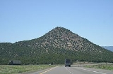
Geography
According to the U.S. Census BureauUnited States Census Bureau
The United States Census Bureau is the government agency that is responsible for the United States Census. It also gathers other national demographic and economic data...
, the county has a total area of 3406 square miles (8,821.5 km²), of which 3392 square miles (8,785.2 km²) is land and 15 square miles (38.8 km²) (0.43%) is water.
Adjacent counties
- Tooele County, UtahTooele County, UtahTooele County is a county located in the U.S. state of Utah. As of 2000, the population was 40,735 and by 2005 was estimated at 51,311. Its county seat and largest city is Tooele....
- (north 1) - Utah County, UtahUtah County, UtahUtah County is a county located in the U.S. state of Utah. As of 2000, the population was 368,536 and by 2008 was estimated at 530,837. It was named for the Spanish name for the Ute Indians. The county seat and largest city is Provo...
- (north 2) - Millard County, UtahMillard County, UtahMillard County is a county located in the U.S. state of Utah. In 2010, its population was 12,420. It was named for Millard Fillmore, thirteenth President of the United States. Its county seat is Fillmore and the largest city is Delta.-Geography:...
- (south) - Sanpete County, UtahSanpete County, UtahSanpete County is a county located in the U.S. state of Utah. The population according to the 2010 U.S. Census was 27,822. It was possibly named for a Ute Indian chief named Sanpitch, which was corrupted to Sanpete. Its county seat is Manti and its largest city is Ephraim.-Geography:According to...
- (east) - White Pine County, NevadaWhite Pine County, NevadaWhite Pine County is a county located in the U.S. state of Nevada. Its population at the 2010 census was 10,030. Its county seat is Ely. It is the home of Great Basin National Park...
- (west)
National protected areas
- Fish Springs National Wildlife RefugeFish Springs National Wildlife RefugeFish Springs National Wildlife Refuge is located at the southern end of the Great Salt Lake Desert, part of theGreat Basin in Juab County, Utah. The Refuge is managed by the United States Fish and Wildlife Service...
- Fishlake National ForestFishlake National ForestFishlake National Forest is located in south central Utah, USA. Its namesake is the largest freshwater mountain lake in the state.-Geography:...
(part) - Uinta National ForestUinta National ForestUinta National Forest is a national forest located in north central Utah, USA. It was originally part of the Uinta Forest Reserve, created by Grover Cleveland on February 2, 1897. The name is derived from the Ute word Yoov-we-teuh which means pine forest...
(part)
Demographics
As of the censusCensus
A census is the procedure of systematically acquiring and recording information about the members of a given population. It is a regularly occurring and official count of a particular population. The term is used mostly in connection with national population and housing censuses; other common...
of 2000, there were 8,238 people, 2,456 households, and 1,981 families residing in the county. The population density
Population density
Population density is a measurement of population per unit area or unit volume. It is frequently applied to living organisms, and particularly to humans...
was 2 people per square mile (1/km²). There were 2,810 housing units at an average density of 1 per square mile (0/km²). The racial makeup of the county was 96.56% White
Race (United States Census)
Race and ethnicity in the United States Census, as defined by the Federal Office of Management and Budget and the United States Census Bureau, are self-identification data items in which residents choose the race or races with which they most closely identify, and indicate whether or not they are...
, 0.15% Black
Race (United States Census)
Race and ethnicity in the United States Census, as defined by the Federal Office of Management and Budget and the United States Census Bureau, are self-identification data items in which residents choose the race or races with which they most closely identify, and indicate whether or not they are...
or African American
Race (United States Census)
Race and ethnicity in the United States Census, as defined by the Federal Office of Management and Budget and the United States Census Bureau, are self-identification data items in which residents choose the race or races with which they most closely identify, and indicate whether or not they are...
, 1.02% Native American
Race (United States Census)
Race and ethnicity in the United States Census, as defined by the Federal Office of Management and Budget and the United States Census Bureau, are self-identification data items in which residents choose the race or races with which they most closely identify, and indicate whether or not they are...
, 0.34% Asian
Race (United States Census)
Race and ethnicity in the United States Census, as defined by the Federal Office of Management and Budget and the United States Census Bureau, are self-identification data items in which residents choose the race or races with which they most closely identify, and indicate whether or not they are...
, 0.05% Pacific Islander
Race (United States Census)
Race and ethnicity in the United States Census, as defined by the Federal Office of Management and Budget and the United States Census Bureau, are self-identification data items in which residents choose the race or races with which they most closely identify, and indicate whether or not they are...
, 0.86% from other races
Race (United States Census)
Race and ethnicity in the United States Census, as defined by the Federal Office of Management and Budget and the United States Census Bureau, are self-identification data items in which residents choose the race or races with which they most closely identify, and indicate whether or not they are...
, and 1.02% from two or more races. 2.63% of the population were Hispanic
Race (United States Census)
Race and ethnicity in the United States Census, as defined by the Federal Office of Management and Budget and the United States Census Bureau, are self-identification data items in which residents choose the race or races with which they most closely identify, and indicate whether or not they are...
or Latino
Race (United States Census)
Race and ethnicity in the United States Census, as defined by the Federal Office of Management and Budget and the United States Census Bureau, are self-identification data items in which residents choose the race or races with which they most closely identify, and indicate whether or not they are...
of any race.
By 2006 the population had grown 14.3% since 2000, basically at the rate of Utah overall. 2005 figures showed that Juab county's population was 95.9% non-Hispanic whites. African-Americans were 0.2% of the county population, Native Americans 1.2% and 0.6%. Latinos were now only 2.3% of the population in the county.
In 2000 there were 2,456 households out of which 49.30% had children under the age of 18 living with them, 69.10% were married couples
Marriage
Marriage is a social union or legal contract between people that creates kinship. It is an institution in which interpersonal relationships, usually intimate and sexual, are acknowledged in a variety of ways, depending on the culture or subculture in which it is found...
living together, 7.90% had a female householder with no husband present, and 19.30% were non-families. 17.50% of all households were made up of individuals and 9.10% had someone living alone who was 65 years of age or older. The average household size was 3.31 and the average family size was 3.79.
In the county, the population was spread out with 38.60% under the age of 18, 9.40% from 18 to 24, 25.20% from 25 to 44, 16.90% from 45 to 64, and 9.80% who were 65 years of age or older. The median age was 26 years. For every 100 females there were 100.30 males. For every 100 females age 18 and over, there were 96.50 males.
The median income for a household in the county was $38,139, and the median income for a family was $42,655. Males had a median income of $33,621 versus $21,394 for females. The per capita income
Per capita income
Per capita income or income per person is a measure of mean income within an economic aggregate, such as a country or city. It is calculated by taking a measure of all sources of income in the aggregate and dividing it by the total population...
for the county was $12,790. About 7.90% of families and 10.40% of the population were below the poverty line, including 10.70% of those under age 18 and 14.50% of those age 65 or over.
Cities and towns
- CallaoCallao, UtahCallao is a small farming community in northern Snake Valley, along the border of Juab County and Tooele County, Utah, United States. It was part of the original Pony Express overland route, and was first called Willow Springs in 1860. E. W. Tripp, his wife and son, were the first to establish...
- EurekaEureka, UtahEureka was originally known as Ruby Hollow before it developed into a bustling mining town. Incorporated as a city in 1892, Eureka became the financial center for the Tintic Mining District, a wealthy gold and silver mining area in Utah and Juab counties. The district was organized in 1869 and by...
- LevanLevan, UtahLevan is a town in Juab County, Utah, United States. The population was 688 at the 2000 census. It is often said that the name of the town derives from its location at the center of Utah, because the name is navel spelled backwards. Several other origins have been suggested for the name, from...
- MonaMona, UtahMona is a city in Juab County, Utah, United States. It is part of the Provo–Orem, Utah Metropolitan Statistical Area. The population was 850 at the 2000 census. At the time this was sufficient under Utah state law for Mona to become a city, which it did at the end of 2000...
- NephiNephi, UtahNephi is a city in Juab County, Utah, United States. It is part of the Provo–Orem, Utah Metropolitan Statistical Area. The population was 4,733 at the 2000 census. It is the county seat of Juab County. It was settled by Mormon pioneers in 1851, and is the principal city in Juab Valley, an...
- Rocky RidgeRocky Ridge, UtahRocky Ridge is a town in Juab County, Utah, United States. It is part of the Provo–Orem, Utah Metropolitan Statistical Area. The population was 403 at the 2000 census.-Geography:Rocky Ridge is located at ....
- Trout CreekTrout Creek, UtahTrout Creek is a small farming community, located along the Pony Express/Overland route in northern Snake Valley, north of Partoun, Utah and south of Callao, Utah. It is named after the creek that flows from the west off of the Deep Creek Mountains. It has one of the most remote Mormon chapels in...
- PartounPartoun, UtahPartoun is an unincorporated community in Juab County, Utah, United States. It is located in Snake Valley at latitude 39.64661N and longitude -113.88700W with an elevation of 4,818'...
- Mills