

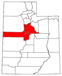
Provo-Orem metropolitan area
Encyclopedia
United States Census Bureau
The United States Census Bureau is the government agency that is responsible for the United States Census. It also gathers other national demographic and economic data...
, is an area consisting of two counties in Utah
Utah
Utah is a state in the Western United States. It was the 45th state to join the Union, on January 4, 1896. Approximately 80% of Utah's 2,763,885 people live along the Wasatch Front, centering on Salt Lake City. This leaves vast expanses of the state nearly uninhabited, making the population the...
, anchored by the cities of Provo
Provo, Utah
Provo is the third largest city in the U.S. state of Utah, located about south of Salt Lake City along the Wasatch Front. Provo is the county seat of Utah County and lies between the cities of Orem to the north and Springville to the south...
and Orem
Orem, Utah
Orem is a city in Utah County, Utah, United States, in the north-central part of the state. It is adjacent to Provo, Lindon, and Vineyard and is about south of Salt Lake City. Orem is one of the principal cities of the Provo-Orem, Utah Metropolitan Statistical Area, which includes all of Utah and...
. As of the 2010 census
United States Census, 2010
The Twenty-third United States Census, known as Census 2010 or the 2010 Census, is the current national census of the United States. National Census Day was April 1, 2010 and is the reference date used in enumerating individuals...
, the MSA had a population of 526,810 (though a July 1, 2009 estimate placed the population at 555,551).
Communities
- AlpineAlpine, UtahAlpine is a city in Utah County, Utah, United States. It is part of the Provo–Orem, Utah Metropolitan Statistical Area. The population was 9555 at the 2010 census. Alpine has been one of the many quickly-growing cities of Utah since the 1970s, and especially the 1990s. It is located on the...
- American ForkAmerican Fork, UtahAmerican Fork is a city in Utah County, Utah, United States, at the foot of Mount Timpanogos in the Wasatch Range, north of Utah Lake. It is part of the Provo–Orem, Utah Metropolitan Statistical Area. The population was 26,263 at the 2010 census, nearly a 20% growth since the 2000 census...
- BenjaminBenjamin, UtahBenjamin is a census-designated place in Utah County, Utah, United States. It is part of the Provo–Orem, Utah Metropolitan Statistical Area...
(CDPCensus-designated placeA census-designated place is a concentration of population identified by the United States Census Bureau for statistical purposes. CDPs are delineated for each decennial census as the statistical counterparts of incorporated places such as cities, towns and villages...
) - Cedar FortCedar Fort, UtahCedar Fort is a town in Utah County, Utah, United States. It is part of the Provo–Orem, Utah Metropolitan Statistical Area. The population was 341 at the 2000 census.-Geography:Cedar Fort is located at ....
- Cedar HillsCedar Hills, UtahCedar Hills is a city in Utah County, Utah, United States. The population was 3,094 at the 2000 census, and was estimated to be 9,551 in 2008. The city began growing rapidly during the 1990s, with the largest growth rate of any municipality in the state. It is located east of Alpine and Highland on...
- DraperDraper, UtahDraper is a city in Salt Lake and Utah Counties in the U.S. state of Utah, located about south of Salt Lake City along the Wasatch Front. Between 1990 and 2000 Draper was Utah's fastest-growing city over 5,000 people . Its population in 1990 was 7,143 and had grown to 25,220 by the 2000 census...
(partial) - Eagle MountainEagle Mountain, UtahEagle Mountain is a city in Utah County, Utah, United States. It is part of the Provo–Orem, Utah Metropolitan Statistical Area. The city is located to the west of the Lake Mountains, which are west of Utah Lake. It was incorporated December 3, 1996 and has been rapidly growing ever since. The...
- ElbertaElberta, UtahElberta is a census-designated place in Utah County, Utah, United States. It is part of the Provo–Orem, Utah Metropolitan Statistical Area. The population was 278 at the 2000 census. It is also known as "The Slant". It was founded as "Mt. Nebo". After the water failed in 1901 most of the...
(CDPCensus-designated placeA census-designated place is a concentration of population identified by the United States Census Bureau for statistical purposes. CDPs are delineated for each decennial census as the statistical counterparts of incorporated places such as cities, towns and villages...
) - Elk RidgeElk Ridge, UtahElk Ridge is a city in Utah County, Utah, United States. Named for a herd of elk that wintered in the area, it is part of the Provo–Orem, Utah Metropolitan Statistical Area. The population was 1,838 at the 2000 census...
- EurekaEureka, UtahEureka was originally known as Ruby Hollow before it developed into a bustling mining town. Incorporated as a city in 1892, Eureka became the financial center for the Tintic Mining District, a wealthy gold and silver mining area in Utah and Juab counties. The district was organized in 1869 and by...
- FairfieldFairfield, UtahFairfield is a town located in Utah County, Utah, United States. It is part of the Provo–Orem, Utah Metropolitan Statistical Area. The latitude of...
- GenolaGenola, UtahGenola is a town in Utah County, Utah, United States. It is part of the Provo–Orem, Utah Metropolitan Statistical Area. The population was 965 at the 2000 census.-Geography:...
- GoshenGoshen, UtahGoshen is a town in Utah County, Utah, United States. It is part of the Provo–Orem, Utah Metropolitan Statistical Area. The population was 874 at the 2000 census.-Geography:Goshen is located at ....
- HighlandHighland, UtahHighland is a city in Utah County, Utah, United States. It is approximately thirty miles from Salt Lake City and is part of the Provo–Orem, Utah Metropolitan Statistical Area. According to the 2010 census the population was 15,523, a 90.0% increase over the 2000 figure of 8,172...
- Lake ShoreLake Shore, UtahLake Shore is a census-designated place in Utah County, Utah, United States. It is part of the Provo–Orem, Utah Metropolitan Statistical Area...
(CDPCensus-designated placeA census-designated place is a concentration of population identified by the United States Census Bureau for statistical purposes. CDPs are delineated for each decennial census as the statistical counterparts of incorporated places such as cities, towns and villages...
) - LehiLehi, Utah-Attractions:Lehi Roller MillsLehi Roller Mills was founded in 1906 by a co-op of farmers. George G. Robinson purchased the mill in 1910, and since then it has remained in the family. It is run today by grandson R. Sherman Robinson....
- LevanLevan, UtahLevan is a town in Juab County, Utah, United States. The population was 688 at the 2000 census. It is often said that the name of the town derives from its location at the center of Utah, because the name is navel spelled backwards. Several other origins have been suggested for the name, from...
- LindonLindon, UtahLindon is a city in Utah County, Utah, United States. It is part of the Provo–Orem, Utah Metropolitan Statistical Area. The population was 10,070 at the 2010 census.The western sculptor Grant Speed resides in Lindon.-Geography:...
- MapletonMapleton, UtahMapleton is a city in Utah County, Utah, United States. It is part of the Provo–Orem, Utah Metropolitan Statistical Area. The population was 5,809 at the 2000 census.-Geography:Mapleton is located at ....
- Mills (unincorporated)
- MonaMona, UtahMona is a city in Juab County, Utah, United States. It is part of the Provo–Orem, Utah Metropolitan Statistical Area. The population was 850 at the 2000 census. At the time this was sufficient under Utah state law for Mona to become a city, which it did at the end of 2000...
- NephiNephi, UtahNephi is a city in Juab County, Utah, United States. It is part of the Provo–Orem, Utah Metropolitan Statistical Area. The population was 4,733 at the 2000 census. It is the county seat of Juab County. It was settled by Mormon pioneers in 1851, and is the principal city in Juab Valley, an...
- OremOrem, UtahOrem is a city in Utah County, Utah, United States, in the north-central part of the state. It is adjacent to Provo, Lindon, and Vineyard and is about south of Salt Lake City. Orem is one of the principal cities of the Provo-Orem, Utah Metropolitan Statistical Area, which includes all of Utah and...
(Principal city) - PalmyraPalmyra, UtahPalmyra is a census-designated place in Utah County, Utah, United States. It is part of the Provo–Orem, Utah Metropolitan Statistical Area. The population was 485 at the 2000 census...
(CDPCensus-designated placeA census-designated place is a concentration of population identified by the United States Census Bureau for statistical purposes. CDPs are delineated for each decennial census as the statistical counterparts of incorporated places such as cities, towns and villages...
) - PartounPartoun, UtahPartoun is an unincorporated community in Juab County, Utah, United States. It is located in Snake Valley at latitude 39.64661N and longitude -113.88700W with an elevation of 4,818'...
(unincorporated) - PaysonPayson, UtahPayson is a city in Utah County, Utah, United States. It is part of the Provo–Orem, Utah Metropolitan Statistical Area. The population was 12,716 at the 2000 census. The current mayor is Rick Moore, who in the 2009 election was the first write-in candidate ever to defeat an incumbent mayor in...
- Pleasant GrovePleasant Grove, UtahPleasant Grove, also known as "Utah's City of Trees", is a city in Utah County, Utah, United States. It is part of the Provo–Orem, Utah Metropolitan Statistical Area. The population was 33,798 at the 2008 census estimates.-History:...
- ProvoProvo, UtahProvo is the third largest city in the U.S. state of Utah, located about south of Salt Lake City along the Wasatch Front. Provo is the county seat of Utah County and lies between the cities of Orem to the north and Springville to the south...
(Principal city) - Rocky RidgeRocky Ridge, UtahRocky Ridge is a town in Juab County, Utah, United States. It is part of the Provo–Orem, Utah Metropolitan Statistical Area. The population was 403 at the 2000 census.-Geography:Rocky Ridge is located at ....
- SalemSalem, UtahSalem is a city in Utah County, Utah, United States. It is part of the Provo–Orem, Utah Metropolitan Statistical Area. The population was 4,372 at the 2000 census...
- SantaquinSantaquin, UtahSantaquin is a city in Utah County, Utah, United States. It is part of the Provo–Orem, Utah Metropolitan Statistical Area. The population was 4,834 at the 2000 census, while the 2008 estimates placed it at 8,400.-Geography:...
- Saratoga SpringsSaratoga Springs, UtahSaratoga Springs is a city in Utah County, Utah, United States. The elevation is 4,505 feet. It is part of the Provo–Orem, Utah Metropolitan Statistical Area. The city is a relatively new development along the northern shores of Utah Lake. It was incorporated on December 31, 1997 and has...
- Spanish ForkSpanish Fork, UtahSpanish Fork is a city in Utah County, Utah, United States. It is part of the Provo–Orem, Utah Metropolitan Statistical Area. The population was 31,497 as of the 2008 census estimate.-History:Spanish Fork was settled by LDS pioneers in 1851...
- Spring LakeSpring Lake, UtahSpring Lake is a census-designated place in Utah County, Utah, United States. It is part of the Provo–Orem, Utah Metropolitan Statistical Area. The population was 469 at the 2000 census...
(CDPCensus-designated placeA census-designated place is a concentration of population identified by the United States Census Bureau for statistical purposes. CDPs are delineated for each decennial census as the statistical counterparts of incorporated places such as cities, towns and villages...
) - SpringvilleSpringville, UtahSpringville is a city in Utah County, Utah, United States. It is part of the Provo–Orem, Utah Metropolitan Statistical Area. The population was 20,424 at the 2000 census, while the 2008 estimates placed it at 28,520. Just minutes south of Provo, Springville is a bedroom community for...
- Trout CreekTrout Creek, UtahTrout Creek is a small farming community, located along the Pony Express/Overland route in northern Snake Valley, north of Partoun, Utah and south of Callao, Utah. It is named after the creek that flows from the west off of the Deep Creek Mountains. It has one of the most remote Mormon chapels in...
(unincorporated) - VineyardVineyard, UtahVineyard is a town in Utah County, Utah, United States. It is part of the Provo–Orem, Utah Metropolitan Statistical Area. The population was 150 at the 2000 census.Vineyard first became a distinct place in 1899.-Geography:...
- West MountainWest Mountain, UtahWest Mountain is a census-designated place in Utah County, Utah, United States. It is part of the Provo–Orem, Utah Metropolitan Statistical Area. As of the 2000 census, the CDP population was 838...
(CDPCensus-designated placeA census-designated place is a concentration of population identified by the United States Census Bureau for statistical purposes. CDPs are delineated for each decennial census as the statistical counterparts of incorporated places such as cities, towns and villages...
) - Woodland HillsWoodland Hills, UtahWoodland Hills is a city in Utah County, Utah, United States. It is part of the Provo–Orem, Utah Metropolitan Statistical Area. The population was 941 at the 2000 census...
Demographics
As of the censusCensus
A census is the procedure of systematically acquiring and recording information about the members of a given population. It is a regularly occurring and official count of a particular population. The term is used mostly in connection with national population and housing censuses; other common...
of 2010, there were 526,810 people, 143,695 households, and 116,844 families residing within the MSA. The racial makeup of the MSA was 89.5% White, 0.5% African American, 0.6% Native American, 1.3% Asian, 0.7% Pacific Islander, 4.6% from other races
Race (United States Census)
Race and ethnicity in the United States Census, as defined by the Federal Office of Management and Budget and the United States Census Bureau, are self-identification data items in which residents choose the race or races with which they most closely identify, and indicate whether or not they are...
, and 2.7% from two or more races. Hispanic or Latino of any race were 10.7% of the population.
As of the census of 2000, median income for a household in the MSA was $41,986, and the median income for a family was $46,426. Males had a median income of $35,750 versus $22,025 for females. The per capita income
Per capita income
Per capita income or income per person is a measure of mean income within an economic aggregate, such as a country or city. It is calculated by taking a measure of all sources of income in the aggregate and dividing it by the total population...
for the MSA was $14,174.