
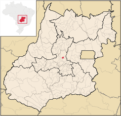
Jesúpolis
Encyclopedia
| Jesúpolis | |
|---|---|
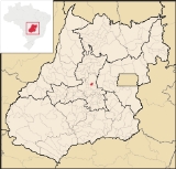
| State | Goiás Goiás Goiás is a state of Brazil, located in the central part of the country. The name Goiás comes from the name of an indigenous community... |
| Coordinates: | 15°57′14"S 49°22′24"W |
| Area: | 120.9 km² |
| Population: | 2,201 (IBGE 2007) |
| Elevation: | 666 m above sea level |
| Postcode (CEP): | 75495-000 |
| Became a city: | 1993 |
| Distance to Goiânia Goiânia -Climate:The city has a tropical wet and dry climate with an average temperature of . There's a wet season, from October to April, and a dry one, from May to September. Annual rainfall is around 1,520 mm.... : |
115 km |
| IBGE statistical microregion: | Anápolis Microregion Anápolis Microregion The Anápolis Microregion is a region of central Goiás state, Brazil, including municipalities surrounding the city of Anápolis. For a map see *Population: 517,221 inhabitants *Cities: 19*Total Area: 8,386.80 km²... |
| Website: | n/a |
Town
A town is a human settlement larger than a village but smaller than a city. The size a settlement must be in order to be called a "town" varies considerably in different parts of the world, so that, for example, many American "small towns" seem to British people to be no more than villages, while...
and municipality
Municipality
A municipality is essentially an urban administrative division having corporate status and usually powers of self-government. It can also be used to mean the governing body of a municipality. A municipality is a general-purpose administrative subdivision, as opposed to a special-purpose district...
in central Goiás
Goiás
Goiás is a state of Brazil, located in the central part of the country. The name Goiás comes from the name of an indigenous community...
state, Brazil
Brazil
Brazil , officially the Federative Republic of Brazil , is the largest country in South America. It is the world's fifth largest country, both by geographical area and by population with over 192 million people...
. The name literally means "City of Jesus".
Distances and Location
- Distance to AnápolisAnápolisAnápolis is the third largest city in the State of Goiás in Brazil. It lies in the center of a rich agricultural region and has become a leader in food processing and pharmaceutical plants.-Location and population:...
: 150 km. - Highway connections from GoiâniaGoiânia-Climate:The city has a tropical wet and dry climate with an average temperature of . There's a wet season, from October to April, and a dry one, from May to September. Annual rainfall is around 1,520 mm....
: GO-080 / NerópolisNerópolisNerópolis is a small city and municipality in central Goiás state, Brazil.-Location:The municipality is part of the metropolitan region of Goiânia, which is 42 kilometers to the west. It is nationally known as the city of garlic and sweets...
/ São Francisco de GoiásSão Francisco de GoiásSão Francisco de Goiás is a small town and municipality in central Goiás state, Brazil.Municipal boundaries:*North: Jaraguá*South: Petrolina de Goiás*East: Pirenópolis*West: Jesúpolis and Jaraguá...
/ GO-529. For all distances see Seplan
Neighboring municipalities: Jaraguá, São Francisco de Goiás
São Francisco de Goiás
São Francisco de Goiás is a small town and municipality in central Goiás state, Brazil.Municipal boundaries:*North: Jaraguá*South: Petrolina de Goiás*East: Pirenópolis*West: Jesúpolis and Jaraguá...
, Petrolina de Goiás
Petrolina de Goiás
Petrolina de Goiás is a small town and municipality in central Goiás state, Brazil.-Location:Petrolina de Goiás is located 81 km. almost due north of Goiânia, the state capital. It is 23 km. southwest of São Francisco de Goiás, 23 km. northwest of Ouro Verde de Goiás, 21 km....
, and Santa Rosa de Goiás
Santa Rosa de Goiás
Santa Rosa de Goiás is a small town and municipality in central Goiás state, Brazil.-Location:Santa Rosa is located 78 km. northwest of the regional center, Anápolis. It is approximately half the distance between Taquaral de Goiás and Petrolina de Goiás. Highway connections are made from...
.
Demographics
- Population density: 18.20 inhab/km² (2007)
- Population growth rate 1996/2007: 0.48.%
- Population in 2007: 2,201
- Urban population in 2007: 1,688
- Rural population in 2007: 513
Economy
The economy is based on modest commerce, public employment, cattle raising, and agriculture. The cattle herd had 12,000 head in 2006 while the main agricultural products were rice, corn, manioc, and a modest production of bananas.- Number of industrial establishments: 0 (2007)
- Number of retail establishments: 13
- Banking establishments: none
- Automobiles: 104 (2007)
Agricultural data 2006
- Number of Farms: 141
- Total area: 10,235 ha.
- Area of permanent crops: 10 (bananas)
- Area of perennial crops: 643 (rice, corn, manioc)
- Area of natural pasture: 7,622 ha.
- Area of woodland and forests: 1,545 ha.
- Persons dependent on farming: 256
- Farms with tractors: 18
- Number of tractors: 28
- Cattle herd: 12,000 head IBGE
Education, Health, and Quality of Life
There were 2 schools in activity with 645 students. The literacy rate was 82.6% in 2000. In the health sector there were no hospitals and 1 walk-in health clinic (2005). The infant mortality rate was 27.68 (in 1,000 live births)Jesúpolis ranked 0.721 on the Municipal Human Development Index
Human Development Index
The Human Development Index is a composite statistic used to rank countries by level of "human development" and separate "very high human development", "high human development", "medium human development", and "low human development" countries...
, placing it 170 (out of 242 municipalities in 2000)in the state and 2,606 (out of 5,507 municipalities in 2000) in the country. All data are from 2000. For the complete list see Frigoletto