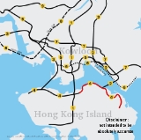
Island Eastern Corridor
Encyclopedia
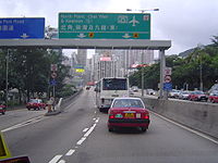
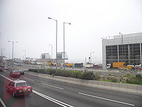
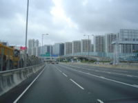
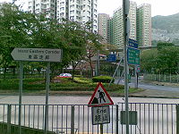
Controlled-access highway
A controlled-access highway is a highway designed exclusively for high-speed vehicular traffic, with all traffic flow and ingress/egress regulated...
along the north shore of Hong Kong Island
Hong Kong Island
Hong Kong Island is an island in the southern part of the Hong Kong Special Administrative Region. It has a population of 1,289,500 and its population density is 16,390/km², as of 2008...
in Hong Kong
Hong Kong
Hong Kong is one of two Special Administrative Regions of the People's Republic of China , the other being Macau. A city-state situated on China's south coast and enclosed by the Pearl River Delta and South China Sea, it is renowned for its expansive skyline and deep natural harbour...
. It starts from Causeway Bay
Causeway Bay
Causeway Bay is a heavily built-up area of Hong Kong, People's Republic of China, located on the Hong Kong Island, and covering parts of Wan Chai and Eastern districts. The Chinese name is also romanized as Tung Lo Wan as in Tung Lo Wan Road...
in the west and ends in Chai Wan
Chai Wan
Chai Wan , formerly mistakenly known as Sai Wan , lies at the east end of the urban area of Hong Kong Island next to Shau Kei Wan. The area is administratively part of the Eastern District, and is a mosaic of industrial and residential areas...
in the east. It is part of Route 4
Route 4 (Hong Kong)
Route 4 is an east-west road artery along the north shore of Hong Kong Island, Hong Kong. Formerly divided into routes 7 and 8, Route 4 consists of two sections:...
. The section between Causeway Bay and Quarry Bay
Quarry Bay
Quarry Bay is an area beneath Mount Parker in the Eastern District of Hong Kong Island, in Hong Kong. The western portion of the area was also formerly known as Lai Chi...
consists mainly of viaduct
Viaduct
A viaduct is a bridge composed of several small spans. The term viaduct is derived from the Latin via for road and ducere to lead something. However, the Ancient Romans did not use that term per se; it is a modern derivation from an analogy with aqueduct. Like the Roman aqueducts, many early...
s built along Victoria Harbour
Victoria Harbour
Victoria Harbour is a natural landform harbour situated between Hong Kong Island and the Kowloon Peninsula in Hong Kong. The harbour's deep, sheltered waters and strategic location on the South China Sea were instrumental in Hong Kong's establishment as a British colony and its subsequent...
.
History
After World War IIWorld War II
World War II, or the Second World War , was a global conflict lasting from 1939 to 1945, involving most of the world's nations—including all of the great powers—eventually forming two opposing military alliances: the Allies and the Axis...
, the Eastern District
Eastern District, Hong Kong
The Eastern District is one of the 18 districts of Hong Kong. It had a population of 587,690 in 2006. The district has the second highest population while its residents have the third highest median household income among 18 districts....
of Hong Kong Island developed rapidly. As a result, the major thoroughfare in the area, King's Road
King's Road, Hong Kong
King's Road is a major east-west street along the northern shore of Hong Kong Island, Hong Kong, extending from Causeway Bay, where it joins Causeway Road, to Sai Wan Ho, where it joins Shau Kei Wan Road.-History:...
, became very congested.
In order to relieve the congestion problem, the idea of constructing the corridor was brought out in 1968. However, commencement of construction did not begin until 1981. The corridor was opened in three phases: Causeway Bay
Causeway Bay
Causeway Bay is a heavily built-up area of Hong Kong, People's Republic of China, located on the Hong Kong Island, and covering parts of Wan Chai and Eastern districts. The Chinese name is also romanized as Tung Lo Wan as in Tung Lo Wan Road...
to Tai Koo Shing on June 8, 1984; Tai Koo Shing to Shau Kei Wan
Shau Kei Wan
Shau Kei Wan or Shaukeiwan, Shaukiwan is a town in Eastern District, Hong Kong. Literally, Shau Kei means a pail, and Wan implies that the town is developed along the coast. Nowadays it is a relatively densely populated town compared with some developing areas.-Name:The name Shau Kei Wan comes...
on July 26, 1985; and Shau Kei Wan
Shau Kei Wan
Shau Kei Wan or Shaukeiwan, Shaukiwan is a town in Eastern District, Hong Kong. Literally, Shau Kei means a pail, and Wan implies that the town is developed along the coast. Nowadays it is a relatively densely populated town compared with some developing areas.-Name:The name Shau Kei Wan comes...
to Chai Wan
Chai Wan
Chai Wan , formerly mistakenly known as Sai Wan , lies at the east end of the urban area of Hong Kong Island next to Shau Kei Wan. The area is administratively part of the Eastern District, and is a mosaic of industrial and residential areas...
on October 12, 1989.
Work has been done to the expressway several times over its life, including the bridge diversions at Quarry Bay
Quarry Bay
Quarry Bay is an area beneath Mount Parker in the Eastern District of Hong Kong Island, in Hong Kong. The western portion of the area was also formerly known as Lai Chi...
, completed in 2003, where Route 4 joins with Route 2
Route 2 (Hong Kong)
Route 2 of Hong Kong runs from Quarry Bay of Hong Kong Island to Ma Liu Shui of the New Territories, formerly known as route 6, and renamed as route 2 in 2004 under the route numbering scheme proposed in the same year....
. There is also a proposed extension of the Corridor into the hills of Chai Wan.
The Government has also proposed the Central-Wan Chai Bypass
Central-Wan Chai Bypass
The Central-Wan Chai Bypass is a proposed 4 km trunk road running between Central and Causeway Bay, Hong Kong. The original design consists of a 2.3 km dual 3-lane tunnel running under new reclamation areas which will be provided by Central and Wan Chai Reclamation project, and also...
, which will connect to the Island Eastern Corridor at its eastern end.
In 2008 the Island Eastern Corridor became the new venue of the Hong Kong Marathon
Hong Kong Marathon
The Hong Kong Marathon, sponsored by Standard Chartered Bank, is an annual marathon race held in February or March in Hong Kong. In addition to the full marathon, a 10 km run and a half marathon are also held.-1997:...
10km race, held on 2008-02-17. The race track started from City Garden
City Garden
City Garden , is a private housing estate in North Point, Hong Kong. It was built from 1983 to 1986 by Cheung Kong Holdings Limited. It consists of 14 blocks, each 28 storeys tall. Part of the site was occupied North Point Power Station before 1983....
in North Point
North Point
North Point is a mixed-use urban area in the Eastern District of Hong Kong. It is the northernmost point of Hong Kong Island, adjacent to both Causeway Bay and Quarry Bay, and projecting toward Kowloon Bay. Fortress Hill occupies the western end of the North Point area.-History:In 1899, The...
, and ran eastwards until Shau Kei Wan
Shau Kei Wan
Shau Kei Wan or Shaukeiwan, Shaukiwan is a town in Eastern District, Hong Kong. Literally, Shau Kei means a pail, and Wan implies that the town is developed along the coast. Nowadays it is a relatively densely populated town compared with some developing areas.-Name:The name Shau Kei Wan comes...
, where it made a U-turn, back along westbound IEC and ended at Victoria Park
Victoria Park, Hong Kong
Victoria Park is a public park in Hong Kong, named after Queen Victoria of the United Kingdom. It is located in Causeway Bay, on the north of Hong Kong Island, between Causeway Bay and Tin Hau MTR stations...
, near the western terminus of the IEC. The noise problem caused by the IEC's design became evident as residents complained about noises as high as 60dB emitting at about five to six o'clock in the morning.
In February 2008 the Government announced that it will construct a waterfront promenade between Causeway Bay and Sai Wan Ho, with significant sections at North Point running under Island Eastern Corridor, using floating boards. However, the Government is concerned about the plan violating the Protection of the Harbour Ordinance
Protection of the Harbour Ordinance
The Protection of the Harbour Ordinance, Cap. 531, is an ordinance in the Hong Kong Law that aims to limit land reclamation in Victoria Harbour.-Content:The ordinance states, in section 3, that:...
, since the boards may need to extend seabound due to the lack of space. Further study will take place regarding the feasibility of the project. When it is finished, a continuous promenade will be formed between Central
Central, Hong Kong
Central is the central business district of Hong Kong. It is located in Central and Western District, on the north shore of Hong Kong Island, across Victoria Harbour from Tsim Sha Tsui, the southernmost point of Kowloon Peninsula...
and Sai Wan Ho
Sai Wan Ho
Sai Wan Ho is a primarily residential area on the northeastern shore of Hong Kong Island, Hong Kong, between Quarry Bay and Shau Kei Wan. It is part of the Eastern District, and is administered together with surrounding areas under the Eastern District Council.-Location:Sai Wan Ho is conventionally...
, together with recreational land use projects related to the Central-Wan Chai Bypass
Central-Wan Chai Bypass
The Central-Wan Chai Bypass is a proposed 4 km trunk road running between Central and Causeway Bay, Hong Kong. The original design consists of a 2.3 km dual 3-lane tunnel running under new reclamation areas which will be provided by Central and Wan Chai Reclamation project, and also...
.
Alignment
The corridor starts at Causeway Bay as a viaduct, where it joins Victoria Park RoadVictoria Park Road
Victoria Park Road is a road in Causeway Bay, Hong Kong that is part of Route 4. It starts in the junction of Route 1 and ends in Hing Fat Street. The road has its name because it is situated on the northern side of Victoria Park....
and Gloucester Road
Gloucester Road, Hong Kong
Gloucester Road is a major road in Hong Kong. It is in the north of Wan Chai and East Point on Hong Kong Island. It connects to Harcourt Road at its western end and it ends east along west side of Victoria Park. It forms part of Hong Kong's Route 4 and connects to the Island Eastern Corridor via...
with a ramp. It then heads east along the coast of North Point, still a viaduct until it comes to Quarry Bay where it descends onto ground level, and interchanges with the approach road of Eastern Harbour Crossing
Eastern Harbour Crossing
The Eastern Harbour Crossing, abbreviated as "EHC" , is a tunnel in Hong Kong. It is a combined road and MTR rail link under Victoria Harbour between Quarry Bay in Hong Kong Island and Cha Kwo Ling in Kowloon.- History :...
. After it has passed Tai Koo Shing, it becomes a viaduct again, now crossing between Sai Wan Ho and Aldrich Bay
Aldrich Bay
Aldrich Bay was formerly a bay in the north shore on the Hong Kong Island, Hong Kong. It is now reclaimed and is a housing area outside the area of Shau Kei Wan, neighbouring A Kung Ngam and Lei King Wan. Outside Aldrich Bay, it is the Shau Kei Wan Typhoon Shelter. It is not a small community...
, making a broad curve toward the Hong Kong Museum of Coastal Defence
Hong Kong Museum of Coastal Defence
The Hong Kong Museum of Coastal Defence is a museum in Hong Kong, located in a former coastal defence fort overlooking the Lei Yue Mun channel, near Shau Kei Wan on Hong Kong Island. The fort was built by the British in 1887, intended to defend the eastern approaches to Victoria Harbour.The total...
, where it returns to ground level and runs past A Kung Ngam
A Kung Ngam
A Kung Ngam is a village and an area in northeast Shau Kei Wan in the north of Hong Kong Island. It contains a fish terminal market and several temples and the Hong Kong Museum of Coastal Defence.A fire broke out in the early morning of 31 October 2005...
and Heng Fa Chuen all the way towards Chai Wan. It ends near Chai Wan Park,at a large roundabout with Chai Wan Road and Wan Tsui Road in Chai Wan, just next to MTR Chai Wan Station.
Criticism
It is often criticised for using up the seafront which could have been enjoyed by residents of Hong Kong had alternative alignments been chosen. Residents have also complained about traffic noises owing to some sections' proximity to residential buildings, and it could be advised that there would have to be sound barriers installed along this section. It has been suggested that the Watson Road - Tin Chiu Street section of the corridor be replaced with a tunnel, but was never considered due to the complex nature of the necessary works.Bus routes using the Corridor
The bus companies in Hong Kong operate a number of "express" bus routes that travel on the Island Eastern Corridor. Examples are:- KMBKowloon Motor BusThe Kowloon Motor Bus Company Limited , a company of the Transport International Holdings Limited, is the largest franchised bus operators in Hong Kong, and one of the largest privately owned public bus operators in the world...
(Jointly operated with CitybusCitybus (Hong Kong)Citybus Limited is one of the three major bus operators in Hong Kong. It provides both franchised and non-franchised bus service. The franchised route network serves mainly Hong Kong Island, cross-harbour routes , Ocean Park, North Lantau and Hong Kong International Airport...
)- 681 Ma On Shan Town CentreMa On Shan (area)Ma On Shan is a new town along the eastern coast of Tolo Harbour in the New Territories of Hong Kong. Although it was initially an extension of Sha Tin New Town, it has been designed to have its own town centre and is now classified as a separate new town in government reports...
<-> CentralCentral, Hong KongCentral is the central business district of Hong Kong. It is located in Central and Western District, on the north shore of Hong Kong Island, across Victoria Harbour from Tsim Sha Tsui, the southernmost point of Kowloon Peninsula...
(Hong Kong StationHong Kong (MTR)Hong Kong Station is the eastern terminus of the Tung Chung Line and Airport Express of the Hong Kong MTR metro system, situated between Man Cheung Street and Harbour View Street, Central, Hong Kong Island, and sits underneath the International Finance Centre...
) - 307 Tai Po CentralTai PoTai Po is an area in the New Territories of Hong Kong. It refers to the vicinity of the traditional market towns in the area presently known as Tai Po Old Market or Tai Po Kau Hui and the Tai Wo Town on the other side of the Lam Tsuen River, near the old Tai Po Market Station of the...
<-> Central Ferry PiersCentral, Hong KongCentral is the central business district of Hong Kong. It is located in Central and Western District, on the north shore of Hong Kong Island, across Victoria Harbour from Tsim Sha Tsui, the southernmost point of Kowloon Peninsula... - 118 Sham Shui Po Tonkin StreetSham Shui PoSham Shui Po, or Shamshuipo, is an area of Sham Shui Po District, Hong Kong, situated in the northwestern part of the Kowloon Peninsula, north of Tai Kok Tsui, east of Cheung Sha Wan and south of Shek Kip Mei. Sham Shui Po is known for its street market for electronic devices.-History:Sham Shui Po...
<-> Siu Sai Wan Island ResortSiu Sai WanSiu Sai Wan is a newly developed residential area in the northeastern part of Hong Kong Island in Hong Kong. It is located in the eastern part of Chai Wan, and is administratively under the Eastern District. The population is about 80,000.-Location:...
- 681 Ma On Shan Town Centre
- New World First BusNew World First BusNew World First Bus Services Limited , abbreviated as First Bus and "NWFB", is the third largest public bus operator in Hong Kong.NWFB was established in 1998, taking over China Motor Bus's franchise on 1 September 1998 to provide bus services on Hong Kong Island together with Citybus...
- 2X Wan Chai Ferry Pier <-> Aldrich BayAldrich BayAldrich Bay was formerly a bay in the north shore on the Hong Kong Island, Hong Kong. It is now reclaimed and is a housing area outside the area of Shau Kei Wan, neighbouring A Kung Ngam and Lei King Wan. Outside Aldrich Bay, it is the Shau Kei Wan Typhoon Shelter. It is not a small community...
- 8 Wan Chai Ferry Pier <-> Heng Fa Chuen
- 8P Wan Chai Ferry Pier <-> Siu Sai WanSiu Sai WanSiu Sai Wan is a newly developed residential area in the northeastern part of Hong Kong Island in Hong Kong. It is located in the eastern part of Chai Wan, and is administratively under the Eastern District. The population is about 80,000.-Location:...
(Island Resort) - 720 CentralCentral, Hong KongCentral is the central business district of Hong Kong. It is located in Central and Western District, on the north shore of Hong Kong Island, across Victoria Harbour from Tsim Sha Tsui, the southernmost point of Kowloon Peninsula...
(Macau Ferry Terminal) <-> Aldrich BayAldrich BayAldrich Bay was formerly a bay in the north shore on the Hong Kong Island, Hong Kong. It is now reclaimed and is a housing area outside the area of Shau Kei Wan, neighbouring A Kung Ngam and Lei King Wan. Outside Aldrich Bay, it is the Shau Kei Wan Typhoon Shelter. It is not a small community... - 720A Aldrich BayAldrich BayAldrich Bay was formerly a bay in the north shore on the Hong Kong Island, Hong Kong. It is now reclaimed and is a housing area outside the area of Shau Kei Wan, neighbouring A Kung Ngam and Lei King Wan. Outside Aldrich Bay, it is the Shau Kei Wan Typhoon Shelter. It is not a small community...
<-> AdmiraltyAdmiralty, Hong KongAdmiralty is the eastern extension of central business district of the Central on the Hong Kong Island of Hong Kong. It is located on the eastern end of the Central and Western District, bordered by Wan Chai to the east and Victoria Harbour to the north. The name of Admiralty refers to the former...
(circular) - 720P CentralCentral, Hong KongCentral is the central business district of Hong Kong. It is located in Central and Western District, on the north shore of Hong Kong Island, across Victoria Harbour from Tsim Sha Tsui, the southernmost point of Kowloon Peninsula...
(Macau Ferry Terminal) <-> Taikoo ShingTaikoo ShingTaikoo Shing, or Tai Koo Shing , is a private residential in Quarry Bay, Hong Kong Island, Hong Kong. It forms a part of the Swire Properties's Island East residential and retail branding, along with TaiKoo Place, the adjacent Cityplaza retail and office complex and EAST, a lifestyle business...
(circular) - 722 Yiu Tung Estate <-> CentralCentral, Hong KongCentral is the central business district of Hong Kong. It is located in Central and Western District, on the north shore of Hong Kong Island, across Victoria Harbour from Tsim Sha Tsui, the southernmost point of Kowloon Peninsula...
(Exchange SquareExchange Square (Hong Kong)The Exchange Square is a building complex located in Central, Hong Kong. It houses offices and the Hong Kong Stock Exchange. It is served by the Central and Hong Kong stations of the MTR metro system....
) (circular)
- 2X Wan Chai Ferry Pier <-> Aldrich Bay
- CitybusCitybus (Hong Kong)Citybus Limited is one of the three major bus operators in Hong Kong. It provides both franchised and non-franchised bus service. The franchised route network serves mainly Hong Kong Island, cross-harbour routes , Ocean Park, North Lantau and Hong Kong International Airport...
- 8X Happy ValleyHappy Valley, Hong KongHappy Valley is a mostly residential suburb of Hong Kong, located in the northern part of Hong Kong Island. Administratively, it is part of Wan Chai District....
(Lower) <-> Siu Sai WanSiu Sai WanSiu Sai Wan is a newly developed residential area in the northeastern part of Hong Kong Island in Hong Kong. It is located in the eastern part of Chai Wan, and is administratively under the Eastern District. The population is about 80,000.-Location:...
(Island Resort) - 780 Chai WanChai WanChai Wan , formerly mistakenly known as Sai Wan , lies at the east end of the urban area of Hong Kong Island next to Shau Kei Wan. The area is administratively part of the Eastern District, and is a mosaic of industrial and residential areas...
(East) <-> CentralCentral, Hong KongCentral is the central business district of Hong Kong. It is located in Central and Western District, on the north shore of Hong Kong Island, across Victoria Harbour from Tsim Sha Tsui, the southernmost point of Kowloon Peninsula...
(Ferry Piers) - 788 CentralCentral, Hong KongCentral is the central business district of Hong Kong. It is located in Central and Western District, on the north shore of Hong Kong Island, across Victoria Harbour from Tsim Sha Tsui, the southernmost point of Kowloon Peninsula...
(Macau Ferry Terminal) <-> Siu Sai WanSiu Sai WanSiu Sai Wan is a newly developed residential area in the northeastern part of Hong Kong Island in Hong Kong. It is located in the eastern part of Chai Wan, and is administratively under the Eastern District. The population is about 80,000.-Location:...
(Island Resort) - 789 Siu Sai WanSiu Sai WanSiu Sai Wan is a newly developed residential area in the northeastern part of Hong Kong Island in Hong Kong. It is located in the eastern part of Chai Wan, and is administratively under the Eastern District. The population is about 80,000.-Location:...
(Island Resort) <-> Admiralty (Rodney Street)
- 8X Happy Valley
Junctions along the Corridor
The junctions along the corridor are as follows:| Road | For | Access | Exit Number (Route 4 Route 4 (Hong Kong) Route 4 is an east-west road artery along the north shore of Hong Kong Island, Hong Kong. Formerly divided into routes 7 and 8, Route 4 consists of two sections:... ) |
|---|---|---|---|
| Hing Fat Street | Causeway Bay | Limited access:
|
6B |
| Tong Shui Road Tong Shui Road Tong Shui Road is a road on the reclamation of North Point on the Hong Kong Island of Hong Kong. The road spans from north Victoria Harbour to south King's Road. There is an exit to Tong Shui Road of Island Eastern Corridor along the north shore of Victoria Harbour. The road near hosts the North... |
North Point | Limited access:
|
6A |
| Man Hong Street | North Point/Quarry Bay | Full access | 6 |
| Eastern Harbour Crossing Eastern Harbour Crossing The Eastern Harbour Crossing, abbreviated as "EHC" , is a tunnel in Hong Kong. It is a combined road and MTR rail link under Victoria Harbour between Quarry Bay in Hong Kong Island and Cha Kwo Ling in Kowloon.- History :... (Route 2 Route 2 (Hong Kong) Route 2 of Hong Kong runs from Quarry Bay of Hong Kong Island to Ma Liu Shui of the New Territories, formerly known as route 6, and renamed as route 2 in 2004 under the route numbering scheme proposed in the same year.... ) |
Kowloon East | Full access | 5 |
| Tai Koo Wan Road | Tai Koo Shing | Full access | 4 |
| Hong On Street/Tai Hong Street | Kornhill Kornhill Kornhill and Kornhill Gardens are apartment buildings on the northern slope of Mount Parker, in Quarry Bay, Hong Kong Island, Hong Kong. Kornhill is of private housing estate and Kornhill Gardens is of Private Sector Participation Scheme... /Sai Wan Ho Sai Wan Ho Sai Wan Ho is a primarily residential area on the northeastern shore of Hong Kong Island, Hong Kong, between Quarry Bay and Shau Kei Wan. It is part of the Eastern District, and is administered together with surrounding areas under the Eastern District Council.-Location:Sai Wan Ho is conventionally... |
Limited access:
|
3C |
| Nam On Street | Shau Kei Wan Shau Kei Wan Shau Kei Wan or Shaukeiwan, Shaukiwan is a town in Eastern District, Hong Kong. Literally, Shau Kei means a pail, and Wan implies that the town is developed along the coast. Nowadays it is a relatively densely populated town compared with some developing areas.-Name:The name Shau Kei Wan comes... /Aldrich Bay Aldrich Bay Aldrich Bay was formerly a bay in the north shore on the Hong Kong Island, Hong Kong. It is now reclaimed and is a housing area outside the area of Shau Kei Wan, neighbouring A Kung Ngam and Lei King Wan. Outside Aldrich Bay, it is the Shau Kei Wan Typhoon Shelter. It is not a small community... |
Limited access:
|
3B |
| Chai Wan Road Chai Wan Road Chai Wan Road located in Hong Kong, is one of the major roads in Chai Wan on Hong Kong Island. It runs from Shau Kei Wan to Chai Wan through Chai Wan Gap; with one of the steepest inclines in Hong Kong on either side, with signs posted 1 in 10 gradient... |
Shek O Shek O Shek O is a beachside village located on the south-eastern part of Hong Kong Island, in Hong Kong. Administratively, it is part of Southern District. The scenery of Shek O is the setting of numerous Cantopop music videos.-Geography:... and Stanley Stanley, Hong Kong Stanley is a town and a tourist attraction in Hong Kong. It located on a peninsula on the southeastern part of Hong Kong Island. It is east of Repulse Bay and west of Shek O, adjacent to Chung Hom Kok... |
Limited access:
|
3A |
| Nam On Street | Shau Kei Wan | Limited access:
|
2B |
| Tung Hei Road | Aldrich Bay | Limited access:
|
2A |
| Shing Tai Road/Wing Tai Road | Siu Sai Wan Siu Sai Wan Siu Sai Wan is a newly developed residential area in the northeastern part of Hong Kong Island in Hong Kong. It is located in the eastern part of Chai Wan, and is administratively under the Eastern District. The population is about 80,000.-Location:... and Heng Fa Chuen |
Full access
|
2 |
| Lee Chung Street | Chai Wan Chai Wan Chai Wan , formerly mistakenly known as Sai Wan , lies at the east end of the urban area of Hong Kong Island next to Shau Kei Wan. The area is administratively part of the Eastern District, and is a mosaic of industrial and residential areas... |
Limited access
|
1 |

