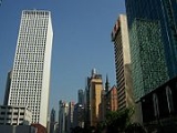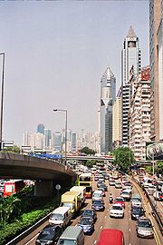
Gloucester Road, Hong Kong
Encyclopedia


Hong Kong
Hong Kong is one of two Special Administrative Regions of the People's Republic of China , the other being Macau. A city-state situated on China's south coast and enclosed by the Pearl River Delta and South China Sea, it is renowned for its expansive skyline and deep natural harbour...
. It is in the north of Wan Chai
Wan Chai
Wan Chai is a metropolitan area situated at the western part of the Wan Chai District on the northern shore of Hong Kong Island, in Hong Kong. Its other boundaries are Canal Road to the east, Arsenal Street to the west and Bowen Road to the south. The area north of Gloucester Road is often called...
and East Point
East Point, Hong Kong
East Point was a cape on the northern shore of Hong Kong Island, Hong Kong. It was a pointed headland that extended from Jardine's Hill, i.e. Lee Garden towards the Kellett Island. It marked the eastern limits of the early City of Victoria. The piece of land separated Causeway Bay in the east and...
on Hong Kong Island
Hong Kong Island
Hong Kong Island is an island in the southern part of the Hong Kong Special Administrative Region. It has a population of 1,289,500 and its population density is 16,390/km², as of 2008...
. It connects to Harcourt Road
Harcourt Road
Harcourt Road is a major road in Admiralty in Hong Kong, connecting Wan Chai and Central.-History:Built after World War II, Harcourt Road was once a waterfront promenade and to ease congestion on Hong Kong Island...
at its western end and it ends east along west side of Victoria Park
Victoria Park, Hong Kong
Victoria Park is a public park in Hong Kong, named after Queen Victoria of the United Kingdom. It is located in Causeway Bay, on the north of Hong Kong Island, between Causeway Bay and Tin Hau MTR stations...
. It forms part of Hong Kong's Route 4
Route 4 (Hong Kong)
Route 4 is an east-west road artery along the north shore of Hong Kong Island, Hong Kong. Formerly divided into routes 7 and 8, Route 4 consists of two sections:...
and connects to the Island Eastern Corridor
Island Eastern Corridor
Island Eastern Corridor is an expressway along the north shore of Hong Kong Island in Hong Kong. It starts from Causeway Bay in the west and ends in Chai Wan in the east. It is part of Route 4...
via Victoria Park Road. The road is connected to the Cross Harbour Tunnel near the Canal Road Flyover. It is one of the only roads in Hong Kong with service roads.
See also
- List of streets and roads in Hong Kong
- Wan Chai Police StationWan Chai Police StationWan Chai Police Station , also known as No. 2 Police Station or Eastern Police Station, is a building located at No. 123 Gloucester Road, Wan Chai, Hong Kong.-History:...
, built in 1932, a Grade III Historic Building

