
.gif)
Interstate 88 (east)
Encyclopedia
Interstate 88 is an intrastate Interstate Highway entirely within the U.S. state
of New York
. Its western end is at Interstate 81 in Binghamton
and its eastern end is at Interstate 90 in Schenectady
. It serves as an important connector route from Albany
to Binghamton
, Elmira
(via NY 17
/future I-86
), and Scranton, Pennsylvania
(via I-81
). It runs near NY 7
, which was once the main route through the area, for its entire length.
on the banks of the Chenango River
. While both directions of I-81 are accessible from I-88 westbound, only one direction of I-81 (northbound) connects to I-88. The missing connection, I-81 south to I-88 east, is made via U.S. Route 11, NY 12
and NY 12A at I-81 exit 6. NY 12A then connects to I-88 at exit 2.
 From I-81, I-88 heads east across the Chenango to Port Dickinson
, where it merges with NY 7
(here also a limited-access highway) at exit 1. The two routes continue north, then east along the eastern bank of the Chenango River, where it meets NY 12A near Chenango Bridge
. I-88 and NY 7 remain alongside the river to Port Crane, where the river begins to follow NY 369
(exit 3) northward. Outside of Port Crane, the expressway heads east to Sanitaria Springs. Here, NY 7 leaves the expressway at exit 4 and begins to parallel I-88, as it does for the remainder of I-88's routing.
I-88 continues east to Harpursville, interchanging with NY 79
(exit 6) near the center of the community. Shortly after meeting NY 79, I-88 reenters a river valley, this time that of the Susquehanna River
. I-88 heads to the northeast, following the river and NY 7 to Bainbridge, New York
where it meets NY 206
and then on to Sidney
, where it meets NY 8
, the primary north–south road through the village, at exit 9. From Sidney, I-88 progresses northeast through southern Otsego County
, passing Unadilla
before entering Oneonta
. Within the city, I-88 interchanges with NY 205
ahead of an exit with NY 28
. NY 28 joins the expressway, following I-88 out of the city.
. I-88, however, remains on a northeasterly track through rural eastern Otsego County. Upon crossing into Schoharie County
, I-88 begins to follow an easterly routing as it heads toward Cobleskill
. While NY 7 enters the village, I-88 passes south of it, connecting to the village via two exits with NY 7. East of Cobleskill, I-88 interchanges with NY 145
. Howe Caverns
, a regionally popular attraction, is located a short distance north of the exit. I-88 continues onward, skirting the northern edge of Schoharie
before passing into Schenectady County
.
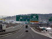
Shortly after entering Schenectady County, I-88 meets U.S. Route 20
east of Duanesburg
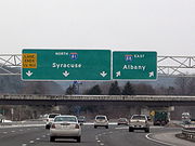
. Past US 20, I-88 continues northeast, interchanging with NY 7 for one final time before ending at the New York State Thruway
(Interstate 90
) in western Schenectady
.
on December 13, 1968, although all 118 miles (190 km) of the route had yet to be constructed. As originally planned by the New York State Department of Transportation
(NYSDOT), I-88 would begin at Interstate 81 in Binghamton and follow the proposed Susquehanna Expressway to Schenectady
, from where it would continue to U.S. Route 4 in Troy
over "Alternate Route 7", the limited-access alignment of NY 7
through the northern suburbs of Albany
. This would have been accomplished by having I-88 meet the New York State Thruway
at exit 25, where it would connect to I-890
. I-88 would then continue to Troy over I-890 and an upgraded NY 7. The proposed connection with I-890 was scrapped in the early 1980s in favor of a connection located to the west of exit 25 in Rotterdam
.
 The first section of I-88 to open was the piece between Chenango Bridge
(exit 2) and Sanitaria Springs (4), which opened in the early 1970s. A second piece near Oneonta between exits 13 and 15 was opened to traffic ca. 1974. Construction progressed southwestward from Oneonta, with the freeway reaching Nineveh
(exit 6) by 1977. The gap between Sanitaria Springs and Nineveh was filled by 1981. The focus then moved to the section of the expressway between Oneonta and Schenectady, which was completed from Oneonta to Duanesburg
(exit 24) by 1981. The Duanesburg–Schenectady leg of I-88 was opened to traffic by 1985. In 1989, construction concluded on I-88 with the opening of the final portion of I-88 between I-81 in Chenango
and NY 7 in Chenango Bridge.
Interchanges along I-88 were not numbered until the early 1980s, though signs left space for the exit numbers to be easily added with unnumbered exit "tabs". The reason for this is that the NYSDOT MUTCD specified that interchanges on new roadways were to be numbered by distance instead of sequentially, however, this was rescinded with the 1983 edition. Interchanges were ultimately numbered sequentially.
In 1999 NYSDOT, the Federal Highway Administration
and the New York State Thruway Authority discussed redesignating the Berkshire Connector as I-90 and redesignating the non-toll part of I-90 from Thruway exit 24 to exit B1 on the Berkshire Connector as I-88. The section of the Thruway between exits 25 and 24 would then be co-designated as I-90 and I-88. This was never implemented.
and northeastern Pennsylvania
, Carr's Creek washed out a 50 feet (15.2 m) section of I-88 southwest of Unadilla
on June 28. Around 6:20 a.m., two trucks from different directions drove into the chasm, apparently unaware of it, killing both drivers. David Swingle, 42, of Waverly
, who was driving eastbound, was identified shortly after the accident. The westbound trucker was Patrick O'Connell, 55, of Lisbon, Maine
. His body was found downstream several days after the water receded.
NYSDOT started construction to replace the section of highway almost immediately, and it was re-opened August 31. Families of both victims planned to sue the state of New York for the incidents.
|rowspan=7|Broome
|Chenango
|0.00
|
|
|Westbound exit and eastbound entrance
|-
|rowspan=3|Fenton
|0.59
|1
|
|West end of NY 7 overlap; westbound exit and eastbound entrance
|-
|2.35
|2
|
|
|-
|4.61
|3
|
|
|-
|rowspan=3|Colesville
|7.81
|4
|
|East end of NY 7 overlap
|-
|12.02
|5
|Martin Hill Road – Belden
|
|-
|16.00
|6
|
|
|-
|rowspan=2|Chenango
|rowspan=2|Afton
|23.77
|7
|
|
|-
|29.43
|8
|
|
|-
|rowspan=3|Delaware
|rowspan=3|Sidney
|33.07
|9
|
|
|-
|37.20
|10
|Unadilla
|
|-
|40.51
|11
|
|
|-
|rowspan=8|Otsego
|Otego
|46.82
|12
|
|
|-
|rowspan=4|Oneonta
|53.51
|13
|
|
|-
|55.76
|14
|Main Street
|Eastbound exit and westbound entrance
|-
|56.43
|15
|
|West end of NY 28 overlap
|-
|58.68
|16
|Emmons
|
|-
|Milford
|61.03
|17
|
|East end of NY 28 overlap
|-
|Maryland
|70.95
|18
|Schenevus
|
|-
|Worcester
|76.70
|19
|
|
|-
|rowspan=4|Schoharie
|rowspan=2|Richmondville
|87.86
|20
|
|
|-
|89.99
|21
|
|
|-
|Cobleskill
|95.16
|22
|
|
|-
|Schoharie
|101.04
|23
|
|Access to NY 7 and NY 30 is via NY 30A
|-
|rowspan=3|Schenectady
|Duanesburg
|112.14
|24
|
|
|-
|rowspan=2|Rotterdam
|116.87
|25
|
|
|-
|117.75
|
|
|Eastbound exit and westbound entrance
U.S. state
A U.S. state is any one of the 50 federated states of the United States of America that share sovereignty with the federal government. Because of this shared sovereignty, an American is a citizen both of the federal entity and of his or her state of domicile. Four states use the official title of...
of New York
New York
New York is a state in the Northeastern region of the United States. It is the nation's third most populous state. New York is bordered by New Jersey and Pennsylvania to the south, and by Connecticut, Massachusetts and Vermont to the east...
. Its western end is at Interstate 81 in Binghamton
Binghamton, New York
Binghamton is a city in the Southern Tier of New York in the United States. It is near the Pennsylvania border, in a bowl-shaped valley at the confluence of the Susquehanna and Chenango Rivers...
and its eastern end is at Interstate 90 in Schenectady
Schenectady, New York
Schenectady is a city in Schenectady County, New York, United States, of which it is the county seat. As of the 2010 census, the city had a population of 66,135...
. It serves as an important connector route from Albany
Albany, New York
Albany is the capital city of the U.S. state of New York, the seat of Albany County, and the central city of New York's Capital District. Roughly north of New York City, Albany sits on the west bank of the Hudson River, about south of its confluence with the Mohawk River...
to Binghamton
Binghamton, New York
Binghamton is a city in the Southern Tier of New York in the United States. It is near the Pennsylvania border, in a bowl-shaped valley at the confluence of the Susquehanna and Chenango Rivers...
, Elmira
Elmira, New York
Elmira is a city in Chemung County, New York, USA. It is the principal city of the 'Elmira, New York Metropolitan Statistical Area' which encompasses Chemung County, New York. The population was 29,200 at the 2010 census. It is the county seat of Chemung County.The City of Elmira is located in...
(via NY 17
New York State Route 17
New York State Route 17 is a state highway that extends for through the Southern Tier and Downstate regions of New York in the United States...
/future I-86
Interstate 86 (east)
Interstate 86 is an Interstate Highway that extends for through northwestern Pennsylvania and southern New York in the United States...
), and Scranton, Pennsylvania
Scranton, Pennsylvania
Scranton is a city in the northeastern part of Pennsylvania, United States. It is the county seat of Lackawanna County and the largest principal city in the Scranton/Wilkes-Barre metropolitan area. Scranton had a population of 76,089 in 2010, according to the U.S...
(via I-81
Interstate 81
Interstate 81 is an Interstate Highway in the eastern part of the United States. Its southern terminus is at Interstate 40 in Dandridge, Tennessee; its northern terminus is on Wellesley Island at the Canadian border, where the Thousand Islands Bridge connects it to Highway 401, the main freeway...
). It runs near NY 7
New York State Route 7
New York State Route 7 is a 180-mile long New York State Highway that runs from the New York/Pennsylvania border south of Binghamton, New York to the New York/Vermont border east of Hoosick. Most of the road runs along the Susquehanna Valley, closely paralleling Interstate 88 throughout...
, which was once the main route through the area, for its entire length.
Binghamton to Oneonta
I-88 begins at an interchange with Interstate 81 just north of downtown BinghamtonBinghamton, New York
Binghamton is a city in the Southern Tier of New York in the United States. It is near the Pennsylvania border, in a bowl-shaped valley at the confluence of the Susquehanna and Chenango Rivers...
on the banks of the Chenango River
Chenango River
The Chenango River is a tributary of the Susquehanna River in central New York in the United States. It drains a dissected plateau area in upstate New York at the northern end of the Susquehanna watershed....
. While both directions of I-81 are accessible from I-88 westbound, only one direction of I-81 (northbound) connects to I-88. The missing connection, I-81 south to I-88 east, is made via U.S. Route 11, NY 12
New York State Route 12
New York State Route 12 is a state highway extending for through central and northern New York in the United States. The southern terminus of the route is at U.S. Route 11 in the town of Chenango in the Southern Tier. The northern terminus is at NY 37 near the village of...
and NY 12A at I-81 exit 6. NY 12A then connects to I-88 at exit 2.
Port Dickinson, New York
Port Dickinson is a village in Broome County, New York, United States. The population was 1,697 at the 2000 census. It is part of the Binghamton Metropolitan Statistical Area....
, where it merges with NY 7
New York State Route 7
New York State Route 7 is a 180-mile long New York State Highway that runs from the New York/Pennsylvania border south of Binghamton, New York to the New York/Vermont border east of Hoosick. Most of the road runs along the Susquehanna Valley, closely paralleling Interstate 88 throughout...
(here also a limited-access highway) at exit 1. The two routes continue north, then east along the eastern bank of the Chenango River, where it meets NY 12A near Chenango Bridge
Chenango Bridge, New York
Chenango Bridge is a hamlet in the southern part of the town of Chenango in Broome County, New York, United States. It lies where State Route 12A crosses the Chenango River....
. I-88 and NY 7 remain alongside the river to Port Crane, where the river begins to follow NY 369
New York State Route 369
New York State Route 369 is a state highway located entirely within the town of Fenton in Broome County, New York. It begins at NY 7B south of the concurrency of Interstate 88 and NY 7 in the hamlet of Port Crane and ends at NY 79 in the hamlet of North Fenton.-Route...
(exit 3) northward. Outside of Port Crane, the expressway heads east to Sanitaria Springs. Here, NY 7 leaves the expressway at exit 4 and begins to parallel I-88, as it does for the remainder of I-88's routing.
I-88 continues east to Harpursville, interchanging with NY 79
New York State Route 79
New York State Route 79 is an east–west state highway in the Southern Tier of New York, United States. The western terminus of the route is at the intersection with NY 414 near the southern end of Seneca Lake east of Watkins Glen...
(exit 6) near the center of the community. Shortly after meeting NY 79, I-88 reenters a river valley, this time that of the Susquehanna River
Susquehanna River
The Susquehanna River is a river located in the northeastern United States. At long, it is the longest river on the American east coast that drains into the Atlantic Ocean, and with its watershed it is the 16th largest river in the United States, and the longest river in the continental United...
. I-88 heads to the northeast, following the river and NY 7 to Bainbridge, New York
Bainbridge, New York
Bainbridge, New York, the name of a village and a town in Chenango County, New York, USA may refer to:* Bainbridge, New York* Bainbridge , New York, a village in the town- See also :...
where it meets NY 206
New York State Route 206
New York State Route 206 is a state highway in the Southern Tier of New York, United States. It runs through some lightly populated regions along the state's southern border, from Central New York to the Catskills. It begins near a busy intersection with Interstate 81 at Whitney Point...
and then on to Sidney
Sidney (village), New York
Sidney is a village in Delaware County, New York, USA. The population was 4,068 at the 2000 census.The Village of Sidney is in west part of the Town of Sidney.-History:The village was named for Admiral Sir Sidney Smith.-Geography:...
, where it meets NY 8
New York State Route 8
New York State Route 8 is a state highway in the central part of New York in the United States. It runs in a southwest-to-northeast direction from the Southern Tier to the northern part of Lake George. The southern terminus of the route is at an interchange with NY 17 in the town of...
, the primary north–south road through the village, at exit 9. From Sidney, I-88 progresses northeast through southern Otsego County
Otsego County, New York
Otsego County is a county located in the U.S. state of New York. The 2010 population was 62,259. The county seat is Cooperstown. The name Otsego is from a Mohawk word meaning "place of the rock."-History:...
, passing Unadilla
Unadilla (village), New York
Unadilla is a village located in the Town of Unadilla in Otsego County, New York, USA. The population was 1,127 at the 2000 census.The Village of Unadilla is located in the south part of the town, southwest of Oneonta...
before entering Oneonta
Oneonta, New York
Oneonta is a city in southern Otsego County, New York, USA. As of the 2010 U.S. Census, had a population of 13,901. Its nickname is "City of the Hills." While the word "oneonta" is of undetermined origin, it is popularly believed to mean "place of open rocks" in the Iroquois language...
. Within the city, I-88 interchanges with NY 205
New York State Route 205
New York State Route 205 is a state highway in New York, running from near the city of Oneonta to the town of Otsego in Otsego County. NY 205 is a two-lane highway its entire length and passes through Hartwick....
ahead of an exit with NY 28
New York State Route 28
New York State Route 28 is a state highway extending for in the shape of a "C" between the Hudson Valley city of Kingston and southern Warren County in the U.S. state of New York. Along the way, it intersects several major routes, including Interstate 88 , U.S. Route 20 , and the...
. NY 28 joins the expressway, following I-88 out of the city.
Oneonta to Schenectady
Northeast of Oneonta, NY 28 leaves I-88 at exit 17 to follow the Susquehanna River northward toward CooperstownCooperstown, New York
Cooperstown is a village in Otsego County, New York, USA. It is located in the Town of Otsego. The population was estimated to be 1,852 at the 2010 census.The Village of Cooperstown is the county seat of Otsego County, New York...
. I-88, however, remains on a northeasterly track through rural eastern Otsego County. Upon crossing into Schoharie County
Schoharie County, New York
As of the census of 2000, there were 31,582 people, 11,991 households and 8,177 families residing in the county. The population density was 51 people per square mile . There were 15,915 housing units at an average density of 26 per square mile...
, I-88 begins to follow an easterly routing as it heads toward Cobleskill
Cobleskill (village), New York
Cobleskill is a village in the western part of the town of Cobleskill in Schoharie County, New York, USA. The population was 4,533 at the 2000 census.The village is southwest of Amsterdam...
. While NY 7 enters the village, I-88 passes south of it, connecting to the village via two exits with NY 7. East of Cobleskill, I-88 interchanges with NY 145
New York State Route 145
New York State Route 145 is a state highway in eastern New York in the United States. The highway extends for from NY 23 in the Greene County town of Cairo to U.S. Route 20 in the Schoharie County town of Sharon. Along the way, NY 145 intersects NY 30 in Middleburgh and...
. Howe Caverns
Howe Caverns
Howe Caverns is a cave in Howes Cave, Schoharie County, New York.-Geology:Geologists believe that the formation of the cave, which lies below ground, began several million years ago...
, a regionally popular attraction, is located a short distance north of the exit. I-88 continues onward, skirting the northern edge of Schoharie
Schoharie (village), New York
Schoharie is a village in Schoharie County, New York, USA. The population was 1,030 at the 2000 census. It is the county seat of Schoharie County...
before passing into Schenectady County
Schenectady County, New York
Schenectady County is a county located in the U.S. state of New York. As of the 2010 census, the population was 154,727. It is part of the Albany-Schenectady-Troy Metropolitan Statistical Area. The county seat is Schenectady. The name is from a Mohawk Indian word meaning "on the other side of the...
.
Shortly after entering Schenectady County, I-88 meets U.S. Route 20
U.S. Route 20 in New York
U.S. Route 20 is a part of the U.S. Highway System that runs from Newport, Oregon, to Boston, Massachusetts. In the U.S. state of New York, US 20 extends from the Pennsylvania state line at Ripley to the Massachusetts state line in the Berkshire Mountains. US 20 is the longest...
east of Duanesburg
Duanesburg, New York
Duanesburg is a town in Schenectady County, New York, USA. The population was 5,808 at the 2000 census. Duanesburg is named for James Duane, who held most of it as an original land grant. The town is in the western part of the county.-History:...
. Past US 20, I-88 continues northeast, interchanging with NY 7 for one final time before ending at the New York State Thruway
New York State Thruway
The New York State Thruway is a system of limited-access highways located within the state of New York in the United States. The system, known officially as the Governor Thomas E. Dewey Thruway for former New York Governor Thomas E. Dewey, is operated by the New York State Thruway Authority and...
(Interstate 90
Interstate 90 in New York
Interstate 90 is a part of the Interstate Highway System that runs from Seattle, Washington, to Boston, Massachusetts. In the U.S. state of New York, I-90 extends from the Pennsylvania state line at Ripley to the Massachusetts state line at Canaan...
) in western Schenectady
Schenectady, New York
Schenectady is a city in Schenectady County, New York, United States, of which it is the county seat. As of the 2010 census, the city had a population of 66,135...
.
History
I-88 was added to the Interstate Highway SystemInterstate Highway System
The Dwight D. Eisenhower National System of Interstate and Defense Highways, , is a network of limited-access roads including freeways, highways, and expressways forming part of the National Highway System of the United States of America...
on December 13, 1968, although all 118 miles (190 km) of the route had yet to be constructed. As originally planned by the New York State Department of Transportation
New York State Department of Transportation
The New York State Department of Transportation is responsible for the development and operation of highways, railroads, mass transit systems, ports, waterways and aviation facilities in the U.S...
(NYSDOT), I-88 would begin at Interstate 81 in Binghamton and follow the proposed Susquehanna Expressway to Schenectady
Schenectady, New York
Schenectady is a city in Schenectady County, New York, United States, of which it is the county seat. As of the 2010 census, the city had a population of 66,135...
, from where it would continue to U.S. Route 4 in Troy
Troy, New York
Troy is a city in the US State of New York and the seat of Rensselaer County. Troy is located on the western edge of Rensselaer County and on the eastern bank of the Hudson River. Troy has close ties to the nearby cities of Albany and Schenectady, forming a region popularly called the Capital...
over "Alternate Route 7", the limited-access alignment of NY 7
New York State Route 7
New York State Route 7 is a 180-mile long New York State Highway that runs from the New York/Pennsylvania border south of Binghamton, New York to the New York/Vermont border east of Hoosick. Most of the road runs along the Susquehanna Valley, closely paralleling Interstate 88 throughout...
through the northern suburbs of Albany
Albany, New York
Albany is the capital city of the U.S. state of New York, the seat of Albany County, and the central city of New York's Capital District. Roughly north of New York City, Albany sits on the west bank of the Hudson River, about south of its confluence with the Mohawk River...
. This would have been accomplished by having I-88 meet the New York State Thruway
New York State Thruway
The New York State Thruway is a system of limited-access highways located within the state of New York in the United States. The system, known officially as the Governor Thomas E. Dewey Thruway for former New York Governor Thomas E. Dewey, is operated by the New York State Thruway Authority and...
at exit 25, where it would connect to I-890
Interstate 890
Interstate 890 is a long auxiliary Interstate Highway in the vicinity of Schenectady, New York, United States. The highway runs southeast–northwest from an interchange with the New York State Thruway northwest of Schenectady to another junction with the Thruway south of the city and passes...
. I-88 would then continue to Troy over I-890 and an upgraded NY 7. The proposed connection with I-890 was scrapped in the early 1980s in favor of a connection located to the west of exit 25 in Rotterdam
Rotterdam (town), New York
Rotterdam is a town in Schenectady County, New York, United States. The population was 28,316 at the 2000 census.The town of Rotterdam is in the south-central part of the county. It was founded by Dutch settlers, who named it after the port of Rotterdam in the Netherlands, where many emigrants last...
.
Chenango Bridge, New York
Chenango Bridge is a hamlet in the southern part of the town of Chenango in Broome County, New York, United States. It lies where State Route 12A crosses the Chenango River....
(exit 2) and Sanitaria Springs (4), which opened in the early 1970s. A second piece near Oneonta between exits 13 and 15 was opened to traffic ca. 1974. Construction progressed southwestward from Oneonta, with the freeway reaching Nineveh
Nineveh, New York
Nineveh is an unincorporated hamlet with about 50 homes on the banks of the Susquehanna River in New York. It is part of the Town of Colesville, Binghamton metropolitan area in eastern Broome county. Nineveh is located on the USGS Afton quadrangle at an elevation of about 960 feet...
(exit 6) by 1977. The gap between Sanitaria Springs and Nineveh was filled by 1981. The focus then moved to the section of the expressway between Oneonta and Schenectady, which was completed from Oneonta to Duanesburg
Duanesburg, New York
Duanesburg is a town in Schenectady County, New York, USA. The population was 5,808 at the 2000 census. Duanesburg is named for James Duane, who held most of it as an original land grant. The town is in the western part of the county.-History:...
(exit 24) by 1981. The Duanesburg–Schenectady leg of I-88 was opened to traffic by 1985. In 1989, construction concluded on I-88 with the opening of the final portion of I-88 between I-81 in Chenango
Chenango, New York
Chenango is a town in Broome County, New York, United States. The population was 11,454 at the 2000 census.The Town of Chenango is in the eastern part of the county, northeast of Binghamton.- History :The town was first settled around 1787....
and NY 7 in Chenango Bridge.
Interchanges along I-88 were not numbered until the early 1980s, though signs left space for the exit numbers to be easily added with unnumbered exit "tabs". The reason for this is that the NYSDOT MUTCD specified that interchanges on new roadways were to be numbered by distance instead of sequentially, however, this was rescinded with the 1983 edition. Interchanges were ultimately numbered sequentially.
In 1999 NYSDOT, the Federal Highway Administration
Federal Highway Administration
The Federal Highway Administration is a division of the United States Department of Transportation that specializes in highway transportation. The agency's major activities are grouped into two "programs," the Federal-aid Highway Program and the Federal Lands Highway Program...
and the New York State Thruway Authority discussed redesignating the Berkshire Connector as I-90 and redesignating the non-toll part of I-90 from Thruway exit 24 to exit B1 on the Berkshire Connector as I-88. The section of the Thruway between exits 25 and 24 would then be co-designated as I-90 and I-88. This was never implemented.
2006 flood
As a result of the June 2006 flooding in upstate New YorkNew York
New York is a state in the Northeastern region of the United States. It is the nation's third most populous state. New York is bordered by New Jersey and Pennsylvania to the south, and by Connecticut, Massachusetts and Vermont to the east...
and northeastern Pennsylvania
Pennsylvania
The Commonwealth of Pennsylvania is a U.S. state that is located in the Northeastern and Mid-Atlantic regions of the United States. The state borders Delaware and Maryland to the south, West Virginia to the southwest, Ohio to the west, New York and Ontario, Canada, to the north, and New Jersey to...
, Carr's Creek washed out a 50 feet (15.2 m) section of I-88 southwest of Unadilla
Unadilla (village), New York
Unadilla is a village located in the Town of Unadilla in Otsego County, New York, USA. The population was 1,127 at the 2000 census.The Village of Unadilla is located in the south part of the town, southwest of Oneonta...
on June 28. Around 6:20 a.m., two trucks from different directions drove into the chasm, apparently unaware of it, killing both drivers. David Swingle, 42, of Waverly
Waverly, Tioga County, New York
----Waverly is the largest village in Tioga County, New York, United States. It is located southeast of Elmira in the Southern Tier region. This village was incorporated as the southwest part of the town of Barton in 1854...
, who was driving eastbound, was identified shortly after the accident. The westbound trucker was Patrick O'Connell, 55, of Lisbon, Maine
Lisbon, Maine
Lisbon is a town in Androscoggin County, Maine, United States. The population was 9,077 at the 2000 census. It is included in both the Lewiston-Auburn, Maine metropolitan statistical area and the Lewiston-Auburn, Maine Metropolitan New England city and town area...
. His body was found downstream several days after the water receded.
NYSDOT started construction to replace the section of highway almost immediately, and it was re-opened August 31. Families of both victims planned to sue the state of New York for the incidents.
Exit list
|-|rowspan=7|Broome
Broome County, New York
Broome County is a county located in the U.S. state of New York. As of the 2010 census, the population was 200,600. It was named in honor of John Broome, who was lieutenant governor in 1806 when Broome County was established. Its county seat is Binghamton, which is also its major city. The current...
|Chenango
Chenango, New York
Chenango is a town in Broome County, New York, United States. The population was 11,454 at the 2000 census.The Town of Chenango is in the eastern part of the county, northeast of Binghamton.- History :The town was first settled around 1787....
|0.00
|
|
|Westbound exit and eastbound entrance
|-
|rowspan=3|Fenton
Fenton, New York
Fenton is a town in Broome County, New York, United States. The population was 6,909 at the 2000 census. The town was named after Reuben Fenton, a governor of New York...
|0.59
|1
|
|West end of NY 7 overlap; westbound exit and eastbound entrance
|-
|2.35
|2
|
|
|-
|4.61
|3
|
|
|-
|rowspan=3|Colesville
Colesville, New York
Colesville is a town in Broome County, New York, United States. The population was 5,441 at the 2000 census.The Town of Colesville is in the northeast part of the county and is northeast of Binghamton.- History :...
|7.81
|4
|
|East end of NY 7 overlap
|-
|12.02
|5
|Martin Hill Road – Belden
|
|-
|16.00
|6
|
|
|-
|rowspan=2|Chenango
Chenango County, New York
Chenango County is a county located in the U.S. state of New York. As of the 2010 census, the population was 50,477. The county's name originates from an Oneida word meaning "large bull-thistle." Its county seat is Norwich.-History:...
|rowspan=2|Afton
Afton (town), New York
Afton is a town in Chenango County, New York, United States. The population was 2,977 at the 2000 census. Afton is situated on the south-east corner of the county and lies wholly within the original township of Clinton...
|23.77
|7
|
|
|-
|29.43
|8
|
|
|-
|rowspan=3|Delaware
Delaware County, New York
Delaware County is a county located in the U.S. state of New York. As of 2010 the population was 47,980. The county seat is Delhi. It is named after the Delaware River, which was named in honor of Thomas West, 3rd Baron De La Warr, appointed governor of Virginia in 1609.-History:When counties...
|rowspan=3|Sidney
Sidney (village), New York
Sidney is a village in Delaware County, New York, USA. The population was 4,068 at the 2000 census.The Village of Sidney is in west part of the Town of Sidney.-History:The village was named for Admiral Sir Sidney Smith.-Geography:...
|33.07
|9
|
|
|-
|37.20
|10
|Unadilla
Unadilla (village), New York
Unadilla is a village located in the Town of Unadilla in Otsego County, New York, USA. The population was 1,127 at the 2000 census.The Village of Unadilla is located in the south part of the town, southwest of Oneonta...
|
|-
|40.51
|11
|
|
|-
|rowspan=8|Otsego
Otsego County, New York
Otsego County is a county located in the U.S. state of New York. The 2010 population was 62,259. The county seat is Cooperstown. The name Otsego is from a Mohawk word meaning "place of the rock."-History:...
|Otego
|46.82
|12
|
|
|-
|rowspan=4|Oneonta
Oneonta, New York
Oneonta is a city in southern Otsego County, New York, USA. As of the 2010 U.S. Census, had a population of 13,901. Its nickname is "City of the Hills." While the word "oneonta" is of undetermined origin, it is popularly believed to mean "place of open rocks" in the Iroquois language...
|53.51
|13
|
|
|-
|55.76
|14
|Main Street
|Eastbound exit and westbound entrance
|-
|56.43
|15
|
|West end of NY 28 overlap
|-
|58.68
|16
|Emmons
|
|-
|Milford
Milford (village), New York
Milford is a village in Otsego County, New York, in the United States. As of the 2000 census, the village had a population of 511.The Village of Milford is in the northeast part of the Town of Milford...
|61.03
|17
|
|East end of NY 28 overlap
|-
|Maryland
Maryland, New York
Maryland is a town in Otsego County, New York, United States. The population was 1,920 at the 2000 census. It was named for the U.S. state of the same name.The Town of Maryland is on the county's south border...
|70.95
|18
|Schenevus
Schenevus, New York
Schenevus is a hamlet in the Town of Maryland in southeastern Otsego County, New York, USA. According to the 1990 U.S. census, the population was 513.The district covers the towns of Maryland, Westford, Milford, Decatur, and, Roseboom....
|
|-
|Worcester
Worcester, New York
Worcester is a town in Otsego County, New York, United States. The population was 2,207 at the 2000 census.Worcester is on the southeast border of the county and is northeast of Oneonta....
|76.70
|19
|
|
|-
|rowspan=4|Schoharie
Schoharie County, New York
As of the census of 2000, there were 31,582 people, 11,991 households and 8,177 families residing in the county. The population density was 51 people per square mile . There were 15,915 housing units at an average density of 26 per square mile...
|rowspan=2|Richmondville
Richmondville (village), New York
Richmondville is a village in Schoharie County, New York, USA. The population was 918 at the 2010 census.The Village of Richmondville is in the center of the Town of Richmondville and is northeast of Oneonta.- History :...
|87.86
|20
|
|
|-
|89.99
|21
|
|
|-
|Cobleskill
Cobleskill (village), New York
Cobleskill is a village in the western part of the town of Cobleskill in Schoharie County, New York, USA. The population was 4,533 at the 2000 census.The village is southwest of Amsterdam...
|95.16
|22
|
|
|-
|Schoharie
Schoharie (village), New York
Schoharie is a village in Schoharie County, New York, USA. The population was 1,030 at the 2000 census. It is the county seat of Schoharie County...
|101.04
|23
|
|Access to NY 7 and NY 30 is via NY 30A
|-
|rowspan=3|Schenectady
Schenectady County, New York
Schenectady County is a county located in the U.S. state of New York. As of the 2010 census, the population was 154,727. It is part of the Albany-Schenectady-Troy Metropolitan Statistical Area. The county seat is Schenectady. The name is from a Mohawk Indian word meaning "on the other side of the...
|Duanesburg
Duanesburg, New York
Duanesburg is a town in Schenectady County, New York, USA. The population was 5,808 at the 2000 census. Duanesburg is named for James Duane, who held most of it as an original land grant. The town is in the western part of the county.-History:...
|112.14
|24
|
|
|-
|rowspan=2|Rotterdam
|116.87
|25
|
|
|-
|117.75
|
|
|Eastbound exit and westbound entrance