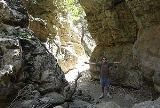
Imbros Gorge
Encyclopedia
Imbros Gorge is a 11 km long canyon
located near Hora Sfakion
in southern Crete
, the Mediterranean island. It runs parallel to Samariá Gorge
, its narrowest part has 1.60 m and it ends at the village of Kommitádes (8 km/ 650 m for hiking). The Imbros village (aka Nimbros) is located at an altitude of 780 meters and is at the South end of the fertile plain of Askyfou.
The legend tells that two brother were banished from Imbros
, Turkey and lived in the Imbros village, Crete.
The Imbros Gorge mule trail was the only connection between Chania
and Hora Sfakion, before the road was built. Remains of this trail can be still seen. The gorge witnessed an evacuation of several thousands of British soldiers during World War II
before heading to Egypt
.
Hiking:
Image:Imbros gorge (Crete).JPG|Imbros Gorge (Crete
)
Image:Imbros Gorge (Crete) 002.JPG|Imbros Gorge
Image:Imbros-Gorge.jpg|Imbros Gorge
Canyon
A canyon or gorge is a deep ravine between cliffs often carved from the landscape by a river. Rivers have a natural tendency to reach a baseline elevation, which is the same elevation as the body of water it will eventually drain into. This forms a canyon. Most canyons were formed by a process of...
located near Hora Sfakion
Hora Sfakion
Image:Chora Sfakion 1941 evacuation monument.jpg|thumb|right|200px|Monument commemorating the evacuation during WW2 of British and ANZAC forces from Hora Sfakion in May 1941. Click on the left plaque for a closer viewrect 198 536 320 1082 rect 0 0 900 1200...
in southern Crete
Crete
Crete is the largest and most populous of the Greek islands, the fifth largest island in the Mediterranean Sea, and one of the thirteen administrative regions of Greece. It forms a significant part of the economy and cultural heritage of Greece while retaining its own local cultural traits...
, the Mediterranean island. It runs parallel to Samariá Gorge
Samaria Gorge
The Samariá Gorge is aNational Park of Greece on the island of Crete - a major tourist attraction of the island - and a World's Biosphere Reserve....
, its narrowest part has 1.60 m and it ends at the village of Kommitádes (8 km/ 650 m for hiking). The Imbros village (aka Nimbros) is located at an altitude of 780 meters and is at the South end of the fertile plain of Askyfou.
The legend tells that two brother were banished from Imbros
Imbros
Imbros or Imroz, officially referred to as Gökçeada since July 29, 1970 , is an island in the Aegean Sea and the largest island of Turkey, part of Çanakkale Province. It is located at the entrance of Saros Bay and is also the westernmost point of Turkey...
, Turkey and lived in the Imbros village, Crete.
The Imbros Gorge mule trail was the only connection between Chania
Chania
Chaniá , , also transliterated Chania, Hania, and Xania, older form Chanea and Venetian Canea, Ottoman Turkish خانيه Hanya) is the second largest city of Crete and the capital of the Chania peripheral unit...
and Hora Sfakion, before the road was built. Remains of this trail can be still seen. The gorge witnessed an evacuation of several thousands of British soldiers during World War II
World War II
World War II, or the Second World War , was a global conflict lasting from 1939 to 1945, involving most of the world's nations—including all of the great powers—eventually forming two opposing military alliances: the Allies and the Axis...
before heading to Egypt
Egypt
Egypt , officially the Arab Republic of Egypt, Arabic: , is a country mainly in North Africa, with the Sinai Peninsula forming a land bridge in Southwest Asia. Egypt is thus a transcontinental country, and a major power in Africa, the Mediterranean Basin, the Middle East and the Muslim world...
.
Hiking:
- The entrance fee is €2.
- Easy to pass, it has no dangerous points and you don't need a guide with you.
- Because it is so small only a short amount of time is needed, ideal for those who can't walk for many hours or don't have much spare time.
- You can pass the gorge all year round except when it's raining or snowing heavily.
- For those who reach Imbros with their own car, they can leave it there, pass the gorge and return to it with a taxi from Kommitádes or walk through the gorge all the way back again, as it is not so tiring.
- As someone walks downhill 8 km and 650 m, it is something like half of Samariá Gorge. But Samariá Gorge is screeScreeScree, also called talus, is a term given to an accumulation of broken rock fragments at the base of crags, mountain cliffs, or valley shoulders. Landforms associated with these materials are sometimes called scree slopes or talus piles...
above the river bed, and Imbros Gorge is round scree of the dry creek bed. The trail is still strenuous, people with over size waist, sandals without socks, and women with elegant shoes covering just their toes, suffer.
Gallery
Image:Imbros gorge (Crete).JPG|Imbros Gorge (Crete
Crete
Crete is the largest and most populous of the Greek islands, the fifth largest island in the Mediterranean Sea, and one of the thirteen administrative regions of Greece. It forms a significant part of the economy and cultural heritage of Greece while retaining its own local cultural traits...
)
Image:Imbros Gorge (Crete) 002.JPG|Imbros Gorge
Image:Imbros-Gorge.jpg|Imbros Gorge

