High Island Reservoir
Encyclopedia
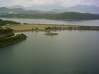
The High Island Reservoir , located in the far south eastern part of the Sai Kung Peninsula
, was opened in 1978 helping to alleviate water shortage problems in Hong Kong
. Its water capacity is approximately 273 million cubic metres. The area it occupies was originally the Kwun Mun Channel (官門海峽), which separated High Island
from the Sai Kung Peninsula.
during the Hong Kong 1967 riots
, the government responded with the High Island Reservoir. It was expected to be the same size as Plover Cove
. The construction, contracted by an Italian company cost more than HKD
$400 million.
was designed by Binnie & Partners as a part of the High Island Water Scheme which included pipeworks and other supporting infrastructure as well as the reservoir itself. The reservoir was created by constructing two main dam
s. One was built at the west of High Island
connecting it with the Sai Kung Peninsula at Yuen Ng Fan (元五墳). The other were built in the Southeast of High Island, connecting it with the Sai Kung Peninsula near Po Pin Chau, a stack island
. Three smaller dams were also constructed in valleys around the reservoir. Aqueduct
s totalling 5 miles in length were also constructed to transfer water from streams
around Sai Kung Peninsula
to the reservoir. Construction spanned 10 years from 1969 to 1979. Two roads were created as part of the scheme, crossing over the dams. This enabled visitors to access a very remote and unspoilt area for recreation. Many of the techniques and technology used, like grouting, was cutting edge at the time.

was built near the reservoir for hosting refugee
s and boat people from Vietnam
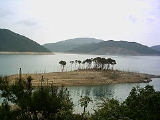
. The area is now a flat piece of grassland that is grazed by cows. It has a comfortable pavilion that leads out of the strip of land.
Sai Kung Peninsula
Sai Kung Peninsula is a peninsula in the easternmost part of the New Territories in Hong Kong. Its name comes from Sai Kung Town in the central southern area of the peninsula...
, was opened in 1978 helping to alleviate water shortage problems in Hong Kong
Hong Kong
Hong Kong is one of two Special Administrative Regions of the People's Republic of China , the other being Macau. A city-state situated on China's south coast and enclosed by the Pearl River Delta and South China Sea, it is renowned for its expansive skyline and deep natural harbour...
. Its water capacity is approximately 273 million cubic metres. The area it occupies was originally the Kwun Mun Channel (官門海峽), which separated High Island
High Island, Hong Kong
High Island or Leung Shuen Wan is a former island in the southeast of Sai Kung Peninsula, Hong Kong. The island was connected to the peninsula by two dams to enclose the Kwun Mun Channel and form the High Island Reservoir. The construction of the dam spanned 10 years from 1969 to 1979...
from the Sai Kung Peninsula.
History
As a result of the water shutdown by mainland ChinaMainland China
Mainland China, the Chinese mainland or simply the mainland, is a geopolitical term that refers to the area under the jurisdiction of the People's Republic of China . According to the Taipei-based Mainland Affairs Council, the term excludes the PRC Special Administrative Regions of Hong Kong and...
during the Hong Kong 1967 riots
Hong Kong 1967 riots
The Hong Kong 1967 riots began in May 1967. They were caused by pro-communist leftists in Hong Kong, inspired by the Cultural Revolution in the People's Republic of China , who turned a labour dispute into large scale demonstrations against British colonial rule. Demonstrators clashed violently...
, the government responded with the High Island Reservoir. It was expected to be the same size as Plover Cove
Plover Cove
Plover Cove or Shuen Wan Hoi is a cove in the Tai Po area of Hong Kong, near Tolo Channel and Tolo Harbour.It is encircled by the hills Pat Sin Leng and Wan Leng , the Yim Tin Tsai, Ma Shi Chau and Tung Tau Chau island ranges, and a long peninsula extending from Fu Tau Sha...
. The construction, contracted by an Italian company cost more than HKD
Hong Kong dollar
The Hong Kong dollar is the currency of the jurisdiction. It is the eighth most traded currency in the world. In English, it is normally abbreviated with the dollar sign $, or alternatively HK$ to distinguish it from other dollar-denominated currencies...
$400 million.
Design
The reservoirReservoir
A reservoir , artificial lake or dam is used to store water.Reservoirs may be created in river valleys by the construction of a dam or may be built by excavation in the ground or by conventional construction techniques such as brickwork or cast concrete.The term reservoir may also be used to...
was designed by Binnie & Partners as a part of the High Island Water Scheme which included pipeworks and other supporting infrastructure as well as the reservoir itself. The reservoir was created by constructing two main dam
Dam
A dam is a barrier that impounds water or underground streams. Dams generally serve the primary purpose of retaining water, while other structures such as floodgates or levees are used to manage or prevent water flow into specific land regions. Hydropower and pumped-storage hydroelectricity are...
s. One was built at the west of High Island
High Island, Hong Kong
High Island or Leung Shuen Wan is a former island in the southeast of Sai Kung Peninsula, Hong Kong. The island was connected to the peninsula by two dams to enclose the Kwun Mun Channel and form the High Island Reservoir. The construction of the dam spanned 10 years from 1969 to 1979...
connecting it with the Sai Kung Peninsula at Yuen Ng Fan (元五墳). The other were built in the Southeast of High Island, connecting it with the Sai Kung Peninsula near Po Pin Chau, a stack island
Stack (geology)
A stack is a geological landform consisting of a steep and often vertical column or columns of rock in the sea near a coast, isolated by erosion. Stacks are formed through processes of coastal geomorphology, which are entirely natural. Time, wind and water are the only factors involved in the...
. Three smaller dams were also constructed in valleys around the reservoir. Aqueduct
Aqueduct
An aqueduct is a water supply or navigable channel constructed to convey water. In modern engineering, the term is used for any system of pipes, ditches, canals, tunnels, and other structures used for this purpose....
s totalling 5 miles in length were also constructed to transfer water from streams
STREAMS
In computer networking, STREAMS is the native framework in Unix System V for implementing character devices.STREAMS was designed as a modular architecture for implementing full-duplex I/O between kernel or user space processes and device drivers. Its most frequent uses have been in developing...
around Sai Kung Peninsula
Peninsula
A peninsula is a piece of land that is bordered by water on three sides but connected to mainland. In many Germanic and Celtic languages and also in Baltic, Slavic and Hungarian, peninsulas are called "half-islands"....
to the reservoir. Construction spanned 10 years from 1969 to 1979. Two roads were created as part of the scheme, crossing over the dams. This enabled visitors to access a very remote and unspoilt area for recreation. Many of the techniques and technology used, like grouting, was cutting edge at the time.

Refugee camp
A refugee campRefugee camp
A refugee camp is a temporary settlement built to receive refugees. Hundreds of thousands of people may live in any one single camp. Usually they are built and run by a government, the United Nations, or international organizations, or NGOs.Refugee camps are generally set up in an impromptu...
was built near the reservoir for hosting refugee
Refugee
A refugee is a person who outside her country of origin or habitual residence because she has suffered persecution on account of race, religion, nationality, political opinion, or because she is a member of a persecuted 'social group'. Such a person may be referred to as an 'asylum seeker' until...
s and boat people from Vietnam
Vietnamese people in Hong Kong
Many of the Vietnamese people in Hong Kong immigrated as a result of the war and persecution in Vietnam since the mid-1970s. There is however also small but growing community of diaspora vietnamese being sent to Hong Kong forming an expatriate community, from countries far afield like Australia,...
. The area is now a flat piece of grassland that is grazed by cows. It has a comfortable pavilion that leads out of the strip of land.
See also
- Reservoirs of Hong KongReservoirs of Hong KongReservoirs in Hong Kong are spread fairly evenly over the entire 1,104 km² of Hong Kong. There is plenty of space for small reservoirs in Hong Kong, as the hilly areas provide valleys suitable for water storage. However, the larger reservoirs, i.e. High Island Reservoir and Plover Cover Reservoir,...
- Lan Nai WanLan Nai WanLan Nai Wan , or Man Yee Wan , was a bay in Sai Kung Peninsula, Sai Kung, New Territories, Hong Kong. It is now part of the High Island Reservoir...
- Sai Kung East Country ParkSai Kung East Country ParkSai Kung East Country Park is a 44.77 km² country park in Sai Kung Peninsula in Hong Kong. It opened in 1978 with features like:* High Island Reservoir* High Island* Tai Long Wan* Pak Tam Au* Sheung Yiu* Wong Shek Pier...
- Hong Kong National GeoparkHong Kong National GeoparkHong Kong Global Geopark of China , formerly Hong Kong National Geopark , was inaugurated on November 3, 2009. It covers an area of 50 km2 across parts of the Eastern and Northeastern New Territories. It includes eight sites...

