
Herman Moll
Encyclopedia

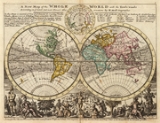
Cartography
Cartography is the study and practice of making maps. Combining science, aesthetics, and technique, cartography builds on the premise that reality can be modeled in ways that communicate spatial information effectively.The fundamental problems of traditional cartography are to:*Set the map's...
, engraver, and publisher. Moll moved to England
England
England is a country that is part of the United Kingdom. It shares land borders with Scotland to the north and Wales to the west; the Irish Sea is to the north west, the Celtic Sea to the south west, with the North Sea to the east and the English Channel to the south separating it from continental...
in 1678 and opened a book and map store in London
London
London is the capital city of :England and the :United Kingdom, the largest metropolitan area in the United Kingdom, and the largest urban zone in the European Union by most measures. Located on the River Thames, London has been a major settlement for two millennia, its history going back to its...
. He produced maps from his studies of the work of other cartographers.
One of Moll's maps of the Island of Newfoundland, published in the 1680s, showed Pointe Riche, the southern limit of the French Shore
French Shore
The French Treaty Shore resulted from the 1713 ratification of the Treaty of Utrecht. The provisions of the treaty allowed the French to fish in season along the north coast of Newfoundland between Cape Bonavista and Point Riche. This area had been frequented by fishermen from Brittany since the...
to be situated at 47°40' north latitude. In 1763 the French
France
The French Republic , The French Republic , The French Republic , (commonly known as France , is a unitary semi-presidential republic in Western Europe with several overseas territories and islands located on other continents and in the Indian, Pacific, and Atlantic oceans. Metropolitan France...
attempted to use this map to establish their claim to the west coast of Newfoundland
Newfoundland and Labrador
Newfoundland and Labrador is the easternmost province of Canada. Situated in the country's Atlantic region, it incorporates the island of Newfoundland and mainland Labrador with a combined area of . As of April 2011, the province's estimated population is 508,400...
, arguing that Point Riche and Cape Ray
Cape Ray
Cape Ray is a headland located at the southwestern extremity of the island of Newfoundland in the Canadian province of Newfoundland and Labrador....
were the same headland. Governor Hugh Palliser
Hugh Palliser
Admiral Sir Hugh Palliser, 1st Baronet was an officer of the British Royal Navy during the Seven Years' War and the American Revolutionary War...
and Captain James Cook
James Cook
Captain James Cook, FRS, RN was a British explorer, navigator and cartographer who ultimately rose to the rank of captain in the Royal Navy...
found evidence to refute Moll's claim and in 1764 the French accepted the placement of Pointe Riche near Port au Choix
Port au Choix, Newfoundland and Labrador
Port au Choix or Port aux Choix is a town in the Canadian province of Newfoundland and Labrador. The nearest airport is Port au Choix Airport, 2.8 km to the southeast.- History :...
.
Origin
Moll's exact place of origin is unknown. Due to his important work in Netherlands' cartography and the fact that he undertook a journey in his late years on behalf of the NetherlandsNetherlands
The Netherlands is a constituent country of the Kingdom of the Netherlands, located mainly in North-West Europe and with several islands in the Caribbean. Mainland Netherlands borders the North Sea to the north and west, Belgium to the south, and Germany to the east, and shares maritime borders...
, it is assumed he originated from Amsterdam
Amsterdam
Amsterdam is the largest city and the capital of the Netherlands. The current position of Amsterdam as capital city of the Kingdom of the Netherlands is governed by the constitution of August 24, 1815 and its successors. Amsterdam has a population of 783,364 within city limits, an urban population...
or Rotterdam
Rotterdam
Rotterdam is the second-largest city in the Netherlands and one of the largest ports in the world. Starting as a dam on the Rotte river, Rotterdam has grown into a major international commercial centre...
. The name, "Moll" occurred not only in the Netherlands however but also in the north German area which may suggest a German origin. Dennis Reinhartz's biography assumed that Moll came from Bremen
Bremen
The City Municipality of Bremen is a Hanseatic city in northwestern Germany. A commercial and industrial city with a major port on the river Weser, Bremen is part of the Bremen-Oldenburg metropolitan area . Bremen is the second most populous city in North Germany and tenth in Germany.Bremen is...
. Moll's birth year is generally accepted to be the year 1654.
Further reading
- Dennis Reinhartz (1997) The cartographer and the literati: Herman Moll and his intellectual circle. E. Mellen Press
- Warnar Moll, Herman Moll
- de.wikipedia.org, Herman Moll (featured article in German)