
Hellisay
Encyclopedia
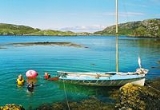
Hellisay is an island in the southern Outer Hebrides
of Scotland
.
 Hellisay lies between Barra
and Eriskay
. One of a string of islands between South Uist
and Barra
, Hellisay is "locked" into its neighbour Gighay
, with a harbour between.
It is mainly gneiss
with quartz
veins.
There are several peaks on the island - such as on the peninsula of Charish, and also Beinn a' Chàrnain (mountain of the small cairn; 73 metres (240 ft)), Meall Meadhonach (Middle rounded hill; 79 metres (259 ft)), and Meall Mòr (next to Meall Meadhonach; 75 metres (246 ft)) and Meall an Healladh.
s including falcon
s and golden eagle
s.
The island is covered in sea thrift.
in origin. It possibly means "island of the caves", which appears to be confirmed by the name Rubha na h-Uamh (headland of the cave) in the east of the island. However, Blaeu
's map has "Hildesay", which suggests that the name may derive from the Norse from "Hilda's Island".
The island's settlement was at Buaile Mhòr ("Bualavore", meaning the Big Fold) near Eilean a' Ghamhna in the north west of the island. The remains of a sheep pen and a well can still be seen.
Like so many other islands in the region, Hellisay was strongly affected by the Highland Clearances
. Firstly, refugees from clearances in neighbouring islands swelled the population, and latterly the island's inhabitants themselves were evicted, and many went to live on Eriskay
. The population peaked at 108 in 1841, and the island was cleared in the 1840s - however it continued to have some inhabitants up until 1890.
Alasdair Ailpin MacGregor's stories reveal a rich folklore and mythology extant on the island, possibly only a fraction of which has been preserved.
Outer Hebrides
The Outer Hebrides also known as the Western Isles and the Long Island, is an island chain off the west coast of Scotland. The islands are geographically contiguous with Comhairle nan Eilean Siar, one of the 32 unitary council areas of Scotland...
of Scotland
Scotland
Scotland is a country that is part of the United Kingdom. Occupying the northern third of the island of Great Britain, it shares a border with England to the south and is bounded by the North Sea to the east, the Atlantic Ocean to the north and west, and the North Channel and Irish Sea to the...
.
Geography and geology
Barra
The island of Barra is a predominantly Gaelic-speaking island, and apart from the adjacent island of Vatersay, to which it is connected by a causeway, is the southernmost inhabited island of the Outer Hebrides in Scotland.-Geography:The 2001 census showed that the resident population was 1,078...
and Eriskay
Eriskay
Eriskay , from the Old Norse for "Eric's Isle", is an island and community council area of the Outer Hebrides in northern Scotland. It lies between South Uist and Barra and is connected to South Uist by a causeway which was opened in 2001. In the same year Eriskay became the ferry terminal for...
. One of a string of islands between South Uist
South Uist
South Uist is an island of the Outer Hebrides in Scotland. In the 2001 census it had a usually resident population of 1,818. There is a nature reserve and a number of sites of archaeological interest, including the only location in Great Britain where prehistoric mummies have been found. The...
and Barra
Barra
The island of Barra is a predominantly Gaelic-speaking island, and apart from the adjacent island of Vatersay, to which it is connected by a causeway, is the southernmost inhabited island of the Outer Hebrides in Scotland.-Geography:The 2001 census showed that the resident population was 1,078...
, Hellisay is "locked" into its neighbour Gighay
Gighay
Gighay is one of a group of uninhabited islands off the northeast coast of Barra in the Outer Hebrides of Scotland.-Geography and geology:...
, with a harbour between.
It is mainly gneiss
Gneiss
Gneiss is a common and widely distributed type of rock formed by high-grade regional metamorphic processes from pre-existing formations that were originally either igneous or sedimentary rocks.-Etymology:...
with quartz
Quartz
Quartz is the second-most-abundant mineral in the Earth's continental crust, after feldspar. It is made up of a continuous framework of SiO4 silicon–oxygen tetrahedra, with each oxygen being shared between two tetrahedra, giving an overall formula SiO2. There are many different varieties of quartz,...
veins.
There are several peaks on the island - such as on the peninsula of Charish, and also Beinn a' Chàrnain (mountain of the small cairn; 73 metres (240 ft)), Meall Meadhonach (Middle rounded hill; 79 metres (259 ft)), and Meall Mòr (next to Meall Meadhonach; 75 metres (246 ft)) and Meall an Healladh.
Wildlife
Along with the usual seabirds, raptorBird of prey
Birds of prey are birds that hunt for food primarily on the wing, using their keen senses, especially vision. They are defined as birds that primarily hunt vertebrates, including other birds. Their talons and beaks tend to be relatively large, powerful and adapted for tearing and/or piercing flesh....
s including falcon
Falcon
A falcon is any species of raptor in the genus Falco. The genus contains 37 species, widely distributed throughout Europe, Asia, and North America....
s and golden eagle
Golden Eagle
The Golden Eagle is one of the best known birds of prey in the Northern Hemisphere. Like all eagles, it belongs to the family Accipitridae. Once widespread across the Holarctic, it has disappeared from many of the more heavily populated areas...
s.
The island is covered in sea thrift.
History
The island's name is Old NorseOld Norse
Old Norse is a North Germanic language that was spoken by inhabitants of Scandinavia and inhabitants of their overseas settlements during the Viking Age, until about 1300....
in origin. It possibly means "island of the caves", which appears to be confirmed by the name Rubha na h-Uamh (headland of the cave) in the east of the island. However, Blaeu
Blaeu
Blaeu is the name of* Willem Janszoon Blaeu or Willem Blaeu, Dutch cartographer not to be confused with Willem Janszoon, a contemporary Dutch explorer* his sons Joan Blaeu and Cornelius Blaeu, cartographers...
's map has "Hildesay", which suggests that the name may derive from the Norse from "Hilda's Island".
The island's settlement was at Buaile Mhòr ("Bualavore", meaning the Big Fold) near Eilean a' Ghamhna in the north west of the island. The remains of a sheep pen and a well can still be seen.
Like so many other islands in the region, Hellisay was strongly affected by the Highland Clearances
Highland Clearances
The Highland Clearances were forced displacements of the population of the Scottish Highlands during the 18th and 19th centuries. They led to mass emigration to the sea coast, the Scottish Lowlands, and the North American colonies...
. Firstly, refugees from clearances in neighbouring islands swelled the population, and latterly the island's inhabitants themselves were evicted, and many went to live on Eriskay
Eriskay
Eriskay , from the Old Norse for "Eric's Isle", is an island and community council area of the Outer Hebrides in northern Scotland. It lies between South Uist and Barra and is connected to South Uist by a causeway which was opened in 2001. In the same year Eriskay became the ferry terminal for...
. The population peaked at 108 in 1841, and the island was cleared in the 1840s - however it continued to have some inhabitants up until 1890.
Alasdair Ailpin MacGregor's stories reveal a rich folklore and mythology extant on the island, possibly only a fraction of which has been preserved.