

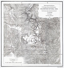
Hayden Geological Survey of 1871
Encyclopedia

Wyoming
Wyoming is a state in the mountain region of the Western United States. The western two thirds of the state is covered mostly with the mountain ranges and rangelands in the foothills of the Eastern Rocky Mountains, while the eastern third of the state is high elevation prairie known as the High...
that later became Yellowstone National Park
Yellowstone National Park
Yellowstone National Park, established by the U.S. Congress and signed into law by President Ulysses S. Grant on March 1, 1872, is a national park located primarily in the U.S. state of Wyoming, although it also extends into Montana and Idaho...
in 1872. It was led by geologist Ferdinand Vandeveer Hayden
Ferdinand Vandeveer Hayden
Dr. Ferdinand Vandeveer Hayden was an American geologist noted for his pioneering surveying expeditions of the Rocky Mountains in the late 19th century. He was also a physician who served with the Union Army during the Civil War.-Early life:Ferdinand Hayden was born in Westfield, Massachusetts...
. The 1871 survey was not Hayden's first, but it was the first federally funded, geological survey to explore and further document features in the region soon to become Yellowstone National Park and played a prominent role in convincing the U.S. Congress to pass the legislation creating the park. In 1894, Nathaniel P. Langford
Nathaniel P. Langford
Nathaniel Pitt Langford was an explorer, businessman, bureaucrat, vigilante and historian from St. Paul, Minnesota who played an important role in the early years of the Montana gold fields, territorial government and the creation of Yellowstone National Park.-Montana Gold Fields:On June 16, 1862...
, the first park superintendent and a member of the Washburn-Langford-Doane Expedition
Washburn-Langford-Doane Expedition
The Washburn Expedition of 1870, explored the region of northwestern Wyoming that a couple years later became Yellowstone National Park. Led by Henry Washburn, Nathaniel P. Langford and under U.S. Army escort led by Lt. Gustavus C...
which explored the park in 1870, wrote this about the Hayden expedition:
Origins
The 1871 Hayden survey had its roots in the Pacific Railroad SurveyPacific Railroad Surveys
The Pacific Railroad Surveys -A series of explorations of the American West to explore possible routes for a transcontinental railroad across North America. The expeditions included surveyors, scientists, and artists and resulted in an immense body of data covering at least on the American West....
bill passed by Congress in 1853 to find the best routes for railroads from the Mississippi to the Pacific coast. The bill spawned an era of federally funded Great Surveys undertaken by the Department of the Interior after the Civil War that brought together explorers, engineers, scientists and topographers in a common effort to chart the western U.S. Hayden along with John Wesley Powell
John Wesley Powell
John Wesley Powell was a U.S. soldier, geologist, explorer of the American West, and director of major scientific and cultural institutions...
, Clarence King
Clarence King
Clarence R. King was an American geologist, mountaineer, and art critic. First director of the United States Geological Survey, from 1879 to 1881, King was noted for his exploration of the Sierra Nevada. He was born in Newport, Rhode Island.-Career:...
and George Wheeler
George Wheeler
Captain George Montague Wheeler was a pioneering explorer and cartographer, leader of the Wheeler Survey, one of the major surveys of the western United States in the late nineteenth century...
were the leaders of these great surveys.
In March 1871, a sum of $40,000 was appropriated by Congress to finance Hayden's fifth survey to explore mostly the territories of Idaho and Montana. Hayden was very familiar with Jay Cooke
Jay Cooke
Jay Cooke was an American financier. Cooke and his firm Jay Cooke & Company were most notable for their role in financing the Union's war effort during the American Civil War...
's desire to promote the Yellowstone region for the Northern Pacific Railroad and had attended Nathaniel P. Langford's January 1871 lecture in Washington D.C. on the Washburn-Langford-Doane Expedition
Washburn-Langford-Doane Expedition
The Washburn Expedition of 1870, explored the region of northwestern Wyoming that a couple years later became Yellowstone National Park. Led by Henry Washburn, Nathaniel P. Langford and under U.S. Army escort led by Lt. Gustavus C...
to Yellowstone of the previous year.Its Exploration and Establishment |publisher=National Park Service |accessdate=10 October 2010}} The $40,000 that was granted for Hayden's expedition was not available until July 1, the beginning of the fiscal year, however the determined Hayden was still able to organize and equip his expedition with the help of the US Army, Fort Bridger]] and the railroads. After the passage of the Sundry Civil bill, Hayden immediately applied to the Secretary of War for permission to draw on the equipment, stores, and transportation at frontier army posts. This was authorized, together with a small escort "when deemed necessary and the public service will permit." Likewise, the Union Pacific and Central Pacific Railroads agreed to carry Hayden's men and equipment without cost.
Hayden had an experienced assistant, James Stevenson. In 1866, Stevenson accompanied Hayden into the badlands of Dakota Territory in a search for minerals and fossils, and from that time on he was the Hayden's assistant in every venture until the Hayden Survey was merged with those of King and Powell to form the U.S. Geological Survey in 1879.
The two were now able to outfit and equip members of his survey at Fort D. A. Russell in Wyoming and transport the equipment, subsistence, wagons, and animals he would need by rail to Ogden, Utah, where a base camp had been set up in May on an old lake terrace a mile east of the city. During the weeks leading up to the expedition the scientists and other men were to make up the party that would venture into the Yellowstone region.
In the spring of 1871, Hayden selected the members of the survey team, 32 in all from among friends and colleagues, seven previous survey participants and a few political patrons. Included in the party was William Henry Jackson
William Henry Jackson
William Henry Jackson was an American painter, Civil War, geological survey photographer and an explorer famous for his images of the American West...
, his photographer from his 1870 survey and Thomas Moran
Thomas Moran
Thomas Moran from Bolton, England was an American painter and printmaker of the Hudson River School in New York whose work often featured the Rocky Mountains. Moran and his family took residence in New York where he obtained work as an artist...
, a guest artist arranged by Jay Cooke. Two of the members, young Albert Peale-mineralogist and George Allen-botanist were respectively a student of Haydens at the University of Pennsylvania
University of Pennsylvania
The University of Pennsylvania is a private, Ivy League university located in Philadelphia, Pennsylvania, United States. Penn is the fourth-oldest institution of higher education in the United States,Penn is the fourth-oldest using the founding dates claimed by each institution...
and Hayden's Natural History professor at Oberlin College
Oberlin College
Oberlin College is a private liberal arts college in Oberlin, Ohio, noteworthy for having been the first American institution of higher learning to regularly admit female and black students. Connected to the college is the Oberlin Conservatory of Music, the oldest continuously operating...
. Both Allen and Peale kept private journals of the expedition which when discovered in later years have brought great insight to the daily operations of the survey team.
Survey route
The survey officially began on June 8, 1871 when it departed Ogden, UtahOgden, Utah
Ogden is a city in Weber County, Utah, United States. Ogden serves as the county seat of Weber County. The population was 82,825 according to the 2010 Census. The city served as a major railway hub through much of its history, and still handles a great deal of freight rail traffic which makes it a...
41.227744°N 111.961193°W although many survey members were already making observations and collecting specimens while the team was assembling in Salt Lake City and then Ogden. The party traveled north reaching Taylor's Bridge 43.491775°N 112.032509°W (now Idaho Falls) on the Snake River
Snake River
The Snake is a major river of the greater Pacific Northwest in the United States. At long, it is the largest tributary of the Columbia River, the largest North American river that empties into the Pacific Ocean...
on June 25, 1871. On June 30, 1871 the survey party had reached into Montana, camping just over the Continental Divide
Continental Divide
The Continental Divide of the Americas, or merely the Continental Gulf of Division or Great Divide, is the name given to the principal, and largely mountainous, hydrological divide of the Americas that separates the watersheds that drain into the Pacific Ocean from those river systems that drain...
near Monida Pass
Monida Pass
Monida Pass is a high mountain pass in the Rocky Mountains of the northwestern United States, at an elevation of 6870 feet above sea level on Interstate 15....
44.55861°N 112.30556°W. Hayden and his survey party reached Virginia City, Montana
Virginia City, Montana
Virginia City is a town in and the county seat of Madison County, Montana, United States. In 1961, the town and the surrounding area was designated a National Historic Landmark District, the Virginia City Historic District...
45.294107°N 111.94123°W on July 4, 1871 and Fort Ellis
Fort Ellis
Fort Ellis was an early United States Army outpost established August 27, 1867 to the eastern side of present-day Bozeman, Montana. The fort was established to protect and support settlers moving into the Gallatin Valley. The post was named for Civil War Colonel Augustus van Horne Ellis who was...
near Bozeman, Montana
Bozeman, Montana
Bozeman is a city in and the county seat of Gallatin County, Montana, United States, in the southwestern part of the state. The 2010 census put Bozeman's population at 37,280 making it the fourth largest city in the state. It is the principal city of the Bozeman micropolitan area, which consists...
on July 10, 1871. By this time, Thomas Moran
Thomas Moran
Thomas Moran from Bolton, England was an American painter and printmaker of the Hudson River School in New York whose work often featured the Rocky Mountains. Moran and his family took residence in New York where he obtained work as an artist...
, the guest artist has joined the survey. At Fort Ellis, both George Allen, the botanist and Cyrus Thomas, the agricultural statistician and entomologist then left the party for health reasons, while José, the guide joined the team. After resupplying and coordinating with the U.S. Army at Fort Ellis, the survey departed south along the Yellowstone River
Yellowstone River
The Yellowstone River is a tributary of the Missouri River, approximately long, in the western United States. Considered the principal tributary of the upper Missouri, the river and its tributaries drain a wide area stretching from the Rocky Mountains in the vicinity of the Yellowstone National...
on July 15, 1871. For the next 45 days, the Hayden Survey would coordinate efforts with the Barlow-Heap expedition under the command of Colonel John W. Barlow
John W. Barlow
John Whitney Barlow was a career officer in the United States Army. During and after the American Civil War, he was noted for his engineering talents.-Biography:...
, Chief Engineer for General Philip Sheridan
Philip Sheridan
Philip Henry Sheridan was a career United States Army officer and a Union general in the American Civil War. His career was noted for his rapid rise to major general and his close association with Lt. Gen. Ulysses S...
that the U.S. Army was sending into Yellowstone at the same time.
As the survey team traveled up the Yellowstone River in what is now called Paradise Valley
Paradise Valley (Montana)
Paradise Valley is a major river valley of the Yellowstone River in southwestern Montana just north of Yellowstone National Park in Park County, Montana. The valley is flanked by the Absaroka Range on the east and the Gallatin Range on the west....
, they confirmed what Hayden already knew, that the trail was unsuitable for their wagons. Near Bottler's Ranch 45°19′30"N 110°47′33"W, the last outpost in the valley near Emigrant Gulch, the survey team setup a base camp that would be used to assist in any communications or support needed while the team was in the Yellowstone region with Fort Ellis. Abandoning their wagons at the base camp, the survey headed into Yankee Jim Canyon 45°11′43"N 110°54′05"W late on July 20, 1871.
Yellowstone region
Gardner River
The Gardner River is a tributary of the Yellowstone River, approximately long, in northwestern Wyoming and south central Montana in the United States. The entire river is located within Yellowstone National Park...
proceeding up that river to what is now called Mammoth Hot Springs
Mammoth Hot Springs
Mammoth Hot Springs is a large complex of hot springs on a hill of travertine in Yellowstone National Park adjacent to Fort Yellowstone and the Mammoth Hot Springs Historic District. It was created over thousands of years as hot water from the spring cooled and deposited calcium carbonate...
where they explored and camped for two days. At Mammoth, they found that two men, named J.C. McCartney and H. R. Horr, had laid claim to 320 acres (1.3 km²) and established a ranch and bath house on the Mammoth terraces near Liberty Cap. These entrepreneurs eventually established a primitive hotel at Mammoth and were not evicted from the area until many years after the park was established. On July 24, 1871 the survey team departed Mammoth en route to Tower Fall. They took a route very close to today's Mammoth-Tower road passing both Undine Falls 44°56′39"N 110°38′20"W on Lava Creek and Wraith Falls 44°56′14"N 110°37′25"W on Lupine Creek. They reached and camped at Tower Creek on July 25, 1871.
The survey team spent three days traveling around Mount Washburn
Mount Washburn
Mount Washburn el. is a prominent mountain peak in the Washburn Range in Yellowstone National Park, Wyoming. The peak was named in 1870 to honor Henry D. Washburn, leader of the Washburn–Langford–Doane Expedition...
and along the western edge of the Yellowstone River in Hayden Valley
Hayden Valley
Hayden Valley is a large, sub-alpine valley in Yellowstone National Park straddling the Yellowstone River between Yellowstone Falls and Yellowstone Lake. The valley floor along the river is an ancient lake bed from a time when Yellowstone Lake was much larger...
to reach its source at Yellowstone Lake
Yellowstone Lake
Yellowstone Lake is the largest body of water in Yellowstone National Park, The lake is 7,732 feet above sea level and covers with 110 miles of shoreline. While the average depth of the lake is 139 feet its deepest spot is at least 390 feet...
on July 28, 1871. It was here that Lt. Gustavus C. Doane
Gustavus Cheyney Doane
Gustavus Cheyney Doane was a U.S. Army Cavalry Captain, explorer, inventor and Civil War soldier who played a prominent role in the exploration of Yellowstone as a member of the Washburn-Langford-Doane Expedition.-Early life:...
replaced Captain Tyler as commander of the military escort. Enroute they camped at Cascade Creek 44°43′00"N 110°29′58"W near Yellowstone Falls
Yellowstone Falls
Yellowstone Falls consist of two major waterfalls on the Yellowstone River, within Yellowstone National Park, Wyoming, United States. As the Yellowstone river flows north from Yellowstone Lake, it leaves the Hayden Valley and plunges first over Upper Yellowstone Falls and then a quarter mile ...
where W. H. Jackson took the first known photographs of the falls. On July 28, 1871 some members of the Hayden party assembled a small boat from components they packed in from Fort Ellis and carved oars from nearby trees. The boat--Annie was the first known boat to sail on the waters of Yellowstone Lake. Annie was used by several members of the party explore the islands and take soundings of the lake. The first trip was made by James Stevenson and Henry Elliot to an island about 1.5 miles (2.4 km) offshore. Hayden named the island Stevenson Island 44°30′55"N 110°23′07"W.
On July 31, 1871 Hayden and some members of his survey team left Yellowstone Lake (others stayed at the lake to tend the boat and supplies) and ventured back into the Hayden Valley where at the Crater Hills Geyser
Sulphur Spring
Sulphur Spring , is a geyser in the Hayden Valley region of Yellowstone National Park in the United States.It is located in the Crater Hills area of Hayden Valley about west of the Grand Loop Road....
group they proceeded due west en route the geyser basins of the Madison River
Madison River
The Madison River is a headwater tributary of the Missouri River, approximately 183 miles long, in Wyoming and Montana. Its confluence with the Jefferson and Gallatin rivers near Three Forks, Montana form the Missouri River....
drainage. They eventually reached the headwaters of Nez Percé Creek 44°34′40"N 110°37′13"W, traveling down the creek until they camped about 6 miles (9.7 km) from the Firehole River
Firehole River
The Firehole River is one of two major tributaries of the Madison River. It flows north approximately from its source in Madison Lake on the Continental Divide to join the Gibbon River at Madison Junction in Yellowstone National Park...
. The party spent several days in the Lower, Midway and Upper Geyser basins finally departing on August 6, 1871.
The survey followed the Firehole River upstream to Madison Lake 44°20′55"N 110°51′58"W and then over the divide to Shoshone Lake
Shoshone Lake
Shoshone Lake is a backcountry lake with the area of elevated at in the southwest section of Yellowstone National Park, Wyoming, US. It lies at the headwaters of the Lewis River a tributary of the Snake River. The U.S...
eventually camping near Lost Lake about 6 miles (9.7 km) from the West Thumb area of Yellowstone Lake. On August 7, 1871 they camped and explored at West Thumb for two days. As some of the military escort was to travel back to Fort Ellis, the survey team took the opportunity to carry back correspondence and a large amount of specimens collected to the Base Camp at Bottler's Ranch. In that correspondence was Hayden's Report No. 7 to Assistant Secretary of the Smithsonian Institution
Smithsonian Institution
The Smithsonian Institution is an educational and research institute and associated museum complex, administered and funded by the government of the United States and by funds from its endowment, contributions, and profits from its retail operations, concessions, licensing activities, and magazines...
, Dr. Spencer Baird
Spencer Fullerton Baird
Spencer Fullerton Baird was an American ornithologist, ichthyologist and herpetologist. Starting in 1850 he was assistant-secretary and later secretary of the Smithsonian Institution in Washington, D.C...
, a bit of which is excerpted below:
Yellowstone Lake, WY August 8th, 1871 - Dear Professor Baird, Your letters of June 6th and July 3rd were brought us from Fort Ellis by Lt. Doane who has just arrived to take command of our escort and accompany my party the remainder of the season. ...We arrived at the banks of the Yellow Stone Lake [sic] July 26th [actually July 28] and pitched our camp near the point where the river leaves the Lake. Hence we brought the first pair of wheels that ever came to the Lake with our Odometer. We launched the first Boat on the Lake, 4.5 feet wide and 11 feet long, with sails and oars. ...A chart of this soundings will be made. Points have been located with a prismatic compass all around the Lake. A man stands on the shore with a compass and takes a bearing to the man in the Boat as he drops the lead, giving a signal at the time. Then a man in the Boat takes a bearing to the fixed point on the shore where the first man is located and thus the soundings will be located on the chart. Henry Elliot and Mr. Carrington have just left in our little boat, the Annie. [They] will make a systematic sketch of the shore with all its indentations, with the banks down, indeed, making a complete topographical as well as pictorial sketch of the shores as seen from the water, for a circuit--of at least 130 miles. ...One of the islands has been explored. We have called it Stevenson's Island as he was undoubtedly the first human that ever set foot upon it. ...We found everything in the Geyser region even more wonderful than it has been respresented. ...I send this back to you by James [Stevenson] who returns to our permanent camp for supplies. ...We hope to reach Fort Ellis about the 1st or 5th of September. Schnönborn does splendid Topographical work. Write at once. Yours Truly, F. V. Hayden, I will send you some Photographs soon.
Between August 9 and August 19, 1871 the survey party traveled around the southern and eastern sides of Yellowstone Lake, crossing the Continental Divide twice and exploring the headwaters of the Yellowstone River. On August 19 they arrived at the northeast corner of the lake at Steamboat Point 44°31′54"N 110°17′34"W (named by Hayden for steam jets nearby) near Turbid Lake where they camped for a few days in preparation for their return to the Yellowstone River via the East Fork (Lamar River
Lamar River
The Lamar River is a tributary of the Yellowstone River, approximately 40 miles long, in northwestern Wyoming in the United States. The river is located entirely within Yellowstone National Park.-History:...
). While camped at Steamboat Point, the party experienced two sizable earthquakes, one that Peale described as:
This morning [August 20] about 1 o'clock we had quite an earthquake. The first schock [sic] lasted about 20 seconds and was followed by five or six shorter ones. Duncan, who was on guard, say that the trees were shaken and that the horses that were lying on the ground sprang to their feet... We had three shocks during the morning.
On August 23, 1871 after dismantling and caching Annie, the party moved northeast away from Yellowstone Lake until they encountered Pelican Creek. They followed the creek northeast until they reached the divide at Mirror Lake 44°44′05"N 110°09′51"W where they camped. The next morning the continued northeast until encountering the headwaters of the East Fork of the Yellowstone River Lamar River
Lamar River
The Lamar River is a tributary of the Yellowstone River, approximately 40 miles long, in northwestern Wyoming in the United States. The river is located entirely within Yellowstone National Park.-History:...
. Following the river downstream they camped just short of Soda Butte Creek
Soda Butte Creek
Soda Butte Creek is an approximately long major tributary of the Lamar River in Yellowstone National Park. It is named for an unusual geologic feature near its mouth. Soda Butte and the creek were named by A. Bart Henderson, a Cooke City miner, in 1870...
. In the morning, on August 25, 1871 they entered the upper Lamar Valley and traveled on good trails northwest through the valley all the way to the Yellowstone River at Baronette Bridge 44°55′45"N 110°24′03"W. In, October 1870, John C. Baronett, a Helena prospector help rescue Truman C. Everts
Truman C. Everts
Truman C. Everts was part of the 1870 Washburn-Langford-Doane Expedition exploring the area which later became Yellowstone National Park...
after he had become lost during the Washburn Expedition of 1870. After rescuing Everts, Baronett returned to Yellowstone and constructed a pack train bridge across the Yellowstone just above the mouth of the Lamar River. This was the first bridge across the Yellowstone. In 1878, during a later survey, Hayden named a nearby peak 44°58′31"N 110°05′19"W in honor of John Baronett. By the evening of August 26, 1871 most of the survey party had left the park region and was camped just north of Gardiner on the Yellowstone River. The next day, most would rendezvous at Bottler's Ranch. After reaching Bottler's, Dr. Hayden posted his report No. 8, August 28, 1871 to Spencer Baird (excerpted):
Dear Professor Baird, We have completed our survey of the Upper Yellow Stone [sic]. Our success has been complete. Our map is now complete of every stream emptying into the Lake or River above this point. Henry Elliot and young Carrington returned in seven days with a wonderful sketch of the Lake...Henry Elliot has sketched all the Craters, the Geysers in motion, the Mud Springs, etc. We have a splendid lot of specimens also. We have about 400 negatives...The Lake has been well photographed. ...Huse does not amount to much. I shall drop him at Chicago and that will end him so far as I am concerned. I intend to have a nice little fellow. Dr. Peale, of Philadelphia, spend the winter at Washington arranging our collections...He is, I think, a young man of the right stamp. ...Henry Elliot is the biggest kind of Trump. He has done some great things on this trip. ...Yours Truly, F.V. Hayden
The return to Fort Bridger
After leaving Bottler's Ranch, the party took two days to arrive at Fort Ellis where they spent six days recuperating, resupplying and preparing correspondence and specimens for shipment. Three members of the party—Huse, Dixon and Adams departed for California. During this stay, Hayden had the opportunity to respond to a letter from George Allen, his former professor who had to leave the survey before it entered the Yellowstone region:
Fort Ellis, September 2nd, 1871, My Dear Professor Allen, We have just returned having completed our work to our entire satisfaction. We have had an uninterrupted series of successes, without a single pullback. Not an accident has happened to any member of our party-we made a most admirable survey of the Yellow Stone Basin [sic], the Lake, all the Hot Springs. Mr. Jackson made the most abundant pictures. Mr. Moran was filled with enthusiasm and has returned to devote himself to the painting of pictures of the Yellow Stone [sic] region. ... I am sorry that you were not able to see the wonderful things in the Yellow Stone [sic] but when reports come before the world, you will get a pretty clear conception of them. All my party are well and speak of you with affection. Yours most sincerely, F.V. Hayden
On September 5, 1871 the remaining members of the Hayden party, less their military escort departed Fort Ellis en route to Three Forks, Montana
Three Forks, Montana
Three Forks is a city in Gallatin County, Montana, United States and is located within the watershed valley system of both the Missouri and Mississippi rivers drainage basins — and is historically considered the birthplace or start of the Missouri River. The population was 1,728 at the 2000 census...
and the Jefferson River
Jefferson River
The Jefferson River is a tributary of the Missouri River, approximately long, in the U.S. state of Montana. The Jefferson River and the Madison River form the official beginning of the Missouri at Missouri Headwaters State Park near Three Forks...
valley. They followed the Jefferson up to the Beaverhead River
Beaverhead River
The Beaverhead River is an approximately -long tributary of the Jefferson River in southwest Montana . It drains an area of roughly . The river's original headwaters, formed by the confluence of the Red Rock River and Horse Prairie Creek, are now flooded under Clark Canyon Reservoir, which also...
where they camped at Beaverhead Rock 45°23′11"N 112°27′35"W on September 9, 1871. Jackson took the first photographs of Beaverhead Rock. They continued south, eventually crossing the divide near Red Rock River
Red Rock River (Montana)
The Red Rock River is a roughly river in southwestern Montana in the United States. Its drainage basin covers over . Its farthest tributary, Hell Roaring Creek, originates in the Beaverhead National Forest near the Montana-Idaho border at Brower's Spring, at an elevation of...
. By the evening of September 14, 1871 they were camped on Medicine Lodge Creek in Idaho. They followed Medicine Lodge Creek down into the Snake River plain arriving at Fort Hall
Fort Hall
Fort Hall, sitting athwart the end of the common stretch shared by the three far west emigrant trails was a 19th century outpost in the eastern Oregon Country, which eventually became part of the present-day United States, and is located in southeastern Idaho near Fort Hall, Idaho...
on September 18, 1871 camping where they had camped during their inbound journey on June 21, 1871. At Fort Hall, Hayden wrote Spencer Baird in his Report No. 10 (excerpted):
Fort Hall, Idaho, September 18, 1871 Dear Professor Baird, I wrote you that we left Fort Ellis the morning of September 5th. We passed down the Gallatin Valley to the three Forks, thence by the Jefferson to its very sources, exploring many of its branches. If you look at Col Raynold's map, you will see that the river was omitted. ...We return from Fort Hall by way of Soda Springs, Bear Lake by Bear River, to Evanston on the Railroad, thence to Fort Bridger where our expedition will close. All is well with us. We are moving along pleasantly without accident of interruption. We preform a good day's work every day. We have not lost a day from storms or anything else since we left Ogden in June last. Yours Truly, F. V. Hayden
By September 29, 1871 the survey party had reached Evanston, Wyoming Territory
Evanston, Wyoming
Evanston is a city in Uinta County, Wyoming, United States. The population was 12,359 at the 2010 census. It is the county seat of Uinta County.-Geography:Evanston is located at...
where they boarded a Union Pacific Railroad train to Fort Bridger
Fort Bridger
Fort Bridger was originally a 19th century fur trading outpost established in 1842 on Blacks Fork of the Green River and later a vital resupply point for wagon trains on the Oregon Trail, California Trail and Mormon Trail. The Army established a military post here in 1858 during the Utah War until...
, arriving there on October 2, 1871. At Fort Bridger, Hayden officially concluded the survey and disbanded the survey team. Hayden and Peale made their way to Salt Lake City and then back to Washington, D.C. Jackson and Charlie Turnbull at the urging of Hayden traveled to Nebraska where there photographed Pawnee Indians on the Omaha reservation.
Survey operations
Once the survey team was organized and underway, the general route and camping locations would be determined by James Stevenson, the survey manager and director and Stephan Hovey, the wagonmaster. In open country, as they found in northern Utah, the survey party traveled an average of 15 miles (24.1 km) miles per day. Routinely after several days of march and when required to rest the party, process their findings and resupply, they would camp at a favorable location for several days.While camping and on the march, the various scientists, photographers and topographers would venture out in small teams from the main party to collect specimens, make observations and document the flora, fauna, geology and geography of the land. In this regard, Dr. Hayden was just another scientist. Additionally, the hunters would attempt to acquire enough game to sustain the party.
In camp, the scientists would process and document their findings while preparing them for shipment to the Smithsonian Institution
Smithsonian Institution
The Smithsonian Institution is an educational and research institute and associated museum complex, administered and funded by the government of the United States and by funds from its endowment, contributions, and profits from its retail operations, concessions, licensing activities, and magazines...
at the next available opportunity. Botanical specimens were pressed, dry and labeled. Mineral samples were trimmed, labeled and packaged for shipment. Photographs were cataloged and described. Correspondence was prepared to scientists in the East explaining the findings and progress of the survey. When next the survey party encountered a station that could handle mail or express shipments—usually a town, stage stop or Army facility—the prepared materials and correspondence would be shipped east.
George Allen, the botanist describes a typical day in the early portion of the survey in his journal:
Thursday, June 29 [1871] - After the Camp broke up went with the Photographic corps on a hill overlooking the vale and changed the papers of the pressed plants, while JacksonWilliam Henry JacksonWilliam Henry Jackson was an American painter, Civil War, geological survey photographer and an explorer famous for his images of the American West...
took pictures... The hills in this passway to Montana are all of igneous character; but there are other varieties of rock boulders (principally quartzites) indicating a different character to the higher mountain passes around. ... After 12 miles traveled today in which we were rapidly ascending we came to the summit of the Chain-the Divide { Monida PassMonida PassMonida Pass is a high mountain pass in the Rocky Mountains of the northwestern United States, at an elevation of 6870 feet above sea level on Interstate 15....
}....At our camp the P.M. five miles from the divide, we have excellent grass and water, and it is understood that we will remain over here one day to recruit. Collected and pressed a large amount of plants. Also found in the streams a number of shells--lymneas and physas. Junction stage station is near our camp.
Survey members, equipment and transport
Note: There are conflicting accounts as to whom was Hayden's topographers or map makers. Existing account names Anton Schönborn and Alfred J. Smith. Another account names Henry GannettHenry Gannett
Henry Gannett, M.E.; LL.D. was an American geographer who is described as the "Father of the Quadrangle" which is the basis for topographical maps in the United States.-Life:...
and that "many USGS map-making methods and standards were later developed under his leadership, and the USGS Geography Program was established under his direction".
| Members | Equipment and transport |
|---|---|
|
|
Expedition's influence on creation of a National Park
The most important product of the expedition, in addition to the sketches and paintings by Thomas Moran and the photographs by William Jackson, was Hayden's lengthy report detailing the findings of his party. Hayden, working with Nathaniel Langford and Jay Cooke was so desirous of preserving the Yellowstone region that he even included drawings and descriptions of thermal features from Langford's 1871 articles in Scribners. Hayden presented this report, the photos, sketches, and paintings to Senators, Congressmen, his superiors in the Department of the Interior, and nearly everyone else who could possibly influence the founding of a park. Most importantly, his political connections with Congressman Henry L. DawesHenry L. Dawes
Henry Laurens Dawes was a Republican United States Senator and United States Representative, notable for the Dawes Act.-Biography:...
of Massachusetts paid dividends. Dawes had supported financing of the expedition, his son, Chester Dawes was a member of the survey team, and Annie, the first boat on Yellowstone Lake was purportedly named after his daughter, Anna Dawes. Hayden also published articles in magazines with national circulation and spent much personal time and effort trying to convince Congress to establish the park.
On December 18, 1871, a bill was introduced simultaneously in the Senate, by Senator S.C. Pomeroy of Kansas, and in the House of Representatives, by Congressman William H. Clagett
William H. Clagett
William Horace Clagett was a nineteenth century politician and lawyer from various places in the United States. He was the uncle of Samuel B. Pettengill....
of the Montana Territory, for the establishment of a park at the headwaters of the Yellowstone River. Hayden's influence on Congress is readily apparent when examining the detailed information contained in the report of the House Committee on Public Lands: "The bill now before Congress has for its objective the withdrawal from settlement, occupancy, or sale, under the laws of the United States a tract of land fifty-five by sixty-five miles, about the sources of the Yellowstone and Missouri Rivers, and dedicates and sets apart as a great national park or pleasure-ground for the benefit and enjoyment of the people."
When the bill was presented to Congress, the bill's chief supporters, ably prepared by Langford, Hayden and Jay Cooke convinced their colleagues that the region's real value was as a park area, to be preserved in its natural state. The bill was approved by a comfortable margin in the Senate on January 30, 1872, and by the House on February 27.
On March 1, 1872, President Ulysses S. Grant
Ulysses S. Grant
Ulysses S. Grant was the 18th President of the United States as well as military commander during the Civil War and post-war Reconstruction periods. Under Grant's command, the Union Army defeated the Confederate military and ended the Confederate States of America...
signed the bill into law, establishing the Yellowstone region as a public park, memorializing the results of three years of exploration by Cook-Folsom-Peterson (1869), Washburn-Langford-Doane (1870) and Hayden (1871).
Park features named in honor of members of the 1871 expedition
- Carrington IslandYellowstone LakeYellowstone Lake is the largest body of water in Yellowstone National Park, The lake is 7,732 feet above sea level and covers with 110 miles of shoreline. While the average depth of the lake is 139 feet its deepest spot is at least 390 feet...
- named for E. Campbell Carrington - Mount DoaneMount DoaneMount Doane el. is a mountain peak in the Absaroka Range in Yellowstone National Park. The peak is named for Lieutenant Gustavus Cheyney Doane, a U.S. Army cavalry officer who escorted the Washburn-Langford-Doane Expedition into Yellowstone in 1870. During that expedition, Doane and Nathaniel P....
- named for Lt. Gustavus C. Doane - Frank IslandYellowstone LakeYellowstone Lake is the largest body of water in Yellowstone National Park, The lake is 7,732 feet above sea level and covers with 110 miles of shoreline. While the average depth of the lake is 139 feet its deepest spot is at least 390 feet...
- named for the brother of Henry Elliot, Frank Elliot - Hayden ValleyHayden ValleyHayden Valley is a large, sub-alpine valley in Yellowstone National Park straddling the Yellowstone River between Yellowstone Falls and Yellowstone Lake. The valley floor along the river is an ancient lake bed from a time when Yellowstone Lake was much larger...
- named for Ferdinand V. Hayden - Moran PointGrand Canyon of the YellowstoneThe Grand Canyon of the Yellowstone is the first large canyon on the Yellowstone River downstream from Yellowstone Falls in Yellowstone National Park...
- named for Thomas Moran - Mount JacksonMount Jackson (Wyoming)Mount Jackson el. is a mountain peak just north of the Madison River, in the Gallatin Range of Yellowstone National Park. Mount Jackson is named in honor of William Henry Jackson, chief photographer of the Hayden Geological Survey of 1871 and a member of several subsequent geological surveys in...
- named for William Henry Jackson - Peale IslandYellowstone LakeYellowstone Lake is the largest body of water in Yellowstone National Park, The lake is 7,732 feet above sea level and covers with 110 miles of shoreline. While the average depth of the lake is 139 feet its deepest spot is at least 390 feet...
- named for Albert C. Peale - Mount StevensonMount StevensonMount Stevenson el. is a mountain peak in the Absaroka Range of Yellowstone National Park. Mount Stevenson was named in 1871 by geologist Ferdinand Hayden during the Hayden Geological Survey of 1871 for his friend and chief assistant, James Stevenson . Stevenson, who had run away from home as a...
- named for James Stevenson - Stevenson IslandYellowstone LakeYellowstone Lake is the largest body of water in Yellowstone National Park, The lake is 7,732 feet above sea level and covers with 110 miles of shoreline. While the average depth of the lake is 139 feet its deepest spot is at least 390 feet...
- named for James Stevenson
See also
- Cook-Folsom-Peterson Expedition
- Washburn-Langford-Doane ExpeditionWashburn-Langford-Doane ExpeditionThe Washburn Expedition of 1870, explored the region of northwestern Wyoming that a couple years later became Yellowstone National Park. Led by Henry Washburn, Nathaniel P. Langford and under U.S. Army escort led by Lt. Gustavus C...
- Expeditions and the protection of Yellowstone (1869-1890)Expeditions and the protection of Yellowstone (1869-1890)This list summarizes the major expeditions to the Yellowstone region that led to the creation of the park and contributed to the protection of the park and its resources between 1869 and 1890.When President Ulysses S...
- United States Geological SurveyUnited States Geological SurveyThe United States Geological Survey is a scientific agency of the United States government. The scientists of the USGS study the landscape of the United States, its natural resources, and the natural hazards that threaten it. The organization has four major science disciplines, concerning biology,...