

Gooi
Encyclopedia

Hilversum
is a municipality and a town in the Netherlands, in the province of North Holland. Located in the region called "'t Gooi", it is the largest town in that area. It is surrounded by heathland, woods, meadows, lakes, and smaller villages...
in the centre of the Netherlands
Netherlands
The Netherlands is a constituent country of the Kingdom of the Netherlands, located mainly in North-West Europe and with several islands in the Caribbean. Mainland Netherlands borders the North Sea to the north and west, Belgium to the south, and Germany to the east, and shares maritime borders...
. It is a slightly hilly area characterised by its green landscape, its historical charm, the wealth of its inhabitants, and its villas. Het Gooi is known in the Netherlands as the home of the rich and famous.
Name
The name "Gooi" is related to "gouw", the Dutch word for "gau", being an old name for a "region". Het Gooi is conventionally referred to in Dutch as "het Gooi" or "'t Gooi", literally meaning "the Gooi". It is also sometimes referred to as "Gooiland". In English, the area is generally referred to as "Het Gooi" (capital "H") or "the Gooi area". People from Het Gooi are called "Gooiers"."Gooi" (xo:i) rhymes roughly with the English name "Roy". The "g" is pronounced as a voiceless velar fricative
Voiceless velar fricative
The voiceless velar fricative is a type of consonantal sound used in some spoken languages. The sound was part of the consonant inventory of Old English and can still be found in some dialects of English, most notably in Scottish English....
, like the "ch" in "loch".
Location and composition
Het Gooi is the area around HilversumHilversum
is a municipality and a town in the Netherlands, in the province of North Holland. Located in the region called "'t Gooi", it is the largest town in that area. It is surrounded by heathland, woods, meadows, lakes, and smaller villages...
in the southeastern corner of the province of North Holland
North Holland
North Holland |West Frisian]]: Noard-Holland) is a province situated on the North Sea in the northwest part of the Netherlands. The provincial capital is Haarlem and its largest city is Amsterdam.-Geography:...
. It is located north of Utrecht
Utrecht (city)
Utrecht city and municipality is the capital and most populous city of the Dutch province of Utrecht. It is located in the eastern corner of the Randstad conurbation, and is the fourth largest city of the Netherlands with a population of 312,634 on 1 Jan 2011.Utrecht's ancient city centre features...
, between Amersfoort
Amersfoort
Amersfoort is a municipality and the second largest city of the province of Utrecht in central Netherlands. The city is growing quickly but has a well-preserved and protected medieval centre. Amersfoort is one of the largest railway junctions in the country, because of its location on two of the...
and Amsterdam
Amsterdam
Amsterdam is the largest city and the capital of the Netherlands. The current position of Amsterdam as capital city of the Kingdom of the Netherlands is governed by the constitution of August 24, 1815 and its successors. Amsterdam has a population of 783,364 within city limits, an urban population...
. The boundaries are not clearly demarcated. It is generally the area between a dry ditch called the Gooyergracht, dug in 1356 to demarcate the border with the province of Utrecht
Utrecht (province)
Utrecht is the smallest province of the Netherlands in terms of area, and is located in the centre of the country. It is bordered by the Eemmeer in the north, Gelderland in the east, the river Rhine in the south, South Holland in the west, and North Holland in the northwest...
, and the river Vecht
Vecht (Utrecht)
thumb|right|[[Satellite]] [[image]] of the surroundings of [[Utrecht |Utrecht]] showing river Vecht and the [[Amsterdam-Rhine Canal]] .220px|thumb|right|Location of river Vecht ....
. Het Gooi refers traditionally to the part of this area that lies in the province of North Holland. Often the term is used to refer just to the higher, sandy, forested part of this area. The towns in the area include (in descending order of size):
- HilversumHilversumis a municipality and a town in the Netherlands, in the province of North Holland. Located in the region called "'t Gooi", it is the largest town in that area. It is surrounded by heathland, woods, meadows, lakes, and smaller villages...
(the centre of the area and the largest municipality) - HuizenHuizenHuizen is a municipality and a town in the Netherlands, in the province of North Holland.The name "Huizen" is Dutch for "houses" and this usage has been linked to the belief that the first stone houses in the region appeared here.-History:...
- BussumBussumBussum is a municipality and a town in the Netherlands, in the province of North Holland.-History:Bussum was first mentioned in 1306. In this time, Bussum was a large heathland with many small farms, sheep pens and forests as is shown on old maps. Since Bussum is situated near the fortified town...
- Naarden
- LarenLarenis a municipality and a town in the Netherlands, in the province of North Holland. Located in the region called 't Gooi, it is the oldest town in that area. It is one of the richest towns in the Netherlands, along with its neighbour Blaricum...
- BlaricumBlaricumBlaricum is a municipality and village in the Netherlands, in the province of North Holland.It is known for its many monumental farm buildings, local cafes and restaurants, nature, several annual community events and extensive up-market residential areas...
.

Gooimeer
The Gooimeer is a bordering lake in the Netherlands between the southeastern part of North Holland and Flevoland....
), a southern extension of the IJsselmeer
IJsselmeer
IJsselmeer is a shallow artificial lake of 1100 km² in the central Netherlands bordering the provinces of Flevoland, North Holland and Friesland, with an average depth of 5 to 6 m. The IJsselmeer is the largest lake in Western Europe....
. An area called the Vechtstreek
Vechtstreek
The Vechtstreek is a region in the Dutch provinces of Utrecht and North Holland along the Vecht River between the towns of Utrecht and Amsterdam...
lies to the west of Het Gooi. Eemland in the province of Utrecht lies to the east. The towns of Weesp
Weesp
Weesp is a town and a municipality in the Netherlands, in the province of North Holland. It has a population of 17,533 .Weesp lies next to the rivers de Vecht and Smal Weesp and also next to the Amsterdam-Rhine Canal. It is in an area called the "Vechtstreek"...
and Eemnes
Eemnes
Eemnes is a municipality and a town in the Netherlands, in the province of Utrecht.-The town of Eemnes :Eemnes formerly consisted of two villages, Eemnes-Binnen and Eemnes-Buiten...
are also sometimes thought to be in Het Gooi. Their inclusion would mean that the region extends in the west to the Amsterdam-Rijnkanaal (not just to the Vecht) and in the east to the river Eem
Eem
The Eem is a river in the north of the Utrecht Province in the Netherlands with a length of approximately .The river is fed by the Vallei Canal and a number of Veluwe creeks, the most important of which are the Heiligenberger Beek, the Barneveldse Beek and the Lunterse Beek, all of which come...
(not just to the Gooyergracht). However, historically and geographically these towns are not really part of Het Gooi. Weesp
Weesp
Weesp is a town and a municipality in the Netherlands, in the province of North Holland. It has a population of 17,533 .Weesp lies next to the rivers de Vecht and Smal Weesp and also next to the Amsterdam-Rhine Canal. It is in an area called the "Vechtstreek"...
is part of the Vechtstreek
Vechtstreek
The Vechtstreek is a region in the Dutch provinces of Utrecht and North Holland along the Vecht River between the towns of Utrecht and Amsterdam...
and Eemnes
Eemnes
Eemnes is a municipality and a town in the Netherlands, in the province of Utrecht.-The town of Eemnes :Eemnes formerly consisted of two villages, Eemnes-Binnen and Eemnes-Buiten...
part of Eemland.
To the west and southwest there are two lake systems called the Loosdrecht Lakes (Loosdrechtseplassen) and the Ankeveen Lakes (Ankeveenscheplassen). On 1 January 2002 the towns in the area of these lake systems was organised into a municipality called Wijdemeren
Wijdemeren
-Population centres :The municipality of Wijdemeren consists of the following cities, towns, villages and/or districts: Ankeveen, Boomhoek, Breukeleveen, 's-Graveland, Kortenhoef, Muyeveld, Nederhorst den Berg, Nieuw-Loosdrecht, Oud-Loosdrecht.- Local government :...
. This municipality includes Ankeveen, Breukeleveen
Breukeleveen
Breukeleveen is a hamlet in the Dutch province of North Holland. It is located in the municipality of Wijdemeren, and lies southwest of Loosdrecht....
, 's-Graveland
's-Graveland
s-Graveland is a village in the Dutch province of North Holland. It is a part of the municipality of Wijdemeren, and lies about 4 km northwest of Hilversum....
, Kortenhoef
Kortenhoef
Kortenhoef is a town in the Dutch province of North Holland. It is a part of the municipality of Wijdemeren, and lies about 3 km northwest of Hilversum.Kortenhoef was a separate municipality until 1966, when it was merged with 's-Graveland....
, Muyeveld
Muyeveld
Muyeveld or Muijeveld is a hamlet in the Dutch province of North Holland. It is a part of the municipality of Wijdemeren, and lies about 8 km southwest of Hilversum.Muijeveld has a population of around 80....
, Nederhorst den Berg, Nieuw-Loosdrecht and Oud-Loosdrecht. Some of this area is fenland
Fenland
Fenland is a local government district in Cambridgeshire, England. Its council is based in March, and covers the neighbouring market towns of Chatteris, Whittlesey, and Wisbech, often called the "capital of the fens"...
. Since then this area has also been considered to be part of Het Gooi, although historically not all of it was. Pasture land called the Utrechtse weilanden lies to the south. To the southeast lies a wooded area in the province of Utrecht called the Laagte van Pijnenburg, or Pijnenburg Depression, marking the transition to the central part of the Utrecht Hill Ridge
Utrecht Hill Ridge
Utrecht Hill Ridge is a ridge of low sandhills that stretches in a direction from southeast to northwest over the Dutch province of Utrecht and over a part of North Holland. The total length of the region is about 50 km. It covers an area of approximately 23.000 ha...
.
Two motorways run through Het Gooi: the A1
A1 motorway (Netherlands)
The A1 motorway is a motorway in the Netherlands. The road connects the city of Amsterdam, near the interchange Watergraafsmeer, with the German border, near Oldenzaal and Bad Bentheim , and the German Autobahn BAB 30...
runs east and west; the A27
A27 motorway (Netherlands)
The A27 motorway is a motorway in the Netherlands. It is approximately 109 kilometers in length.The A27 is located in the Dutch provinces North Brabant, South Holland, Utrecht, North Holland, and Flevoland. It connects the city of Breda with the Almere...
runs north and south. The railways Amsterdam-Hilversum-Amersfoort (Gooilijn
Gooilijn
The Amsterdam–Zutphen railway is a railway line in the Netherlands - running from Amsterdam to Zutphen; the line passes through the towns Hilversum, Amersfoort and Apeldoorn...
) and Hilversum-Utrecht run through the area. A line called the "Gooiboog
Gooiboog
The Gooiboog is a railway chord which links the Dutch Flevolijn and Gooilijn railway lines.The link is double tracked. The outer, southbound line is 2200 metres long, the inner northbound one is 1400 metre...
" links the Gooilijn with the Flevolijn
Flevolijn
The Weesp–Lelystad railway, also known as the Flevolijn, is a Dutch railway line. It is operated by Nederlandse Spoorwegen. The line runs from Weesp, in the province of North Holland, to Lelystad, capital of the neighbouring province of Flevoland....
to Almere
Almere
Almere is a planned city and municipality in the province of Flevoland, the Netherlands, bordering Lelystad and Zeewolde. The municipality of Almere comprises the districts Almere Stad, Almere Haven, Almere Buiten, Almere Hout, Almere Poort and Almere Pampus .Almere is the youngest city in the...
and Lelystad
Lelystad
Lelystad is a municipality and a city in the centre of the Netherlands, and it is the capital of the province of Flevoland. The city, built on reclaimed land, was founded in 1967 and was named after Cornelis Lely, who engineered the Afsluitdijk, making the reclamation possible...
.
Landscape and nature

Utrecht Hill Ridge
Utrecht Hill Ridge is a ridge of low sandhills that stretches in a direction from southeast to northwest over the Dutch province of Utrecht and over a part of North Holland. The total length of the region is about 50 km. It covers an area of approximately 23.000 ha...
(Utrechtse Heuvelrug). The "hilliness" of this area is relative. It is considered hilly because the rest of the countryside is flat and below sea level. The highest point in Het Gooi is the Tafelberg (36.4 m above sea level), which is located halfway between Blaricum
Blaricum
Blaricum is a municipality and village in the Netherlands, in the province of North Holland.It is known for its many monumental farm buildings, local cafes and restaurants, nature, several annual community events and extensive up-market residential areas...
and Huizen
Huizen
Huizen is a municipality and a town in the Netherlands, in the province of North Holland.The name "Huizen" is Dutch for "houses" and this usage has been linked to the belief that the first stone houses in the region appeared here.-History:...
.
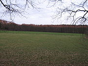
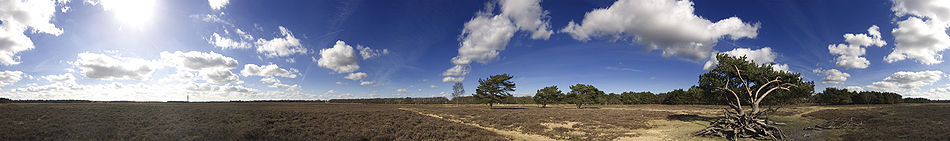
Originally the Gooi area was covered with woods and heath. It was at one time encircled by treacherous high and low fen areas (with peat bogs) that created a natural barrier and isolated it from the Utrecht area to the south. Today there is still a good amount of variation in the landscape in the Gooi area. The landscape is dominated by a dry, sandy ridge. To the east and west of the ridge there is flat wet low-lying pasture land. The changes in land elevation, and the transition from wet to dry, are important for many animals and plants. The bodies of water at the margins of the area are fed by water seeping through the sandy ridge.
Deciduous
Deciduous means "falling off at maturity" or "tending to fall off", and is typically used in reference to trees or shrubs that lose their leaves seasonally, and to the shedding of other plant structures such as petals after flowering or fruit when ripe...
and coniferous woods, heath, grassland
Grassland
Grasslands are areas where the vegetation is dominated by grasses and other herbaceous plants . However, sedge and rush families can also be found. Grasslands occur naturally on all continents except Antarctica...
with sand pits, land developed as estates and the unique leftovers of open high ground and commons (engen en meenten). Some areas have been set aside for protection, including the Naardermeer (the oldest nature reserve in the Netherlands and the home of a unique colony of black cormorants (phalacrocorax nigra)) and the Gooi Nature Reserve (Goois Natuurreservaat). These areas are valuable buffers against encroaching urban development. A feature of the landscape in Het Gooi is the consistent encirclement of many heath areas with wooded margins, creating the illusion of an uninterrupted landscape and keeping the built-up areas out of sight. In the Netherlands this is rare.
There is some concern about the motorways running through the area (the A1
A1 motorway (Netherlands)
The A1 motorway is a motorway in the Netherlands. The road connects the city of Amsterdam, near the interchange Watergraafsmeer, with the German border, near Oldenzaal and Bad Bentheim , and the German Autobahn BAB 30...
and A27
A27 motorway (Netherlands)
The A27 motorway is a motorway in the Netherlands. It is approximately 109 kilometers in length.The A27 is located in the Dutch provinces North Brabant, South Holland, Utrecht, North Holland, and Flevoland. It connects the city of Breda with the Almere...
) because they cut through important nature areas. Near Hilversum
Hilversum
is a municipality and a town in the Netherlands, in the province of North Holland. Located in the region called "'t Gooi", it is the largest town in that area. It is surrounded by heathland, woods, meadows, lakes, and smaller villages...
the longest wildlife crossing
Wildlife crossing
Wildlife crossings are structures that allow animals to cross human-made barriers safely. Wildlife crossings may include: underpass tunnels, viaducts, and overpasses ; amphibian tunnels; fish ladders; tunnels and culverts ; green roofs .Wildlife crossings are a...
overpass in the world has been constructed over the N524 and the Amsterdam-Hilversum railway line. Called the Natuurbrug Zanderij Crailo (literally, the "Crailo Sand Quarry Nature Bridge"), the massive structure is over 800 meters long and spans not just the motorway and railway line, but also a business park, river and sports complex. Monitoring is currently underway to examine the effectiveness of this innovative project combining wildlife protection with urban development.
Prehistory
The Gooi area is situated on high sandy ground. In the constantly changing watery landscape of prehistoric Holland, this area was suitable for settlement and is thought to be one of the oldest inhabited parts of the Netherlands. Prehistoric mounds and the remains of the "Hilversum culture" are found in the area. The pottery remains found in Hilversum and area, particularly in burial mounds, indicate that the Hilversum culture dates from the early and mid-Bronze AgeBronze Age
The Bronze Age is a period characterized by the use of copper and its alloy bronze as the chief hard materials in the manufacture of some implements and weapons. Chronologically, it stands between the Stone Age and Iron Age...
period (1800-1200 BCE). This culture is known for its cask-shaped and thick-sided urns, decorated on the edges with finger and nail imprints. The Hofland Geological Museum beside the St. John's Cemetery (St.-Janskerkhof) has a few objects from this culture on display.
In this area water gathered in lower locations on the edges. These drinking spots provided a source of water for livestock and became the centres of the settlements in the area. Because of the low fertility of the sandy soil, the grazing of sheep was the main agricultural activity. This led to the development of wool production.
Until around 1300 Het Gooi was mostly undeveloped. There were only a few farming settlements that used the land, woods and open fields in common.
Medieval period

Elten
Elten is a small German town located in Northrhine-Westfalia. It has a population of around 4,500. Since 1975, it is part of the town Emmerich am Rhein. Between 1949 and 1963, Elten was part of the Netherlands . There is a substantial minority of Dutch citizens.- External links :*...
(nowadays Germany, then part of Guelders
Guelders
Guelders or Gueldres is the name of a historical county, later duchy of the Holy Roman Empire, located in the Low Countries.-Geography:...
) called the "Godgewijde Maagden van Elten" (literally, the "Virgins of Elten Consecrated to God"). It was Count Wichmann of Ghent who founded the convent and gave lordship over Het Gooi to the convent.
The first village in Het Gooi was Laren
Laren
is a municipality and a town in the Netherlands, in the province of North Holland. Located in the region called 't Gooi, it is the oldest town in that area. It is one of the richest towns in the Netherlands, along with its neighbour Blaricum...
. In 1085 a chapel was founded at the current location of the St. John's Cemetery (St.-Janskerkhof) in Laren. It became the religious centre for the area. It developed into a church and a place of pilgrimage
Pilgrimage
A pilgrimage is a journey or search of great moral or spiritual significance. Typically, it is a journey to a shrine or other location of importance to a person's beliefs and faith...
, which would later acquire the status of basilica
Basilica
The Latin word basilica , was originally used to describe a Roman public building, usually located in the forum of a Roman town. Public basilicas began to appear in Hellenistic cities in the 2nd century BC.The term was also applied to buildings used for religious purposes...
and make Laren
Laren
is a municipality and a town in the Netherlands, in the province of North Holland. Located in the region called 't Gooi, it is the oldest town in that area. It is one of the richest towns in the Netherlands, along with its neighbour Blaricum...
the site of an annual St. John's Procession held on the Feast of St. John
Nativity of St. John the Baptist
The Nativity of St. John the Baptist is a Christian feast day celebrating the birth of John the Baptist, a prophet who foretold the coming of the Messiah in the person of Jesus and who baptized Jesus.-Significance:Christians have long interpreted the life of John the Baptist as a preparation for...
on 24 June. In 1285 Floris V, Count of Holland
Floris V, Count of Holland
Count Floris V of Holland and Zeeland , "der Keerlen God" , is one of the most important figures of the first, native dynasty of Holland . His life was documented in detail in the Rijmkroniek by Melis Stoke, his chronicler...
, purchased the heerlijkheid
Heerlijkheid
A heerlijkheid was the basic administrative and judicial unit in rural areas in Dutch-speaking lands before 1800. It originated in the feudal subdivision of government authority in the Middle Ages. The closest English equivalents of the word are "seigniory" and "manor"...
rights from the convent. (Afterwards there were disputes between the County of Holland
County of Holland
The County of Holland was a county in the Holy Roman Empire and from 1482 part of the Habsburg Netherlands in what is now the Netherlands. It covered an area roughly corresponding to the current Dutch provinces of North-Holland and South-Holland, as well as the islands of Terschelling, Vlieland,...
and the Bishopric of Utrecht over the governance of the area.) The churches founded in the other towns in the area all bore the name of St. Vitus, the patron saint of Het Gooi. Naarden and Hilversum each had two churches so named; Bussum and Blaricum one each.
Around 1300 a sort of farmer's co-operative (boerenzelforganisatie) was formed in the area. Unique in the Netherlands, its members asserted their rights to use and regulate the land as a commons. Called "the erfgooiers", this medieval organisation remarkably lasted until 1972.
The people in the area (especially Bussum, Laren and Blaricum) spoke a Dutch Low Saxon
Dutch Low Saxon
Dutch Low Saxon is a group of Low Saxon, i.e. West Low German dialects spoken in the northeastern Netherlands. In comparison, the remainder of the Netherlands speak a collection of Low Franconian dialects.The class "Dutch Low Saxon" is not unanimous...
dialect called "Goois". Emigration from Frisia
Frisia
Frisia is a coastal region along the southeastern corner of the North Sea, i.e. the German Bight. Frisia is the traditional homeland of the Frisians, a Germanic people who speak Frisian, a language group closely related to the English language...
to Huizen meant that a Frisian
West Frisian language
West Frisian is a language spoken mostly in the province of Friesland in the north of the Netherlands. West Frisian is the name by which this language is usually known outside the Netherlands, to distinguish it from the closely related Frisian languages of Saterland Frisian and North Frisian,...
dialect was spoken there.
Modern era
Starting around 1500, and reaching a peak in the 17th century, sand was quarried in the area for the expansion of Amsterdam. As a result a number of waterways were dug in 's-Graveland, Naarden and Bussum. The canal system and the arrival of a canal boat system connecting the area to Amsterdam helped the area to grow further economically. Hilversum developed into a centre for the production of wool and textiles.
The broadcast industry in Het Gooi developed after the NSF factory (Nederlandse Seintoestellen Fabriek, Dutch Broadcasting-equipment Factory) was built in Hilversum in 1918. It expanded from Hilversum to the other towns nearby. The first television broadcast in the Netherlands was from Bussum. Today the Netherlands Public Broadcasting has offices and studios all over the area.
Het Gooi has become heavily populated. Because of the nature in the area and its historic charm, the villages have become attractive to the affluent, including retirees. The population is relatively older and there are many old-age homes. The original inhabitants of the area have been submerged by the flood of newcomers. The local dialect that used to be spoken here has virtually disappeared.
Hilversum
Hilversum
is a municipality and a town in the Netherlands, in the province of North Holland. Located in the region called "'t Gooi", it is the largest town in that area. It is surrounded by heathland, woods, meadows, lakes, and smaller villages...
is now the most important and the largest town in Het Gooi, a role it took over from Naarden in the 18th century. The town is the principal centre for radio and television broadcasting in the Netherlands. A traditionally Catholic town, the most important church is the St. Vitus Church (Sint-Vituskerk).
Hilversum became the centre of Het Gooi as a result of the rapid development of wool production and the textile and carpet-making industry. A Philips radio and transmitter factory, called "NSF" or Nederlandse Seintoestellen Fabriek, was built in Hilversum in 1918. This led to the founding of the Netherlands Public Broadcasting system and the various networks, including AVRO
Avro
Avro was a British aircraft manufacturer, with numerous landmark designs such as the Avro 504 trainer in the First World War, the Avro Lancaster, one of the pre-eminent bombers of the Second World War, and the delta wing Avro Vulcan, a stalwart of the Cold War.-Early history:One of the world's...
, VARA, KRO
KRO
KRO, or Katholieke Radio Omroep , is a Dutch public broadcasting organization founded on 23 April 1925. Broadly Catholic in its spiritual outlook, KRO broadcasts the bulk of its television output on the Nederland 1 channel. KRO is also responsible for managing broadcasts made by the Catholic Church...
, NCRV
NCRV
NCRV is a public radio and television broadcaster in the Netherlands, mostly transmitting on Nederland 1 and Nederland 2....
, NTS and the NOB and others. Broadcasting became the major economic activity in the town. In 1965 the town's population was 103,000, but in recent decades it had lost some of its industries and the population has declined. In 2006 the population was 84,000. Despite its high profile, Hilversum has its problems. Hilversum has attracted a good deal of crime, partly related to drugs. There is also a housing shortage. The city is encircled by nature reserves and unable to expand.
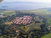
Naarden
Good Friday
Good Friday , is a religious holiday observed primarily by Christians commemorating the crucifixion of Jesus Christ and his death at Calvary. The holiday is observed during Holy Week as part of the Paschal Triduum on the Friday preceding Easter Sunday, and may coincide with the Jewish observance of...
, a performance of Bach
Bạch
Bạch is a Vietnamese surname. The name is transliterated as Bai in Chinese and Baek, in Korean.Bach is the anglicized variation of the surname Bạch.-Notable people with the surname Bạch:* Bạch Liêu...
's St. Matthew Passion in the local church, which is called the Great Church or St. Vitus Church. Despite its earlier importance, Naarden was surpassed by Hilversum in the 18th century and today is much smaller than its neighbour Bussum. It is now a part of the municipality of Bussum, albeit one with an interesting history and townscape.
Laren and Blaricum
Laren
is a municipality and a town in the Netherlands, in the province of North Holland. Located in the region called 't Gooi, it is the oldest town in that area. It is one of the richest towns in the Netherlands, along with its neighbour Blaricum...
and Blaricum
Blaricum
Blaricum is a municipality and village in the Netherlands, in the province of North Holland.It is known for its many monumental farm buildings, local cafes and restaurants, nature, several annual community events and extensive up-market residential areas...
were poor, small farming villages. Laren is former place of pilgrimage and a procession takes place there on 24 June. There are also "death paths" (doodwegen) leading to the cemetery of St. John's Church (Sint-Janskerkhof) in Laren. From around the time of the introduction of the steam train in 1882 until around 1950, there was an artists' colony in the area. The inhabitants included Anton Mauve
Anton Mauve
Anthonij Rudolf Mauve was a Dutch realist painter who was a leading member of the Hague School. He signed his paintings 'A. Mauve' or with a monogrammed 'A.M.'. He was a very significant early influence on his cousin-in-law Vincent van Gogh.Most of Mauve's work depicts people and animals in...
(teacher of Vincent van Gogh
Vincent van Gogh
Vincent Willem van Gogh , and used Brabant dialect in his writing; it is therefore likely that he himself pronounced his name with a Brabant accent: , with a voiced V and palatalized G and gh. In France, where much of his work was produced, it is...
), Jan Sluijters, Ferdinand Hart Nibbrig and American art collector William Singer, whose collection became the basis for the Singer Laren
Singer Laren
Singer Laren is a museum and concert hall located in the center of Laren on the Oude Drift. The museum is devoted to presenting and preserving the collection of the American artist William Henry Singer and his wife Anna.-History:...
museum. Today Laren and Blaricum are residential towns for television personalities, retirees and people who struck it rich during the internet boom in the 1990s. According to Statistics Netherlands (CBS), the residents of Blaricum
Blaricum
Blaricum is a municipality and village in the Netherlands, in the province of North Holland.It is known for its many monumental farm buildings, local cafes and restaurants, nature, several annual community events and extensive up-market residential areas...
are the richest of any municipality in the Netherlands. The residents of Laren are the oldest. An interesting feature of Blaricum and Laren is that each still has a recognisable village green
Village green
A village green is a common open area which is a part of a settlement. Traditionally, such an area was often common grass land at the centre of a small agricultural settlement, used for grazing and sometimes for community events...
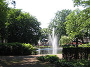
in their centre, called a "brink" in Dutch. In Laren it has a pond and fountain in its centre. Quite a few famous people live in Blaricum.
Bussum

Bussum
Bussum is a municipality and a town in the Netherlands, in the province of North Holland.-History:Bussum was first mentioned in 1306. In this time, Bussum was a large heathland with many small farms, sheep pens and forests as is shown on old maps. Since Bussum is situated near the fortified town...
was founded in about 1000 AD. It remained a farming village until the 19th century. When the railway was laid, a station was built for both Bussum and Naarden, making the area more accessible. Artists settled in the town, including Frederik van Eeden
Frederik van Eeden
Frederik Willem van Eeden was a late 19th century and early 20th century Dutch writer and psychiatrist...
, who started his own "Walden
Walden
Walden is an American book written by noted Transcendentalist Henry David Thoreau...
colony" here, and Herman Gorter
Herman Gorter
Herman Gorter was a Dutch poet and socialist. He was a leading member of the Tachtigers, a highly influential group of Dutch writers who worked together in Amsterdam in the 1880s, centered around De Nieuwe Gids .Gorter's first book, a 4,000 verse epic poem called "Mei" , sealed his reputation...
. In the 20th century it grew rapidly as a residential commuter town. In the 1950s the first public television broadcast was made from Studio Irene (now gone). In the 1980s growth slowed and it became somewhat of a retirement community. Its inhabitants are now amongst the oldest of any municipality in the Netherlands. Today, thanks to its location on the Hilversum-Amsterdam railway line, the conurbation of Bussum-Naarden-Hilversumse Meent is the second largest built-up area in Het Gooi, behind Hilversum, but ahead of Huizen.
Huizen

Huizen
Huizen is a municipality and a town in the Netherlands, in the province of North Holland.The name "Huizen" is Dutch for "houses" and this usage has been linked to the belief that the first stone houses in the region appeared here.-History:...
was a traditionally Protestant farming village oriented around the production of cheese, but by the 19th century it had extended to the shore to the north and had become a fishing village as well. After the Zuiderzee was blocked off by the Afsluitdijk
Afsluitdijk
The Afsluitdijk is a major causeway in the Netherlands, constructed between 1927 and 1933 and running from Den Oever on Wieringen in North Holland province, to the village of Zurich in Friesland province, over a length of and a width of 90 m, at an initial height of 7.25 m above sea-level.It is...
and Flevoland
Flevoland
Flevoland is a province of the Netherlands. Located in the centre of the country, at the location of the former Zuiderzee, the province was established on January 1, 1986; the twelfth province of the country, with Lelystad as its capital...
was drained and created, the fishing industry died out, but the town is still located on the Gooimeer, a southern extension of the IJsselmeer. After the war, the town grew rapidly because of the construction of a Philips
Philips
Koninklijke Philips Electronics N.V. , more commonly known as Philips, is a multinational Dutch electronics company....
factory there (since closed). Unlike Bussum and Hilversum, the population of the town is still growing and has a residential character. With its population of 42,000, Huizen is one of the larger towns in the Netherlands without its own railway connection.
Cultural and historical items of interest
There are a number of cultural and historical items of interest in the area:- Prehistoric burial mounds
- The "death paths" (doodwegen) leading to the cemetery of St. John's Church (Sint-Janskerkhof) in Laren
- The Erfgooiers
- The village centres of Laren and Blaricum, the only villages in the province of North Holland with recognisable village greenVillage greenA village green is a common open area which is a part of a settlement. Traditionally, such an area was often common grass land at the centre of a small agricultural settlement, used for grazing and sometimes for community events...
s - The fort and museum at Naarden
- The old fishing harbour and village centre of Huizen
- The remaining structures in the historical defence line of Amsterdam (Stelling van AmsterdamStelling van AmsterdamThe UNESCO World Heritage Site known as the Defence Line of Amsterdam is a 135 km long ring of fortifications around Amsterdam, consisting of 42 forts located between 10 to 15 kilometers the centre, and lowlands that can easily be flooded in time of war...
) - The architecture and broadcasting studios at Hilversum
- The estate landscape of 's-Graveland
- The remaining structures in the northern part of the historical Dutch Water LineDutch Water LineThe Dutch Water Line was a series of water based defences conceived by Maurice of Nassau in the early 17th century, and realised by his half brother Frederick Henry...
- The original Gooi dialect (now almost extinct)
The public image of Het Gooi
For Dutch people, the Gooi area is synonymous with the broadcasting industry, the affluence of the area's inhabitants and high property values. "Gooi parking" is the casual parking of a high-priced automobile outside permitted places. The phrase "the Gooi mattress" is a reference to the perceived loose morals of the broadcasting industry. The English equivalent is probably "the director's couch". The reputation of Het Gooi has perhaps forever been marked by a popular television show called "Gooi Women" (Gooische VrouwenGooische Vrouwen
Gooische Vrouwen is a Dutch drama series, created by Linda de Mol for her brother John's Tien channel. Favourably compared to Desperate Housewives and Sex in the City, the series chronicles the lives of four upper-class women residing in Het Gooi and ran from 2005 to 2009...
), which follows the lives of four decadent women living in the area.
People from Het Gooi are known for the way they pronounce "r" before a vowel and at the end of a syllable. The "r" in a word like "drie" is not rolled as it is in standard Dutch
Dutch language
Dutch is a West Germanic language and the native language of the majority of the population of the Netherlands, Belgium, and Suriname, the three member states of the Dutch Language Union. Most speakers live in the European Union, where it is a first language for about 23 million and a second...
. The "r" at the end of a syllable is not pronounced, so that "daardoor" sounds like "daahdooh". Many Dutch people find this speech trait rather annoying. This is not the original local dialect, but a modern speech pattern of people who have moved to Het Gooi from Amsterdam and elsewhere in the Randstad
Randstad
Image:Randstad_with_scale.png|400px|thumb|right|Clickable schematic map of the Randstadcircle 528 380 26 Schipholrect 426 356 498 436 Haarlemmermeerrect 399 166 479 245 Velsencircle 250 716 32 Delftcircle 220 642 60 The Hague...
. Because so many people from the area of Het Gooi appear on television, this manner of speech is influential throughout the country.