

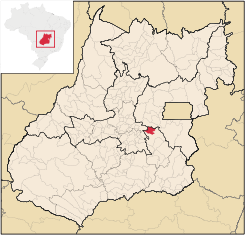
Gameleira de Goiás
Encyclopedia
| Gameleira de Goiás | |
|---|---|
| State | Goiás Goiás Goiás is a state of Brazil, located in the central part of the country. The name Goiás comes from the name of an indigenous community... |
| Coordinates: | 16°28′07"S 48°37′55"W |
| Area: | 595.3 km² |
| Population: | 3,289 (IBGE 2007) |
| Elevation of municipal seat: | 993 m above sea level |
| Postcode (CEP): | 75184-000 |
| Became a city: | 1998 |
| Distance to Goiânia Goiânia -Climate:The city has a tropical wet and dry climate with an average temperature of . There's a wet season, from October to April, and a dry one, from May to September. Annual rainfall is around 1,520 mm.... : |
99 km. |
| IBGE statistical microregion: | Pires do Rio Microregion Pires do Rio Microregion The Pires do Rio Microregion is a statistical region of south-central Goiás state, Brazil. The most important city is Pires do Rio. The area includes 10 cities with a population of 90,327 in an area of 9,449.80 km²... |
| Website: | n/a |
Municipality
A municipality is essentially an urban administrative division having corporate status and usually powers of self-government. It can also be used to mean the governing body of a municipality. A municipality is a general-purpose administrative subdivision, as opposed to a special-purpose district...
in central Goiás
Goiás
Goiás is a state of Brazil, located in the central part of the country. The name Goiás comes from the name of an indigenous community...
state, Brazil
Brazil
Brazil , officially the Federative Republic of Brazil , is the largest country in South America. It is the world's fifth largest country, both by geographical area and by population with over 192 million people...
. The population in 2007 was 3,289 in a total area of 595 square kilometers.
Geographical Information
The distance to the state capital, GoiâniaGoiânia
-Climate:The city has a tropical wet and dry climate with an average temperature of . There's a wet season, from October to April, and a dry one, from May to September. Annual rainfall is around 1,520 mm....
, is 99 km. Highway connections from Goiânia
Goiânia
-Climate:The city has a tropical wet and dry climate with an average temperature of . There's a wet season, from October to April, and a dry one, from May to September. Annual rainfall is around 1,520 mm....
are made by BR-457 / GO-010 / Bonfinópolis
Bonfinópolis
Bonfinópolis is a small town and municipality in central Goiás state, Brazil. It is located a short distance east of Goiânia and is part of the Goiânia metropolitan area.The distance to Goiânia is 33 km...
/ Leopoldo de Bulhões
Leopoldo de Bulhões
Leopoldo de Bulhões is a small town and municipality in central Goiás state, Brazil. The total area was 495.0 km² in October 2002) and the population was 8,916 in 2007...
/ Silvânia
Silvânia
Silvânia is a small city and municipality in southcentral Goiás state, Brazil.-Location and highway connections:Silvânia is located 77 kilometers from the state capital of Goiânia, 180 km...
/ GO-437. (18 km unpaved).
Gameleira has municipal boundaries with Silvânia
Silvânia
Silvânia is a small city and municipality in southcentral Goiás state, Brazil.-Location and highway connections:Silvânia is located 77 kilometers from the state capital of Goiânia, 180 km...
, Abadiânia
Abadiânia
Abadiânia is a small town and municipality in the state of Goiás, Brazil. It is home to a famous Brazilian medium and "psychic surgeon" — João de Deus.-Location:Abadiânia is part of the Entorno de Brasília statistical micro-region...
, and Anápolis
Anápolis
Anápolis is the third largest city in the State of Goiás in Brazil. It lies in the center of a rich agricultural region and has become a leader in food processing and pharmaceutical plants.-Location and population:...
.
Political Data
- Eligible voters: 2,399 (December 2007)
- Mayor: José Denisson de Sousa (January 2005)
- Vice-mayor: Marizete Coelho Borges
- Councilmembers: 09
Demographics
- Population density in 2007: 5.52 inhab/km²
- Population growth rate 1996/2007: n/a
- Total population in 2007: 3,289
- Total population in 1980: n/a
- Urban population in 2007: 1,005
- Rural population in 2007: 2,284
The Economy
The main economic activities are livestock raising, agriculture, and services.Economic Data
- Industrial units: 02 (June/2007)
- Retail units: 25 (August/2007)
- Banking institutions: none (2007)
- Motor vehicles: 156 automobiles and 153 pickup trucks. (IBGE 2007)
- Number of inhabitants per motor vehicle: 10.6
Agriculture
Agriculture is based on cattle raising and growing of corn
Maize
Maize known in many English-speaking countries as corn or mielie/mealie, is a grain domesticated by indigenous peoples in Mesoamerica in prehistoric times. The leafy stalk produces ears which contain seeds called kernels. Though technically a grain, maize kernels are used in cooking as a vegetable...
, sugarcane
Sugarcane
Sugarcane refers to any of six to 37 species of tall perennial grasses of the genus Saccharum . Native to the warm temperate to tropical regions of South Asia, they have stout, jointed, fibrous stalks that are rich in sugar, and measure two to six metres tall...
, rice
Rice
Rice is the seed of the monocot plants Oryza sativa or Oryza glaberrima . As a cereal grain, it is the most important staple food for a large part of the world's human population, especially in East Asia, Southeast Asia, South Asia, the Middle East, and the West Indies...
, and soybeans.
In 2004 the cattle herd was 20,250 head, of which 6,000 were milking cows. The main agricultural products in planted area were soybeans (25,000 hectares), corn (1,200 hectares), beans, sorghum, tomatoes, and citrus fruits.
- Number of farms, total area and workers: 529 on 61,520 ha. with 1,300 workers.
- Land distribution: 32,000 ha. were planted in permanent or perennial crops and 19,511 ha. were natural pasture. 91 farms had a total of 222 tractors (2006).
Education and Health
- Literacy rate: n/a
- Infant mortality rate: n/a
- Schools: 03 (2006)
- Students: 833
- Hospitals: 0 (July 2003)
- Hospital beds: 0
- Walk-in public health clinics: 01
See also
- List of municipalities in Goiás
- Microregions of Goiás