
Fawkner, Victoria
Encyclopedia
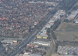
Fawkner is a suburb in Melbourne
, Victoria
, Australia
, 12 km north from Melbourne's central business district
. Its Local Government Area is the City of Moreland
. At the 2006 Census, Fawkner had a population of 11,876.
It is located at the northern end of the Moreland municipality and is bound by Merri Creek
on the east, the Hume Highway
on the west and the Western Ring Road on the north, and Boundary Road on the south separating the leafy suburb from the Coburg North
.
. In 1867 John Jukes bought a parcel of land in the area and named it Fawkner in honour of the pioneer settler.
One of the original settlers in Fawkner was Michael Dowling and his family who settled on their property at Major Road near Merri Creek in September 1902, grazing cattle to fatten for market. Miss Dowling described the area then as a harsh windy place with few trees and a few unfinished shacks.
The first school in the area was the Fawkner State School, opened 1909, on Lynch Road. The school was decommissioned in the 1990s and was subsequently purchased in 1997 by the Quang Duc Buddhist Welfare Association to form the buddhist Quang Duc Temple.
The opening of the Upfield railway line on 8 October 1889 (electrified to Fawkner on 2 December 1920); and the development and opening of the Fawkner general cemetery
in December 1906 encouraged residential development in the south of the suburb.
By 1910 there were 35 houses within walking distance of Fawkner Station.
Electricity was extended to Fawkner in 1920 by the City of Coburg Electricity Supply Department. Returned soldiers started settling the suburb in the 1920s. By 1939 post office directories listed 180 buildings in Fawkner.
North Fawkner remained a dairy farm owned by the Coyne family until 1945. The period after World War II
saw the most significant period of development in the suburb with the first public housing built by the Housing Commission in 1949 and continuing up until the 1960s with the development of the Moomba Park estate, named after the initial Labour Day Moomba Parade held in 1955. Other facilities established included Fawkner swimming pool in 1964 and Fawkner Library in 1969.
The Post Office opened in 1878 as Box Forest, was renamed Fawkner in 1885 and closed in 1888. The next Fawkner office was open in 1904 and 1905. The third (known briefly as Faulkner) was open from 1909 until renamed Fawkner South in 1960. The fourth was open from 1960 until renamed Fawkner East in 1970, when the current Fawkner office opened. In addition, a Fawkner West office was open from 1962 until 1993, and the Fawkner North office on Anderson Road in the Moomba Park area opened in 1961.
The suburb was transferred in 1994 from the Municipality of Broadmeadows
to the new City of Moreland when the Victorian Government redrew local government boundaries.
began in 1956 and an islamic college, Darul Ulum College of Victoria, was established in 1997 on the grounds of the former Fawkner North Primary school.
.
The Coburg North - Campbellfield (K-Mart
) bus (route no. ) runs through mainstream Fawkner, providing access to neighbouring suburbs.
The Upfield Bike Path
, Merri Creek Trail
and the Western Ring Road Trail
provide facilities for recreational and commuting cyclists.
. There is also significant open space along Merri Creek
.
Melbourne
Melbourne is the capital and most populous city in the state of Victoria, and the second most populous city in Australia. The Melbourne City Centre is the hub of the greater metropolitan area and the Census statistical division—of which "Melbourne" is the common name. As of June 2009, the greater...
, Victoria
Victoria (Australia)
Victoria is the second most populous state in Australia. Geographically the smallest mainland state, Victoria is bordered by New South Wales, South Australia, and Tasmania on Boundary Islet to the north, west and south respectively....
, Australia
Australia
Australia , officially the Commonwealth of Australia, is a country in the Southern Hemisphere comprising the mainland of the Australian continent, the island of Tasmania, and numerous smaller islands in the Indian and Pacific Oceans. It is the world's sixth-largest country by total area...
, 12 km north from Melbourne's central business district
Melbourne city centre
Melbourne City Centre is an area of Melbourne in Victoria, Australia. It is not to be confused with the larger local government area of the City of Melbourne...
. Its Local Government Area is the City of Moreland
City of Moreland
The City of Moreland is a Local Government Area located within the metropolitan area of Melbourne, Victoria, Australia. It comprises the inner northern suburbs between 4 and 10 kilometres from the Melbourne city centre....
. At the 2006 Census, Fawkner had a population of 11,876.
It is located at the northern end of the Moreland municipality and is bound by Merri Creek
Merri Creek
The Merri Creek is a waterway in southern parts of Victoria, Australia which flows through the northern suburbs of Melbourne. It begins in Wallan north of Melbourne and flows south for 70km until it joins the Yarra River at Dights Falls...
on the east, the Hume Highway
Hume Highway
The Hume Highway/Hume Freeway is one of Australia's major inter-city highways, running for 880 km between Sydney and Melbourne. It is part of the Auslink National Network and is a vital link for road freight to transport goods to and from the two cities as well as serving Albury-Wodonga and...
on the west and the Western Ring Road on the north, and Boundary Road on the south separating the leafy suburb from the Coburg North
Coburg North, Victoria
Coburg North is a suburb in Melbourne, Victoria, Australia, 10 km north from Melbourne's central business district. Its Local Government Area is the City of Moreland. At the 2006 Census, Coburg North had a population of 6064....
.
History
The area was originally called and was part of Box Forest, named by Melbourne settler pioneer, John Pascoe FawknerJohn Pascoe Fawkner
John Pascoe Fawkner was an early pioneer, businessman and politician of Melbourne, Victoria, Australia. In 1835 he financed a party of free settlers from Van Diemen's Land , to sail to the mainland in his ship, Enterprize...
. In 1867 John Jukes bought a parcel of land in the area and named it Fawkner in honour of the pioneer settler.
One of the original settlers in Fawkner was Michael Dowling and his family who settled on their property at Major Road near Merri Creek in September 1902, grazing cattle to fatten for market. Miss Dowling described the area then as a harsh windy place with few trees and a few unfinished shacks.
The first school in the area was the Fawkner State School, opened 1909, on Lynch Road. The school was decommissioned in the 1990s and was subsequently purchased in 1997 by the Quang Duc Buddhist Welfare Association to form the buddhist Quang Duc Temple.
The opening of the Upfield railway line on 8 October 1889 (electrified to Fawkner on 2 December 1920); and the development and opening of the Fawkner general cemetery
Fawkner Crematorium and Memorial Park
Fawkner Crematorium and Memorial Park is located in the north western Melbourne suburb of Fawkner, Victoria, Australia. It is the largest cemetery by land size in the state....
in December 1906 encouraged residential development in the south of the suburb.
By 1910 there were 35 houses within walking distance of Fawkner Station.
Electricity was extended to Fawkner in 1920 by the City of Coburg Electricity Supply Department. Returned soldiers started settling the suburb in the 1920s. By 1939 post office directories listed 180 buildings in Fawkner.
North Fawkner remained a dairy farm owned by the Coyne family until 1945. The period after World War II
World War II
World War II, or the Second World War , was a global conflict lasting from 1939 to 1945, involving most of the world's nations—including all of the great powers—eventually forming two opposing military alliances: the Allies and the Axis...
saw the most significant period of development in the suburb with the first public housing built by the Housing Commission in 1949 and continuing up until the 1960s with the development of the Moomba Park estate, named after the initial Labour Day Moomba Parade held in 1955. Other facilities established included Fawkner swimming pool in 1964 and Fawkner Library in 1969.
The Post Office opened in 1878 as Box Forest, was renamed Fawkner in 1885 and closed in 1888. The next Fawkner office was open in 1904 and 1905. The third (known briefly as Faulkner) was open from 1909 until renamed Fawkner South in 1960. The fourth was open from 1960 until renamed Fawkner East in 1970, when the current Fawkner office opened. In addition, a Fawkner West office was open from 1962 until 1993, and the Fawkner North office on Anderson Road in the Moomba Park area opened in 1961.
The suburb was transferred in 1994 from the Municipality of Broadmeadows
City of Broadmeadows
The City of Broadmeadows was a Local Government Area located about north of Melbourne, the state capital of Victoria, Australia. The city covered an area of , and existed from 1857 until 1994.-History:...
to the new City of Moreland when the Victorian Government redrew local government boundaries.
Shopping
The main commercial areas in Fawkner are the strip bordering the Hume Highway, which is mainly automotive-related and light-industrial and the Bonwick Street shopping strip. There are a number of corner shops and small shopping strips dotted about the residential area. Bonwick Street offers a wide range of shops including Italian cuisine as well as one of the best Italian cafe' bar.Schools
Within the suburb of Fawkner, there are two government primary schools: Fawkner Primary and Moomba Park Primary. Two Catholic primary schools were also built: St. Matthew's PS and St. Mark's PS (1934). Fawkner Secondary CollegeFawkner Secondary College
John Fawkner College John Fawkner College John Fawkner College (formerly Fawkner Secondary college is a public co-educational secondary school located in Fawkner, Victoria, Australia. In 2009 the school has approximately 400 students from Year 7 to year 12....
began in 1956 and an islamic college, Darul Ulum College of Victoria, was established in 1997 on the grounds of the former Fawkner North Primary school.
Transport
The stations of Gowrie and Fawkner on the Upfield railway line provide public transport to Melbourne CBD. The Gowrie station bus (route no. ) provides transport to Northland Shopping CentreNorthland Shopping Centre
Northland Shopping Centre is a major shopping centre in East Preston, approximately 11 km north of the Melbourne Central Business District in Victoria. Its motto is Style Up...
.
The Coburg North - Campbellfield (K-Mart
Kmart Australia
Kmart Australia Limited is a discount department store chain owned by Wesfarmers. It operates 172 stores in Australia and 15 in New Zealand, with its head office located in Mulgrave, Victoria. Wesfarmers uses the Kmart name under licence from Sears Holdings Corporation.-History:Kmart Australia...
) bus (route no. ) runs through mainstream Fawkner, providing access to neighbouring suburbs.
The Upfield Bike Path
Upfield bike path
The Upfield Bike Path is a shared use path for cyclists and pedestrians, which follows Upfield railway line through the inner northern suburbs of Melbourne, Victoria, Australia....
, Merri Creek Trail
Merri Creek Trail
The Merri Creek Trail is a shared use path for cyclists and pedestrians, which follows the Merri Creek through the northern suburbs of Melbourne, Victoria, Australia.-Following the Path:...
and the Western Ring Road Trail
Western Ring Road Trail
The Western Ring Road Trail is a shared use path for cyclists and pedestrians that bridges the northern suburbs and follows the Western Ring Road...
provide facilities for recreational and commuting cyclists.
Reserves
Fawkner has three major reserves: Charles Mutton Reserve - home ground for the Northern Saints; Moomba Park - home ground for Moreland United; and CB Smith Reserve - home ground for the Fawkner BluesFawkner Blues
Fawkner Blues is an Australian association football club from Fawkner, a suburb of Melbourne, Victoria. The club was formed in 1965 by local Italian Australians...
. There is also significant open space along Merri Creek
Merri Creek
The Merri Creek is a waterway in southern parts of Victoria, Australia which flows through the northern suburbs of Melbourne. It begins in Wallan north of Melbourne and flows south for 70km until it joins the Yarra River at Dights Falls...
.
Religious settlements
- The Great Prophet Islamic Centre
- Quang Duc Temple Vietnamese Mahayana Buddhist Temple named after Thich Quang Duc http://www.quangduc.com/
- The Greek Orthodox Parish of St Nektarios
- Two Catholic Churches - St Mark's and St Matthew's
See also
- City of BroadmeadowsCity of BroadmeadowsThe City of Broadmeadows was a Local Government Area located about north of Melbourne, the state capital of Victoria, Australia. The city covered an area of , and existed from 1857 until 1994.-History:...
- the former local government area of which Fawkner was a part.