

Fairfax County Parkway
Encyclopedia
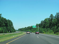
The Fairfax County Parkway, signed as State Route 7100, is a secondary state highway
in the U.S. state
of Virginia
. It provides a north–south arterial route in Fairfax County with a mix of interchange
s and signalized and unsignalized intersections. Its alignment roughly corresponds to part of the once-proposed Outer Beltway around Washington, D.C.
The first segment of the roadway opened in 1987; the road was completed in 2010.
The Franconia-Springfield Parkway (State Route 7900) is a spur near the south end of SR 7100, leading east through Springfield and serving the Franconia-Springfield Metro
station. While SR 7100 has access to the main lanes of I-95, SR 7900 interchanges with the HOV lanes of the Shirley Highway, a reversible lane
system in the median of I-95 and I-395 to Washington.
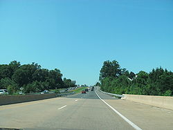
s at major roads and traffic signals at less major roads. Along the main parkway (SR 7100), there are 17 full or partial interchanges and 39 signals, with eleven of those signals at interchanges; the Franconia-Springfield Parkway (SR 7900) has five interchanges and only three signals. In addition, there are many unsignalized intersections along the road, but none of these are driveway
s, since the road is limited-access. The road generally has a speed limit
of 50 mph (22.4 m/s).
The south end of SR 7100 begins at an intersection with US 1 at Accotink
and heads northwest through Fort Belvoir
, leaving the fort at a diamond interchange
with Telegraph Road (SR 611
), crossing 1-95 at a full cloverleaf
(exit 166), crossing over Fullerton Road, passing through interchanges with Boudinot Drive and Barta Road, and turning west through West Springfield at Rolling Road. This portion replaced the existing Backlick Road (SR 617), which continues north from the I-95 interchange and connects to the Franconia-Springfield Parkway (SR 7900). During most of the parkway's life, the portion between Fullerton Road and SR 7900 had not been constructed due to delay caused by environmental issues, including an oil spill
along its path through the Fort Belvoir Proving Ground. Since approval in 2008, construction began in 2009 and the new portion was opened in late 2010.
SR 7900 begins at an intersection with Beulah Street (SR 613
), with Manchester Boulevard/Kingstowne Boulevard continuing east to Van Dorn Street
. The road heads west, with interchanges at the Franconia-Springfield Metrorail/VRE
station, Frontier Drive, the Shirley Highway reversible
HOV lanes, and Backlick Road (SR 617). At the Rolling Road (SR 638) interchange, SR 7900 ends and merges with SR 7100. Rolling Road south of the interchange was rebuilt to carry SR 7100, and a large loop ramp is designed for northbound SR 7100 traffic. Beyond this interchange, SR 7100 has two diamond interchange
s, with Sydenstricker Road/Gambrill Road (SR 640) and Pohick Road (SR 641)/Hooes Road (SR 636), before a stretch of several miles with only at-grade intersections. From Backlick Road (SR 617) west to this SR 636 interchange, the parkway paralleled and replaced the existing Hooes Road (SR 636).
 From Hooes and Pohick Roads (SR 636/SR 641) northwest to the interchange with Ox Road (SR 123), SR 7100 is a surface road, built directly on the former Pohick Road. The parkway beyond Ox Road was built on a new alignment, and has a much smaller number of intersections. Just past Ox Road, SR 7100 passes under Clara Barton Drive, a minor residential street. It intersects the west end of Burke Center Parkway (SR 643
), crosses over the Virginia Railway Express
Manassas Line
and Fairfax Station Road (SR 660), and intersects several other roads before a freeway section begins at a folded diamond interchange with Braddock Road (SR 620). A complicated three-level diamond takes SR 7100 over Lee Highway
(US 29) at the south end of West Ox Road (SR 608
), and SR 7100 crosses I-66 at exit 55, a cloverleaf
. After passing over Fair Lakes Circle (SR 7701), the freeway ends at Fair Lakes Parkway (SR 7700); the next interchange, at Lee Jackson Memorial Highway (US 50), is a partial cloverleaf with two signals on SR 7100.
From US 50 to Franklin Farm Road, the parkway curves northwest to reach the Outer Beltway right-of-way. This straight path is followed until Baron Cameron Avenue (SR 606
), and includes an overpass at Pinecrest Road in the Fox Mill Estates neighborhood. After crossing the Dulles Access Road (SR 267), SR 7100 follows the east border of Herndon, with interchanges at Sunset Hills Road (SR 675) and Baron Cameron Avenue (SR 606). The parkway leaves the straight Outer Beltway alignment just beyond Baron Cameron Avenue, curving northwest and north to end at a diamond interchange
with Leesburg Pike (SR 7), at which the traffic signals are on SR 7100. Algonkian Parkway continues north as a four-lane local road, eventually curving back west and south to SR 7 just east of SR 28.
 SR 7100 is also known as the John F. (Jack) Herrity Parkway, designated by the Virginia General Assembly
in 1995, and the Trooper Charles Mark Cosslett Memorial Highway, designated in 2010 as the final link through Fort Belvoir
. In 2001 SR 7900 was named the Joseph V. Gartlan, Jr., Parkway. Jack Herrity
served for 12 years on the Fairfax County Board of Supervisors
, and was instrumental in getting the road built; Joseph V. Gartlan, Jr.
was a state senator
who served Fairfax County for 28 years. These names are ceremonial, and are rarely used by the public.
The Fairfax County Parkway Trail is a multi-use trail that runs alongside the Franconia-Springfield Parkway and Fairfax County Parkway from Beulah Road to SR 7, mostly as a sidepath, but sometimes using adjacent frontage road
s and old alignments of the roads that the parkway replaced. It intersects the Washington and Old Dominion Trail north of Sunset Hills Road at Herndon, near that trail's mile 19.
's comprehensive plan. In Virginia, by the time of a 1965 plan, it was to run through southern and western Fairfax County, crossing the Potomac River
at Mason Neck and north of Great Falls
, and passing generally west of State Route 123 (Ox Road) and east of SR 645
(Clifton Road, Stringfellow Road, and Lees Corner Road). The straight part of the Fairfax County Parkway between south of Franklin Farm Road and north of Baron Cameron Road is built where the beltway would have been. During the 1970s, attention was focused on the Metrorail system, and environmental concerns temporarily pushed the Outer Beltway onto the back burner. In the 1980s and 1990s, when the plan was revived as the Western Transportation Corridor, the route was shifted further west.
The idea for the Springfield Bypass started in the 1970s as a bypass of SR 644
(Old Keene Mill Road) in Springfield. It was soon expanded, by 1978, to include most of what had been planned as the Outer Beltway. The Commonwealth Transportation Board
approved final plans on July 16, 1987 for the 33 miles (53.1 km) road, with 16 interchanges and 35 traffic signals between U.S. Route 1 at Fort Belvoir and State Route 7 near Dranesville
. A spur to Franconia was included, providing access to the Shirley Highway HOV lanes and the Franconia-Springfield Metrorail station. Except for a short six-lane piece in Reston, the $242 million plan included only four lanes. Since it was a surface road, the highway could incorporate existing roads. This included portions of SR 617 (Backlick Road), SR 636 (Hooes Road), SR 641 (Pohick Road), and SR 680 (Stuart Road).
55 homes and five businesses had to be taken by eminent domain
to build the road. Included in these 55 homes were five at the brand-new Innisfree subdivision in Springfield. Only months after families moved into the houses, located between SR 636 (Hooes Road) and the proposed highway, they were informed that their land would be needed for the interchange at SR 640 (Sydenstricker Road). Originally planned as an at-grade intersection, projections of increased traffic led to a redesign that required more right-of-way.
The Fairfax County Board of Supervisors
changed the name to the Fairfax County Parkway on June 23, 1988, noting that it traveled far from Springfield. The Franconia Spur was not renamed to the suggested Springfield Parkway at that time, to give time to find a single name for the entire spur, already known as Kingstowne Boulevard at its east end. By the next year, the permanent Franconia-Springfield Parkway name had been applied to the portion west of State Route 613
(Beulah Street); the rest of the road was not built as part of the project, and now carries the Manchester Boulevard and Kingstowne Boulevard names.
Three bond issues were approved by Fairfax County voters to pay for construction of the highway, as well as other roads in the county: $135 million in November 1985, $150 million in April 1988, and $130 million in November 1992. The first portions of the road to open were financed by developers building in the area: the Cavalier Land Development Corporation from a new interchange on Interstate 66 north to U.S. Route 50, and the Hazel/Peterson Companies from Stringfellow Road north to Franklin Farm Road, both completed in 1987. On October 24, 1989, the gap from US 50 to Stringfellow Road was filled, and the road was extended from Franklin Farm Road north to West Ox Road (SR 608). It was further extended north to a new interchange on the Dulles Toll Road (SR 267) on October 22, 1991, and north to Sunset Hills Road (SR 675) on July 7, 1993.
Franconia-Springfield Parkway (1989–1995)
The first piece of the Franconia-Springfield Parkway, a short bypass of Hooes Road (SR 636) from Rolling Road (SR 638) east over Accotink Creek
to near Lackawanna Drive, opened on August 7, 1989. The rest of this spur to Beulah Street (SR 613) in Franconia opened on June 8, 1992, along with the reversible HOV
ramps to the Shirley Highway (I-95/I-395). (The Franconia-Springfield station did not open for Virginia Railway Express
and Metrorail trains until four and five years later, respectively; the interchange at Frontier Drive serving the station opened in December 1995).
Springfield to I-66 (1993–1996)
The next pieces of the road to open were in the southwest, with an upgrade and bypass of Hooes Road (SR 636) from Pohick Road (SR 641) east to Rolling Road (SR 638) and the Franconia-Springfield Parkway opening by November 1993. The highway from Ox Road (SR 123) north to Braddock Road (SR 620) opened on July 28, 1995, and was connected to the existing portion at I-66 on September 19. Two interchanges along this portion and the older one to the north - at US 50 and at US 29 - opened on December 14 and December 20 respectively. From SR 123 southeast to the beginning of the Franconia-Springfield Parkway, existing two-lane roads were widened, opening the road from SR 123 east to Lee Chapel Road (SR 643) by May 1996 and to Pohick Road (SR 641) on July 2, 1996, completing the road from Springfield to Herndon. However, until a new bridge opened in early September 2002, traffic on Pohick Road northbound (just east of Hooes Road) was required to turn right onto the parkway.
US 1 to I-95 (1997) and Herndon to SR 7 (1999–2001)
The southernmost portion, from US 1 north across I-95 to Fullerton Road, mostly an upgrade of Backlick Road (SR 617), opened south of Telegraph Road (SR 611) by July 1997 and north of Telegraph Road later that year. The first part north of Sunset Hills Road (SR 675), a short piece from the new interchange with SR 7 south to Sugarland Road (SR 604), opened by June 1999. Extensions opened south to Wiehle Avenue (SR 828) on November 1, 2000 and Baron Cameron Avenue (SR 606) on December 21, 2000. The gap was filled on November 5, 2001, finally completing the parkway north of Springfield.
I-95 to Springfield
Construction has been delayed many times on the last segment, between Fullerton Road (just north of I-95) and Rolling Road (SR 638), which will allow traffic on the main part of the parkway to connect directly to the I-95 main lanes. Plans were made here in the late 1980s, and it was to be paid for by a developer who was to build a development on land bought from the U.S. Army's Fort Belvoir
. But those plans fell through, and traffic growth necessitated a redesign. Plans were again postponed in the early 2000s due to necessary environmental cleanup of that part of Fort Belvoir, which included unexploded ordnance
. The Environmental Protection Agency
discovered in 2005 that an oil spill
on the property had not been properly cleaned. , the project had been designed as a full freeway but was placed on hold. As of September 2010, this portion of the parkway opened for traffic, closing the gap that once existed. Until Phase III of this extension is completed, drivers on southbound SR 7100 must exit at Rolling Road to stay on the parkway southbound and likewise for northbound traffic. Phase III will reconstruct the Rolling Road interchange, turning the Fairfax County Parkway south (along Rolling Rd.), and the Franconia-Springfield Parkway will become a spur.
Future improvements
Plans have been made for an interchange at Fair Lakes Parkway, just north of I-66. This project will be funded with American Recovery and Reinvestment Act of 2009 funds. This project was certified on August 10, 2009, and the construction contract is expected to be let August 2010. Furthermore, improvements are being made to the West Ox Road and Sunrise Valley Drive intersections with the parkway along with interchanges with the new portion of the parkway between Fullerton Road and Rolling Road at Boudinot Drive. Additions and improvements to the I-95 interchange with Fairfax County Parkway are currently under development as well.
s are listed.
State highway
State highway, state road or state route can refer to one of three related concepts, two of them related to a state or provincial government in a country that is divided into states or provinces :#A...
in the U.S. state
U.S. state
A U.S. state is any one of the 50 federated states of the United States of America that share sovereignty with the federal government. Because of this shared sovereignty, an American is a citizen both of the federal entity and of his or her state of domicile. Four states use the official title of...
of Virginia
Virginia
The Commonwealth of Virginia , is a U.S. state on the Atlantic Coast of the Southern United States. Virginia is nicknamed the "Old Dominion" and sometimes the "Mother of Presidents" after the eight U.S. presidents born there...
. It provides a north–south arterial route in Fairfax County with a mix of interchange
Interchange (road)
In the field of road transport, an interchange is a road junction that typically uses grade separation, and one or more ramps, to permit traffic on at least one highway to pass through the junction without directly crossing any other traffic stream. It differs from a standard intersection, at which...
s and signalized and unsignalized intersections. Its alignment roughly corresponds to part of the once-proposed Outer Beltway around Washington, D.C.
Washington, D.C.
Washington, D.C., formally the District of Columbia and commonly referred to as Washington, "the District", or simply D.C., is the capital of the United States. On July 16, 1790, the United States Congress approved the creation of a permanent national capital as permitted by the U.S. Constitution....
The first segment of the roadway opened in 1987; the road was completed in 2010.
The Franconia-Springfield Parkway (State Route 7900) is a spur near the south end of SR 7100, leading east through Springfield and serving the Franconia-Springfield Metro
Washington Metro
The Washington Metro, commonly called Metro, and unofficially Metrorail, is the rapid transit system in Washington, D.C., United States, and its surrounding suburbs. It is administered by the Washington Metropolitan Area Transit Authority , which also operates Metrobus service under the Metro name...
station. While SR 7100 has access to the main lanes of I-95, SR 7900 interchanges with the HOV lanes of the Shirley Highway, a reversible lane
Reversible lane
A reversible lane , called a counterflow lane or contraflow lane in transport engineering nomenclature, is a lane in which traffic may travel in either direction, depending on certain conditions...
system in the median of I-95 and I-395 to Washington.
Route description
The Fairfax County Parkway and its branch to Franconia generally have interchangeInterchange (road)
In the field of road transport, an interchange is a road junction that typically uses grade separation, and one or more ramps, to permit traffic on at least one highway to pass through the junction without directly crossing any other traffic stream. It differs from a standard intersection, at which...
s at major roads and traffic signals at less major roads. Along the main parkway (SR 7100), there are 17 full or partial interchanges and 39 signals, with eleven of those signals at interchanges; the Franconia-Springfield Parkway (SR 7900) has five interchanges and only three signals. In addition, there are many unsignalized intersections along the road, but none of these are driveway
Driveway
A driveway is a type of private road for local access to one or a small group of structures, and is owned and maintained by an individual or group....
s, since the road is limited-access. The road generally has a speed limit
Speed limit
Road speed limits are used in most countries to regulate the speed of road vehicles. Speed limits may define maximum , minimum or no speed limit and are normally indicated using a traffic sign...
of 50 mph (22.4 m/s).
The south end of SR 7100 begins at an intersection with US 1 at Accotink
Accotink, Virginia
Accotink is an unincorporated community in Fairfax County, Virginia, USA. Accotink is located along Accotink Creek within Fort Belvoir....
and heads northwest through Fort Belvoir
Fort Belvoir
Fort Belvoir is a United States Army installation and a census-designated place in Fairfax County, Virginia, United States. Originally, it was the site of the Belvoir plantation. Today, Fort Belvoir is home to a number of important United States military organizations...
, leaving the fort at a diamond interchange
Diamond interchange
A diamond interchange is a common type of road junction, used where a freeway crosses a minor road. The freeway itself is grade-separated from the minor road, one crossing the other over a bridge...
with Telegraph Road (SR 611
Virginia State Route 611 (Fairfax County)
State Route 611 is a secondary state highway in the U.S. state of Virginia, and traverses eastern Fairfax County. SR 611 provides a major artery for commuters, connecting the Eisenhower Valley section of Alexandria with Lorton and points south along US 1...
), crossing 1-95 at a full cloverleaf
Cloverleaf interchange
A cloverleaf interchange is a two-level interchange in which left turns, reverse direction in left-driving regions, are handled by ramp roads...
(exit 166), crossing over Fullerton Road, passing through interchanges with Boudinot Drive and Barta Road, and turning west through West Springfield at Rolling Road. This portion replaced the existing Backlick Road (SR 617), which continues north from the I-95 interchange and connects to the Franconia-Springfield Parkway (SR 7900). During most of the parkway's life, the portion between Fullerton Road and SR 7900 had not been constructed due to delay caused by environmental issues, including an oil spill
Oil spill
An oil spill is the release of a liquid petroleum hydrocarbon into the environment, especially marine areas, due to human activity, and is a form of pollution. The term is mostly used to describe marine oil spills, where oil is released into the ocean or coastal waters...
along its path through the Fort Belvoir Proving Ground. Since approval in 2008, construction began in 2009 and the new portion was opened in late 2010.
SR 7900 begins at an intersection with Beulah Street (SR 613
Virginia State Route 613 (Fairfax County)
State Route 613 is the designation of several distinct suburban surface routes within Fairfax County in the U.S. state of Virginia. These routes were once mostly connected but changes in road alignment, new road construction, and annexations by the independent city of Alexandria have separated them...
), with Manchester Boulevard/Kingstowne Boulevard continuing east to Van Dorn Street
Virginia State Route 613 (Fairfax County)
State Route 613 is the designation of several distinct suburban surface routes within Fairfax County in the U.S. state of Virginia. These routes were once mostly connected but changes in road alignment, new road construction, and annexations by the independent city of Alexandria have separated them...
. The road heads west, with interchanges at the Franconia-Springfield Metrorail/VRE
Virginia Railway Express
The Virginia Railway Express is a regional/ commuter rail service that connects the Northern Virginia suburbs to Union Station in Washington, D.C., via two lines: the Fredericksburg Line from Fredericksburg, Virginia, and the Manassas Line from Broad Run/Airport station in Bristow,...
station, Frontier Drive, the Shirley Highway reversible
Reversible lane
A reversible lane , called a counterflow lane or contraflow lane in transport engineering nomenclature, is a lane in which traffic may travel in either direction, depending on certain conditions...
HOV lanes, and Backlick Road (SR 617). At the Rolling Road (SR 638) interchange, SR 7900 ends and merges with SR 7100. Rolling Road south of the interchange was rebuilt to carry SR 7100, and a large loop ramp is designed for northbound SR 7100 traffic. Beyond this interchange, SR 7100 has two diamond interchange
Diamond interchange
A diamond interchange is a common type of road junction, used where a freeway crosses a minor road. The freeway itself is grade-separated from the minor road, one crossing the other over a bridge...
s, with Sydenstricker Road/Gambrill Road (SR 640) and Pohick Road (SR 641)/Hooes Road (SR 636), before a stretch of several miles with only at-grade intersections. From Backlick Road (SR 617) west to this SR 636 interchange, the parkway paralleled and replaced the existing Hooes Road (SR 636).
Virginia State Route 643 (Fairfax County)
Fairfax County Route 643 is a major secondary road in western Fairfax County, Virginia. This route is composed of three disconnected segments:*Henderson Road, which runs for 6.12 miles.*Old Ox Road*Lee Chapel Road and Burke Centre Parkway...
), crosses over the Virginia Railway Express
Virginia Railway Express
The Virginia Railway Express is a regional/ commuter rail service that connects the Northern Virginia suburbs to Union Station in Washington, D.C., via two lines: the Fredericksburg Line from Fredericksburg, Virginia, and the Manassas Line from Broad Run/Airport station in Bristow,...
Manassas Line
Manassas Line
The Manassas Line is a Virginia Railway Express commuter line that extends from Washington, D.C. to Bristow, VA. Service began on the line on June 22, 1992, and is the first of VRE's two lines to open when the new commuter railroad was established. The line comprises trackage owned by both CSX...
and Fairfax Station Road (SR 660), and intersects several other roads before a freeway section begins at a folded diamond interchange with Braddock Road (SR 620). A complicated three-level diamond takes SR 7100 over Lee Highway
Lee Highway
The Lee Highway was a National Auto Trail in the United States connecting New York City and San Francisco, California via the South and Southwest. It was named after Robert E...
(US 29) at the south end of West Ox Road (SR 608
Virginia State Route 608 (Fairfax County)
State Route 608 is a secondary state highway in the U.S. state of Virginia, and traverses western Fairfax County. Before the Fairfax County Parkway from US 29 to Reston was complete, SR 608 was the main north–south road in western Fairfax County....
), and SR 7100 crosses I-66 at exit 55, a cloverleaf
Cloverleaf interchange
A cloverleaf interchange is a two-level interchange in which left turns, reverse direction in left-driving regions, are handled by ramp roads...
. After passing over Fair Lakes Circle (SR 7701), the freeway ends at Fair Lakes Parkway (SR 7700); the next interchange, at Lee Jackson Memorial Highway (US 50), is a partial cloverleaf with two signals on SR 7100.
From US 50 to Franklin Farm Road, the parkway curves northwest to reach the Outer Beltway right-of-way. This straight path is followed until Baron Cameron Avenue (SR 606
Virginia State Route 606 (Fairfax and Loudoun Counties)
State Route 606 is a secondary state highway in the U.S. state of Virginia, and traverses Fairfax County and Loudoun County. This route goes through Reston and Herndon in Fairfax County, and Sterling and Arcola in Loudoun County...
), and includes an overpass at Pinecrest Road in the Fox Mill Estates neighborhood. After crossing the Dulles Access Road (SR 267), SR 7100 follows the east border of Herndon, with interchanges at Sunset Hills Road (SR 675) and Baron Cameron Avenue (SR 606). The parkway leaves the straight Outer Beltway alignment just beyond Baron Cameron Avenue, curving northwest and north to end at a diamond interchange
Diamond interchange
A diamond interchange is a common type of road junction, used where a freeway crosses a minor road. The freeway itself is grade-separated from the minor road, one crossing the other over a bridge...
with Leesburg Pike (SR 7), at which the traffic signals are on SR 7100. Algonkian Parkway continues north as a four-lane local road, eventually curving back west and south to SR 7 just east of SR 28.
Virginia General Assembly
The Virginia General Assembly is the legislative body of the Commonwealth of Virginia, and the oldest legislative body in the Western Hemisphere, established on July 30, 1619. The General Assembly is a bicameral body consisting of a lower house, the Virginia House of Delegates, with 100 members,...
in 1995, and the Trooper Charles Mark Cosslett Memorial Highway, designated in 2010 as the final link through Fort Belvoir
Fort Belvoir
Fort Belvoir is a United States Army installation and a census-designated place in Fairfax County, Virginia, United States. Originally, it was the site of the Belvoir plantation. Today, Fort Belvoir is home to a number of important United States military organizations...
. In 2001 SR 7900 was named the Joseph V. Gartlan, Jr., Parkway. Jack Herrity
Jack Herrity
John F. "Jack" Herrity was a politician from Fairfax County, Virginia. He served as the chairman of the Fairfax County Board of Supervisors from 1976 to his defeat for reelection by Democrat Audrey Moore. He has previously served as a member of the board, representing the Springfield district, from...
served for 12 years on the Fairfax County Board of Supervisors
Fairfax County Board of Supervisors
The Fairfax County Board of Supervisors, sometimes abbreviated as FCBS, is the governing body of Fairfax County; a county of over a million in Northern Virginia. The board has nine districts, and one at-large district which is always occupied by the Chair...
, and was instrumental in getting the road built; Joseph V. Gartlan, Jr.
Joseph V. Gartlan, Jr.
Joseph Vincent Gartlan, Jr. was a long-serving Democratic member of the Senate of Virginia.-Early life and career:...
was a state senator
Senate of Virginia
The Senate of Virginia is the upper house of the Virginia General Assembly. The Senate is composed of 40 Senators representing an equal number of single-member constituent districts. The Senate is presided over by the Lieutenant Governor of Virginia...
who served Fairfax County for 28 years. These names are ceremonial, and are rarely used by the public.
The Fairfax County Parkway Trail is a multi-use trail that runs alongside the Franconia-Springfield Parkway and Fairfax County Parkway from Beulah Road to SR 7, mostly as a sidepath, but sometimes using adjacent frontage road
Frontage road
A frontage road is a non-limited access road running parallel to a higher-speed road, usually a freeway, and feeding it at appropriate points of access...
s and old alignments of the roads that the parkway replaced. It intersects the Washington and Old Dominion Trail north of Sunset Hills Road at Herndon, near that trail's mile 19.
Planning
The Outer Beltway was first planned in 1950 as the "Cross Country Loop", part of the National Capital Planning CommissionNational Capital Planning Commission
The National Capital Planning Commission is a U.S. government agency that provides planning guidance for Washington, D.C. and the surrounding National Capital Region...
's comprehensive plan. In Virginia, by the time of a 1965 plan, it was to run through southern and western Fairfax County, crossing the Potomac River
Potomac River
The Potomac River flows into the Chesapeake Bay, located along the mid-Atlantic coast of the United States. The river is approximately long, with a drainage area of about 14,700 square miles...
at Mason Neck and north of Great Falls
Great Falls, Virginia
Great Falls is a census-designated place in Fairfax County, Virginia, United States. The population was 15,427 at the 2010 census.Although primarily a bedroom community for Washington, D.C., one major attraction is Great Falls Park which overlooks the Great Falls of the Potomac River, for which...
, and passing generally west of State Route 123 (Ox Road) and east of SR 645
Virginia State Route 645 (Fairfax County)
Virginia Secondary Route 645 is a major secondary road completely within the bounds of western Fairfax County, Virginia. There are six portions, three of them being major, named Wall Road, Lees Corner Road, Stringfellow Road, Clifton Road, Main Street and Burke Lake Road...
(Clifton Road, Stringfellow Road, and Lees Corner Road). The straight part of the Fairfax County Parkway between south of Franklin Farm Road and north of Baron Cameron Road is built where the beltway would have been. During the 1970s, attention was focused on the Metrorail system, and environmental concerns temporarily pushed the Outer Beltway onto the back burner. In the 1980s and 1990s, when the plan was revived as the Western Transportation Corridor, the route was shifted further west.
The idea for the Springfield Bypass started in the 1970s as a bypass of SR 644
Virginia State Route 644 (Fairfax County)
State Route 644 is a secondary state highway in southern Fairfax County, Virginia. It is the closest main east–west road that is south of the Beltway. It is known primarily as Franconia Road east of I-95, and Old Keene Mill Rd west of I-95...
(Old Keene Mill Road) in Springfield. It was soon expanded, by 1978, to include most of what had been planned as the Outer Beltway. The Commonwealth Transportation Board
Commonwealth Transportation Board
The Commonwealth Transportation Board, formerly the State Highway and Transportation Board, regulates and funds transportation in Virginia. It oversees the Virginia Department of Transportation.-Membership:The Board consists of seventeen members:...
approved final plans on July 16, 1987 for the 33 miles (53.1 km) road, with 16 interchanges and 35 traffic signals between U.S. Route 1 at Fort Belvoir and State Route 7 near Dranesville
Dranesville, Virginia
Dranesville is an unincorporated community in Fairfax County, Virginia, USA. Dranesville is located on the Leesburg Pike at its intersection with Georgetown Pike. The Census Bureau defines Dranesville as a census-designated place with a population of 11,921 as of 2010...
. A spur to Franconia was included, providing access to the Shirley Highway HOV lanes and the Franconia-Springfield Metrorail station. Except for a short six-lane piece in Reston, the $242 million plan included only four lanes. Since it was a surface road, the highway could incorporate existing roads. This included portions of SR 617 (Backlick Road), SR 636 (Hooes Road), SR 641 (Pohick Road), and SR 680 (Stuart Road).
55 homes and five businesses had to be taken by eminent domain
Eminent domain
Eminent domain , compulsory purchase , resumption/compulsory acquisition , or expropriation is an action of the state to seize a citizen's private property, expropriate property, or seize a citizen's rights in property with due monetary compensation, but without the owner's consent...
to build the road. Included in these 55 homes were five at the brand-new Innisfree subdivision in Springfield. Only months after families moved into the houses, located between SR 636 (Hooes Road) and the proposed highway, they were informed that their land would be needed for the interchange at SR 640 (Sydenstricker Road). Originally planned as an at-grade intersection, projections of increased traffic led to a redesign that required more right-of-way.
The Fairfax County Board of Supervisors
Fairfax County Board of Supervisors
The Fairfax County Board of Supervisors, sometimes abbreviated as FCBS, is the governing body of Fairfax County; a county of over a million in Northern Virginia. The board has nine districts, and one at-large district which is always occupied by the Chair...
changed the name to the Fairfax County Parkway on June 23, 1988, noting that it traveled far from Springfield. The Franconia Spur was not renamed to the suggested Springfield Parkway at that time, to give time to find a single name for the entire spur, already known as Kingstowne Boulevard at its east end. By the next year, the permanent Franconia-Springfield Parkway name had been applied to the portion west of State Route 613
Virginia State Route 613 (Fairfax County)
State Route 613 is the designation of several distinct suburban surface routes within Fairfax County in the U.S. state of Virginia. These routes were once mostly connected but changes in road alignment, new road construction, and annexations by the independent city of Alexandria have separated them...
(Beulah Street); the rest of the road was not built as part of the project, and now carries the Manchester Boulevard and Kingstowne Boulevard names.
Construction
I-66 to Herndon (1987–1993)Three bond issues were approved by Fairfax County voters to pay for construction of the highway, as well as other roads in the county: $135 million in November 1985, $150 million in April 1988, and $130 million in November 1992. The first portions of the road to open were financed by developers building in the area: the Cavalier Land Development Corporation from a new interchange on Interstate 66 north to U.S. Route 50, and the Hazel/Peterson Companies from Stringfellow Road north to Franklin Farm Road, both completed in 1987. On October 24, 1989, the gap from US 50 to Stringfellow Road was filled, and the road was extended from Franklin Farm Road north to West Ox Road (SR 608). It was further extended north to a new interchange on the Dulles Toll Road (SR 267) on October 22, 1991, and north to Sunset Hills Road (SR 675) on July 7, 1993.
Franconia-Springfield Parkway (1989–1995)
The first piece of the Franconia-Springfield Parkway, a short bypass of Hooes Road (SR 636) from Rolling Road (SR 638) east over Accotink Creek
Accotink Creek
Accotink Creek is a tributary stream of the Potomac River in Fairfax County, Virginia, in the United States. At Springfield, Accotink Creek is dammed to create Lake Accotink. The stream empties into the Potomac at Gunston Cove's Accotink Bay, to the west of Fort Belvoir.-External links:**...
to near Lackawanna Drive, opened on August 7, 1989. The rest of this spur to Beulah Street (SR 613) in Franconia opened on June 8, 1992, along with the reversible HOV
HOV
HOV may refer to:* High-occupancy vehicle lane* Ørsta-Volda Airport, Hovden in Hovden, Norway* Hovig* A small street gang located in Naperville* see Hov...
ramps to the Shirley Highway (I-95/I-395). (The Franconia-Springfield station did not open for Virginia Railway Express
Virginia Railway Express
The Virginia Railway Express is a regional/ commuter rail service that connects the Northern Virginia suburbs to Union Station in Washington, D.C., via two lines: the Fredericksburg Line from Fredericksburg, Virginia, and the Manassas Line from Broad Run/Airport station in Bristow,...
and Metrorail trains until four and five years later, respectively; the interchange at Frontier Drive serving the station opened in December 1995).
Springfield to I-66 (1993–1996)
The next pieces of the road to open were in the southwest, with an upgrade and bypass of Hooes Road (SR 636) from Pohick Road (SR 641) east to Rolling Road (SR 638) and the Franconia-Springfield Parkway opening by November 1993. The highway from Ox Road (SR 123) north to Braddock Road (SR 620) opened on July 28, 1995, and was connected to the existing portion at I-66 on September 19. Two interchanges along this portion and the older one to the north - at US 50 and at US 29 - opened on December 14 and December 20 respectively. From SR 123 southeast to the beginning of the Franconia-Springfield Parkway, existing two-lane roads were widened, opening the road from SR 123 east to Lee Chapel Road (SR 643) by May 1996 and to Pohick Road (SR 641) on July 2, 1996, completing the road from Springfield to Herndon. However, until a new bridge opened in early September 2002, traffic on Pohick Road northbound (just east of Hooes Road) was required to turn right onto the parkway.
US 1 to I-95 (1997) and Herndon to SR 7 (1999–2001)
The southernmost portion, from US 1 north across I-95 to Fullerton Road, mostly an upgrade of Backlick Road (SR 617), opened south of Telegraph Road (SR 611) by July 1997 and north of Telegraph Road later that year. The first part north of Sunset Hills Road (SR 675), a short piece from the new interchange with SR 7 south to Sugarland Road (SR 604), opened by June 1999. Extensions opened south to Wiehle Avenue (SR 828) on November 1, 2000 and Baron Cameron Avenue (SR 606) on December 21, 2000. The gap was filled on November 5, 2001, finally completing the parkway north of Springfield.
I-95 to Springfield
Construction has been delayed many times on the last segment, between Fullerton Road (just north of I-95) and Rolling Road (SR 638), which will allow traffic on the main part of the parkway to connect directly to the I-95 main lanes. Plans were made here in the late 1980s, and it was to be paid for by a developer who was to build a development on land bought from the U.S. Army's Fort Belvoir
Fort Belvoir
Fort Belvoir is a United States Army installation and a census-designated place in Fairfax County, Virginia, United States. Originally, it was the site of the Belvoir plantation. Today, Fort Belvoir is home to a number of important United States military organizations...
. But those plans fell through, and traffic growth necessitated a redesign. Plans were again postponed in the early 2000s due to necessary environmental cleanup of that part of Fort Belvoir, which included unexploded ordnance
Unexploded ordnance
Unexploded ordnance are explosive weapons that did not explode when they were employed and still pose a risk of detonation, potentially many decades after they were used or discarded.While "UXO" is widely and informally used, munitions and explosives of...
. The Environmental Protection Agency
United States Environmental Protection Agency
The U.S. Environmental Protection Agency is an agency of the federal government of the United States charged with protecting human health and the environment, by writing and enforcing regulations based on laws passed by Congress...
discovered in 2005 that an oil spill
Oil spill
An oil spill is the release of a liquid petroleum hydrocarbon into the environment, especially marine areas, due to human activity, and is a form of pollution. The term is mostly used to describe marine oil spills, where oil is released into the ocean or coastal waters...
on the property had not been properly cleaned. , the project had been designed as a full freeway but was placed on hold. As of September 2010, this portion of the parkway opened for traffic, closing the gap that once existed. Until Phase III of this extension is completed, drivers on southbound SR 7100 must exit at Rolling Road to stay on the parkway southbound and likewise for northbound traffic. Phase III will reconstruct the Rolling Road interchange, turning the Fairfax County Parkway south (along Rolling Rd.), and the Franconia-Springfield Parkway will become a spur.
Future improvements
Plans have been made for an interchange at Fair Lakes Parkway, just north of I-66. This project will be funded with American Recovery and Reinvestment Act of 2009 funds. This project was certified on August 10, 2009, and the construction contract is expected to be let August 2010. Furthermore, improvements are being made to the West Ox Road and Sunrise Valley Drive intersections with the parkway along with interchanges with the new portion of the parkway between Fullerton Road and Rolling Road at Boudinot Drive. Additions and improvements to the I-95 interchange with Fairfax County Parkway are currently under development as well.
Major intersections
Only signalized intersections and interchangeInterchange (road)
In the field of road transport, an interchange is a road junction that typically uses grade separation, and one or more ramps, to permit traffic on at least one highway to pass through the junction without directly crossing any other traffic stream. It differs from a standard intersection, at which...
s are listed.
Fairfax County Parkway (SR 7100)
| Location | Mile | Road(s) | Notes |
|---|---|---|---|
| Fort Belvoir Fort Belvoir Fort Belvoir is a United States Army installation and a census-designated place in Fairfax County, Virginia, United States. Originally, it was the site of the Belvoir plantation. Today, Fort Belvoir is home to a number of important United States military organizations... |
0.0 | ||
| 0.8 | Kingman Road, Farrar Road | ||
| Newington Newington, Virginia Newington is a census-designated place in affluent, suburban Fairfax County, Virginia, United States. The population was 19,784 at the 2000 census.... |
1.8 | Interchange | |
| 2.3 | |||
| 2.6 | |||
| 2.8 | |||
| 3.0 | Interchange; exit 166 of I-95 | ||
| 3.1 | Interchange; northbound exit only; other traffic should use SR 4600 | ||
| 3.3 | Boudinot Drive | ||
| 4.2 | Barta Road | ||
| 4.8 | |||
| West Springfield West Springfield, Virginia West Springfield is a census-designated place in Fairfax County, Virginia, United States. The population was 22,460 at the 2000 census.-Geography:West Springfield is located at .... |
5.1 | Interchange with a signal on SR 7100 northbound | |
| 5.5 | Whitlers Creek Drive | ||
| 6.0-6.2 | Interchange | ||
| 7.1-7.3 | Interchange | ||
| 8.3 | |||
| 8.6 | - South Run Park | ||
| Burke Burke, Virginia -Demographics:As of the census of 2000, there were 57,737 people, 19,215 households, and 15,756 families residing in the community. Burke is the largest community in Virginia recognized by the Census Bureau, other than counties and incorporated cities . The population density was 5,008.0 people per... |
|||
| 8.9 | |||
| 10.0 | |||
| 10.7 | |||
| 11.2 | |||
| 13.2 | Interchange | ||
| 13.9 | |||
| Fairfax Station Fairfax Station, Virginia Fairfax Station is a census-designated place in Fairfax County, Virginia, ZIP code 22039. The population as of the 2010 Census was 12,030. As a suburb of Washington, DC, it is a bedroom community for many who work in the federal government.-Averages:... |
|||
| 16.4 | |||
| 17.1 | Interchange | ||
| Fairfax Fairfax, Virginia The City of Fairfax is an independent city forming an enclave within the confines of Fairfax County, in the Commonwealth of Virginia in the United States. Although politically independent of the surrounding county, the City is nevertheless the county seat.... |
|||
| 18.2 | Interchange | ||
| 19.3 | , Washington Washington, D.C. Washington, D.C., formally the District of Columbia and commonly referred to as Washington, "the District", or simply D.C., is the capital of the United States. On July 16, 1790, the United States Congress approved the creation of a permanent national capital as permitted by the U.S. Constitution.... |
Interchange; exit 55 of I-66 | |
| 20.0 | |||
| 20.2 | |||
| 21.0 | Interchange with signals on SR 7100 | ||
| Herndon Herndon, Virginia Herndon is a town in Fairfax County, Virginia, in the Washington, D.C. metropolitan area of the United States. The population was 21,655 at the 2000 census, which makes it the largest of three towns in the county.-History:... |
|||
| 21.5 | |||
| 22.9 | |||
| 23.2 | |||
| 23.7 | |||
| 24.8 | |||
| Reston | 26.4 | ||
| 27.1 | |||
| 27.5 | – Washington Washington, D.C. Washington, D.C., formally the District of Columbia and commonly referred to as Washington, "the District", or simply D.C., is the capital of the United States. On July 16, 1790, the United States Congress approved the creation of a permanent national capital as permitted by the U.S. Constitution.... , Dulles Airport |
Interchange with signals on SR 7100; exit 11 of SR 267 | |
| 27.8 | Interchange with a signal on SR 7100 | ||
| 28.1 | |||
| 28.5 | Interchange | ||
| 29.1 | |||
| 29.5 | |||
| 30.5 | |||
| 31.4 | |||
| Sterling | 31.8 | Interchange with signals on SR 7100 |
Franconia-Springfield Parkway (SR 7900)
See also
- Intercounty ConnectorIntercounty ConnectorMaryland Route 200 , more commonly known as the Intercounty Connector or ICC, is a partially completed toll freeway under construction in Maryland which connects Gaithersburg in Montgomery County and Laurel in Prince George's County. When completed, it will reach the community of Konterra just...
, a toll road being built in Maryland on some of the Outer Beltway right-of-way - Montrose Parkway, a surface road being built in Maryland on some of the Outer Beltway right-of-way, where the Intercounty Connector's path is further north