
Faina
Encyclopedia
| Faina | |
|---|---|
| State | Goiás Goiás Goiás is a state of Brazil, located in the central part of the country. The name Goiás comes from the name of an indigenous community... |
| Area: | 1,944.9 km² |
| Population: | 6,918 (IBGE 2007) |
| Elevation: | 360 m above sea level |
| Postcode (CEP): | 76740-000 |
| Became a city: | 1989 |
| Distance to Goiânia Goiânia -Climate:The city has a tropical wet and dry climate with an average temperature of . There's a wet season, from October to April, and a dry one, from May to September. Annual rainfall is around 1,520 mm.... : |
218 km. |
| IBGE statistical microregion: | Rio Vermelho Microregion Rio Vermelho Microregion The Rio Vermelho Microregion is a geographical region in central Goiás state, Brazil. The most important city is Goiás, also known as Goiás Velho. The Rio Vermelho, a tributary of the Araguaia River flows through the region... |
| Website: | n/a |
| Coordinates: | 15°26′52"S 50°22′06"W |
- For the Argentine pizzeria dish "Fainá", see FarinataFarinataFarinata, socca, or cecina is a sort of thin, unleavened pancake or crêpe of chickpea flour originating in Genoa and later a typical food of the Ligurian Sea coast, from Nice to Pisa.-Names:...
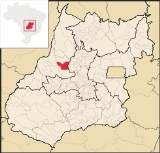
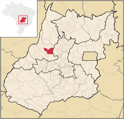
Faina is a small town and municipality
Municipality
A municipality is essentially an urban administrative division having corporate status and usually powers of self-government. It can also be used to mean the governing body of a municipality. A municipality is a general-purpose administrative subdivision, as opposed to a special-purpose district...
in central-west Goiás
Goiás
Goiás is a state of Brazil, located in the central part of the country. The name Goiás comes from the name of an indigenous community...
state, Brazil
Brazil
Brazil , officially the Federative Republic of Brazil , is the largest country in South America. It is the world's fifth largest country, both by geographical area and by population with over 192 million people...
. The population was 6,918 (2007) in a total area of 1,944.9 km².
Location and Connections
Faina is located 218 km. from GoiâniaGoiânia
-Climate:The city has a tropical wet and dry climate with an average temperature of . There's a wet season, from October to April, and a dry one, from May to September. Annual rainfall is around 1,520 mm....
in the central-west area of the state. It is part of the Rio Vermelho Microregion
Rio Vermelho Microregion
The Rio Vermelho Microregion is a geographical region in central Goiás state, Brazil. The most important city is Goiás, also known as Goiás Velho. The Rio Vermelho, a tributary of the Araguaia River flows through the region...
. The main highways of access are: GO-070 / Goianira
Goianira
Goianira is a small city and municipality in central Goiás state, Brazil, located 32 kilometers northwest of the state capital, Goiânia. The population was 24,110 in a total area of 200.4 km² . Goianira is becoming a major producer of shoes.Goianira is four kilometers east of highway BR-457 /...
/ Itaberaí
Itaberaí
Itaberaí is a small city and municipality in central Goiás state, Brazil. Itaberaí is a large producer of agricultural products including corn, rice, soybeans, tomatoes, and sugarcane.-Location:...
until the crossroads at Cidade de Goiás
Goiás, Goiás
Goiás is a small city and municipality in the state of Goiás in Brazil. The population was 24,072 in a total area of 3,108 km² . It is the former capital of the state and preserves much of its colonial heritage...
, and GO-164.
Municipal boundaries:
- North: AraguapazAraguapazAraguapaz is a small town and municipality in north-western Goiás state, Brazil. The population was 7,482 in a total area of 2,193.6 km². It is a major producer of cattle.-Location and Municipal Boundaries:...
- South: GoiásGoiás, GoiásGoiás is a small city and municipality in the state of Goiás in Brazil. The population was 24,072 in a total area of 3,108 km² . It is the former capital of the state and preserves much of its colonial heritage...
- East: ItapurangaItapurangaItapuranga is a small town and municipality in northern Goiás state, Brazil.-Location and Climate:Itapuranga is located northwest of Goiânia and north of Goiás, the old capital of the state....
- West: MatrinchãMatrinchãMatrinchã is a small town and municipality in west-central Goiás state, Brazil.-Location:*Statistical microregion: Rio Vermelho Microregion*Distance to the state capital: 261 km.*Distance to regional center : 106 km....
Political Data
- Eligible voters: 5,981 (12/2007)
- Mayor: Caio Vellasco de Castro Curado (January 2009)
- Councilmembers: 09
Demographic Data
- Population density: 3.56 inhab/km² (2007)
- Population growth rate 2000/2007: -0.99.%
- Urban population in 2007: 3,862
- Rural population in 2007: 3,056
Economic Data
The main economic activities were cattle raising and agriculture. There were 146,000 head of cattle (2006). There was modest production of rice, corn, bananas, sugarcane, papaya, and passion fruit.Education and Health
- Literacy rate: 79.4%
- Infant mortality rate: 28.53 in 1,000 live births
- Schools: 19 with 2,288 students in 2006
- Hospitals: 02 with 29 beds in 2007
- HDI-M: 0.703
- State ranking: 208 (out of 242 municipalities in 2000)
- National ranking: 2,945 (out of 5,507 municipalities in 2000)