
El Camino Del Diablo
Encyclopedia
El Camino Del Diablo is a historic 250-mile Spanish colonial trail route, which originally ran from Caborca
, Sonora
through Quitovac, Sonoyta and Quitobaquito Springs, before continuing through extremely remote and arid desert to the Colorado River at Yuma Crossing, now Yuma, Arizona
. From there, travelers could reach the Spanish colonies of California
.
, while avoiding most of the more hostile Native American tribes. However, the 1781 Quechan
(Yuman) Indian uprising at Yuma Crossing on the Colorado prevented travelers from reaching California via the trail. Although Lieutenant Colonel Pedro Fages
managed to rescue captured Spanish survivors of the uprising in December of that year, El Camino del Diablo largely fell into disuse until 1849, when the gold rush in California brought many new migrants from Mexico to the California gold fields. Afterwards, the trail was used by both U.S. and Mexican boundary survey teams, mapping and cataloging the land bought in the 1853 Gadsden Purchase
. A second wave of miners used the trail in the 1860s when placer gold was discovered along the Colorado River. Many of these migrants would die from thirst and heat exhaustion en route. As a later traveler noted, "frequent graves and bleaching skulls of animals are painful reminders of unfortunate travelers who died from thirst on the road."
Historically, the trail ran from Mexico to Yuma Crossing at the Colorado River. The most difficult stretch of the trail was the 130-mile stretch from Sonoyta, Sonora to what is now Yuma, Arizona. In summer, temperatures here soar to 120 degrees F and people require two gallons of water a day just to survive. Many travelers lost their lives here. Most of the graves line the last 30 miles of the trail to Yuma; by one count there are 65 graves near Tinajas Altas.
Use of the trail declined sharply after the railroad reached Yuma in 1870. While prospectors and transient visitors continued to frequent the area, El Camino Del Diablo failed to regain its status as a major migration route. Occasionally the route was used by cartographers and boundary survey parties, who documented numerous graves and domesticated animal skeletons.
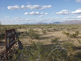
In recognition of its historic significance, El Camino del Diablo was listed on the National Register of Historic Places
in 1978. It can still be transited by visitors to the Cabeza Prieta National Wildlife Refuge
, established in 1939 to protect desert wildlife. With the exception of a few Border Patrol stations, the section of original trail between Las Playas and Tinajas Altas remains virtually unchanged.
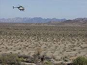 Today, the Camino Del Diablo remains an unpaved trail, suitable for four-wheel-drive and high clearance vehicles carrying extra water and emergency equipment. No emergency or tow services are available, and visitors use the trail at their own risk. Once originating in Mexico, the route now connects to existing unpaved trails originating in Ajo, Arizona. Today, the Camino Del Diablo crosses the southern edges of Organ Pipe Cactus National Monument
, Cabeza Prieta National Wildlife Refuge
, and the Barry M. Goldwater Air Force Range
, terminating at Yuma, Arizona. The trail is never more than a few miles from the US-Mexico border. To transit the entire trail, a permit is required from the Cabeza Prieta NWR office in Ajo, Arizona
.
South of the U.S.-Mexico border, the original Mexican sections of the Camino Del Diablo have largely disappeared. The Mexican government later constructed a paved highway, Mexican Federal Highway 2, which roughly parallels the border for 120 miles.
Caborca
Caborca is both a municipality and a municipal seat in the Mexican state of Sonora. The area of the municipality is 10,721.84 km², which is 5.78 percent of the state total. The municipal population was 81,308 of whom 59,922 lived in the municipal seat...
, Sonora
Sonora
Sonora officially Estado Libre y Soberano de Sonora is one of the 31 states which, with the Federal District, comprise the 32 Federal Entities of Mexico. It is divided into 72 municipalities; the capital city is Hermosillo....
through Quitovac, Sonoyta and Quitobaquito Springs, before continuing through extremely remote and arid desert to the Colorado River at Yuma Crossing, now Yuma, Arizona
Yuma, Arizona
Yuma is a city in and the county seat of Yuma County, Arizona, United States. It is located in the southwestern corner of the state, and the population of the city was 77,515 at the 2000 census, with a 2008 Census Bureau estimated population of 90,041....
. From there, travelers could reach the Spanish colonies of California
Las Californias
The Californias, or in — - was the name given by the Spanish to their northwestern territory of New Spain, comprising the present day states of Baja California and Baja California Sur on the Baja California Peninsula in Mexico; and the present day U.S. state of California in the United States of...
.
History of the Trail
El Camino Del Diablo is believed to follow Native American footpaths dating back at least 1,000 years. In 1540, accompanied by native guides, Captain Melchior Diaz led a detachment of the Coronado Expedition through this vicinity in route to California. The first Europeans definitely known to have transited the route were in the party of Jesuit Padre Eusebio Francisco Kino, Commander Juan Matheo Mange, and Father Adamo Gilig, who along with attendants and Native American guides (who knew the location of vital water sources needed along the route) first made the crossing in February of 1699. The trail offered a shorter route than sailing around Baja CaliforniaBaja California
Baja California officially Estado Libre y Soberano de Baja California is one of the 31 states which, with the Federal District, comprise the 32 Federal Entities of Mexico. It is both the northernmost and westernmost state of Mexico. Before becoming a state in 1953, the area was known as the North...
, while avoiding most of the more hostile Native American tribes. However, the 1781 Quechan
Quechan
The Quechan are a Native American tribe who live on the Fort Yuma Indian Reservation on the lower Colorado River in Arizona and California just north of the border with Mexico...
(Yuman) Indian uprising at Yuma Crossing on the Colorado prevented travelers from reaching California via the trail. Although Lieutenant Colonel Pedro Fages
Pedro Fages
Pere Fages Beleta , nicknamed L'Ós , was a soldier, explorer, and the second Spanish military Governor of Las Californias Province of New Spain from 1770 to 1774, and the Governor of Las Californias from 1782 to 1791.-Life:...
managed to rescue captured Spanish survivors of the uprising in December of that year, El Camino del Diablo largely fell into disuse until 1849, when the gold rush in California brought many new migrants from Mexico to the California gold fields. Afterwards, the trail was used by both U.S. and Mexican boundary survey teams, mapping and cataloging the land bought in the 1853 Gadsden Purchase
Gadsden Purchase
The Gadsden Purchase is a region of present-day southern Arizona and southwestern New Mexico that was purchased by the United States in a treaty signed by James Gadsden, the American ambassador to Mexico at the time, on December 30, 1853. It was then ratified, with changes, by the U.S...
. A second wave of miners used the trail in the 1860s when placer gold was discovered along the Colorado River. Many of these migrants would die from thirst and heat exhaustion en route. As a later traveler noted, "frequent graves and bleaching skulls of animals are painful reminders of unfortunate travelers who died from thirst on the road."
Historically, the trail ran from Mexico to Yuma Crossing at the Colorado River. The most difficult stretch of the trail was the 130-mile stretch from Sonoyta, Sonora to what is now Yuma, Arizona. In summer, temperatures here soar to 120 degrees F and people require two gallons of water a day just to survive. Many travelers lost their lives here. Most of the graves line the last 30 miles of the trail to Yuma; by one count there are 65 graves near Tinajas Altas.
Use of the trail declined sharply after the railroad reached Yuma in 1870. While prospectors and transient visitors continued to frequent the area, El Camino Del Diablo failed to regain its status as a major migration route. Occasionally the route was used by cartographers and boundary survey parties, who documented numerous graves and domesticated animal skeletons.
In recognition of its historic significance, El Camino del Diablo was listed on the National Register of Historic Places
National Register of Historic Places
The National Register of Historic Places is the United States government's official list of districts, sites, buildings, structures, and objects deemed worthy of preservation...
in 1978. It can still be transited by visitors to the Cabeza Prieta National Wildlife Refuge
Cabeza Prieta National Wildlife Refuge
The Cabeza Prieta National Wildlife Refuge is located in the Sonoran Desert in southwestern Arizona in the United States. The refuge, established in 1939 to protect Desert Bighorn Sheep, is located along of the U.S.-Mexico border, and covers 860,010 acres — larger than the land area of the state...
, established in 1939 to protect desert wildlife. With the exception of a few Border Patrol stations, the section of original trail between Las Playas and Tinajas Altas remains virtually unchanged.
Tinajas Altas
The historic campground at Tinajas Altas (Spanish, "High Tanks") features nine cup-like pools perched one above the other on a steep granite slope, that are replenished solely by rainwater. When full, these tinajas may hold 20,000 gallons, but due to the lack of rainfall and arid atmosphere, one or more are frequently empty. In the days before motor vehicle transport, some travelers perished after finding one or more pools dry. During the 1891-1896 U.S. Boundary Survey expedition, the surveying party related the story of three dead prospectors found just above the empty first tank. The men's fingers were worn raw from climbing the rock to the second tank, which held water, and it was apparent the men had died just yards from their salvation.El Camino del Diablo today
Organ Pipe Cactus National Monument
Organ Pipe Cactus National Monument is a U.S. National Monument and UNESCO biosphere reserve located in extreme southern Arizona which shares a border with the Mexican state of Sonora. The park is the only place in the United States where the Organ Pipe Cactus grows wild...
, Cabeza Prieta National Wildlife Refuge
Cabeza Prieta National Wildlife Refuge
The Cabeza Prieta National Wildlife Refuge is located in the Sonoran Desert in southwestern Arizona in the United States. The refuge, established in 1939 to protect Desert Bighorn Sheep, is located along of the U.S.-Mexico border, and covers 860,010 acres — larger than the land area of the state...
, and the Barry M. Goldwater Air Force Range
Barry M. Goldwater Air Force Range
The Barry M. Goldwater Air Force Range is a bombing range in the U.S. state of Arizona that runs along the Mexican border....
, terminating at Yuma, Arizona. The trail is never more than a few miles from the US-Mexico border. To transit the entire trail, a permit is required from the Cabeza Prieta NWR office in Ajo, Arizona
Ajo, Arizona
Ajo is a census-designated place in Pima County, Arizona, United States. The population was 3,705 at the 2000 census. Ajo is located on State Route 85 just from the Mexican border. It is the closest community to Organ Pipe Cactus National Monument....
.
South of the U.S.-Mexico border, the original Mexican sections of the Camino Del Diablo have largely disappeared. The Mexican government later constructed a paved highway, Mexican Federal Highway 2, which roughly parallels the border for 120 miles.
Further reading
- William T. Hornaday, 1908, Campfires on Desert and Lava. Reprinted Tucson; University of Arizona Press, 1985.
External links
- Trail guide and photo gallery
- El Camino Del Diablo at Desert USA