

East Side, Providence, Rhode Island
Encyclopedia
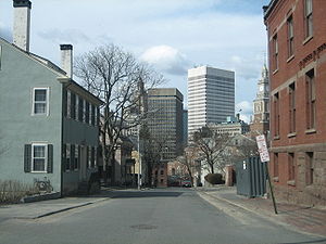
Providence, Rhode Island
Providence is the capital and most populous city of Rhode Island and was one of the first cities established in the United States. Located in Providence County, it is the third largest city in the New England region...
, Rhode Island
Rhode Island
The state of Rhode Island and Providence Plantations, more commonly referred to as Rhode Island , is a state in the New England region of the United States. It is the smallest U.S. state by area...
on the eponymous eastern part of the city. It officially comprises the neighborhoods of Blackstone
Blackstone, Providence, Rhode Island
Blackstone is a predominantly residential neighborhood in Providence, Rhode Island. It is in the northeast corner of the city and is bounded to the south and west by Lloyd Avenue and Hope Street respectively...
, Hope
Hope, Providence, Rhode Island
Hope is a neighborhood on the northern border of Providence, Rhode Island. To the west, it is bounded by North Main Street, the North Burial Ground, and Interstate 95, while Rochambeau Ave, Hope Street, and the Providence-Pawtucket city line roughly delineate its boundaries to the south, east, and...
(commonly known as Summit), Mount Hope
Mount Hope, Providence, Rhode Island
Mount Hope is a neighborhood in northern Providence, Rhode Island. It is one of six neighborhoods comprising the East Side of Providence. The area is bounded to the north by Rochambeau Avenue, to the east by Hope Street, to the south by Olney Street, while the western border is the former New...
, College Hill
College Hill, Providence, Rhode Island
College Hill is a neighborhood in Providence, Rhode Island, and one of six neighborhoods comprising the East Side of Providence and part of College Hill Historic District. It is roughly bounded by North Main Street to the west, Power Street to the south, Governor Street and Arlington Avenue to...
(once known as Prospect Hill), Wayland, and Fox Point
Fox Point, Providence, Rhode Island
Fox Point is a neighborhood in the East Side of Providence, RI. It is bounded by the Providence and Seekonk rivers, Interstate 195 and the College Hill and Wayland neighborhoods...
.
The area is separated from East Providence, Rhode Island
East Providence, Rhode Island
East Providence is a city in Providence County, Rhode Island, United States. The population was 47,037 at the 2010 census, making it the fifth largest city in the state.-Geography:East Providence is located at ....
to the east by the Seekonk River
Seekonk River
The Seekonk River is a tidal extension of the Providence River in the U.S. state of Rhode Island. It flows approximately 8 km . Most historical scholars agree that the name is derived from two Native American words, sucki and honc...
. To the west it is separated from the rest of Providence by the Providence River
Providence River
thumb|The city of Providence as seen from the Providence River at its confluence with the Narragansett BayThe Providence River is a tidal river in the U.S. state of Rhode Island. It flows approximately 8 miles...
and Interstate 95
Interstate 95 in Rhode Island
Interstate 95, the main north–south Interstate Highway on the east coast of the United States, runs generally southwest-northeast through the U.S. state of Rhode Island. It runs from the border with Connecticut near Westerly through Warwick and Providence and to the Massachusetts state line...
. To the north, it borders Pawtucket, Rhode Island
Pawtucket, Rhode Island
Pawtucket is a city in Providence County, Rhode Island, United States. The population was 71,148 at the 2010 census. It is the fourth largest city in the state.-History:...
. To the south, it abuts Narragansett Bay
Narragansett Bay
Narragansett Bay is a bay and estuary on the north side of Rhode Island Sound. Covering 147 mi2 , the Bay forms New England's largest estuary, which functions as an expansive natural harbor, and includes a small archipelago...
, which is formed by the confluence of the Seekonk
Seekonk River
The Seekonk River is a tidal extension of the Providence River in the U.S. state of Rhode Island. It flows approximately 8 km . Most historical scholars agree that the name is derived from two Native American words, sucki and honc...
and Providence River
Providence River
thumb|The city of Providence as seen from the Providence River at its confluence with the Narragansett BayThe Providence River is a tidal river in the U.S. state of Rhode Island. It flows approximately 8 miles...
s.
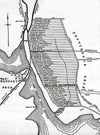
Roger Williams
Roger Williams (theologian)
Roger Williams was an English Protestant theologian who was an early proponent of religious freedom and the separation of church and state. In 1636, he began the colony of Providence Plantation, which provided a refuge for religious minorities. Williams started the first Baptist church in America,...
founded Providence along College Hill. As such, the area includes some of the oldest sections of the city. The spot where he landed after crossing the Seekonk River is marked by a small park in Fox Point.
Universities and Schools
The East Side contains most of Brown UniversityBrown University
Brown University is a private, Ivy League university located in Providence, Rhode Island, United States. Founded in 1764 prior to American independence from the British Empire as the College in the English Colony of Rhode Island and Providence Plantations early in the reign of King George III ,...
's facilities. These include the Main Green, the Rockefeller Library, the Pembroke Campus
Pembroke College (Brown University)
Pembroke College in Brown University was the coordinate women's college for Brown University in Providence, Rhode Island. It was founded in 1891 and closed in 1971.-Founding and early history:...
, and the School of Medicine. Many of the Rhode Island School of Design
Rhode Island School of Design
Rhode Island School of Design is a fine arts and design college located in Providence, Rhode Island. It was founded in 1877. Located at the base of College Hill, the RISD campus is contiguous with the Brown University campus. The two institutions share social, academic, and community resources and...
's buildings are along the slope of College Hill. The RISD Museum
Rhode Island School of Design Museum
Rhode Island School of Design Museum is a prominent art museum in Providence, Rhode Island affiliated with the well-known Rhode Island School of Design...
is located on Benefit Street.
Private schools include the Moses Brown School
Moses Brown School
Moses Brown School is a Quaker school located in Providence, Rhode Island, founded by Moses Brown, a Quaker abolitionist, in 1784. It is one of the oldest preparatory schools in the country.-Founder:...
, the Wheeler School
Wheeler School
The Wheeler School is a coeducational independent day school located on the East Side of Providence, Rhode Island, United States. The school serves students from the nursery level through twelfth-grade.- Mary C. Wheeler :...
, Lincoln School
Lincoln School, Rhode Island
Lincoln School is a liberal arts college preparatory day school for girls nursery through twelfth grade, located in Providence, Rhode Island.-History:...
, School One, Providence Hebrew Day School, and the French-American School.
Hope High School
Hope High School (Rhode Island)
Hope High School is a public high school in the East Side of Providence, Rhode Island, U.S.A. operated by Providence Public School District. It was founded in 1898 and since 2003, Hope High School has been partitioned into three semi-independent "communities" -- Hope High School Arts Community,...
is located at the corner of Hope and Olney Streets. It is one of Providence's public high schools.
Restaurants and Shopping
Thayer Street
Thayer Street in Providence, Rhode Island is a popular destination for students of the area's nearby schools of Brown University, Moses Brown School, Wheeler School, RISD, Providence College, Johnson & Wales University, and Rhode Island College....
, adjoining Brown University at Veteran's Gate, and along Wickenden Street
Wickenden Street
Wickenden Street in Providence, Rhode Island is a popular destination for students of the area's colleges and schools. The street is surrounded by universities on the East Side of Providence's College Hill, including Brown University, RISD, Moses Brown School, & The Wheeler School.-History:The...
, South Water Street. Both streets are home to numerous small and independent shops, though Thayer Street has a few chain stores. Brown University's bookstore is located on Thayer. A notable Thayer Street landmark is the Avon Cinema
Avon Cinema
The Avon Cinema is an Art Deco Theatre opened on the East Side of Providence, near Brown University, since February, 1938 in the United States of America.-History:...
which dates back to the early twentieth century.
Wayland Square is another shopping area, located at the intersection of Wayland Ave. and Angell St. Restaurants in Wayland Square include The Edge, Farmstead/La Laiterie, Haruki East, Minerva's Pizza, and Red Stripe.
Parks
The East Side contains numerous parks and green spaces.India Point Park
India Point Park
India Point Park is a park in the Fox Point neighborhood of Providence, Rhode Island at the confluence of the Seekonk River and Providence River. The park takes its name from the maritime activity connecting Providence with the East and West Indies....
, the largest of these, is located along the northernmost shore of Narragansett Bay. It is the only large expanse of Bay-side shoreline in Providence reserved for public use.
Interstate 195 separates the park from the rest of Fox Point. Construction plans for the relocation of 195 include plans for a new, larger pedestrian bridge over the interstate, to allow better access between the park and the rest of India Point.
Other parks include:
- Blackstone Boulevard Park is a green space between northbound and southbound lanes of Blackstone Boulevard. It consists of 19.3 acres (7.8 ha) of parkland and a 1.7 miles (2.7 km) path for jogging and walking.
- Blackstone Park just north of Richmond Square at the end of Waterman Street in Wayland. Blackstone Park is 40 acres (16.2 ha) city park with 2400 feet (731.5 m) of shore frontage on the Seekonk River.
- Brown Street Park, behind Hope High School. Brown Street Park has several children's play structures and an adult fitness equipment area, ongoing programming includes Children's Play Dates, Fitness Classes, Yoga Classes and a Summer Concert Series.friendsofbrownstreetpark
- Constance Witherby Park in Wayland.
- Gano Street Park, a dog-park along the Seekonk River with numerous athletic fields. The area is also known as Engineer's Field.
- Lippitt Memorial Park, a 6 acres (2.4 ha) park at the intersection of Hope Street and Blackstone Boulevard near the Pawtucket border. It is named after former Rhode Island governor Charles W. Lippitt.
- Market Square, a small park on the edge of Downtown.
- Mary Sharpe Park, a small park between Benefit and Pratt Avenue.
- Paterson Park, a small park in Wayland adjacent to Blackstone Park.
- Gladys Potter Park is a small park in Wayland at the corner of Elton St. and Humboldt Ave.
- Prospect Terrace ParkProspect Terrace ParkProspect Terrace Park is a park located on Congdon Street in the College Hill neighborhood of Providence, Rhode Island. The park, founded in 1867, overlooks the city's "downcity."Author and Providence native H. P...
on top of College Hill.
- Roger William's Landing in Fox Point.
- Roger Williams National MemorialRoger Williams National MemorialRoger Williams National Memorial is a landscaped urban park located on a common lot of the original settlement of Providence, Rhode Island, by Roger Williams in 1636. Bounded by North Main, Canal, and Smith Streets and Park Row, the memorial commemorates the life of the co-founder of the Colony of...
at the bottom of College Hill.
- RiverwalkWaterplace ParkWaterplace Park is an urban park situated along the Woonasquatucket River in downtown Providence, Rhode Island. Finished in 1994, Waterplace Park is connected to 3/4 mile of cobblestone-paved pedestrian walkways along the waterfront known as Riverwalk. Venice-styled Pedestrian bridges cross the...
located along the Providence River, where part of WaterfireWaterFireWaterFire is the award-winning sculpture by Barnaby Evans presented on the rivers of downtown Providence, RI.First created by Evans in 1994 to celebrate the tenth anniversary of First Night Providence, WaterFire has grown to become an annual public art phenomenon.WaterFire is simultaneously a free...
is held.
- Veterans' Memorial Park, on the edge of Downtown, is home to a war memorial.
Demographics
Mostly residential, the East Side is the most affluent part of the city with higher property values, lower unemployment, and higher income levels than the city as a whole. Approximately 20% of the city's 175,000 people live on the East Side. Mount Hope and the area along Elmgrove Avenue have historically had a large community of Russian Jews.
Government
Three of the fifteen Providence City CouncilProvidence City Council
The Providence City Council is the fifteen-member legislative body of the city of Providence, Rhode Island. The two major responsibilities of the council are enacting ordinances necessary to ensure the welfare and good order of the city and adopting the city's annual budget...
wards are located on the East Side. Ward One includes all of Fox Point and parts of College Hill and Wayland south of Angell St. Ward Two encompasses the remainder of College Hill and Wayland, most of Blackstone, and parts of Mount Hope. Ward Three includes Hope (Summit) and most of Mount Hope.
As of the 2006 elections, Ward One is represented in the City Council by Seth Yurdin, Ward Two by Cliff Wood, and Ward Three by Kevin Jackson. All three are Democrats.
Major public buildings include the Rhode Island Supreme Court on Benefit Street and the RI Office of the Attorney General on South Main Street.
Hospitals
Miriam HospitalMiriam Hospital
The Miriam Hospital is a private, not-for-profit hospital at 164 Summit Avenue in Providence, Rhode Island. It a major teaching affiliate associated with the Alpert Medical School of Brown University.-History:...
, a private, non-profit hospital, is located along Summit Avenue in the Hope (Summit) area. Local Jewish organizations founded the hospital in 1926.
Butler Hospital
Butler Hospital
Butler Hospital is a private, non-profit, psychiatric and substance abuse hospital for children, adolescents, adults, and seniors, located in Providence, Rhode Island. The hospital is affiliated with the Warren Alpert Medical School of Brown University, and is the flagship for Brown University's...
, located off Blackstone Boulevard, is Rhode Island's only private mental health hospital. Founded in 1844, the hospital offers psychiatric and substance-abuse treatment programs.
Landmarks
The East Side contains the oldest section of the city. The Providence Preservation Society and the Rhode Island Historical SocietyRhode Island Historical Society
The Rhode Island Historical Society is a privately endowed membership organization, founded in 1822, dedicated to collecting, preserving, and sharing the history of Rhode Island...
have preserved numerous historic buildings, especially in the College Hill area. Historic landmarks include:
- The Athenaeum - The fourth oldest library in America, located on Benefit Street.
- The First Baptist Church in AmericaFirst Baptist Church in AmericaThe First Baptist Church in America is the First Baptist Church of Providence, Rhode Island, also known as First Baptist Meetinghouse. The oldest Baptist church congregation in the United States, it was founded by Roger Williams in Providence, Rhode Island in 1638...
- The oldest BaptistBaptistBaptists comprise a group of Christian denominations and churches that subscribe to a doctrine that baptism should be performed only for professing believers , and that it must be done by immersion...
church in the United States, founded by Roger Williams in 1638. It is located on North Main Street. - The First Christian Science Church - A domed church on Meeting Street.
- The John Brown House - The home of John BrownJohn Brown (Rhode Island)John Brown I was an American merchant, slave trader, and statesman from Providence, Rhode Island. In 1764, John Brown joined his brothers Nicholas Brown and Moses Brown as well as William Ellery, the Baptist Reverend James Manning, the Baptist Reverend Isaac Backus, the Congregationalist Reverend...
(1736–1803), a china tradeChina tradeChina trade may refer to* History of trade of the People's Republic of China * Economy of the People's Republic of China* Economic history of China * Economic history of modern China...
r, slave trader, and Federalist, his family financed the establishment of Brown University. His house is located at the corner of Benefit and Power Street. - The Marine Armory - An armory in service during the American Civil WarAmerican Civil WarThe American Civil War was a civil war fought in the United States of America. In response to the election of Abraham Lincoln as President of the United States, 11 southern slave states declared their secession from the United States and formed the Confederate States of America ; the other 25...
, it was the first headquarters of the Rhode Island State PoliceRhode Island State PoliceThe Rhode Island State Police is an agency of the state of Rhode Island responsible for statewide law enforcement and regulation, especially in areas underserved by local police agencies and on the state's limited-access highways...
. - The Old State House - The former statehouse of Rhode Island.