
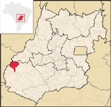
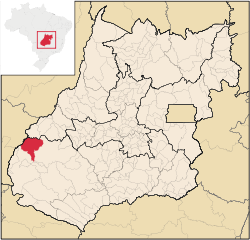
Doverlândia
Encyclopedia
| Doverlândia | |
|---|---|
| State | Goiás Goiás Goiás is a state of Brazil, located in the central part of the country. The name Goiás comes from the name of an indigenous community... |
| Area: | 3,207.5 km² |
| Population: | 8,344(IBGE 2007) |
| Elevation: | 509m |
| Postcode (CEP): | 75855-000 |
| IBGE statistical microregion: | 018 Sudoeste de Goiás |
| Became a city: | 1982 |
| Mayor: | Ipácio Divino de Oliveira |
| Distance to Goiânia Goiânia -Climate:The city has a tropical wet and dry climate with an average temperature of . There's a wet season, from October to April, and a dry one, from May to September. Annual rainfall is around 1,520 mm.... : |
394 km. |
| Website: | |
Municipality
A municipality is essentially an urban administrative division having corporate status and usually powers of self-government. It can also be used to mean the governing body of a municipality. A municipality is a general-purpose administrative subdivision, as opposed to a special-purpose district...
in eastern Goiás
Goiás
Goiás is a state of Brazil, located in the central part of the country. The name Goiás comes from the name of an indigenous community...
state, Brazil
Brazil
Brazil , officially the Federative Republic of Brazil , is the largest country in South America. It is the world's fifth largest country, both by geographical area and by population with over 192 million people...
. It is a large producer of cattle and soybeans.
Location and Highway Connections
Doverlândia is in the Southwest Goiás MicroregionSouthwest Goiás Microregion
Sudoeste de Goiás Microregion is a region in southwest Goiás state, Brazil. It includes 18 municipalities with a population of 397,387 in a total area of 56,293.30 km² . The population density was 7.06 inhabitants/km² . The largest towns are Jataí, Santa Helena de Goiás, and Rio Verde...
in the far eastern section of the state and is relatively isolated from major population centers. Surrounding municipalities are: Mineiros
Mineiros
Mineiros is a city in the southwest of the state of Goiás, Brazil. Mineiros is the westernmost city in Goiás and a great producer of cattle, soybeans, and corn....
and Caiapônia
Caiapônia
Caiapônia is a small town and municipality in south-central Goiás state, Brazil. It has the third largest cattle herd in the state and is a major producer of grains. The town is also known as Torres Do Rio Bonito or just Rio Bonito.-Geography:...
. To the east lies the Araguaia River
Araguaia River
The Araguaia River or, in Portuguese, Rio Araguaia is one of the major rivers of Brazil, and the principal tributary of the Tocantins. It has a total length of approximately 2,627 km. Araguaia means "river of macaws" in the Tupi language....
and the boundary with the state of Mato Grosso
Mato Grosso
Mato Grosso is one of the states of Brazil, the third largest in area, located in the western part of the country.Neighboring states are Rondônia, Amazonas, Pará, Tocantins, Goiás and Mato Grosso do Sul. It also borders Bolivia to the southwest...
.
Connecting highways from Goiânia
Goiânia
-Climate:The city has a tropical wet and dry climate with an average temperature of . There's a wet season, from October to April, and a dry one, from May to September. Annual rainfall is around 1,520 mm....
are GO-060 / Trindade
Trindade, Goiás
Trindade is a city and municipality in Goiás state, Brazil. It is famous for the religious celebrations held there in July and is now the third most important pilgrimage site in Brazil....
/ Nazário
Nazário
Nazário is a small town and municipality in eastern Goiás state, Brazil.-Location:Nazário is located 74 km. west of the state capital, Goiânia a few kilometers west of the Rio dos Bois, a major tributary of the Paranaíba River. The regional center, Anicuns, is 21 km to the northwest...
/ Firminópolis
Firminópolis
Firminópolis is a small town and municipality in eastern Goiás state, Brazil.-Location and connections:*Distance to São Luís de Montes Belos: 9 km....
/ Israelândia
Israelândia
Israelândia is a small town and municipality in eastern Goiás state, Brazil.-Location:Israelândia is located in the Iporá Microregion, 28 km. northeast of regional center Iporá. State capital Goiânia is 199 km. to the east...
/ Iporá
Iporá
Iporá is a small city and municipality in west-central Goiás state, Brazil. The population was 31,060 in a total area of 1,026.4 km² . It is known as the City of the Clear Waters because of its many streams and rivers.-Location:...
/ GO-221 / Palestina de Goiás
Palestina de Goiás
Palestina de Goiás is a small town and municipality in eastern Goiás state, Brazil.-Location:Palestina is located in the Sudoeste de Goiás Microregion between the Rio Bonito and the Rio Caiapó. There are paved road connections linking the town to Jataí in the south and to Iporá in the northeast...
/ Caiapônia
Caiapônia
Caiapônia is a small town and municipality in south-central Goiás state, Brazil. It has the third largest cattle herd in the state and is a major producer of grains. The town is also known as Torres Do Rio Bonito or just Rio Bonito.-Geography:...
.
History
The municipality began in 1949 with the settlement of Rio do Peixe. Manuel Ribeiro Campos arrived with his family, bought lands and built his house along the banks of this river. The first roads were opened by Campos himself using an axe and machete. Campos and his workers built a landing strip in the jungle and the first plane landed in 1951. In 1958 Dovercindo Borges arrived becoming the local political leader. At this time Rio do Peixe belonged to the municipality of CaiapôniaCaiapônia
Caiapônia is a small town and municipality in south-central Goiás state, Brazil. It has the third largest cattle herd in the state and is a major producer of grains. The town is also known as Torres Do Rio Bonito or just Rio Bonito.-Geography:...
. In 1964 the first bulldozer arrived and the dense vegetation began to be opened up for farmland and cattle pastures. In 1969 Rio do Peixe was elevated to district status and the name was changed to Doverlândia, in homage to its founder Dovercindo Borges. In 1982 it became an independent municipality.
Demographics
- Population growth rate 2000/2007: -0.36%
- Population density || 2.60 inhab/km²
- Urban population || 5.073
- Rural population || 3,271
Economy
The economy is based on cattle raising and agriculture, especially corn, rice, and soybeans. In 2006 there were 931 agricultural units with a total of 342,000 hectares. Of this total 326 were farms with a total of 9,878 hectares in cropland. Pasture made up 248,000 hectares and there were 77,000 hectares left in woods and forests.Economic data
- Industrial units: 13 (06/2007)
- Retail units: 138 (08/2007)
- Banking institutions: Banco do Brasil S.A. (08/2007)
- Dairies: Laticínios Catupiry Ltda. (22/05/2006)
- Cattle: 245,000 head (2006)
- Rice: 2,000 hectares
- Corn: 1,000 hectares
- Soybeans: 8,000 hectares
Data are from IBGE
Education and health
- Literacy rate: 82.1%
- Infant mortality rate: 28.66 in 1,000 live births
- Schools: 11 (2006) with 2,315 students
- Hospitals: 01 (2007) with 24 beds
- Walk-in public health clinics: 03
- MHDI: 0.710
- State ranking: 198 (out of 242 municipalities in 2000)
- National ranking: 2,831 (out of 5,507 municipalities in 2000)