

Croydon Park, South Australia
Encyclopedia
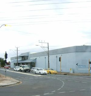
Croydon Park is a north-western suburb
of Adelaide
7km from the CBD
, in the state of South Australia
, Australia
and is within the City of Port Adelaide Enfield
. It is adjacent to Dudley Park
, Devon Park
, Renown Park
, Regency Park
, Ferryden Park
Kilkenny
, and West Croydon
. The post code for Croydon Park is 5008. It is bounded to the south by Lamont Street and Torrens Road
, to the north by Regency Road
and in the east and west by Harrison Road and Goodall Avenue respectively. Croydon Park is predominantly a residential suburb, with a warehousing presence on the northern edges near Regency Road.
. However, St. Margaret Mary's, a Catholic primary school operates within the suburb. The local high school was Croydon High School (closed 2007), in adjacent West Croydon. The Douglas Mawson Institute of TAFE is located on the western end of the suburb. Polonia Reserve, the base of a State League football (soccer)
team is located on the eastern side of Croydon Park.
, both being closed at the end of 1997.
 The 300, 230, 231 and 232 routes serve Regency Road. The 230 and 232 also serve Pym Street and Days and Harrison Roads, while the 231 also serves South Road
. The 250, 251, 252, 253 and 254 serve Torrens Road. All of the bus routes except 300 travel between the city and Centro Arndale.
Suburb
The word suburb mostly refers to a residential area, either existing as part of a city or as a separate residential community within commuting distance of a city . Some suburbs have a degree of administrative autonomy, and most have lower population density than inner city neighborhoods...
of Adelaide
Adelaide
Adelaide is the capital city of South Australia and the fifth-largest city in Australia. Adelaide has an estimated population of more than 1.2 million...
7km from the CBD
Central business district
A central business district is the commercial and often geographic heart of a city. In North America this part of a city is commonly referred to as "downtown" or "city center"...
, in the state of South Australia
South Australia
South Australia is a state of Australia in the southern central part of the country. It covers some of the most arid parts of the continent; with a total land area of , it is the fourth largest of Australia's six states and two territories.South Australia shares borders with all of the mainland...
, Australia
Australia
Australia , officially the Commonwealth of Australia, is a country in the Southern Hemisphere comprising the mainland of the Australian continent, the island of Tasmania, and numerous smaller islands in the Indian and Pacific Oceans. It is the world's sixth-largest country by total area...
and is within the City of Port Adelaide Enfield
City of Port Adelaide Enfield
The City of Port Adelaide Enfield was established on 1 January 1997 by the amalgamation of the City of Port Adelaide and the City of Enfield, and is one of the larger metropolitan councils within South Australia....
. It is adjacent to Dudley Park
Dudley Park, South Australia
Dudley Park, is a suburb of Adelaide, South Australia, located approximately 3 kilometres north-west of the CBD. The suburb is bordered by Regency Road , Simpson Avenue , the Adelaide-Gawler railway line , and a line directly north-south from the Harrison Road-Simpson Avenue intersection to...
, Devon Park
Devon Park, South Australia
Devon Park is an inner northern suburb of Adelaide, South Australia. It is located in the cities of Port Adelaide Enfield and Charles Sturt.-Geography:...
, Renown Park
Renown Park, South Australia
Renown Park is an inner northern suburb of Adelaide, South Australia. It is located in the City of Charles Sturt.-Geography:The suburb lies between Torrens Road and the Gawler Central railway line, which form its southwestern and eastern boundaries, respectively.-Demographics:The 2006 Census by the...
, Regency Park
Regency Park, South Australia
Regency Park is an inner-northern suburb of Adelaide, 8km from the City Centre, in the state of South Australia, Australia. It is located in the City of Port Adelaide Enfield, and is adjacent to Wingfield, Angle Park, Ferryden Park, Kilburn, Prospect, Dudley Park and Croydon Park...
, Ferryden Park
Ferryden Park, South Australia
Ferryden Park is a north-western suburb of Adelaide 9km from the central business district, in the state of South Australia, Australia. Situated in the City of Port Adelaide Enfield local government area, it is adjacent to Kilkenny, Angle Park, Woodville Gardens, Croydon Park, and Regency Park...
Kilkenny
Kilkenny, South Australia
Kilkenny is a suburb of Adelaide, South Australia. It is located in the City of Charles Sturt.-History:The area incorporating the current suburb of Kilkenny was subdivided in 1849 as the Township of Kilkenny..-Demographics:...
, and West Croydon
West Croydon, South Australia
West Croydon is a suburb in the north-west of Adelaide, South Australia.West Croydon has a population of 3881, ABS Census 2006, and is located 5 km west of the Central Business District of Adelaide. The population has changed greatly over the past 15 years as older residents move away and...
. The post code for Croydon Park is 5008. It is bounded to the south by Lamont Street and Torrens Road
Torrens Road, Adelaide
Torrens Road is an arterial road in the northwestern suburbs of Adelaide, Australia. The road travels in a southeast-northwest direction and is parallel with Port Road for most of its length. Major roads that intersect Torrens Road include South Road, Churchill Road and Regency Road...
, to the north by Regency Road
Regency Road, Adelaide
Regency Road is a main east-west road connecting the inner northern suburbs of Adelaide, South Australia. Located approximately north of the city centre, it spans from Arndale Shopping Centre, Kilkenny in the west to Broadview in the east....
and in the east and west by Harrison Road and Goodall Avenue respectively. Croydon Park is predominantly a residential suburb, with a warehousing presence on the northern edges near Regency Road.
Facilities
The suburb is not served by a public primary school. Croydon Park Primary School was closed at the end of 1997 due to declining enrolments. The former site at Hudson Avenue was later developed into housing. The closest primary schools are Challa Gardens Primary School, to the west in Kilkenny, or Brompton Primary School in BromptonBrompton, South Australia
Brompton is an inner northern suburb of Adelaide, South Australia. It is located in the City of Charles Sturt.-History:Brompton was established in June 1849 and quickly grew...
. However, St. Margaret Mary's, a Catholic primary school operates within the suburb. The local high school was Croydon High School (closed 2007), in adjacent West Croydon. The Douglas Mawson Institute of TAFE is located on the western end of the suburb. Polonia Reserve, the base of a State League football (soccer)
Football (soccer)
Association football, more commonly known as football or soccer, is a sport played between two teams of eleven players with a spherical ball...
team is located on the eastern side of Croydon Park.
History
The Croydon Park area was originally a post war returned soldier housing estate. It subsequently attracted waves of European immigration. Over time, the children of these immigrants have largely vacated the area, leaving a relatively elderly population. This is reflected in the declining enrolment rates at nearby schools, with Croydon Park Primary School and Croydon Primary School in the nearby suburb of CroydonCroydon, South Australia
Croydon is an inner northern suburb of Adelaide, South Australia. It is located in the City of Charles Sturt.-History:The land on which the suburb now stands was purchased in 1853 by Alfred Watts and Philip Levi. They laid out the Village of Croydon in 1855, comprising Croydon Farm of and lots of...
, both being closed at the end of 1997.
Transport
South Road, Adelaide
South Road is a major north–south conduit in Adelaide, South Australia. Also known as Main South Road, it is Adelaide's most important arterial road.- Route :...
. The 250, 251, 252, 253 and 254 serve Torrens Road. All of the bus routes except 300 travel between the city and Centro Arndale.