

Climate of Brazil
Encyclopedia
Climate
Climate encompasses the statistics of temperature, humidity, atmospheric pressure, wind, rainfall, atmospheric particle count and other meteorological elemental measurements in a given region over long periods...
of Brazil
Brazil
Brazil , officially the Federative Republic of Brazil , is the largest country in South America. It is the world's fifth largest country, both by geographical area and by population with over 192 million people...
varies considerably mostly from tropical North (the equator
Equator
An equator is the intersection of a sphere's surface with the plane perpendicular to the sphere's axis of rotation and containing the sphere's center of mass....
traverses the mouth of the Amazon) to temperate zones below the Tropic of Capricorn
Tropic of Capricorn
The Tropic of Capricorn, or Southern tropic, marks the most southerly latitude on the Earth at which the Sun can be directly overhead. This event occurs at the December solstice, when the southern hemisphere is tilted towards the Sun to its maximum extent.Tropic of Capricorn is one of the five...
(23°27' S latitude), which crosses the country at the latitude of the city of São Paulo
São Paulo
São Paulo is the largest city in Brazil, the largest city in the southern hemisphere and South America, and the world's seventh largest city by population. The metropolis is anchor to the São Paulo metropolitan area, ranked as the second-most populous metropolitan area in the Americas and among...
. Brazil has six climatic regions: tropical rainforest
Tropical rainforest climate
A tropical rainforest climate, also known as an equatorial climate, is a tropical climate usually found along the equator...
, tropical wet and dry, tropical monsoon
Tropical monsoon climate
Tropical monsoon climate, occasionally also known as a tropical wet climate or tropical monsoon and trade-wind littoral climate in climate classification, is a relatively rare type of climate that corresponds to the Köppen climate classification category "Am."Tropical monsoon climates have monthly...
, semiarid, humid subtropical and subtropical highland.
Temperatures along the equator are high, averaging above 25 °C (77 °F), but not reaching the summer extremes of up to 40°C (104°F) in the temperate zones. There is little seasonal variation near the equator, although at times it can get cool enough for wearing a jacket, especially in the rain.
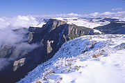
At the country's other extreme, there are frosts south of the Tropic of Capricorn during the winter (June–August), and in some years there are snowfalls on the high plateau
Snow in Brazil
Snow occurs in Brazil occasionally, but virtually every year in some cities of the high plains of the southern states of Rio Grande do Sul and Santa Catarina, that account for approximately , and where there are the coldest cities in the country, where snow can happen when polar air masses reach...
and mountainous areas of some regions. Snow falls more frequently in the states of Rio Grande do Sul
Rio Grande do Sul
Rio Grande do Sul is the southernmost state in Brazil, and the state with the fifth highest Human Development Index in the country. In this state is located the southernmost city in the country, Chuí, on the border with Uruguay. In the region of Bento Gonçalves and Caxias do Sul, the largest wine...
, Santa Catarina
Santa Catarina (state)
Santa Catarina is a state in southern Brazil with one of the highest standards of living in Latin America. Its capital is Florianópolis, which mostly lies on the Santa Catarina Island. Neighbouring states are Rio Grande do Sul to the south and Paraná to the north. It is bounded on the east by...
, and Paraná
Paraná (state)
Paraná is one of the states of Brazil, located in the South of the country, bordered on the north by São Paulo state, on the east by the Atlantic Ocean, on the south by Santa Catarina state and the Misiones Province of Argentina, and on the west by Mato Grosso do Sul and the republic of Paraguay,...
and less frequently in the states of São Paulo
São Paulo (state)
São Paulo is a state in Brazil. It is the major industrial and economic powerhouse of the Brazilian economy. Named after Saint Paul, São Paulo has the largest population, industrial complex, and economic production in the country. It is the richest state in Brazil...
, Rio de Janeiro
Rio de Janeiro (state)
Rio de Janeiro is one of the 27 states of Brazil.Rio de Janeiro has the second largest economy of Brazil behind only São Paulo state.The state of Rio de Janeiro is located within the Brazilian geopolitical region classified as the Southeast...
, Minas Gerais
Minas Gerais
Minas Gerais is one of the 26 states of Brazil, of which it is the second most populous, the third richest, and the fourth largest in area. Minas Gerais is the Brazilian state with the largest number of Presidents of Brazil, the current one, Dilma Rousseff, being one of them. The capital is the...
, and Espírito Santo
Espírito Santo
Espírito Santo is one of the states of southeastern Brazil, often referred to by the abbreviation "ES". Its capital is Vitória and the largest city is Vila Velha. The name of the state means literally "holy spirit" after the Holy Ghost of Christianity...
. Temperatures in the cities of Belo Horizonte
Belo Horizonte
Belo Horizonte is the capital of and largest city in the state of Minas Gerais, located in the southeastern region of Brazil. It is the third largest metropolitan area in the country...
and Brasília
Brasília
Brasília is the capital city of Brazil. The name is commonly spelled Brasilia in English. The city and its District are located in the Central-West region of the country, along a plateau known as Planalto Central. It has a population of about 2,557,000 as of the 2008 IBGE estimate, making it the...
are moderate, usually between 15ºC (59°F) and 30°C (86°F), because of their elevation of approximately 1000 metres (3,281 ft). Rio de Janeiro
Rio de Janeiro
Rio de Janeiro , commonly referred to simply as Rio, is the capital city of the State of Rio de Janeiro, the second largest city of Brazil, and the third largest metropolitan area and agglomeration in South America, boasting approximately 6.3 million people within the city proper, making it the 6th...
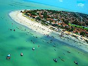
, Recife, and Salvador on the coast have warm climates, with average temperatures of each month ranging from 23 to 27 °C (73.4 to 80.6 °F), but enjoy constant trade winds. The cities of São Paulo
São Paulo
São Paulo is the largest city in Brazil, the largest city in the southern hemisphere and South America, and the world's seventh largest city by population. The metropolis is anchor to the São Paulo metropolitan area, ranked as the second-most populous metropolitan area in the Americas and among...
, Curitiba
Curitiba
Curitiba is the capital of the Brazilian state of Paraná. It is the largest city with the biggest economy of both Paraná and southern Brazil. The population of Curitiba numbers approximately 1.75 million people and the latest GDP figures for the city surpass US$61 billion according to...
, Florianópolis
Florianópolis
-Climate:Florianópolis experiences a warm humid subtropical climate, falling just short of a true tropical climate. The seasons of the year are distinct, with a well-defined summer and winter, and characteristic weather for autumn and spring. Frost is infrequent, but occurs occasionally in the winter...
and Porto Alegre
Porto Alegre
Porto Alegre is the tenth most populous municipality in Brazil, with 1,409,939 inhabitants, and the centre of Brazil's fourth largest metropolitan area . It is also the capital city of the southernmost Brazilian state of Rio Grande do Sul. The city is the southernmost capital city of a Brazilian...
have a subtropical climate similar to that of southern United States, and temperatures can fall below freezing in winter.
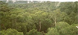
Precipitation levels vary widely. Most of Brazil has moderate rainfall of between 1000 and 1500 mm (39.4 and 59.1 in) a year, with most of the rain falling in the summer (between December and April) south of the Equator. The Amazon region is notoriously humid, with rainfall generally more than 2000 mm (78.7 in) per year and reaching as high as 3000 mm (118.1 in) in parts of the western Amazon and near Belém. It is less widely known that, despite high annual precipitation, the Amazon rain forest has a three- to five-month dry season, the timing of which varies according to location north or south of the equator.
High and relatively regular levels of precipitation in the Amazon contrast sharply with the dryness of the semiarid Northeast, where rainfall is scarce and there are severe droughts in cycles averaging seven years. The Northeast
Northeast Region, Brazil
The Northeast Region of Brazil is composed of the following states: Maranhão, Piauí, Ceará, Rio Grande do Norte, Paraíba, Pernambuco, Alagoas, Sergipe and Bahia, and it represents 18.26% of the Brazilian territory....
is the driest part of the country. The region also constitutes the hottest part of Brazil, where during the dry season between May and November, temperatures of more than 38 °C (100.4 °F) have been recorded. However, the sertão
Sertão
In Portuguese, the word sertão first referred to the vast hinterlands of Asia that Lusitanian explorers encountered. In Brazil, the geographical term referred to backlands away from the Atlantic coastal regions where the Portuguese first settled in South America in the early sixteenth century...
, a region of semidesert vegetation
Desert
A desert is a landscape or region that receives an extremely low amount of precipitation, less than enough to support growth of most plants. Most deserts have an average annual precipitation of less than...
used primarily for low-density ranching, turns green when there is rain. Most of the Center-West has 1500 to 2000 mm (59.1 to 78.7 in) of rain per year, with a pronounced dry season in the middle of the year, while the South and most of the East is without a distinct dry season.
General Climate
Although most of Brazil lies in the tropics, more than 60 percent of the population live in areas which are cooled either by altitude, sea winds or polar fronts. While the coastal cities of Rio de Janeiro, Recife and Salvador can get extremely hot, plateau cities such as São Paulo, Brasília and Belo Horizonte have mild climates, and the southern cities of Porto Alegre and Curitiba have mild winters, but while Curitiba has a warm summer, Porto Alegre has a hot summer.Despite the popular image of the Amazon as a region of blistering heat, temperatures of more than 32°C (90°F) are in fact rare. The annual average temperature in the region is 22-26°C (72-79°F), with not much variation between the warmest and the coldest months. The hottest part of Brazil is the northeast, where temperatures of more than 38°C (100°F) are frequently recorded during the dry season between May and November. Along the Atlantic coast from Recife to Rio de Janeiro, average temperatures range from 23 to 27°C (73-81°F). Inland, on higher ground, temperatures are lower, ranging from 18 to 21°C (64-70°F). South of Rio the seasons are more defined and the range of temperatures significantly wider, with the annual average falling between 17 and 19°C (63-66°F).
Brazil's most intense rain falls around the mouth of the Amazon near the city of Belém, and also in the upper regions of Amazonia where more than 2,000 millimetres (78 inches) of rain fall every year. Most of Brazil has moderate rainfall of between 1,000 and 1,500 millimetres (39 to 59 inches) a year, most of it coming between December and April. The driest part of the country is the northeast, where rainfall is irregular and the evaporation rate very high, making it difficult to grow crops.
Southeast Region
The latitudinal position around the Tropic of Capricorn, the very uneven topography and disturbed circulation systems greatly influence the climatology of the Southeast and it is quite diverse in temperature.The annual medium temperature ranges from 20 °C (68 °F) as seen on the border between São Paulo and Paraná to 24 °C (75.2 °F) in the north of Minas Gerais, while in the elevated areas of the Serra do Espinhaço, Serra da Mantiqueira and Serra do Mar
Serra do Mar
Serra do Mar is a 1,500 km long system of mountain ranges and escarpments in Southeastern Brazil, which runs in parallel to the Atlantic Ocean coast from the state of Espírito Santo to southern Santa Catarina, although some include Serra Geral in the Serra do Mar, in which case this range...
the average medium temperature can be below 18 °C (64.4 °F) due to the combined effect of the latitude with the frequency of the polar currents.
In the summer
Summer
Summer is the warmest of the four temperate seasons, between spring and autumn. At the summer solstice, the days are longest and the nights are shortest, with day-length decreasing as the season progresses after the solstice...
, mainly in the month of January, the normal average temperatures range from 30 to 32 °C (86 to 89.6 F) in the valleys of the rivers São Francisco and Jequitinhonha
Jequitinhonha River
thumb|Source of the river in [[Serro]]|rightThe Jequitinhonha River is a river that flows mainly through the Brazilian state of Minas Gerais. Its source lies near Diamantina in the Serra do Espinhaço at an elevation of 1,200 m, after which it flows northward and then east-northeastward across the...
, in the Zona da Mata
Zona da Mata (Minas Gerais)
Zona da Mata is a mesoregion of the state of Minas Gerais, Brazil, situated in the southeastern part of the state, along the border of the states of Minas Gerais, Rio de Janeiro and Espírito Santo...
(Forest Zone) of Minas Gerais, in the coastal lowlands and to the west of the state of São Paulo.
In the winter
Winter
Winter is the coldest season of the year in temperate climates, between autumn and spring. At the winter solstice, the days are shortest and the nights are longest, with days lengthening as the season progresses after the solstice.-Meteorology:...
, the normal average temperatures range from 6 to 20 °C (42.8 to 68 F) with minimum absolute from -4 C, the lowest temperatures being at the highest elevations. Vast areas of Minas Gerais and São Paulo register occurrences of frosts, after the passage of the polar
Polar region
Earth's polar regions are the areas of the globe surrounding the poles also known as frigid zones. The North Pole and South Pole being the centers, these regions are dominated by the polar ice caps, resting respectively on the Arctic Ocean and the continent of Antarctica...
fronts
Weather front
A weather front is a boundary separating two masses of air of different densities, and is the principal cause of meteorological phenomena. In surface weather analyses, fronts are depicted using various colored lines and symbols, depending on the type of front...
.
As far as the incidence of rain is concerned, there are two areas with heavy precipitation: one following the coast
Coast
A coastline or seashore is the area where land meets the sea or ocean. A precise line that can be called a coastline cannot be determined due to the dynamic nature of tides. The term "coastal zone" can be used instead, which is a spatial zone where interaction of the sea and land processes occurs...
and the Serra do Mar, where the rains are precipitated by the southerly currents; and the other from the west of Minas Gerais to the Municipal district of Rio de Janeiro, where the rain
Rain
Rain is liquid precipitation, as opposed to non-liquid kinds of precipitation such as snow, hail and sleet. Rain requires the presence of a thick layer of the atmosphere to have temperatures above the melting point of water near and above the Earth's surface...
s are brought by the Westerly system. The annual precipitation total in these areas is in excess of 1500 mm (59.1 in). In the Serra da Mantiqueira these indexes surpass 1750 mm (68.9 in), and at the summit of Itatiaia
Itatiaia
Itatiaia is a Brazilian municipality of the state of Rio de Janeiro. It is located at an altitude of 390 meters. Its population was 30,168 and its area is 224.96 km²....
, 2340 mm (92.1 in).
In the Serra do Mar, in São Paulo, it rains on the average more than 3600 mm (141.7 in). Near Paranapiacaba
Paranapiacaba
Paranapiacaba is a village and a district of the municipality of Santo André in Brazil . It was established as a company town for the employees of São Paulo Railway, a privately owned British railway company. This railway allowed the transport of cargo and people from inside Paulista to the port of...
and Itapanhaú maximum rainfall was measured at 4457.8 mm (175.5 in) in one year. In the valleys of the rivers Jequitinhonha and Doce the smallest annual pluviometric indexes are recorded at around 900 mm (35.4 in).
The maximum pluviometric index of the Southeast area usually occurs in January and the minimum in July, while the dry period is usually concentrated in the winter, lasting six months in the case of the valleys of the rivers Jequitinhonha and São Francisco, to as little as two months in the Serra do Mar and Serra da Mantiqueira.
Charts of selected cities
Northeast Region
The climatic characterization of the Northeast area is a little complex, and the four systems of circulation that influence the region are denominated Systems of Disturbed Currents of South, North, East and West. The System of disturbed currents of South is represented by the polarPolar region
Earth's polar regions are the areas of the globe surrounding the poles also known as frigid zones. The North Pole and South Pole being the centers, these regions are dominated by the polar ice caps, resting respectively on the Arctic Ocean and the continent of Antarctica...
mass
Mass
Mass can be defined as a quantitive measure of the resistance an object has to change in its velocity.In physics, mass commonly refers to any of the following three properties of matter, which have been shown experimentally to be equivalent:...
es that reach the area in the spring-summer, acts in the coastal areas until the south of Bahia, bringing frontal and back-frontals rain
Rain
Rain is liquid precipitation, as opposed to non-liquid kinds of precipitation such as snow, hail and sleet. Rain requires the presence of a thick layer of the atmosphere to have temperatures above the melting point of water near and above the Earth's surface...
s. In the winter the polar masses reach even the coast of Pernambuco, while the hinterlands regions remain under the influence of the tropical mass
Mass
Mass can be defined as a quantitive measure of the resistance an object has to change in its velocity.In physics, mass commonly refers to any of the following three properties of matter, which have been shown experimentally to be equivalent:...
.
The system of disturbed currents of North, represented by Convergence Intertropical (CIT), produces rain from the summer to the autumn even in Pernambuco, in the vicinity of the Raso da Catarina. On the other hand, the currents of the East are more frequent in the winter and they usually produce abundant rains in the coastal regions, rarely reaching the scarps of the Plateau of Borborema (800 m (2,625 ft)) and of Chapada Diamantina (1200 m (3,937 ft)).
Finally, the system of currents of the West, brought by the lines of Tropical Instability (IT), occur from the end of spring to the beginning of autumn, rarely reaching the states of Piauí and Maranhão.
Temperatures are high, with annual averages between 20 and 28 °C (68 and 82.4 F), maximums of around 40 °C (104 °F) having been observed in the south of Maranhão and Piauí. The months of winter, mainly June and July, produce minimum temperatures between 12 and 16 °C (53.6 and 60.8 F) in the coastal regions, much lower in the plateau
Plateau
In geology and earth science, a plateau , also called a high plain or tableland, is an area of highland, usually consisting of relatively flat terrain. A highly eroded plateau is called a dissected plateau...
region
Region
Region is most commonly found as a term used in terrestrial and astrophysics sciences also an area, notably among the different sub-disciplines of geography, studied by regional geographers. Regions consist of subregions that contain clusters of like areas that are distinctive by their uniformity...
s where temperatures of 1 °C (33.8 °F) have been recorded in Chapada Diamantina after the passage of a polar front.
The pluviosity of the area is complex and is source of concern: its annual totals vary from 2000 mm (78.7 in) to values even lower than 500 mm (19.7 in), as verified in the Raso da Catarina, between Bahia and Pernambuco, and in the depression of Patos in Paraíba. In a general way, the annual medium precipitation in the northeast area is lower than 1000 mm (39.4 in) - in the city of Cabaceiras, interior of Paraíba, was observed the smallest annual pluviometric index registered in Brazil, 278 mm (10.9 in)/year. Besides it in the interior of this area the rainy period is usually of just two months in the year, sometimes not coming in some years, causing then the denominated regional droughts.
Charts of selected cities
South Region
Tropic of Capricorn
The Tropic of Capricorn, or Southern tropic, marks the most southerly latitude on the Earth at which the Sun can be directly overhead. This event occurs at the December solstice, when the southern hemisphere is tilted towards the Sun to its maximum extent.Tropic of Capricorn is one of the five...
, in a temperate zone. It is influenced by the system of disturbed circulation of the South, which produces the rains, mainly in the summer. It is also influenced by the system of disturbed circulation of the West, that brings rains and storms, sometimes hail, producing winds with bursts of 60 to 90 km/h (37.3 to 55.9 mph).
Regarding temperatures: the winter is mild and the summer is hot. The annual medium temperatures range from 14 to 22 °C (57.2 to 71.6 F), and in places with altitude
Altitude
Altitude or height is defined based on the context in which it is used . As a general definition, altitude is a distance measurement, usually in the vertical or "up" direction, between a reference datum and a point or object. The reference datum also often varies according to the context...
s above 1100 m (3,609 ft), drops to approximately 10 °C (50 °F). Some parts of the southern region also have an oceanic climate.
In the summer
Summer
Summer is the warmest of the four temperate seasons, between spring and autumn. At the summer solstice, the days are longest and the nights are shortest, with day-length decreasing as the season progresses after the solstice...
, mainly in January, in the valleys of the rivers Paranapanema, Paraná and Ibicuí-Jacuí, the medium temperature is in excess of 24 °C (75.2 °F), and the medium temperature of the river Uruguay surpasses 26 °C (78.8 °F). The average maximum temperature stays around 24 to 27 °C (75.2 to 80.6 F) on the elevated surfaces of the plateau and, in the lowest areas, between 30 and 32 °C (86 and 89.6 F).
In the winter
Winter
Winter is the coldest season of the year in temperate climates, between autumn and spring. At the winter solstice, the days are shortest and the nights are longest, with days lengthening as the season progresses after the solstice.-Meteorology:...
, mainly in July, the medium temperature stays relatively low, oscillating between 10 and 15 °C (50 and 59 F), except for the valleys of the rivers Paranapanema and Paraná, besides the coast of Paraná and Santa Catarina, where the averages are approximately 15 to 18 °C (59 to 64.4 F). The average maximum temperature is also low, around 20 to 24 °C (68 to 75.2 F), in the big valleys and in the coast, and 16 to 20 °C (60.8 to 68 F) in the plateau
Plateau
In geology and earth science, a plateau , also called a high plain or tableland, is an area of highland, usually consisting of relatively flat terrain. A highly eroded plateau is called a dissected plateau...
region
Region
Region is most commonly found as a term used in terrestrial and astrophysics sciences also an area, notably among the different sub-disciplines of geography, studied by regional geographers. Regions consist of subregions that contain clusters of like areas that are distinctive by their uniformity...
. The average minimum temperature varies from 6 to 12 °C (42.8 to 53.6 F)
, and the thermometer frequently registers temperatures near 0|ºC, sometimes even reaching negative indexes, accompanied by frost and snow
Snow
Snow is a form of precipitation within the Earth's atmosphere in the form of crystalline water ice, consisting of a multitude of snowflakes that fall from clouds. Since snow is composed of small ice particles, it is a granular material. It has an open and therefore soft structure, unless packed by...
, in consequence of the invasion of polar
Polar region
Earth's polar regions are the areas of the globe surrounding the poles also known as frigid zones. The North Pole and South Pole being the centers, these regions are dominated by the polar ice caps, resting respectively on the Arctic Ocean and the continent of Antarctica...
mass
Mass
Mass can be defined as a quantitive measure of the resistance an object has to change in its velocity.In physics, mass commonly refers to any of the following three properties of matter, which have been shown experimentally to be equivalent:...
es.
The annual medium pluviosity oscillates from 1250 to 2000 mm (49.2 to 78.7 in), except along the coast of Paraná and west of Santa Catarina, where the values are in excess of 2000 mm (78.7 in), and in the north of Paraná and in a small coastal area of Santa Catarina, which have lower recordings down to 1250 mm (49.2 in). The maximum pluviometric indexes occur in the winter and the minimum in the summer throughout almost the whole area.
Charts of selected cities
North Region
Amazon Basin
The Amazon Basin is the part of South America drained by the Amazon River and its tributaries that drains an area of about , or roughly 40 percent of South America. The basin is located in the countries of Bolivia, Brazil, Colombia, Ecuador, Guyana, Peru, and Venezuela...
, representing the largest extension of hot and humid forest
Forest
A forest, also referred to as a wood or the woods, is an area with a high density of trees. As with cities, depending where you are in the world, what is considered a forest may vary significantly in size and have various classification according to how and what of the forest is composed...
on the planet
Planet
A planet is a celestial body orbiting a star or stellar remnant that is massive enough to be rounded by its own gravity, is not massive enough to cause thermonuclear fusion, and has cleared its neighbouring region of planetesimals.The term planet is ancient, with ties to history, science,...
. The area is cut, of an end to the other, by Ecuador and is characterized by low altitudes (0 to 200 m (0 to 656.2 ft)). There are four main systems of atmospheric circulation that act in the area, they are: system of winds of Northeast (NE) to East (E) of the Atlantic South and Azores, subtropical anticyclones, generally stable in nature; system of winds of West (W) of the mass equatorial continental (mEc); system of winds of North (N) of the Convergence
Convergence
-Mathematics:* Convergence , refers to the notion that some functions and sequences approach a limit under certain conditions* Convergence , the notion that a sequence of transformations come to the same conclusion, no matter what order they are performed in.-Natural sciences:*Convergence ,...
Intertropical (CIT); and system of winds of South (S) of the Polar anticyclone. These last three systems are responsible for variability of the climate and for the rains in the area. With regard to temperatures, the climate is hot, with annual medium temperatures ranging from
24 to 26 °C (75.2 to 78.8 F).
Regarding the pluviosity, there is not a homogeneity as it occur with the temperature. In the mouth of the river Amazonas, in the coast of Pará and in the western section of the area, the total annual pluviometric index exceeds 3000 mm (118.1 in) in general. In the direction NO-SE, of Roraima to east of Pará there is less rain, with annual totals in the order of 1500 to 1700 mm (59.1 to 66.9 in).
The rain
Rain
Rain is liquid precipitation, as opposed to non-liquid kinds of precipitation such as snow, hail and sleet. Rain requires the presence of a thick layer of the atmosphere to have temperatures above the melting point of water near and above the Earth's surface...
y period of the area occurs in summer & autumn, the exception being Roraima and of the north part of Amazonas, where the maximum pluviometric indexes occurs in winter, due to influence of the climatic conditions of the Northern Hemisphere
Northern Hemisphere
The Northern Hemisphere is the half of a planet that is north of its equator—the word hemisphere literally means “half sphere”. It is also that half of the celestial sphere north of the celestial equator...
.
Middle-West Region
Convergence
-Mathematics:* Convergence , refers to the notion that some functions and sequences approach a limit under certain conditions* Convergence , the notion that a sequence of transformations come to the same conclusion, no matter what order they are performed in.-Natural sciences:*Convergence ,...
Intertropical (CIT), that produces rains in the summer, autumn and winter in the north of the region; and the system of disturbed currents of the South, represented by the polar
Polar region
Earth's polar regions are the areas of the globe surrounding the poles also known as frigid zones. The North Pole and South Pole being the centers, these regions are dominated by the polar ice caps, resting respectively on the Arctic Ocean and the continent of Antarctica...
fronts
Weather front
A weather front is a boundary separating two masses of air of different densities, and is the principal cause of meteorological phenomena. In surface weather analyses, fronts are depicted using various colored lines and symbols, depending on the type of front...
, invading the area in the winter with great frequency, producing rain
Rain
Rain is liquid precipitation, as opposed to non-liquid kinds of precipitation such as snow, hail and sleet. Rain requires the presence of a thick layer of the atmosphere to have temperatures above the melting point of water near and above the Earth's surface...
s of one to three days duration. In the north and south extremes of the region, the annual medium temperature is 22 °C (71.6 °F) and in the Chapadas it varies from 20 to 22 °C (68 to 71.6 F). In the spring and summer, temperatures are commonly high, the average of the hottest month varying from 24 to 26 °C (75.2 to 78.8 F). The average of the maximum temperatures of September (hotter month) oscillates between 30 and 36 °C (86 and 96.8 F).
The people of the westwinter
Winter
Winter is the coldest season of the year in temperate climates, between autumn and spring. At the winter solstice, the days are shortest and the nights are longest, with days lengthening as the season progresses after the solstice.-Meteorology:...
is an interesting season, low temperatures occurring quite frequently. This is caused by the polar invasion, that produces the cold weather which is very common at this time of the year. The medium temperature of the cold
Cold
Cold describes the condition of low temperature.Cold may also refer to:*Common cold, a contagious viral infectious disease of the upper respiratory system*Chronic obstructive pulmonary disease...
est month
Month
A month is a unit of time, used with calendars, which was first used and invented in Mesopotamia, as a natural period related to the motion of the Moon; month and Moon are cognates. The traditional concept arose with the cycle of moon phases; such months are synodic months and last approximately...
oscillates between 15 and 24 °C (59 and 75.2 F), and the average of the minimum temperatures ranges from 8 to 18 °C (46.4 to 64.4 F). Minimum temperatures are sometimes negative.
The characterization of the pluviosity of the region is almost exclusively due to the system of atmospheric circulation. The annual medium pluviosity varies from 2000 to 3000 mm (78.7 to 118.1 in) in the north of Mato Grosso, to 1250 mm (49.2 in) in the Pantanal
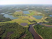
Pantanal
The Pantanal is a tropical wetland and one of the world's largest wetland of any kind. Most of it lies within the Brazilian state of Mato Grosso do Sul, but it extends into Mato Grosso and portions of Bolivia and Paraguay, sprawling over an area estimated at between and...
mato-grossense.
In spite of this inequality, the region is well provided with rain. Its seasonality is typically tropical, with maximum in the summer and minimum in the winter. More than 70% of the total rain that is accumulated during the year falls from November to March. The winter is excessively dry, because the rains are very rare.
See also
- BrazilBrazilBrazil , officially the Federative Republic of Brazil , is the largest country in South America. It is the world's fifth largest country, both by geographical area and by population with over 192 million people...
- Geography of BrazilGeography of BrazilThe country of Brazil occupies roughly half of South America, bordering the Atlantic Ocean. Brazil covers a total area of which includes of land and of water. The highest point in Brazil is Pico da Neblina at...