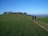
Chanctonbury Ring
Overview
Hill fort
A hill fort is a type of earthworks used as a fortified refuge or defended settlement, located to exploit a rise in elevation for defensive advantage. They are typically European and of the Bronze and Iron Ages. Some were used in the post-Roman period...
based ring of trees atop Chanctonbury Hill on the South Downs
South Downs
The South Downs is a range of chalk hills that extends for about across the south-eastern coastal counties of England from the Itchen Valley of Hampshire in the west to Beachy Head, near Eastbourne, East Sussex, in the east. It is bounded on its northern side by a steep escarpment, from whose...
, on the border of the civil parish
Civil parish
In England, a civil parish is a territorial designation and, where they are found, the lowest tier of local government below districts and counties...
es of Washington
Washington, West Sussex
Washington is a village and civil parish in the Horsham District of West Sussex, England. It is located five miles west of Steyning and three miles east of Storrington on the A24 between Horsham and Worthing. The parish covers an area of 1,276 hectares...
and Wiston
Wiston, West Sussex
Wiston is a scattered village and civil parish in the Horsham District of West Sussex, England. It lies on the A283 road northwest of Steyning.The parish covers an area of...
in the English
England
England is a country that is part of the United Kingdom. It shares land borders with Scotland to the north and Wales to the west; the Irish Sea is to the north west, the Celtic Sea to the south west, with the North Sea to the east and the English Channel to the south separating it from continental...
county of West Sussex
West Sussex
West Sussex is a county in the south of England, bordering onto East Sussex , Hampshire and Surrey. The county of Sussex has been divided into East and West since the 12th century, and obtained separate county councils in 1888, but it remained a single ceremonial county until 1974 and the coming...
. A ridgeway
Ridgeway
A ridgeway is a road or path that follows a ridge, or the highest part of the landscape.-Roads and pathways:*The Ridgeway, an ancient track in southern England, which now forms part of the Ridgeway Path or National Trail...
, now part of the South Downs Way
South Downs Way
The South Downs Way is a long distance footpath and bridleway running along the South Downs in southern England, and is one of 15 National Trails in England and Wales...
, runs along the hill. Bertrand Russell
Bertrand Russell
Bertrand Arthur William Russell, 3rd Earl Russell, OM, FRS was a British philosopher, logician, mathematician, historian, and social critic. At various points in his life he considered himself a liberal, a socialist, and a pacifist, but he also admitted that he had never been any of these things...
once remarked that "any view that includes Chanctonbury Ring is a good view".
A trig point
Trig point
A triangulation station, also known as a triangulation pillar, trigonometrical station, trigonometrical point, trig station, trig beacon or trig point, and sometimes informally as a trig, is a fixed surveying station, used in geodetic surveying and other surveying projects in its vicinity...
is located about 400 metre west of the Ring, recorded by the Ordnance Survey
Ordnance Survey
Ordnance Survey , an executive agency and non-ministerial government department of the Government of the United Kingdom, is the national mapping agency for Great Britain, producing maps of Great Britain , and one of the world's largest producers of maps.The name reflects its creation together with...
as 238 metres (781 ft) above sea level.
Unanswered Questions

