

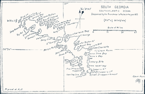
Cape Charlotte
Encyclopedia
Cape (geography)
In geography, a cape or headland is a point or body of land extending into a body of water, usually the sea.A cape usually represents a marked change in trend of the coastline. Their proximity to the coastline makes them prone to natural forms of erosion, mainly tidal actions. This results in capes...
that forms the southeast side of the entrance to Royal Bay
Royal Bay
Royal Bay is a bay, 4 miles wide and indenting 5 miles , entered between Cape Charlotte and Cape Harcourt along the north coast of South Georgia....
on the north coast near the eastern end of South Georgia in the Atlantic Ocean
Atlantic Ocean
The Atlantic Ocean is the second-largest of the world's oceanic divisions. With a total area of about , it covers approximately 20% of the Earth's surface and about 26% of its water surface area...
. It was discovered in 1775 by a British expedition under Captain James Cook
James Cook
Captain James Cook, FRS, RN was a British explorer, navigator and cartographer who ultimately rose to the rank of captain in the Royal Navy...
, who named it for Queen Charlotte, wife of King George III of the United Kingdom
George III of the United Kingdom
George III was King of Great Britain and King of Ireland from 25 October 1760 until the union of these two countries on 1 January 1801, after which he was King of the United Kingdom of Great Britain and Ireland until his death...
.