
Canning Highway
Encyclopedia
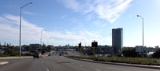
Canning Highway is a mostly 4 lane single carriageway major arterial road in Perth, Western Australia
. The speed limit is 60 km/h. It is located south of the Swan River
and links Perth
with Fremantle
, running between The Causeway
in Victoria Park
and Queen Victoria Street
in Fremantle.
, a pioneer West Australian pastoralist and late 19th century settler in the area that is now part of the City of Melville.
The modern highway was formally commenced in the 1920s, with major work commencing in 1927 to upgrade an 8 miles (12.9 km) section between Suburban Street, South Perth
and Petra Street, East Fremantle
. The road initially had the following names:
The road was officially named Canning Highway on 23 November 1937. In 1938, the present northern bridge over Canning River
was opened. It was 32 feet (9.8 m) wide and constructed of timber, as was then common practice. The experience gained building this bridge was used to construct the Fremantle Traffic Bridge over the Swan River
one year later. The Fremantle Traffic Bridge joined Canning Highway near Fremantle
with North Fremantle
, and this intersection forms the highway's present western terminus.
In 1958, the present southern bridge over Canning River
was constructed which coincided with the opening of Kwinana Freeway
between the Narrows Bridge
and Canning Highway.
In 1974, the rotary (roundabout) at the southern end of the Causeway in Victoria Park
was upgraded to a parclo interchange
, which resulted in Canning Highway joining seamlessly with Great Eastern Highway
. At the same time, Stirling Highway
was extended from North Fremantle
across the Swan River
via the new Stirling bridge to join with Canning Highway.
In 1979, a new grade separated interchange was built near Canning Bridge at Kwinana Freeway
to route the freeway underneath Canning Highway and progress the freeway further southwards.
Apart from minor additional lanes and modifications, the highway is largely unchanged since.
at night-time, with its ornamental lighting and an iconic animated rooftop neon beer sign
(for many years advertising Swan Lager
). It is situated in Applecross adjacent to Canning Bridge. The hotel has reopened with a pub and a bottle shop called Raffles Liquor Merchants. The Raffles now has two beer advertising neon lights, one for Victoria bitter and one large one advertising Crown lager.
at the Canning Bridge station on the Mandurah railway line. Buses also stop at this station and enter and exit the freeway via bus lanes.
Perth, Western Australia
Perth is the capital and largest city of the Australian state of Western Australia and the fourth most populous city in Australia. The Perth metropolitan area has an estimated population of almost 1,700,000....
. The speed limit is 60 km/h. It is located south of the Swan River
Swan River (Western Australia)
The Swan River estuary flows through the city of Perth, in the south west of Western Australia. Its lower reaches are relatively wide and deep, with few constrictions, while the upper reaches are usually quite narrow and shallow....
and links Perth
Perth, Western Australia
Perth is the capital and largest city of the Australian state of Western Australia and the fourth most populous city in Australia. The Perth metropolitan area has an estimated population of almost 1,700,000....
with Fremantle
Fremantle
Freemantle is a suburb of Southampton in England.Fremantle or Freemantle may also refer to:- Places :* Fremantle, the port city to the capital Perth, Western Australia...
, running between The Causeway
The Causeway
The Causeway is the name of the traffic crossing of the Swan River in Western Australia at the eastern end of Perth Water. Made up of two bridges on either side of Heirisson Island, the crossing links the City of Perth and Victoria Park....
in Victoria Park
Victoria Park, Western Australia
The Town of Victoria Park is a Local Government Area of Western Australia. It covers an area of 17.62 km² in metropolitan Perth, the capital of Western Australia. The Town of Victoria Park maintains 154.55 km of roads, a little over 1 km² of parks and gardens and has a...
and Queen Victoria Street
Queen Victoria Street, Fremantle
Queen Victoria Street is the main road entering Fremantle's city centre from the direction of Perth. It turns off Stirling Highway and bridges the Swan River before meeting incoming traffic from Canning Highway and taking it into the centre of Fremantle. Two famous Perth bars are located on the...
in Fremantle.
History
Canning Highway is named for Alfred CanningAlfred Canning
Alfred Wernam Canning was a Western Australian government surveyor. Born at Campbellfield north of Melbourne, he started work in New South Wales as a cadet surveyor and in 1893 joined the Western Australian Department of Lands and Survey.In 1901 a royal commission resulted in Canning being...
, a pioneer West Australian pastoralist and late 19th century settler in the area that is now part of the City of Melville.
The modern highway was formally commenced in the 1920s, with major work commencing in 1927 to upgrade an 8 miles (12.9 km) section between Suburban Street, South Perth
South Perth, Western Australia
South Perth is a residential suburb 3 kilometres south of the central business district of Perth, the capital of Western Australia, which adjoins the southern shore of Perth Water on the Swan River...
and Petra Street, East Fremantle
East Fremantle, Western Australia
The Town of East Fremantle is a Local Government Area in the southern suburbs of the Western Australian capital city of Perth, located immediately northeast of the port city of Fremantle and about southwest of Perth's central business district...
. The road initially had the following names:
- Canning Road (Fremantle–Wireless Hill)
- Perth–Fremantle Road (Wireless Hill–Canning Bridge)
- Lower Canning Road (Canning Bridge–South Terrace)
- Fremantle Road (South Terrace–Causeway)
The road was officially named Canning Highway on 23 November 1937. In 1938, the present northern bridge over Canning River
Canning River (Western Australia)
The Canning River is a major tributary of the Swan River in south western Western Australia.-Source and route:With headwaters on the Darling Scarp, the Canning meanders through suburbs of Perth on the Swan Coastal Plain, including Cannington, Thornlie, Riverton, Shelley, Rossmoyne and Mount...
was opened. It was 32 feet (9.8 m) wide and constructed of timber, as was then common practice. The experience gained building this bridge was used to construct the Fremantle Traffic Bridge over the Swan River
Swan River (Western Australia)
The Swan River estuary flows through the city of Perth, in the south west of Western Australia. Its lower reaches are relatively wide and deep, with few constrictions, while the upper reaches are usually quite narrow and shallow....
one year later. The Fremantle Traffic Bridge joined Canning Highway near Fremantle
Fremantle, Western Australia
Fremantle is a city in Western Australia, located at the mouth of the Swan River. Fremantle Harbour serves as the port of Perth, the state capital. Fremantle was the first area settled by the Swan River colonists in 1829...
with North Fremantle
North Fremantle, Western Australia
North Fremantle is a small suburb of Perth, Western Australia, located within the City of Fremantle. Its postcode is 6159.The suburb is situated on the Swan River, north of the Port of Fremantle...
, and this intersection forms the highway's present western terminus.
In 1958, the present southern bridge over Canning River
Canning River (Western Australia)
The Canning River is a major tributary of the Swan River in south western Western Australia.-Source and route:With headwaters on the Darling Scarp, the Canning meanders through suburbs of Perth on the Swan Coastal Plain, including Cannington, Thornlie, Riverton, Shelley, Rossmoyne and Mount...
was constructed which coincided with the opening of Kwinana Freeway
Kwinana Freeway
The Kwinana Freeway is a major arterial road in Perth, Western Australia, linking Perth with the southern suburbs and then further on towards Mandurah, a distance of . It has a speed limit of , except in central Perth and south of Lakes Road . Like all Western Australian freeways, the minimum...
between the Narrows Bridge
Narrows Bridge
The Narrows Bridge is a freeway crossing of the Swan River in Perth, Western Australia, at The Narrows between Mill Point and Mount Eliza. Made up of two road bridges and a railway bridge, it connects the Mitchell and Kwinana Freeways, linking the city's northern and southern suburbs...
and Canning Highway.
In 1974, the rotary (roundabout) at the southern end of the Causeway in Victoria Park
Victoria Park, Western Australia
The Town of Victoria Park is a Local Government Area of Western Australia. It covers an area of 17.62 km² in metropolitan Perth, the capital of Western Australia. The Town of Victoria Park maintains 154.55 km of roads, a little over 1 km² of parks and gardens and has a...
was upgraded to a parclo interchange
Parclo interchange
A partial cloverleaf interchange or parclo is a modification of a cloverleaf interchange. The parclo interchange was developed by the Ontario Ministry of Transportation as a replacement for the cloverleaf on 400-Series Highways, removing the dangerous weaving patterns and allowing for more...
, which resulted in Canning Highway joining seamlessly with Great Eastern Highway
Great Eastern Highway
The Great Eastern Highway is a major road between the Western Australian cities of Perth and Kalgoorlie. It is a key route for vehicles accessing the eastern wheatbelt and the eastern goldfields...
. At the same time, Stirling Highway
Stirling Highway
Stirling Highway is, for most of its length, a four-lane single carriageway and major arterial road between Perth, Western Australia and the port city of Fremantle in Western Australia on the northern side of the Swan River. The speed limit is 60 km/h...
was extended from North Fremantle
North Fremantle, Western Australia
North Fremantle is a small suburb of Perth, Western Australia, located within the City of Fremantle. Its postcode is 6159.The suburb is situated on the Swan River, north of the Port of Fremantle...
across the Swan River
Swan River (Western Australia)
The Swan River estuary flows through the city of Perth, in the south west of Western Australia. Its lower reaches are relatively wide and deep, with few constrictions, while the upper reaches are usually quite narrow and shallow....
via the new Stirling bridge to join with Canning Highway.
In 1979, a new grade separated interchange was built near Canning Bridge at Kwinana Freeway
Kwinana Freeway
The Kwinana Freeway is a major arterial road in Perth, Western Australia, linking Perth with the southern suburbs and then further on towards Mandurah, a distance of . It has a speed limit of , except in central Perth and south of Lakes Road . Like all Western Australian freeways, the minimum...
to route the freeway underneath Canning Highway and progress the freeway further southwards.
Apart from minor additional lanes and modifications, the highway is largely unchanged since.
Raffles Hotel
One of the most enduring sights on Canning Highway has been the Raffles HotelRaffles Hotel, Perth
Raffles Hotel is located at the corner of Canning Highway and Canning Beach Road in the Perth suburb of Applecross, Western Australia. It is a two-storey hotel designed in the Inter-War Functionalist style and is one of the few examples of a hotel in this style surviving in the Perth metropolitan...
at night-time, with its ornamental lighting and an iconic animated rooftop neon beer sign
Neon sign
Neon signs are made using electrified, luminous tube lights that contain rarefied neon or other gases. They are the most common use for neon lighting, which was first demonstrated in a modern form in December, 1910 by Georges Claude at the Paris Motor Show. While they are used worldwide, neon signs...
(for many years advertising Swan Lager
Swan Brewery
The Swan Brewery is a brewery located in Perth, Western Australia. It was founded in central Perth in 1837. From 1879, it occupied riverside premises below Mount Eliza, displacing an official "Aboriginal institution" which recognised traditional use of the land by indigenous people.The brewery...
). It is situated in Applecross adjacent to Canning Bridge. The hotel has reopened with a pub and a bottle shop called Raffles Liquor Merchants. The Raffles now has two beer advertising neon lights, one for Victoria bitter and one large one advertising Crown lager.
Public transport
Canning Highway crosses the Kwinana FreewayKwinana Freeway
The Kwinana Freeway is a major arterial road in Perth, Western Australia, linking Perth with the southern suburbs and then further on towards Mandurah, a distance of . It has a speed limit of , except in central Perth and south of Lakes Road . Like all Western Australian freeways, the minimum...
at the Canning Bridge station on the Mandurah railway line. Buses also stop at this station and enter and exit the freeway via bus lanes.
See also
- Highways in AustraliaHighways in AustraliaThis is a list of highways in Australia, listed alphabetically along with each highway's route number and location. Note that some highways service more than one state or territory.-Route numbering systems:...
- List of highways in Western Australia
- List of major roads in Perth, Western Australia