
Calumet County, Wisconsin
Encyclopedia
Calumet County is a county located in the U.S. state
of Wisconsin
. It is included in the Appleton, Wisconsin
, Metropolitan Statistical Area. As of 2010, the county's population was 48,971. The county seat
is Chilton
.
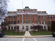 The county's name originated from the word Calumet, which was a ceremonial pipe
used by Native Americans
in councils on the east shore of Lake Winnebago
. Native Americans from New York State had been relocated to the southwest part of the county in the 1830s, including the Brothertown Indians
, Oneida Indians, and Stockbridge Indians. Many of the early residents in the Holyland region
in southern part of the county were emigrants from the Schleswig
-Holstein
region in Germany
in the 1840s.
The county was legally organized on February 5, 1850 by Chapter 84 Laws of 1850.
, the county has a total area of 397 square miles (1,028.2 km²), of which 320 square miles (828.8 km²) is land and 77 square miles (199.4 km²) (19.44%) is water. The west boundary is largely in Lake Winnebago
. The Niagara Escarpment
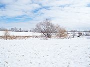
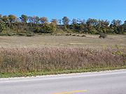
runs north-south several miles east of the western boundary. The topography has been greatly influenced by glaciation.
 As of the census
of 2000, there were 40,631 people, 14,910 households, and 11,167 families residing in the county. The population density
was 127 /sqmi. There were 15,758 housing units at an average density of 49 /sqmi. The racial makeup of the county was 96.68% White
, 0.31% Black
or African American
, 0.34% Native American
, 1.55% Asian
, 0.01% Pacific Islander
, 0.38% from other races
, and 0.74% from two or more races. 1.07% of the population were Hispanic
or Latino
of any race. 63.4% were of German ancestry according to Census 2000. 96.0% spoke English
, 1.7% Spanish
and 1.2% German
as their first language.
There were 14,910 households out of which 38.50% had children under the age of 18 living with them, 65.00% were married couples
living together, 6.50% had a female householder with no husband present, and 25.10% were non-families. 20.40% of all households were made up of individuals and 7.50% had someone living alone who was 65 years of age or older. The average household size was 2.70 and the average family size was 3.15.
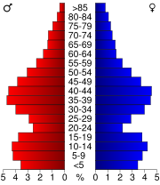
In the county, the population was spread out with 28.60% under the age of 18, 7.20% from 18 to 24, 32.00% from 25 to 44, 21.40% from 45 to 64, and 10.80% who were 65 years of age or older. The median age was 35 years. For every 100 females there were 100.00 males. For every 100 females age 18 and over, there were 99.00 males.
In 1931, the Wisconsin Department of Agriculture described Calumet County as "one of the most important producers of American cheese among the counties of Wisconsin."
is partially located in southern Calumet County.
s run through Calumet County. There are several U.S. routes in the county. U.S. Route 10
runs east-west across the north edge of the county. U.S. Route 151
runs north-south near the west edge of the county, and turns east-west at the middle of the county. North-south state highways include 55 along the west edge, and 32/57 through the center. East-west state highways include 114 at the northwest corner of the county, and the now defunct 149 along the southeast corner. The Tri-County Expressway (WI 441) runs in a east-west to north-south curve in the extreme northwest corner of the county within Appleton city limits.
. It is located just west of New Holstein
.
. The first non-natives to enter the county most likely came in the county from the lake through the Fox River
. The Manitowoc River
and Sheboygan River
both run through the county and flow into Lake Michigan
through neighboring counties.
, and two county run harbors.
spear
ing season in February.
U.S. state
A U.S. state is any one of the 50 federated states of the United States of America that share sovereignty with the federal government. Because of this shared sovereignty, an American is a citizen both of the federal entity and of his or her state of domicile. Four states use the official title of...
of Wisconsin
Wisconsin
Wisconsin is a U.S. state located in the north-central United States and is part of the Midwest. It is bordered by Minnesota to the west, Iowa to the southwest, Illinois to the south, Lake Michigan to the east, Michigan to the northeast, and Lake Superior to the north. Wisconsin's capital is...
. It is included in the Appleton, Wisconsin
Appleton, Wisconsin
Appleton is a city in Outagamie, Calumet, and Winnebago Counties in the U.S. state of Wisconsin. It is situated on the Fox River, 30 miles southwest of Green Bay and 100 miles north of Milwaukee. Appleton is the county seat of Outagamie County. The population was 78,086 at the 2010 census...
, Metropolitan Statistical Area. As of 2010, the county's population was 48,971. The county seat
County seat
A county seat is an administrative center, or seat of government, for a county or civil parish. The term is primarily used in the United States....
is Chilton
Chilton, Wisconsin
Chilton is a city in and county seat of Calumet County in the U.S. state of Wisconsin. The population was 3,708 at the 2000 census. The city is located partially within the Town of Chilton.-History:...
.
History

Calumet (pipe)
A Calumet is a ceremonial smoking pipe used by some Native American Nations. Traditionally it has been smoked to seal a covenant or treaty, or to offer prayers in a religious ceremony.- Etymology :...
used by Native Americans
Native Americans in the United States
Native Americans in the United States are the indigenous peoples in North America within the boundaries of the present-day continental United States, parts of Alaska, and the island state of Hawaii. They are composed of numerous, distinct tribes, states, and ethnic groups, many of which survive as...
in councils on the east shore of Lake Winnebago
Lake Winnebago
Lake Winnebago is a freshwater lake in eastern Wisconsin, United States. It is the largest lake entirely within the state.-Statistics:...
. Native Americans from New York State had been relocated to the southwest part of the county in the 1830s, including the Brothertown Indians
Brothertown Indians
The Brothertown Indians are Native American descendants of the Pequot and Mohegan tribes in southern New England...
, Oneida Indians, and Stockbridge Indians. Many of the early residents in the Holyland region
The Holyland (Wisconsin)
The Holyland is an American region located mainly in northeastern Fond du Lac County, Wisconsin and southern Calumet County. The area is known for its distinctive agricultural landscape, a close-knit community life, and deep Roman Catholicism brought by Germans who began settling the region in the...
in southern part of the county were emigrants from the Schleswig
Schleswig
Schleswig or South Jutland is a region covering the area about 60 km north and 70 km south of the border between Germany and Denmark; the territory has been divided between the two countries since 1920, with Northern Schleswig in Denmark and Southern Schleswig in Germany...
-Holstein
Holstein
Holstein is the region between the rivers Elbe and Eider. It is part of Schleswig-Holstein, the northernmost state of Germany....
region in Germany
Germany
Germany , officially the Federal Republic of Germany , is a federal parliamentary republic in Europe. The country consists of 16 states while the capital and largest city is Berlin. Germany covers an area of 357,021 km2 and has a largely temperate seasonal climate...
in the 1840s.
The county was legally organized on February 5, 1850 by Chapter 84 Laws of 1850.
Geography
According to the U.S. Census BureauUnited States Census Bureau
The United States Census Bureau is the government agency that is responsible for the United States Census. It also gathers other national demographic and economic data...
, the county has a total area of 397 square miles (1,028.2 km²), of which 320 square miles (828.8 km²) is land and 77 square miles (199.4 km²) (19.44%) is water. The west boundary is largely in Lake Winnebago
Lake Winnebago
Lake Winnebago is a freshwater lake in eastern Wisconsin, United States. It is the largest lake entirely within the state.-Statistics:...
. The Niagara Escarpment
Niagara Escarpment
The Niagara Escarpment is a long escarpment, or cuesta, in the United States and Canada that runs westward from New York State, through Ontario, Michigan, Wisconsin and Illinois...
runs north-south several miles east of the western boundary. The topography has been greatly influenced by glaciation.
Adjacent counties
- Brown County – northeast
- Manitowoc CountyManitowoc County, WisconsinManitowoc County is a county in the U.S. state of Wisconsin. As of 2000, the population was 82,887. Its county seat is Manitowoc. The United States Census Bureau's Manitowoc Micropolitan Statistical Area includes all of Manitowoc County.-Government:...
– east - Sheboygan County – southeast
- Fond du Lac CountyFond du Lac County, WisconsinFond du Lac County is a county located in the U.S. state of Wisconsin. As of 2000, the population was 97,296. Its county seat is Fond du Lac. The United States Census Bureau's Fond du Lac Metropolitan Statistical Area includes all of Fond du Lac County. The county name is French for "bottom of the...
– southwest - Winnebago CountyWinnebago County, WisconsinWinnebago County is a county in the U.S. state of Wisconsin. As of 2009, the population estimate was 163,370. Its county seat is Oshkosh. Winnebago County is included in the Oshkosh, Wisconsin-Neenah, Wisconsin, Metropolitan Statistical Area.-Geography:...
– west - Outagamie CountyOutagamie County, WisconsinOutagamie is a county in the northeast region of the U.S. state of Wisconsin. Its county seat is Appleton. As of the 2009 census estimate, its population was 177,155....
– northwest
Major highways
Demographics


Census
A census is the procedure of systematically acquiring and recording information about the members of a given population. It is a regularly occurring and official count of a particular population. The term is used mostly in connection with national population and housing censuses; other common...
of 2000, there were 40,631 people, 14,910 households, and 11,167 families residing in the county. The population density
Population density
Population density is a measurement of population per unit area or unit volume. It is frequently applied to living organisms, and particularly to humans...
was 127 /sqmi. There were 15,758 housing units at an average density of 49 /sqmi. The racial makeup of the county was 96.68% White
Race (United States Census)
Race and ethnicity in the United States Census, as defined by the Federal Office of Management and Budget and the United States Census Bureau, are self-identification data items in which residents choose the race or races with which they most closely identify, and indicate whether or not they are...
, 0.31% Black
Race (United States Census)
Race and ethnicity in the United States Census, as defined by the Federal Office of Management and Budget and the United States Census Bureau, are self-identification data items in which residents choose the race or races with which they most closely identify, and indicate whether or not they are...
or African American
Race (United States Census)
Race and ethnicity in the United States Census, as defined by the Federal Office of Management and Budget and the United States Census Bureau, are self-identification data items in which residents choose the race or races with which they most closely identify, and indicate whether or not they are...
, 0.34% Native American
Race (United States Census)
Race and ethnicity in the United States Census, as defined by the Federal Office of Management and Budget and the United States Census Bureau, are self-identification data items in which residents choose the race or races with which they most closely identify, and indicate whether or not they are...
, 1.55% Asian
Race (United States Census)
Race and ethnicity in the United States Census, as defined by the Federal Office of Management and Budget and the United States Census Bureau, are self-identification data items in which residents choose the race or races with which they most closely identify, and indicate whether or not they are...
, 0.01% Pacific Islander
Race (United States Census)
Race and ethnicity in the United States Census, as defined by the Federal Office of Management and Budget and the United States Census Bureau, are self-identification data items in which residents choose the race or races with which they most closely identify, and indicate whether or not they are...
, 0.38% from other races
Race (United States Census)
Race and ethnicity in the United States Census, as defined by the Federal Office of Management and Budget and the United States Census Bureau, are self-identification data items in which residents choose the race or races with which they most closely identify, and indicate whether or not they are...
, and 0.74% from two or more races. 1.07% of the population were Hispanic
Race (United States Census)
Race and ethnicity in the United States Census, as defined by the Federal Office of Management and Budget and the United States Census Bureau, are self-identification data items in which residents choose the race or races with which they most closely identify, and indicate whether or not they are...
or Latino
Race (United States Census)
Race and ethnicity in the United States Census, as defined by the Federal Office of Management and Budget and the United States Census Bureau, are self-identification data items in which residents choose the race or races with which they most closely identify, and indicate whether or not they are...
of any race. 63.4% were of German ancestry according to Census 2000. 96.0% spoke English
English language
English is a West Germanic language that arose in the Anglo-Saxon kingdoms of England and spread into what was to become south-east Scotland under the influence of the Anglian medieval kingdom of Northumbria...
, 1.7% Spanish
Spanish language
Spanish , also known as Castilian , is a Romance language in the Ibero-Romance group that evolved from several languages and dialects in central-northern Iberia around the 9th century and gradually spread with the expansion of the Kingdom of Castile into central and southern Iberia during the...
and 1.2% German
German language
German is a West Germanic language, related to and classified alongside English and Dutch. With an estimated 90 – 98 million native speakers, German is one of the world's major languages and is the most widely-spoken first language in the European Union....
as their first language.
There were 14,910 households out of which 38.50% had children under the age of 18 living with them, 65.00% were married couples
Marriage
Marriage is a social union or legal contract between people that creates kinship. It is an institution in which interpersonal relationships, usually intimate and sexual, are acknowledged in a variety of ways, depending on the culture or subculture in which it is found...
living together, 6.50% had a female householder with no husband present, and 25.10% were non-families. 20.40% of all households were made up of individuals and 7.50% had someone living alone who was 65 years of age or older. The average household size was 2.70 and the average family size was 3.15.
In the county, the population was spread out with 28.60% under the age of 18, 7.20% from 18 to 24, 32.00% from 25 to 44, 21.40% from 45 to 64, and 10.80% who were 65 years of age or older. The median age was 35 years. For every 100 females there were 100.00 males. For every 100 females age 18 and over, there were 99.00 males.
Dairy Industry
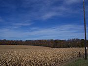
The University of Wisconsin–Extension has compiled statistics on Calumet County's dairy industry. Calumet County has more bovines (cattle and calves) than people. As of 2010 there are 28,600 head of dairy cows and 65,000 head of bovine total (that includes dairy cows, beef cattle, and calves.) 73% of land in the county is owned by farmers. 2400 residents are employed in farming. Agriculture results in $338 million in economic activity, and it contributes $68.2 million in income to the county total income (including $7.2 million towards taxes). As of 2007, 99.3% of farms are owned by individuals, families, family partnerships or family corporations. Only 0.7% are owned by non-family corporate entities. As of April 1, 2010, Calumet county had 174 farms with dairy herd licenses.In 1931, the Wisconsin Department of Agriculture described Calumet County as "one of the most important producers of American cheese among the counties of Wisconsin."
Regions
The HolylandThe Holyland (Wisconsin)
The Holyland is an American region located mainly in northeastern Fond du Lac County, Wisconsin and southern Calumet County. The area is known for its distinctive agricultural landscape, a close-knit community life, and deep Roman Catholicism brought by Germans who began settling the region in the...
is partially located in southern Calumet County.
Cities
|
Kiel, Wisconsin Kiel is a city in Calumet and Manitowoc Counties in the U.S. state of Wisconsin. The population was 3,450 at the 2000 census. The city is located mostly within Manitowoc County, though a portion extends west into adjacent Calumet County.... (partial) Menasha, Wisconsin Menasha is a city in Calumet and Winnebago Counties in the U.S. state of Wisconsin. The population was 16,331 at the 2000 census. The city is located mostly in the Town of Menasha in Winnebago County; only a small portion is in the Town of Harrison in Calumet County. Doty Island is located... (partial) New Holstein, Wisconsin New Holstein is a city in Calumet County in the U.S. state of Wisconsin. The population was 3,301 at the 2000 census. The city is located within the Town of New Holstein.-History:... |
Villages
|
Sherwood, Wisconsin Sherwood is a village in Calumet County, Wisconsin, United States. The population was 1,550 at the 2000 census. The historical unincorporated community of High Cliff is located within present-day Sherwood.-Geography:... Stockbridge, Wisconsin Stockbridge is a village in Calumet County, Wisconsin, United States. The population was 649 in the 2000 census. The village lies within the Town of Stockbridge.-History:... |
Towns
|
Harrison, Calumet County, Wisconsin Harrison is a town in Calumet County in the U.S. state of Wisconsin. The population was 10,839 at the 2010 census. Parts of the town of Harrison and town of Buchanan are collectively known locally as Darboy. The unincorporated communities of Harrison and Highland Beach are located in the town... |
Woodville, Calumet County, Wisconsin Woodville is a town in Calumet County in the U.S. state of Wisconsin. The population was 993 at the 2000 census. The unincorporated communities of Dundas and St... |
Unincorporated communities
- BrantBrant, WisconsinBrant is an unincorporated community located in the town of Chilton, Calumet County, Wisconsin, United States....
- Brothertown
- CalumetvilleCalumetville, WisconsinCalumetville is an unincorporated community that straddles the county line between Calumet and Fond du Lac counties in Wisconsin. The main part of the village in Fond du Lac County lies in the Town of Calumet, Wisconsin and that part in Calumet County lies in the Town of Brothertown,...
(partial) - CharlesburgCharlesburg, WisconsinCharlesburg is an unincorporated community in the town of Brothertown, Wisconsin in Calumet County, Wisconsin, United States.-Location:Charlesburg is located on St. Charles Road at its intersection with Washington Road. It is considered part of the Holyland region in southern Calumet...
- DarboyDarboy, WisconsinDarboy is an unincorporated community in Calumet and Outagamie Counties in the Fox Cities area of the U.S. state of Wisconsin. Located in the towns of Harrison and Buchanan, Darboy extends from Manitowoc Road on the south, CE on the north, State Park Road on the east, and Highway 441 on the west...
(partial) - DundasDundas, WisconsinDundas is an unincorporated community located in the town of Woodville, Calumet County, Wisconsin, United States....
- Eckers LakelandEckers Lakeland, WisconsinEckers Lakeland is an unincorporated community located in the town of Brothertown, Calumet County, Wisconsin, United States. Eckers Lakeland is located on the eastern shore of Lake Winnebago....
- Forest JunctionForest Junction, WisconsinForest Junction is an unincorporated census-designated place in the Town of Brillion, in Calumet County, Wisconsin in the United States. As of the 2010 census, its population was 616.The community has its own water tower and utilities. Its ZIP code is 54123....
- HarrisonHarrison (community), Calumet County, WisconsinHarrison is an unincorporated community located in the town of Harrison, Calumet County, Wisconsin, United States....
- HaytonHayton, WisconsinHayton is an unincorporated community in the town of Charlestown, Calumet County, Wisconsin, United States. It is located a few miles east of Chilton at the intersection of U.S. Route 151 and County T. The Manitowoc River flows eastward through the community. It is dammed by a mill and the...
- Highland BeachHighland Beach, WisconsinHighland Beach is an unincorporated community located in the town of Harrison, Calumet County, Wisconsin, United States. Highland Beach is located on the northeast shore of Lake Winnebago west-northwest of Sherwood....
- JerichoJericho, WisconsinJericho is an unincorporated community in the town of Brothertown in Calumet County, Wisconsin, United States. Jericho is located at the intersection of County highways C & H. Jericho is part of the Holyland region in Wisconsin.-References:...
- KlotenKloten, WisconsinKloten, Wisconsin is an unincorporated community in the Town of Stockbridge in Calumet County, Wisconsin. The community is located at the intersection of County Highways F and C, approximately 3 miles east of Lake Winnebago and 5 miles west of Chilton....
- Maple HeightsMaple Heights, WisconsinMaple Heights is an unincorporated community located in the town of Brothertown, Calumet County, Wisconsin, United States....
- MeggersMeggers, WisconsinMeggers is an unincorporated community located in the towns of New Holstein in Calumet County and Schleswig in Manitowoc County, in the U.S. state of Wisconsin....
(partial) - QuinneyQuinney, WisconsinQuinney is an unincorporated community located in the town of Brothertown, Calumet County, Wisconsin, United States....
- St. AnnaSt. Anna, WisconsinSt. Anna is an unincorporated community in Calumet and Sheboygan Counties in the U.S. state of Wisconsin. It lies in the towns of Russell and New Holstein. The name of the community is pronounced "St...
(partial) - St. JohnSt. John, WisconsinSt. John is an unincorporated community located, in the town of Woodville, in Calumet County, Wisconsin, United States. It is located at the intersection of County B and County BB....
- Waverly BeachWaverly Beach, WisconsinWaverly Beach is an unincorporated community located in Calumet and Winnebago Counties, United States. The Calumet County portion of Waverly Beach is located in the town of Harrison, while the Winnebago County portion is in the town of Menasha. Waverly Beach is located on the north shore of Lake...
(partial) - WellsWells, Manitowoc County, WisconsinWells is an unincorporated community located in the towns of Rantoul and Rockland, Calumet and Manitowoc Counties, Wisconsin, United States....
(partial)
Land
No interstate highwayInterstate Highway System
The Dwight D. Eisenhower National System of Interstate and Defense Highways, , is a network of limited-access roads including freeways, highways, and expressways forming part of the National Highway System of the United States of America...
s run through Calumet County. There are several U.S. routes in the county. U.S. Route 10
U.S. Route 10
U.S. Route 10 is an east–west United States highway formed in 1926. Though it never became the cross-country highway suggested by the "0" as the last digit of its route number, U.S...
runs east-west across the north edge of the county. U.S. Route 151
U.S. Route 151
U.S. Route 151 is a U.S. Highway that runs through the states of Iowa and Wisconsin. The southern terminus for U.S. 151 is at a junction with Interstate 80 in Iowa County, Iowa, and its northern terminus is at Manitowoc, Wisconsin. The route, from south to north follows a northeasterly path through...
runs north-south near the west edge of the county, and turns east-west at the middle of the county. North-south state highways include 55 along the west edge, and 32/57 through the center. East-west state highways include 114 at the northwest corner of the county, and the now defunct 149 along the southeast corner. The Tri-County Expressway (WI 441) runs in a east-west to north-south curve in the extreme northwest corner of the county within Appleton city limits.
Air
The only airport located in Calumet County is the small New Holstein Municipal AirportNew Holstein Municipal Airport
New Holstein Municipal Airport is a public airport located New Holstein, Wisconsin. It is located on the west edge of the city on County Highway H.-Facilities:The main runway was paved in 1958.*Runway 14/32 3,600 x 75 ft. , asphalt...
. It is located just west of New Holstein
New Holstein, Wisconsin
New Holstein is a city in Calumet County in the U.S. state of Wisconsin. The population was 3,301 at the 2000 census. The city is located within the Town of New Holstein.-History:...
.
Water
Nearly the entire west boundary of the county is located in Lake WinnebagoLake Winnebago
Lake Winnebago is a freshwater lake in eastern Wisconsin, United States. It is the largest lake entirely within the state.-Statistics:...
. The first non-natives to enter the county most likely came in the county from the lake through the Fox River
Fox River (Wisconsin)
The Fox River is a river in eastern and central Wisconsin in the United States. Along the banks is a chain of cities, including Oshkosh, Neenah, Menasha, Appleton, Little Chute, Kimberly, Combined Locks, and Kaukauna. Except for Oshkosh, these cities refer to themselves as the Fox Cities...
. The Manitowoc River
Manitowoc River
The Manitowoc River is a river, about 40 mi long, in eastern Wisconsin in the United States. It flows into Lake Michigan at the city of Manitowoc.-Course:The Manitowoc River is formed in eastern Calumet County by its north and south branches:...
and Sheboygan River
Sheboygan River
The Sheboygan River is a river flowing to Lake Michigan in eastern Wisconsin in the United States. It is about long and enters the lake at the city of Sheboygan.-Course:...
both run through the county and flow into Lake Michigan
Lake Michigan
Lake Michigan is one of the five Great Lakes of North America and the only one located entirely within the United States. It is the second largest of the Great Lakes by volume and the third largest by surface area, after Lake Superior and Lake Huron...
through neighboring counties.
County Parks
Calumet County has three county parksCalumet County Parks
Calumet County, Wisconsin maintains three county parks and two harbors.- Ledge View Nature Center :Ledge View Nature Center is located two miles south of Chilton, Wisconsin. The nature center was built in 1981....
, and two county run harbors.
Calumet County Fairgrounds
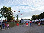
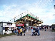
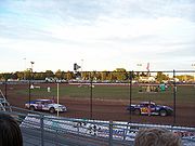
Calumet County celebrated its 150th annual fair in 2006. The fairgrounds host dirt track stockcars races on Friday nights in the summer.Lake Winnebago
The west boundary of the county is located almost entirely in Lake Winnebago. Boaters use the lake for recreational boating and fishing in the summer. The lake is the site of ice fishing in the winter, and the Wisconsin Department of Natural Resources manages a sturgeonSturgeon
Sturgeon is the common name used for some 26 species of fish in the family Acipenseridae, including the genera Acipenser, Huso, Scaphirhynchus and Pseudoscaphirhynchus. The term includes over 20 species commonly referred to as sturgeon and several closely related species that have distinct common...
spear
Spear
A spear is a pole weapon consisting of a shaft, usually of wood, with a pointed head.The head may be simply the sharpened end of the shaft itself, as is the case with bamboo spears, or it may be made of a more durable material fastened to the shaft, such as flint, obsidian, iron, steel or...
ing season in February.
See also
- National Register of Historic Places listings in Calumet County, Wisconsin


 U.S. Highway 10
 U.S. Highway 151


