

Bon Air, Virginia
Encyclopedia
Bon Air is a census-designated place
(CDP) in Chesterfield County
, Virginia
, United States
. The population was 16,366 at the 2010 census. The community is considered a suburb
of the independent city
of Richmond
in the Richmond-Petersburg
region, and shares a post office with Richmond. Originally developed as a resort, a central portion of Bon Air has been designated as a National Historical District
with many structures of Victorian
design from the late 19th and early 20th centuries. Its name means "good air," reflecting its role as a resort getaway that Richmonders enjoyed for its fresh air as opposed to the dirty air of Richmond's industrial downtown of the late 19th century.
Road (near the southwest corner of present-day intersection of Belleau Drive and Jahnke and Brown roads).
Brown Road and Belleau Drive each follow portions of the old Warwick Road which are now west of Chippenham Parkway, which severed the old route in the mid-1960s when it was built between present-day Jahnke Road and Midlothian Turnpike.
 An 1864 map, noted as "Published by D. Van Nostrand, New York", and entitled Map of Richmond, Virginia and Surrounding Country appears to show a small cluster of buildings labeled "Pawhite Stop" on the "Railroad to Coal Mines" line at the site of historic Bon Air village. However, it has also been suggested that "Pawhite Stop" (which on the map is "Pawhite STA") is not Bon Air, Virginia. First, it is on what is labeled "Railroad to Coal Mines", and the Richmond and Danville
line is several miles south of this. The island shown in the James River
might be "Williams Island", but there is no actual major creek as shown on the map flowing into the river at this point. If the creek is "Powhite Creek
", then the accuracy of the map is questionable. This noted, the small stream of Rattle Snake creek flows into the river near Williams Island and originates just to the east of the present-day Bon Air.
A much better map to examine is Survey of a part of Chesterfield County, Virginia. Made under the direction of A.H. Campbell Capt. P.E. & Ch'f Top'l Dep't. by P.W.O. Koerner Lieut. P.E. ; B.F. Blackford and C.E. Cassell Asst. Eng'rs. 1862 & 1863. (This is in the Library of Congress
digital collection.) Of particular note is the area owned by "Cogbill" which is in the vicinity of the area near Buford Road near Bon Air Elementary School and Grand Summit subdivision. The "red line" east of "Cogbill" property does approximate the path of the road said to have been near Burroughs Street and crossed the tracks and continued on to Belleau Road where some suggest there was a "flag stop" for Brown's Summit which is west of this near the current (2009) Buford Road bridge over the tracks.
This map does not show a "Pawhite Station" nor any station for "Bon Air, Virginia".
provided a more healthful atmosphere, particularly in the hot summer months in central Virginia. With its nearby location and greater elevation, Bon Air offered these features nearby, and was founded as a summer resort
town about 8 miles (13 km) outside of Richmond by railroad. One of the founders was Colonel Algernon S. Buford
, of Chatham, Virginia
, who is best known for his presidency of the Richmond and Danville Railroad
during its massive postwar expansion, which ended in 1894 with the formation of the Southern Railway System (now part of Norfolk Southern). Bon Air's connections with the railroad's leaders could possibly be evidenced by the fact that over many of the years until passenger service ended in 1957, the community simultaneously had three stops within 1 miles (2 km) of trackage.
Colonel Buford was a graduate of the University of Virginia
. He became a lawyer, and represented Pittsylvania County
in the Virginia House of Delegates
during 1853 and 1854. During the Civil War
, Buford served the Confederacy
in Richmond at Virginia Depot, although the title "Colonel" is believed to have been honorary, a southern custom common in the post-slavery years. With the support of Virginia Governor Francis H. Pierpont, on September 13, 1865, Buford became president of the 140 miles (225 km) Richmond and Danville Railroad (R&D).
Around 1875, Buford purchased a large tract of land known as the old Anderson Edwards plantation on the south side of the R&D right-of-way. He personally (as well as through the R&D Railroad) helped in the development of Brown's Summit, which was renamed Grand Summit, then Bon Air, after the French expression for "good air". This choice may also have been related to the earlier settlement by French Huguenot
s, a group of religious refugees, slightly to the west.
In 1877, Buford was among the first investors and officers in the Bon Air Land and Improvement Company. Other R&D officials involved in the development of Bon Air were General Thomas M. Logan
, Andrew Talcott
, and his son, Thomas Mann Randolph Talcott. Col. Buford is honored by the naming of the thoroughfare Buford Road in Bon Air. Logan Street is named for General Logan.
Polk Street is named for Bon Air resident Polk Miller
, a pharmacist
and highly-acclaimed banjo
player who founded what became Sergeant's Pet Care Products while creating treatments for his favorite hunting dog, Sergeant.
Other prominent residents included Dr. Hunter McGuire
who was affiliated with the Medical College of Virginia and several other important hospitals and medical schools (and for whom McGuire Veterans Administration Medical Center
in Richmond was named), his wife Mary Stuart McGuire, and their 10 children, many of whom also went into the field of medicine.
.
In 1911, the new Westham Bridge
crossed the James River
between Henrico County
and Chesterfield County
about 7 miles (11 km) upstream from Richmond
. Built as a toll bridge
, it was named for the nearby Westham Station
of the Chesapeake and Ohio Railway
in 1911.
The privately-owned Westham Bridge was financed by a group headed by developer George Craghead Gregory
, who resided at Granite Hall, an estate about a mile from Williams Dam, where he had a mansion erected which was faced with stone quarried nearby. Gregory was also involved with plans to extend a streetcar
line from an existing line at Westhampton Park (now the University of Richmond
) to Bon Air, which he saw as becoming a "bedroom community" of Richmond. Between the James River and Bon Air, Gregory controlled large land areas along the proposed rail line which he hoped to develop. However, despite his plans, aside from grading of right-of-way all the way from the Westham Bridge to Bon Air, Gregory's planned streetcar line did not materialize. This may have been due to weight issues at the Westham Bridge and/or right-of-way matters in Henrico County. However, portions of the planned and partially-improved route can be seen in modern times with the gentle slopes found on present-day Southampton Road and along Mohawk Drive.
After 1933, State Route 147
was routed across the Westham Bridge. It connected River Road and Westham Parkway in Henrico
with Southampton Road and the new Huguenot Road in Chesterfield
. In 1950, the Westham Bridge, which had been subject to flooding and was inadequate for traffic in the growing suburban area, was replaced by the new Huguenot Memorial Bridge
(named in honor of the French Huguenot
settlers who came to the area in the eighteenth century to escape religious persecution
in France
).
The old bridge was dismantled, but the abutments were still visible at each end, and overhead power and telephone lines continued to mark the route for many years. Traces of the old streetcar right-of-way may be seen along gently sloped Southampton Road and Mohawk Drive near Forest Hill Avenue (which was formerly known as Granite Road), and on Logan Street and Hazen Street in Bon Air, where a washboard surface was long rumored by local lore to be the remnants of the streetcar project. Gregory's old mansion, Granite Hall, now located in the Cherokee Estates subdivision near Williams Dam, was still in use as a private residence in 2008. The C&O's Westham Station was relocated to a Richmond city park at Robin Hood Road and Hermitage Road in 1961.
The Southern Railway ended commuter service to Richmond in 1957, and the Bon Air station was dismantled.
The original Southern Railway Station was a building brought to Bon Air from the International Cotton Exposition which had been held in Atlanta, Georgia
, in 1881. This station was replaced in 1917, and portions of the original station were used in an old home on the south side of the tracks (still existent in 2005).
Other early stops in the Bon Air area include "The Steps", located on the north side of the tracks near the current Buford Road Bridge, a stop for the Bon Air Inn south of the Inn site on Burroughs Street, and a stop near the current subdivision of Woodmont for the Wherry Farm. This latter station was the only private station on this section of the railroad and was known as Lee Park.
The early railroad alignment through Bon Air may have been to take advantage of a kaolin clay mine said to have been located on the south side of the tracks near the current Buford Road bridge. A plant built in Manchester to process the clay from Bon Air burned before it could go into production, ending the project.
East of the current city limit along Forest Hill Avenue was land which was earlier known as "The Old Burton Place" with an antebellum
farmhouse. The land was described by a historian as poor for farming due to the many rocks on the site.
In 1889, the 165 acre (0.6677319 km²) tract (and the old farmhouse) was purchased by J.R.F. Burroughs, originally of Lynchburg
, (then in Campbell County
), and his wife Lucy. A childless couple, a few years later the Burroughs opened an orphanage which was originally called "The Home for Friendless Children", and was incorporated in 1898. Religiously devout, the couple never solicited for funds for the orphanage, but there are tales of the support they received anyway. When Mr. Burroughs died in 1915, he was buried at a site now surrounded by neighboring apartments, where his tombstone reads "Faithful unto Death". Burroughs Street in Bon Air was named for the couple.
After he died, the home was taken over by others, and became known as the Bethany Home. It was supported by the community, notably including Bon Air Presbyterian Church, until it closed during the 1940s. A 1936 newspaper article in the Richmond Times-Dispatch
stated that over a thousand children had known the farm as "home", maintaining an average of 50 boys and girls at a time. http://richmondthenandnow.com/Newspaper-Articles/Bethany-Home-for-Children.html
One of the buildings of the Bethany Home survived into the second half of the twentieth century, and was long used as an adult home for the elderly and disabled. Some of the land north of modern Forest Hill Avenue was still in such use at the beginning of the twenty-first century, where a new nursing home was built in the 1980s. South of the old Granite Road, later renamed Forest Hill Avenue, Chesterfield County built a water tower on part of the property. However, beginning in 1960, children were to return to much of the rest of the land.
By the mid-1950s, Bon Air's elementary school was already in its second home, but most high school students had to travel to Manchester or Midlothian
high schools. In the 1960s, a new high school and later a middle school were built by Chesterfield County Public Schools
on part of the former Bethany home property. Huguenot High School
opened on September 6, 1960. The first principal was George H. Reid, a longtime principal of Manchester High School, for whom G. H. Reid Elementary School in another section of the county had been named. A fourteen classroom addition was completed around 1964. G. H. Reid retired at the end of the 1968-69 school year, the last before the city annexed the land occupied by the school the following January 1. Also on the former Burroughs land, Fred D. Thompson Middle School, named for a long-time county educator, was completed in 1965, and was one of the first county schools feature central air conditioning.
, Thompson Middle School, and J.B. Fisher Elementary School (named for a Midlothian-area physician) were among approximately a dozen schools, support buildings, and future school sites conveyed to the City of Richmond along with 23 square miles (60 km²) of territory as the result of a compromise negotiated during the annexation suit by the City of Richmond against Chesterfield County in the late 1960s. The annexation became effective January 1, 1970. the original Bon Air Elementary School and the newer building and Bon Air Primary School were allowed to remain in the county.
According to the United States Census Bureau
, the CDP has a total area of 21.64 sqkm, of which 21.56 sqkm is land and 0.08 sqkm, or 0.38%, is water.
Just west of the fall line
, which divides Virginia's Tidewater
and Piedmont
geological regions, the average elevation in the Bon Air area is approximately 200 feet (61 m) above sea-level, which is significantly higher than most of Richmond, only 8 miles (13 km) to the east. The two branches of Powhite Creek
originate nearby, and it flows into the James River
just upstream from downtown Richmond.
of 2000, there were 16,213 people, 6,308 households, and 4,459 families residing in the CDP. The population density
was 1,834.1 people per square mile (708.1/km²). There were 6,502 housing units at an average density of 735.5/sq mi (284.0/km²). The racial makeup of the CDP was 86.91% White, 8.43% African American, 0.16% Native American, 2.53% Asian, 0.04% Pacific Islander, 0.85% from other races
, and 1.10% from two or more races. Hispanic or Latino of any race were 1.73% of the population.
There were 6,308 households out of which 32.8% had children under the age of 18 living with them, 58.6% were married couples
living together, 9.6% had a female householder with no husband present, and 29.3% were non-families. 24.7% of all households were made up of individuals and 9.1% had someone living alone who was 65 years of age or older. The average household size was 2.47 and the average family size was 2.97.
In the CDP the population was spread out with 26.6% under the age of 18, 5.7% from 18 to 24, 26.3% from 25 to 44, 27.7% from 45 to 64, and 13.7% who were 65 years of age or older. The median age was 40 years. For every 100 females there were 93.2 males. For every 100 females age 18 and over, there were 85.9 males.
The median income for a household in the CDP was $57,493, and the median income for a family was $67,656. Males had a median income of $42,796 versus $31,551 for females. The per capita income
for the CDP was $26,527. About 0.8% of families and 1.8% of the population were below the poverty line, including 0.9% of those under age 18 and 1.8% of those age 65 or over.
serving the area are Bon Air Elementary School, Crestwood Elementary School, Greenfield Elementary School, Robious Middle School and James River High School
. The independent St. Michael's Episcopal School, Riverside School Inc., and Stony Point School are also located in Bon Air. Bon Air Elementary was the inspiration for a series of children's books, The Kids of the Polk Street School by Patricia Reilly Giff
.
Bon Air is also home to the Department of Juvenile Justice's Reception and Diagnostic Center (RDC) and Bon Air Juvenile Correctional Center. At RDC, juveniles from across the state are evaluated and processed. At the end of the 6-8 week stay at RDC, juveniles are given their sentences and sent to their respective permanent placements.
Bon Air Juvenile Correctional Center is one of these permanent placements. The Hill is the minimum security wing, with several open cottages for offenders with lesser crimes and shorter stays, and up until recently was coed. The Expansion is a Level 5 Maximum security wing for all types of offenders. The Expansions has 8 units on two different housing wings. It has two dedicated units for sex offenders, with the other six being divided into three units for regular wards, two for ASU (Administrative Segregation), with one of those being further divided into half ASU and half Protective Custody, with the final unit being reserved for those with mental problems.
Census-designated place
A census-designated place is a concentration of population identified by the United States Census Bureau for statistical purposes. CDPs are delineated for each decennial census as the statistical counterparts of incorporated places such as cities, towns and villages...
(CDP) in Chesterfield County
Chesterfield County, Virginia
Chesterfield County is a county located in the Commonwealth of Virginia, a state of the United States. In 2010, its population was estimated to be 316,236. Chesterfield County is now the fourth-largest municipality in Virginia . Its county seat is Chesterfield...
, Virginia
Virginia
The Commonwealth of Virginia , is a U.S. state on the Atlantic Coast of the Southern United States. Virginia is nicknamed the "Old Dominion" and sometimes the "Mother of Presidents" after the eight U.S. presidents born there...
, United States
United States
The United States of America is a federal constitutional republic comprising fifty states and a federal district...
. The population was 16,366 at the 2010 census. The community is considered a suburb
Suburb
The word suburb mostly refers to a residential area, either existing as part of a city or as a separate residential community within commuting distance of a city . Some suburbs have a degree of administrative autonomy, and most have lower population density than inner city neighborhoods...
of the independent city
Independent city
An independent city is a city that does not form part of another general-purpose local government entity. These type of cities should not be confused with city-states , which are fully sovereign cities that are not part of any other sovereign state.-Historical precursors:In the Holy Roman Empire,...
of Richmond
Richmond, Virginia
Richmond is the capital of the Commonwealth of Virginia, in the United States. It is an independent city and not part of any county. Richmond is the center of the Richmond Metropolitan Statistical Area and the Greater Richmond area...
in the Richmond-Petersburg
Richmond-Petersburg
The Greater Richmond Region is a region located in a central part of the state of Virginia in the United States. As of 2010, it had a population of 1,258,251, making it the 43rd largest MSA in the country...
region, and shares a post office with Richmond. Originally developed as a resort, a central portion of Bon Air has been designated as a National Historical District
National Register of Historic Places
The National Register of Historic Places is the United States government's official list of districts, sites, buildings, structures, and objects deemed worthy of preservation...
with many structures of Victorian
Victorian architecture
The term Victorian architecture refers collectively to several architectural styles employed predominantly during the middle and late 19th century. The period that it indicates may slightly overlap the actual reign, 20 June 1837 – 22 January 1901, of Queen Victoria. This represents the British and...
design from the late 19th and early 20th centuries. Its name means "good air," reflecting its role as a resort getaway that Richmonders enjoyed for its fresh air as opposed to the dirty air of Richmond's industrial downtown of the late 19th century.
History
The area came to be known as Brown's Summit, probably named for the Brown family farm which was located nearby along the old WarwickWarwick, Virginia
Warwick is an extinct independent city which was located in the State of Virginia in the United States from 1952 until 1958. Formed by a political conversion of the former Warwick County, Virginia , it is now part of the independent city of Newport News, Virginia.-History:Warwick River Shire, named...
Road (near the southwest corner of present-day intersection of Belleau Drive and Jahnke and Brown roads).
Brown Road and Belleau Drive each follow portions of the old Warwick Road which are now west of Chippenham Parkway, which severed the old route in the mid-1960s when it was built between present-day Jahnke Road and Midlothian Turnpike.
Old maps
Richmond and Danville Railroad
The Richmond and Danville Railroad was chartered in Virginia in the United States in 1847. The portion between Richmond and Danville, Virginia was completed in 1856...
line is several miles south of this. The island shown in the James River
James River
The James River may refer to:Rivers in the United States and their namesakes* James River * James River , North Dakota, South Dakota* James River * James River * James River...
might be "Williams Island", but there is no actual major creek as shown on the map flowing into the river at this point. If the creek is "Powhite Creek
Powhite Creek
Powhite Creek is an stream rising near the unincorporated community of Bon Air in Chesterfield County and flowing into the independent city of Richmond in central Virginia...
", then the accuracy of the map is questionable. This noted, the small stream of Rattle Snake creek flows into the river near Williams Island and originates just to the east of the present-day Bon Air.
A much better map to examine is Survey of a part of Chesterfield County, Virginia. Made under the direction of A.H. Campbell Capt. P.E. & Ch'f Top'l Dep't. by P.W.O. Koerner Lieut. P.E. ; B.F. Blackford and C.E. Cassell Asst. Eng'rs. 1862 & 1863. (This is in the Library of Congress
Library of Congress
The Library of Congress is the research library of the United States Congress, de facto national library of the United States, and the oldest federal cultural institution in the United States. Located in three buildings in Washington, D.C., it is the largest library in the world by shelf space and...
digital collection.) Of particular note is the area owned by "Cogbill" which is in the vicinity of the area near Buford Road near Bon Air Elementary School and Grand Summit subdivision. The "red line" east of "Cogbill" property does approximate the path of the road said to have been near Burroughs Street and crossed the tracks and continued on to Belleau Road where some suggest there was a "flag stop" for Brown's Summit which is west of this near the current (2009) Buford Road bridge over the tracks.
This map does not show a "Pawhite Station" nor any station for "Bon Air, Virginia".
Bon Air: the resort era
In the 19th century, it was believed that the higher elevation and distance from the urban area of RichmondRichmond, Virginia
Richmond is the capital of the Commonwealth of Virginia, in the United States. It is an independent city and not part of any county. Richmond is the center of the Richmond Metropolitan Statistical Area and the Greater Richmond area...
provided a more healthful atmosphere, particularly in the hot summer months in central Virginia. With its nearby location and greater elevation, Bon Air offered these features nearby, and was founded as a summer resort
Resort
A resort is a place used for relaxation or recreation, attracting visitors for holidays or vacations. Resorts are places, towns or sometimes commercial establishment operated by a single company....
town about 8 miles (13 km) outside of Richmond by railroad. One of the founders was Colonel Algernon S. Buford
Algernon S. Buford
Algernon Sidney Buford of Chatham, Virginia is best known for his presidency of the Richmond and Danville Railroad during its massive post civil war expansion into the Southern Railway system ....
, of Chatham, Virginia
Chatham, Virginia
Chatham is a town in Pittsylvania County, Virginia, United States. Chatham's population was 1,338 at the 2000 census. It is included in the Danville, Virginia Metropolitan Statistical Area. Chatham is home to Chatham High School and Hargrave Military Academy. It is also home to Chatham Hall , an...
, who is best known for his presidency of the Richmond and Danville Railroad
Richmond and Danville Railroad
The Richmond and Danville Railroad was chartered in Virginia in the United States in 1847. The portion between Richmond and Danville, Virginia was completed in 1856...
during its massive postwar expansion, which ended in 1894 with the formation of the Southern Railway System (now part of Norfolk Southern). Bon Air's connections with the railroad's leaders could possibly be evidenced by the fact that over many of the years until passenger service ended in 1957, the community simultaneously had three stops within 1 miles (2 km) of trackage.
Colonel Buford was a graduate of the University of Virginia
University of Virginia
The University of Virginia is a public research university located in Charlottesville, Virginia, United States, founded by Thomas Jefferson...
. He became a lawyer, and represented Pittsylvania County
Pittsylvania County, Virginia
As of the census of 2000, there were 61,745 people, 24,684 households, and 18,216 families residing in the county. The population density was 64 people per square mile . There were 28,011 housing units at an average density of 29 per square mile...
in the Virginia House of Delegates
Virginia House of Delegates
The Virginia House of Delegates is the lower house of the Virginia General Assembly. It has 100 members elected for terms of two years; unlike most states, these elections take place during odd-numbered years. The House is presided over by the Speaker of the House, who is elected from among the...
during 1853 and 1854. During the Civil War
American Civil War
The American Civil War was a civil war fought in the United States of America. In response to the election of Abraham Lincoln as President of the United States, 11 southern slave states declared their secession from the United States and formed the Confederate States of America ; the other 25...
, Buford served the Confederacy
Confederate States of America
The Confederate States of America was a government set up from 1861 to 1865 by 11 Southern slave states of the United States of America that had declared their secession from the U.S...
in Richmond at Virginia Depot, although the title "Colonel" is believed to have been honorary, a southern custom common in the post-slavery years. With the support of Virginia Governor Francis H. Pierpont, on September 13, 1865, Buford became president of the 140 miles (225 km) Richmond and Danville Railroad (R&D).
Around 1875, Buford purchased a large tract of land known as the old Anderson Edwards plantation on the south side of the R&D right-of-way. He personally (as well as through the R&D Railroad) helped in the development of Brown's Summit, which was renamed Grand Summit, then Bon Air, after the French expression for "good air". This choice may also have been related to the earlier settlement by French Huguenot
Huguenot
The Huguenots were members of the Protestant Reformed Church of France during the 16th and 17th centuries. Since the 17th century, people who formerly would have been called Huguenots have instead simply been called French Protestants, a title suggested by their German co-religionists, the...
s, a group of religious refugees, slightly to the west.
In 1877, Buford was among the first investors and officers in the Bon Air Land and Improvement Company. Other R&D officials involved in the development of Bon Air were General Thomas M. Logan
Thomas M. Logan
Thomas Muldrup Logan was an American soldier and businessman. He served as a Confederate general during the American Civil War, and afterward was greatly involved in railroad development in the Southern United States....
, Andrew Talcott
Andrew Talcott
Andrew Talcott was an American civil engineer and close friend of Civil War General Robert E. Lee. While serving as a Confederate States of America Colonel and the State Engineer of Virginia, he was arrested and made prisoner of war during that conflict.-Early life:Talcott was born on April 20,...
, and his son, Thomas Mann Randolph Talcott. Col. Buford is honored by the naming of the thoroughfare Buford Road in Bon Air. Logan Street is named for General Logan.
Polk Street is named for Bon Air resident Polk Miller
Polk Miller
Polk Miller was a pharmacist and musician from Richmond and Bon Air, Virginia.-Early life, Civil War, druggist:Polk Miller was born in Prince Edward County, Virginia in August, 1844. While growing up, he learned to play the banjo from slaves on his father's plantation. He became a druggist in...
, a pharmacist
Pharmacist
Pharmacists are allied health professionals who practice in pharmacy, the field of health sciences focusing on safe and effective medication use...
and highly-acclaimed banjo
Banjo
In the 1830s Sweeney became the first white man to play the banjo on stage. His version of the instrument replaced the gourd with a drum-like sound box and included four full-length strings alongside a short fifth-string. There is no proof, however, that Sweeney invented either innovation. This new...
player who founded what became Sergeant's Pet Care Products while creating treatments for his favorite hunting dog, Sergeant.
Other prominent residents included Dr. Hunter McGuire
Hunter McGuire
Hunter Holmes McGuire, M.D. was a physician, teacher, and orator. He started several schools and hospitals which later became part of the Medical College of Virginia in Richmond, Virginia. His statue sits prominently on the grounds of the Virginia State Capitol...
who was affiliated with the Medical College of Virginia and several other important hospitals and medical schools (and for whom McGuire Veterans Administration Medical Center
Hunter Holmes McGuire Veterans Administration Medical Center
Hunter Holmes McGuire Veterans Administration Medical Center is located in Richmond, Virginia.-History:McGuire VA Hospital was established on the land of a former racetrack in Chesterfield County, Virginia after World War II along State Route 10 and Richmond's Belt Boulevard, an early highway bypass...
in Richmond was named), his wife Mary Stuart McGuire, and their 10 children, many of whom also went into the field of medicine.
Village period
In the 20th century, as the residential area around Richmond grew, Bon Air evolved into a middle-class neighborhoodNeighbourhood
A neighbourhood or neighborhood is a geographically localised community within a larger city, town or suburb. Neighbourhoods are often social communities with considerable face-to-face interaction among members. "Researchers have not agreed on an exact definition...
.
In 1911, the new Westham Bridge
Westham Bridge
Westham Bridge crossed the James River between Henrico County and Chesterfield County. The bridge was located between Bosher Dam and Williams Island Dam just west of the 7 miles of rapids and falls which constitute the fall line of the James River at Richmond, Virginia.Built as a toll bridge in...
crossed the James River
James River
The James River may refer to:Rivers in the United States and their namesakes* James River * James River , North Dakota, South Dakota* James River * James River * James River...
between Henrico County
Henrico County, Virginia
Henrico is a county located in the Commonwealth of Virginia, a state of the United States. As of 2010, Henrico was home to 306,935 people. It is located in the Richmond-Petersburg region and is a portion of the Richmond Metropolitan Statistical Area...
and Chesterfield County
Chesterfield County, Virginia
Chesterfield County is a county located in the Commonwealth of Virginia, a state of the United States. In 2010, its population was estimated to be 316,236. Chesterfield County is now the fourth-largest municipality in Virginia . Its county seat is Chesterfield...
about 7 miles (11 km) upstream from Richmond
Richmond, Virginia
Richmond is the capital of the Commonwealth of Virginia, in the United States. It is an independent city and not part of any county. Richmond is the center of the Richmond Metropolitan Statistical Area and the Greater Richmond area...
. Built as a toll bridge
Toll bridge
A toll bridge is a bridge over which traffic may pass upon payment of a toll, or fee.- History :The practice of collecting tolls on bridges probably harks back to the days of ferry crossings where people paid a fee to be ferried across stretches of water. As boats became impractical to carry large...
, it was named for the nearby Westham Station
Westham Station
Westham Station in Henrico County, Virginia, was originally located at Westham, Virginia on the Richmond and Allegheny Railroad , which was laid along the towpath of the James River and Kanawha Canal in the 1880s. The R&A railroad was acquired by the Chesapeake and Ohio Railway in the 1890s...
of the Chesapeake and Ohio Railway
Chesapeake and Ohio Railway
The Chesapeake and Ohio Railway was a Class I railroad formed in 1869 in Virginia from several smaller Virginia railroads begun in the 19th century. Led by industrialist Collis P...
in 1911.
The privately-owned Westham Bridge was financed by a group headed by developer George Craghead Gregory
George C. Gregory
George Craghead Gregory was an American attorney, businessman, historian, and author. He lived with his wife and seven children at "Granite Hall", an estate located near Granite in northwestern Chesterfield County about 8 miles west of Richmond, Virginia.In 1932, he discovered the foundation of...
, who resided at Granite Hall, an estate about a mile from Williams Dam, where he had a mansion erected which was faced with stone quarried nearby. Gregory was also involved with plans to extend a streetcar
Tram
A tram is a passenger rail vehicle which runs on tracks along public urban streets and also sometimes on separate rights of way. It may also run between cities and/or towns , and/or partially grade separated even in the cities...
line from an existing line at Westhampton Park (now the University of Richmond
University of Richmond
The University of Richmond is a selective, private, nonsectarian, liberal arts university located on the border of the city of Richmond and Henrico County, Virginia. The University of Richmond is a primarily undergraduate, residential university with approximately 4,000 undergraduate and graduate...
) to Bon Air, which he saw as becoming a "bedroom community" of Richmond. Between the James River and Bon Air, Gregory controlled large land areas along the proposed rail line which he hoped to develop. However, despite his plans, aside from grading of right-of-way all the way from the Westham Bridge to Bon Air, Gregory's planned streetcar line did not materialize. This may have been due to weight issues at the Westham Bridge and/or right-of-way matters in Henrico County. However, portions of the planned and partially-improved route can be seen in modern times with the gentle slopes found on present-day Southampton Road and along Mohawk Drive.
After 1933, State Route 147
Virginia State Route 147
Virginia State Route 147 is a primary state highway in the U.S. state of Virginia. The state highway runs from U.S. Route 60 in Midlothian east to US 60 in Richmond. SR 147 connects Midlothian with the West End of Richmond via the Huguenot Memorial Bridge across the James River...
was routed across the Westham Bridge. It connected River Road and Westham Parkway in Henrico
Henrico County, Virginia
Henrico is a county located in the Commonwealth of Virginia, a state of the United States. As of 2010, Henrico was home to 306,935 people. It is located in the Richmond-Petersburg region and is a portion of the Richmond Metropolitan Statistical Area...
with Southampton Road and the new Huguenot Road in Chesterfield
Chesterfield County, Virginia
Chesterfield County is a county located in the Commonwealth of Virginia, a state of the United States. In 2010, its population was estimated to be 316,236. Chesterfield County is now the fourth-largest municipality in Virginia . Its county seat is Chesterfield...
. In 1950, the Westham Bridge, which had been subject to flooding and was inadequate for traffic in the growing suburban area, was replaced by the new Huguenot Memorial Bridge
Huguenot Memorial Bridge
Huguenot Memorial Bridge is located in Henrico County and the independent city of Richmond, Virginia. It carries State Route 147 across the former Chesapeake and Ohio Railway , the James River and Kanawha Canal, and the James River in the fall line region above the head of navigation at...
(named in honor of the French Huguenot
Huguenot
The Huguenots were members of the Protestant Reformed Church of France during the 16th and 17th centuries. Since the 17th century, people who formerly would have been called Huguenots have instead simply been called French Protestants, a title suggested by their German co-religionists, the...
settlers who came to the area in the eighteenth century to escape religious persecution
Religious persecution
Religious persecution is the systematic mistreatment of an individual or group of individuals as a response to their religious beliefs or affiliations or lack thereof....
in France
France
The French Republic , The French Republic , The French Republic , (commonly known as France , is a unitary semi-presidential republic in Western Europe with several overseas territories and islands located on other continents and in the Indian, Pacific, and Atlantic oceans. Metropolitan France...
).
The old bridge was dismantled, but the abutments were still visible at each end, and overhead power and telephone lines continued to mark the route for many years. Traces of the old streetcar right-of-way may be seen along gently sloped Southampton Road and Mohawk Drive near Forest Hill Avenue (which was formerly known as Granite Road), and on Logan Street and Hazen Street in Bon Air, where a washboard surface was long rumored by local lore to be the remnants of the streetcar project. Gregory's old mansion, Granite Hall, now located in the Cherokee Estates subdivision near Williams Dam, was still in use as a private residence in 2008. The C&O's Westham Station was relocated to a Richmond city park at Robin Hood Road and Hermitage Road in 1961.
The Southern Railway ended commuter service to Richmond in 1957, and the Bon Air station was dismantled.
The original Southern Railway Station was a building brought to Bon Air from the International Cotton Exposition which had been held in Atlanta, Georgia
Atlanta, Georgia
Atlanta is the capital and most populous city in the U.S. state of Georgia. According to the 2010 census, Atlanta's population is 420,003. Atlanta is the cultural and economic center of the Atlanta metropolitan area, which is home to 5,268,860 people and is the ninth largest metropolitan area in...
, in 1881. This station was replaced in 1917, and portions of the original station were used in an old home on the south side of the tracks (still existent in 2005).
Other early stops in the Bon Air area include "The Steps", located on the north side of the tracks near the current Buford Road Bridge, a stop for the Bon Air Inn south of the Inn site on Burroughs Street, and a stop near the current subdivision of Woodmont for the Wherry Farm. This latter station was the only private station on this section of the railroad and was known as Lee Park.
The early railroad alignment through Bon Air may have been to take advantage of a kaolin clay mine said to have been located on the south side of the tracks near the current Buford Road bridge. A plant built in Manchester to process the clay from Bon Air burned before it could go into production, ending the project.
Land for the benefit of children
Another Confederate civil war veteran came to Bon Air, and like Colonel Buford, General Logan, Polk Miller, and other contemporaries of the time, he (and his wife) were to leave a long-lasting impact upon the community, as well as their family name on a street.East of the current city limit along Forest Hill Avenue was land which was earlier known as "The Old Burton Place" with an antebellum
Antebellum architecture
Antebellum architecture is a term used to describe the characteristic neoclassical architectural style of the Southern United States, especially the Old South, from after the birth of the United States in the American Revolution, to the start of the American Civil War...
farmhouse. The land was described by a historian as poor for farming due to the many rocks on the site.
In 1889, the 165 acre (0.6677319 km²) tract (and the old farmhouse) was purchased by J.R.F. Burroughs, originally of Lynchburg
Lynchburg, Virginia
Lynchburg is an independent city in the Commonwealth of Virginia. The population was 75,568 as of 2010. Located in the foothills of the Blue Ridge Mountains along the banks of the James River, Lynchburg is known as the "City of Seven Hills" or "The Hill City." Lynchburg was the only major city in...
, (then in Campbell County
Campbell County, Virginia
As of the census of 2000, there were 51,078 people, 20,639 households, and 14,694 families residing in the county. The population density was 101 people per square mile . There were 22,088 housing units at an average density of 44 per square mile...
), and his wife Lucy. A childless couple, a few years later the Burroughs opened an orphanage which was originally called "The Home for Friendless Children", and was incorporated in 1898. Religiously devout, the couple never solicited for funds for the orphanage, but there are tales of the support they received anyway. When Mr. Burroughs died in 1915, he was buried at a site now surrounded by neighboring apartments, where his tombstone reads "Faithful unto Death". Burroughs Street in Bon Air was named for the couple.
After he died, the home was taken over by others, and became known as the Bethany Home. It was supported by the community, notably including Bon Air Presbyterian Church, until it closed during the 1940s. A 1936 newspaper article in the Richmond Times-Dispatch
Richmond Times-Dispatch
The Richmond Times-Dispatch is the primary daily newspaper in Richmond the capital of Virginia, United States, and is commonly considered the "newspaper of record" for events occurring in much of the state...
stated that over a thousand children had known the farm as "home", maintaining an average of 50 boys and girls at a time. http://richmondthenandnow.com/Newspaper-Articles/Bethany-Home-for-Children.html
One of the buildings of the Bethany Home survived into the second half of the twentieth century, and was long used as an adult home for the elderly and disabled. Some of the land north of modern Forest Hill Avenue was still in such use at the beginning of the twenty-first century, where a new nursing home was built in the 1980s. South of the old Granite Road, later renamed Forest Hill Avenue, Chesterfield County built a water tower on part of the property. However, beginning in 1960, children were to return to much of the rest of the land.
By the mid-1950s, Bon Air's elementary school was already in its second home, but most high school students had to travel to Manchester or Midlothian
Midlothian High School (Virginia)
Midlothian High School is an American secondary school in the Midlothian section of unincorporated Chesterfield County, Virginia, United States. Midlothian is a part of Chesterfield County Public Schools.-History:...
high schools. In the 1960s, a new high school and later a middle school were built by Chesterfield County Public Schools
Chesterfield County Public Schools
Chesterfield County Public Schools is the school system of Chesterfield County, Virginia, United States. Almost 59,000 students are enrolled in 62 Chesterfield public schools...
on part of the former Bethany home property. Huguenot High School
Huguenot High School
Huguenot High School, part of the Richmond Public Schools system, is a high school located in Richmond, Virginia, with grades 9-12.Huguenot High School was named in honor of the Huguenots, French Protestants who emigrated to the English Virginia Colony beginning in the early 18th century.-Land for...
opened on September 6, 1960. The first principal was George H. Reid, a longtime principal of Manchester High School, for whom G. H. Reid Elementary School in another section of the county had been named. A fourteen classroom addition was completed around 1964. G. H. Reid retired at the end of the 1968-69 school year, the last before the city annexed the land occupied by the school the following January 1. Also on the former Burroughs land, Fred D. Thompson Middle School, named for a long-time county educator, was completed in 1965, and was one of the first county schools feature central air conditioning.
1970 Richmond-Chesterfield annexation
A portion of what was then considered Bon Air was annexed by the City of Richmond in 1970. In the Bon Air area, Huguenot High SchoolHuguenot High School
Huguenot High School, part of the Richmond Public Schools system, is a high school located in Richmond, Virginia, with grades 9-12.Huguenot High School was named in honor of the Huguenots, French Protestants who emigrated to the English Virginia Colony beginning in the early 18th century.-Land for...
, Thompson Middle School, and J.B. Fisher Elementary School (named for a Midlothian-area physician) were among approximately a dozen schools, support buildings, and future school sites conveyed to the City of Richmond along with 23 square miles (60 km²) of territory as the result of a compromise negotiated during the annexation suit by the City of Richmond against Chesterfield County in the late 1960s. The annexation became effective January 1, 1970. the original Bon Air Elementary School and the newer building and Bon Air Primary School were allowed to remain in the county.
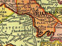
Geography
Bon Air is located at 37°31′12"N 77°34′8"W (37.519947, -77.568768). The elevation is 328 feet (100 m). The community is located in the Eastern Standard time zone.According to the United States Census Bureau
United States Census Bureau
The United States Census Bureau is the government agency that is responsible for the United States Census. It also gathers other national demographic and economic data...
, the CDP has a total area of 21.64 sqkm, of which 21.56 sqkm is land and 0.08 sqkm, or 0.38%, is water.
Just west of the fall line
Atlantic Seaboard fall line
The Atlantic Seaboard Fall Line, or Fall Zone, is a escarpment where the Piedmont and Atlantic coastal plain meet in the eastern United States...
, which divides Virginia's Tidewater
Tidewater region of Virginia
The Tidewater region of Virginia is the eastern portion of the Commonwealth of Virginia formally known as Hampton Roads. The term tidewater may be correctly applied to all portions of any area, including Virginia, where the water level is affected by the tides...
and Piedmont
Piedmont (United States)
The Piedmont is a plateau region located in the eastern United States between the Atlantic Coastal Plain and the main Appalachian Mountains, stretching from New Jersey in the north to central Alabama in the south. The Piedmont province is a physiographic province of the larger Appalachian division...
geological regions, the average elevation in the Bon Air area is approximately 200 feet (61 m) above sea-level, which is significantly higher than most of Richmond, only 8 miles (13 km) to the east. The two branches of Powhite Creek
Powhite Creek
Powhite Creek is an stream rising near the unincorporated community of Bon Air in Chesterfield County and flowing into the independent city of Richmond in central Virginia...
originate nearby, and it flows into the James River
James River
The James River may refer to:Rivers in the United States and their namesakes* James River * James River , North Dakota, South Dakota* James River * James River * James River...
just upstream from downtown Richmond.
Demographics
As of the censusCensus
A census is the procedure of systematically acquiring and recording information about the members of a given population. It is a regularly occurring and official count of a particular population. The term is used mostly in connection with national population and housing censuses; other common...
of 2000, there were 16,213 people, 6,308 households, and 4,459 families residing in the CDP. The population density
Population density
Population density is a measurement of population per unit area or unit volume. It is frequently applied to living organisms, and particularly to humans...
was 1,834.1 people per square mile (708.1/km²). There were 6,502 housing units at an average density of 735.5/sq mi (284.0/km²). The racial makeup of the CDP was 86.91% White, 8.43% African American, 0.16% Native American, 2.53% Asian, 0.04% Pacific Islander, 0.85% from other races
Race (United States Census)
Race and ethnicity in the United States Census, as defined by the Federal Office of Management and Budget and the United States Census Bureau, are self-identification data items in which residents choose the race or races with which they most closely identify, and indicate whether or not they are...
, and 1.10% from two or more races. Hispanic or Latino of any race were 1.73% of the population.
There were 6,308 households out of which 32.8% had children under the age of 18 living with them, 58.6% were married couples
Marriage
Marriage is a social union or legal contract between people that creates kinship. It is an institution in which interpersonal relationships, usually intimate and sexual, are acknowledged in a variety of ways, depending on the culture or subculture in which it is found...
living together, 9.6% had a female householder with no husband present, and 29.3% were non-families. 24.7% of all households were made up of individuals and 9.1% had someone living alone who was 65 years of age or older. The average household size was 2.47 and the average family size was 2.97.
In the CDP the population was spread out with 26.6% under the age of 18, 5.7% from 18 to 24, 26.3% from 25 to 44, 27.7% from 45 to 64, and 13.7% who were 65 years of age or older. The median age was 40 years. For every 100 females there were 93.2 males. For every 100 females age 18 and over, there were 85.9 males.
The median income for a household in the CDP was $57,493, and the median income for a family was $67,656. Males had a median income of $42,796 versus $31,551 for females. The per capita income
Per capita income
Per capita income or income per person is a measure of mean income within an economic aggregate, such as a country or city. It is calculated by taking a measure of all sources of income in the aggregate and dividing it by the total population...
for the CDP was $26,527. About 0.8% of families and 1.8% of the population were below the poverty line, including 0.9% of those under age 18 and 1.8% of those age 65 or over.
Schools
The Chesterfield County Public SchoolsChesterfield County Public Schools
Chesterfield County Public Schools is the school system of Chesterfield County, Virginia, United States. Almost 59,000 students are enrolled in 62 Chesterfield public schools...
serving the area are Bon Air Elementary School, Crestwood Elementary School, Greenfield Elementary School, Robious Middle School and James River High School
James River High School (Chesterfield County, Virginia)
James River High School is located in Midlothian, an unincorporated community in Chesterfield County, Virginia, United States. James River High School has been recognized by the United States Department of Education as a School of Excellence, earning the high honor of Blue Ribbon in 2000...
. The independent St. Michael's Episcopal School, Riverside School Inc., and Stony Point School are also located in Bon Air. Bon Air Elementary was the inspiration for a series of children's books, The Kids of the Polk Street School by Patricia Reilly Giff
Patricia Reilly Giff
Patricia Reilly Giff was born on April 26, 1935 in Brooklyn, New York. She is an author and teacher. She was educated at Marymount College, where she was awarded a B.A. degree, and St. John's University, where she earned an M.A. and Hofstra University, where she was awarded a Professional Diploma...
.
Bon Air is also home to the Department of Juvenile Justice's Reception and Diagnostic Center (RDC) and Bon Air Juvenile Correctional Center. At RDC, juveniles from across the state are evaluated and processed. At the end of the 6-8 week stay at RDC, juveniles are given their sentences and sent to their respective permanent placements.
Bon Air Juvenile Correctional Center is one of these permanent placements. The Hill is the minimum security wing, with several open cottages for offenders with lesser crimes and shorter stays, and up until recently was coed. The Expansion is a Level 5 Maximum security wing for all types of offenders. The Expansions has 8 units on two different housing wings. It has two dedicated units for sex offenders, with the other six being divided into three units for regular wards, two for ASU (Administrative Segregation), with one of those being further divided into half ASU and half Protective Custody, with the final unit being reserved for those with mental problems.
Religious life
Places of worship in Bon Air include Buford Road Baptist, St. Joseph Roman Catholic, Bon Air Baptist, Bon Air Christian, Bon Air United Methodist, Stony Point Reformed Presbyterian, and the Islamic Center of Richmond.Further reading
- Claflin, Mary Anne, and Richardson, Elizabeth Guy (1977) Bon Air: A History, Hale Publishing, Richmond, Virginia
- Widerman, John C. (2004) The Sinking of the U.S.S. Cairo, University Press of Mississippi, ISBN 1-57806-680-8
External links
- Chesterfield County Planning Dept. Bon Air page
- "Bon Air Buzz", community website