

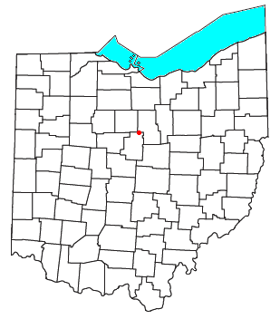
Blooming Grove, Ohio
Encyclopedia
Unincorporated area
In law, an unincorporated area is a region of land that is not a part of any municipality.To "incorporate" in this context means to form a municipal corporation, a city, town, or village with its own government. An unincorporated community is usually not subject to or taxed by a municipal government...
in northeastern North Bloomfield Township
North Bloomfield Township, Morrow County, Ohio
North Bloomfield Township is one of the sixteen townships of Morrow County, Ohio, United States. The 2000 census found 1,866 people in the township.-Geography:Located in the northern part of the county, it borders the following townships:...
, Morrow County
Morrow County, Ohio
Morrow County is a county located in the state of Ohio, United States. Shawnee people used the area for hunting purposes before white settlers arrived in the early 19th century. Morrow County was organized in 1848 from parts of four neighboring counties and named for Jeremiah Morrow, Governor of...
, Ohio
Ohio
Ohio is a Midwestern state in the United States. The 34th largest state by area in the U.S.,it is the 7th‑most populous with over 11.5 million residents, containing several major American cities and seven metropolitan areas with populations of 500,000 or more.The state's capital is Columbus...
, United States
United States
The United States of America is a federal constitutional republic comprising fifty states and a federal district...
. The community is located at the junction of State Route 97
Ohio State Route 97
State Route 97 is an east–west state highway in the northern portion of the U.S. state of Ohio. Its western terminus is at State Route 309/State Route 61/State Route 19 in Galion, and its eastern terminus is at State Route 3 near Loudonville....
and Morrow County Road 20. The nearest city is Galion, Ohio
Galion, Ohio
Settlers arrived in the area as early as 1817. The location was at the crossroads of a north-south road from Columbus to Portland , and the east-west route that later became the Lincoln Highway and subsequently the Harding Highway....
, located to the northwest. Mount Gilead
Mount Gilead, Ohio
Mount Gilead is a village in Morrow County, Ohio, United States.Mount Gilead's population was 3,290 at the 2000 census. It is the county seat of Morrow County and the center of population of Ohio. The village was established in 1832, eight years after white settlers arrived in the region...
, the county seat
County seat
A county seat is an administrative center, or seat of government, for a county or civil parish. The term is primarily used in the United States....
of Morrow County, is located southwest of Blooming Grove on State Route 61
Ohio State Route 61
State Route 61 is a north–south state highway in the northern portion of the U.S. state of Ohio. Its southern terminus is at the U.S. Route 36/State Route 3 concurrency in Sunbury, and its northern terminus is at U.S. Route 6 east of Huron, at the southern-most point of Lake Erie...
.
Founded under the name of "Corsica", the community is the nearest settlement to the birthplace of Warren G. Harding
Warren G. Harding
Warren Gamaliel Harding was the 29th President of the United States . A Republican from Ohio, Harding was an influential self-made newspaper publisher. He served in the Ohio Senate , as the 28th Lieutenant Governor of Ohio and as a U.S. Senator...
, the 29th President of the United States of America. The Harding birthplace is no longer standing; however, the site is marked by an Ohio Historical Society Marker.
The community was laid out by Salmon E. Harding.