
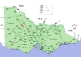
Birchip, Victoria
Encyclopedia

The Mallee
The Mallee is the most northwesterly district in the state of Victoria, and also encompasses the agricultural district of South Australia. Definitions vary, however all are based on the Victorian distribution of mallee eucalypts...
region of Victoria, Australia
Australia
Australia , officially the Commonwealth of Australia, is a country in the Southern Hemisphere comprising the mainland of the Australian continent, the island of Tasmania, and numerous smaller islands in the Indian and Pacific Oceans. It is the world's sixth-largest country by total area...
on the Sunraysia Highway
Sunraysia Highway
The Sunraysia Highway , is a important north-south route in western Victoria. The highway extends north a length of 331 km from the Western Highway near Ballarat to the Calder Highway near Ouyen....
north of Donald
Donald, Victoria
Donald is a town in Victoria, Australia, located on the Richardson River, at the junction of Sunraysia Highway and Borung Highway, in the Shire of Buloke. The town is named after William Donald, a Scottish pastoralist who was the first settler in the area in 1844...
. The town is located in the Shire of Buloke Local Government Area. At the 2006 census
Census in Australia
The Australian census is administered once every five years by the Australian Bureau of Statistics. The most recent census was conducted on 9 August 2011; the next will be conducted in 2016. Prior to the introduction of regular censuses in 1961, they had also been run in 1901, 1911, 1921, 1933,...
Birchip had a population of 822. It has a P-12 school, and an Australian rules football
Australian rules football
Australian rules football, officially known as Australian football, also called football, Aussie rules or footy is a sport played between two teams of 22 players on either...
club called Birchip-Watchem, also known as the Birchip-Watchem Bulls, or just the "Bulls".
A pastoral run was established in the region named Wirmburchep and when surveyed a parish was gazetted as Wirmbirchip.
Closer settlement began in the area by then known as Wirrimbirchip around 1882 and a Post Office under that name opened on 2 July 1883 (Birchip from 1 January 1890). The town was surveyed as Birchip in 1887 though known by the inhabitants by the original name for quite some years later.
The farms in the area typically grow wheat
Wheat
Wheat is a cereal grain, originally from the Levant region of the Near East, but now cultivated worldwide. In 2007 world production of wheat was 607 million tons, making it the third most-produced cereal after maize and rice...
, barley
Barley
Barley is a major cereal grain, a member of the grass family. It serves as a major animal fodder, as a base malt for beer and certain distilled beverages, and as a component of various health foods...
, canola
Canola
Canola refers to a cultivar of either Rapeseed or Field Mustard . Its seeds are used to produce edible oil suitable for consumption by humans and livestock. The oil is also suitable for use as biodiesel.Originally, Canola was bred naturally from rapeseed in Canada by Keith Downey and Baldur R...
, and other cereals. Some people have pig sheds, though most livestock in the district are sheep. There is a hospital which shares a lodge for elderly care.
Five main roads enter the town. It is located approximately 312 kilometres (194 mi) northwest of Victoria's capital city Melbourne
Melbourne
Melbourne is the capital and most populous city in the state of Victoria, and the second most populous city in Australia. The Melbourne City Centre is the hub of the greater metropolitan area and the Census statistical division—of which "Melbourne" is the common name. As of June 2009, the greater...
. A road passes through Birchip that divides the Wimmera region of Victoria (to the south) from the Mallee region of Victoria (to the north). To travel to Birchip from Melbourne there are two preferred routes, one through Ballarat
Ballarat, Victoria
Ballarat is a city in the state of Victoria, Australia, approximately west-north-west of the state capital Melbourne situated on the lower plains of the Great Dividing Range and the Yarrowee River catchment. It is the largest inland centre and third most populous city in the state and the fifth...
via the Sunraysia Highway
Sunraysia Highway
The Sunraysia Highway , is a important north-south route in western Victoria. The highway extends north a length of 331 km from the Western Highway near Ballarat to the Calder Highway near Ouyen....
and one through Bendigo
Bendigo, Victoria
Bendigo is a major regional city in the state of Victoria, Australia, located very close to the geographical centre of the state and approximately north west of the state capital Melbourne. It is the second largest inland city and fourth most populous city in the state. The estimated urban...
via the Calder Highway
Calder Highway
Calder Highway is a Highway linking Ravenswood South in Victoria, to Mildura. North of the Victoria/New South Wales border, the highway continues north to Broken Hill, Tibooburra and the New South Wales/Queensland border as the Silver City Highway, under the standard national route shield as far...
. Each route's travel times are similar and the Ballarat route is more mountainous in some areas. There is an aerodrome for light aircraft.
Birchip is also home to BCG (Birchip Cropping Group) is a non for profit research organisation led by farmers in the Wimmera
Wimmera
The Wimmera is a region in the west of the Australian state of Victoria.It covers the dryland farming area south of the range of Mallee scrub, east of the South Australia border and north of the Great Dividing Range...
-Mallee
Mallee
Mallee may refer to:* Mallee , the habit of woody plants that grow with multiple stems from underground lignotubers* Mallee , a biogeographic region in southern Western Australia...
region of Victoria
Victoria (Australia)
Victoria is the second most populous state in Australia. Geographically the smallest mainland state, Victoria is bordered by New South Wales, South Australia, and Tasmania on Boundary Islet to the north, west and south respectively....
, Australia
Australia
Australia , officially the Commonwealth of Australia, is a country in the Southern Hemisphere comprising the mainland of the Australian continent, the island of Tasmania, and numerous smaller islands in the Indian and Pacific Oceans. It is the world's sixth-largest country by total area...
.
BCG's aim is to improve the profitability and long-term viability of Mallee and Wimmera communities through research, demonstration and exchange of ideas amongst farmers and industry groups.
Official BCG website
With its neighbouring township Watchem
Watchem, Victoria
Watchem is a small town in Victoria, Australia, located on the Sunraysia Highway near to Donald. At the 2006 census, Watchem and the surrounding area had a population of 213.The Post Office opened on 2 November 1889....
Birchip has a football
Australian rules football
Australian rules football, officially known as Australian football, also called football, Aussie rules or footy is a sport played between two teams of 22 players on either...
team (Birchip-Watchem) competing in the North Central Football League
North Central Football League
The North Central Football League is an Australian rules football league based in North Central Victoria, Australia.The League was formed in 1930...
.
Golfers play at the Birchip Golf Club on Watson Street.
Most sport in Birchip is played at the Birchip Community Leisure Centre (BCLC). The BCLC is home to Australian rules football, netball, hockey, cricket, tennis, golf and squash. The BCLC also has one of the best function centres in country Victoria, with full bar facilities and a modern commercial kitchen regularly caters for crowds in excess of 200 people.