
Amphoe Mueang Lop Buri
Encyclopedia
Mueang Lopburi is the capital district (Amphoe Mueang) of Lopburi Province
, central Thailand
.
era, it was Lavo
or Lava Pura, the important city of the eastern part of Chao Phraya river valley. In Ayuthaya kingdom, it was the northeastern frontier city. The glorious period of Lopburi was during the reign of King Narai
the Great. He stayed in his palace
8–9 months a year, making Lopburi was the 2nd capital of the kingdom. After his reign, the city became nearly deserted, only to be enriched again when King Mongkut
visited and renovated King Narai's Palace.
Field Marshal Plaek Phibunsongkhram set up Lopburi as the military center of Thailand. He relandscaped the Lopburi city, with its modern center located about 4 km east from the historical center. His building style, Art Deco
is showing along Narai Maharat road.
. The rest is intermixed between plains and hills. Beside the Lopburi River
, the important water resource are the Sap Lek Reservoir and Khlong Raphiphat. Neighboring districts are (from the west clockwise) Tha Wung
, Ban Mi
, Khok Samrong
and Phatthana Nikhom
of Lopburi Province, Phra Phutthabat
, Nong Don
and Don Phut
of Saraburi Province
, Ban Phraek
of Ayutthaya Province
, and Chaiyo
of Ang Thong Province
.
), which are further subdivided into 223 villages (muban
). The town (thesaban mueang) Lopburi
covers the complete tambon Tha Hin and parts of Thale Chup Son. There are two further subdistrict municipalities (thesaban tambon) - Khao Phra Ngam covering the complete tambon Khao Phra Ngam, and Khok Tum covering the tambon Khok Tum and Nikhom Sang Ton Eng. There are further 19 Tambon administrative organizations (TAO).
Geocode 13 not used.
Lopburi Province
Lop Buri is one of the central provinces of Thailand. Neighboring provinces are Phetchabun, Chaiyaphum, Nakhon Ratchasima, Saraburi, Phra Nakhon Si Ayutthaya, Ang Thong, Sing Buri and Nakhon Sawan.-Geography:...
, central Thailand
Thailand
Thailand , officially the Kingdom of Thailand , formerly known as Siam , is a country located at the centre of the Indochina peninsula and Southeast Asia. It is bordered to the north by Burma and Laos, to the east by Laos and Cambodia, to the south by the Gulf of Thailand and Malaysia, and to the...
.
History
Lopburi is an ancient city. In KhmerKhmer people
Khmer people are the predominant ethnic group in Cambodia, accounting for approximately 90% of the 14.8 million people in the country. They speak the Khmer language, which is part of the larger Mon–Khmer language family found throughout Southeast Asia...
era, it was Lavo
Lavo
Known as Lavo during most of its history, Lopburi province is one of the most important cities in the history of Thailand. The city has a long history, dating back into the prehistory period since the bronze age of more than 3,500 years ago....
or Lava Pura, the important city of the eastern part of Chao Phraya river valley. In Ayuthaya kingdom, it was the northeastern frontier city. The glorious period of Lopburi was during the reign of King Narai
Narai
Somdet Phra Narai or Somdet Phra Ramathibodi III was the king of Ayutthaya from 1656 to 1688 and arguably the most famous Ayutthayan king. His reign was the most prosperous during the Ayutthaya period and saw the great commercial and diplomatic activities with foreign nations including the...
the Great. He stayed in his palace
King Narai's Palace
The King Narai's Palace in Lopburi was built by King Narai the Great, the king who ruled Ayutthaya from 1656 to 1688. He ordered to build the palace in 1666 in the same area of King Ramesuan's Palace. King Narai stayed here for about 8-9 months a year, except rainy season...
8–9 months a year, making Lopburi was the 2nd capital of the kingdom. After his reign, the city became nearly deserted, only to be enriched again when King Mongkut
Mongkut
Phra Bat Somdet Phra Poramenthramaha Mongkut Phra Chom Klao Chao Yu Hua , or Rama IV, known in foreign countries as King Mongkut , was the fourth monarch of Siam under the House of Chakri, ruling from 1851-1868...
visited and renovated King Narai's Palace.
Field Marshal Plaek Phibunsongkhram set up Lopburi as the military center of Thailand. He relandscaped the Lopburi city, with its modern center located about 4 km east from the historical center. His building style, Art Deco
Art Deco
Art deco , or deco, is an eclectic artistic and design style that began in Paris in the 1920s and flourished internationally throughout the 1930s, into the World War II era. The style influenced all areas of design, including architecture and interior design, industrial design, fashion and...
is showing along Narai Maharat road.
Geography
The southwestern part of the district is very low alluvial plainAlluvial plain
An alluvial plain is a relatively flat landform created by the deposition of sediment over a long period of time by one or more rivers coming from highland regions, from which alluvial soil forms...
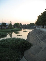
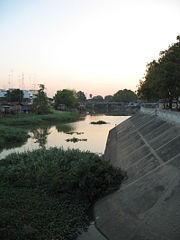
. The rest is intermixed between plains and hills. Beside the Lopburi River
Lopburi River
The Lopburi River is a tributary of the Chao Phraya River in central Thailand. It splits from the Chao Phraya river at Tambon Bang Phutsa, Singburi. Passing through Tha Wung district and the town of Lopburi, it enters the Chao Phraya together with the Pa Sak River at the town of Ayutthaya. It is...
, the important water resource are the Sap Lek Reservoir and Khlong Raphiphat. Neighboring districts are (from the west clockwise) Tha Wung
Amphoe Tha Wung
Tha Wung is a district in western part of Lopburi Province, central Thailand.-Geography:The main water resource of Tha Wung is the Lopburi and Bang Kham rivers...
, Ban Mi
Amphoe Ban Mi
Ban Mi is a district in the western part Lopburi Province, central Thailand.-History:The district was created in 1883, then named Sanam Chaeng. When the district office was moved to Ban Huay Kaew, the district name was changed to Huay Kaew as well...
, Khok Samrong
Amphoe Khok Samrong
Khok Samrong is a district of Lopburi Province in central Thailand. The district is the transportation hub of the province.-History:Originally named Phu Kha, the minor district was renamed to Sa Bot in 1909...
and Phatthana Nikhom
Amphoe Phatthana Nikhom
Phatthana Nikhom is a district of Lopburi Province in central Thailand.-Geography:Neighboring districts are Chai Badan and Tha Luang of Lopburi Province, Muak Lek, Wang Muang, Kaeng Khoi, Chaloem Phra Kiat and Phra Phutthabat of Saraburi Province, and Mueang Lop Buri and Khok Samrong of...
of Lopburi Province, Phra Phutthabat
Amphoe Phra Phutthabat
Phra Phutthabat is a district located in Saraburi Province, Thailand.The district is named after the Wat Phra Phutthabat, meaning temple of Buddha's footprint. In the 17th century a hunter found a puddle of water which looked like a footprint...
, Nong Don
Amphoe Nong Don
Nong Don is a district in the northwestern part of Saraburi Province in central Thailand.-History:10 km from Bang Khamoad there is a big pond. The west side of the pond has a big Tummy-wood tree or in Thai Kradon...
and Don Phut
Amphoe Don Phut
Don Phut is a district in the western part of Saraburi Province, Thailand.-History:Tambon Don Phut, Dong Ta Ngao, Ban Luang and Phai Lio were separated from Ban Mo district to create the minor district Don Phut on May 31, 1971...
of Saraburi Province
Saraburi Province
Saraburi is one of the central provinces of Thailand. Neighboring provinces are Lopburi, Nakhon Ratchasima, Nakhon Nayok, Pathum Thani and Ayutthaya. Saraburi has been an important town since ancient times...
, Ban Phraek
Amphoe Ban Phraek
Ban Phraek is the northernmost district of Ayutthaya Province.-History:Tambon Phraek was separated from Maha Rat district to become a minor district in 1937...
of Ayutthaya Province
Ayutthaya Province
Phra Nakhon Si Ayutthaya is one of the central provinces of Thailand. Neighboring provinces are Ang Thong, Lop Buri, Saraburi, Pathum Thani, Nonthaburi, Nakhon Pathom and Suphan Buri....
, and Chaiyo
Amphoe Chaiyo
Chaiyo is a district in eastern part of Ang Thong Province.-History:The name of Ban Chaiyo traces back to when King Naresuan the Great and his brother, who later became King Ekathotsarot, won against the King of Lan Na and Burmese soldiers in this area...
of Ang Thong Province
Ang Thong Province
Ang Thong is one of the central provinces of Thailand. The name means "golden bowl" which refer to Angthong as a central for prosperity as it has a lot of rice fields....
.
Administration
The district is subdivided into 24 subdistricts (tambonTambon
Tambon is a local government unit in Thailand. Below district and province , they form the third administrative subdivision level. As of the 2009 there are 7255 tambon, not including the 169 khwaeng of Bangkok, which are set at the same administrative level, thus every district contains 8-10 tambon...
), which are further subdivided into 223 villages (muban
Muban
Muban is the lowest administrative subdivision of Thailand. Usually translated as village, they are the subdivision of tambon. As of 2008, there are 74944 administrative villages in Thailand. As of the 1990 census, the average village consisted of 144 households or 746 persons.A muban does not...
). The town (thesaban mueang) Lopburi
Lopburi
Lopburi ) is the capital city of Lopburi Province in Thailand. It is located about 150 km north-east of Bangkok. As of 2006 it has a population of 26,500...
covers the complete tambon Tha Hin and parts of Thale Chup Son. There are two further subdistrict municipalities (thesaban tambon) - Khao Phra Ngam covering the complete tambon Khao Phra Ngam, and Khok Tum covering the tambon Khok Tum and Nikhom Sang Ton Eng. There are further 19 Tambon administrative organizations (TAO).
| No. | Name | Thai | Inh. Population A population is all the organisms that both belong to the same group or species and live in the same geographical area. The area that is used to define a sexual population is such that inter-breeding is possible between any pair within the area and more probable than cross-breeding with individuals... |
|---|---|---|---|
| 1. | Thale Chup Son | ทะเลชุบศร | 34,742 |
| 2. | Tha Hin | ท่าหิน | 8,487 |
| 3. | Kok Ko | กกโก | 8,304 |
| 4. | Kong Thanu | โก่งธนู | 4,893 |
| 5. | Khao Phra Ngam | เขาพระงาม | 28,664 |
| 6. | Khao Sam Yot | เขาสามยอด | 28,262 |
| 7. | Khok Kathiam | โคกกะเทียม | 4,833 |
| 8. | Khok Lam Phan | โคกลำพาน | 3,554 |
| 9. | Khok Tum | โคกตูม | 15,504 |
| 10. | Ngio Rai | งิ้วราย | 5,592 |
| 11. | Don Pho | ดอนโพธิ์ | 3,582 |
| 12. | Talung | ตะลุง | 5,218 |
| 14. | Tha Khae | ท่าแค | 13,666 |
| 15. | Tha Sala | ท่าศาลา | 12,515 |
| 16. | Nikhom Sang Ton Eng | นิคมสร้างตนเอง | 11,737 |
| 17. | Bang Khan Mak | บางขันหมาก | 8,935 |
| 18. | Ban Khoi | บ้านข่อย | 3,081 |
| 19. | Thai Talat | ท้ายตลาด | 3,039 |
| 20. | Pa Tan | ป่าตาล | 12,523 |
| 21. | Phrommat | พรหมมาสตร์ | 6,779 |
| 22. | Pho Kao Ton | โพธิ์เก้าต้น | 10,540 |
| 23. | Pho Tru | โพธิ์ตรุ | 2,721 |
| 24. | Si Khlong | สี่คลอง | 1,067 |
| 25. | Thanon Yai | ถนนใหญ่ | 9,604 |
Geocode 13 not used.