
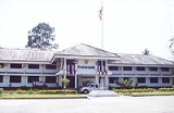
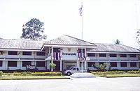
Amphoe Kanchanadit
Encyclopedia
Kanchanadit is a district (Amphoe
) in the province Surat Thani
in the south of Thailand
.
Thathong Mai (named Khlong Tha Phechon at that time). During the reign of King Nangklao (Rama III) the town was moved because its location was malaria-infested, and renamed to Kanchanadit. It was a provincial town (Mueang
) under the control of Nakhon Si Thammarat
. During the reign of Rama IV it was put under supervision of Bangkok directly. In 1899 the province was merged with Chaiya
and was thus reduced to be an Amphoe
.
of the Gulf of Thailand
in the north, the low river valley of the Tapi River
to the west, and the Nakhon Si Thammarat mountain range
in the south and west. The Tai Rom Yen National Park
was created on December 31, 1991, protecting the forested hills of that mountain range. The main river in the district is the Thathong River, which empties into the Tapi estuary.
Neighboring districts are (from the east clockwise) Don Sak
, Sichon
and Nopphitam of Nakhon Si Thammarat Province
, Ban Na San
and Mueang Surat Thani
.
The main road through the district is Thailand Route 401
, which connects Kanchanadit with the town Surat Thani. Thailand Route 44
begins at Route 401 and runs to the southwest as part of a landbridge across the Malay Peninsula.
 The district Kanchanadit is subdivided into 13 subdistricts (tambon
), which are further subdivided into 117 villages (muban
). There are three subdistrict municipalities (thesaban tambon) - Kanchanadit covers the whole tambon Ka Dae, Tha Thong Mai covers parts of the tambon Tha Thong Mai, and Chang Sai the whole tambon Chang Sai. There are also 11 tambon administrative organizations (TAO), for each tambon except Ka Dae and Chang Sai which are administrated by the thesaban tambon.
Amphoe
An amphoe is the second level administrative subdivision of Thailand. Usually translated as district, amphoe make up the provinces, and are analogous to a county seat...
) in the province Surat Thani
Surat Thani Province
Surat Thani is the largest of the southern provinces of Thailand, on the eastern shore of the Gulf of Thailand. Surat Thani means City of Good People, the title given to the city by King Vajiravudh ....
in the south of Thailand
Thailand
Thailand , officially the Kingdom of Thailand , formerly known as Siam , is a country located at the centre of the Indochina peninsula and Southeast Asia. It is bordered to the north by Burma and Laos, to the east by Laos and Cambodia, to the south by the Gulf of Thailand and Malaysia, and to the...
.
History
Originally the town was named Thathong (ท่าทอง) and was located at the shore of KhlongKhlong
A khlong is the general name for a canal in the central plain of Thailand. These canals are spawned by the Chao Phraya, the Tha Chin, the Mae Klong Rivers and their tributaries...
Thathong Mai (named Khlong Tha Phechon at that time). During the reign of King Nangklao (Rama III) the town was moved because its location was malaria-infested, and renamed to Kanchanadit. It was a provincial town (Mueang
Mueang
Mueang were historical semi-independent city-states or principalities in present-day Thailand, Laos, parts of northern Vietnam and the Shan State of Myanmar. Smaller Mueang were subordinate to more powerful neighboring Mueang, which in turn were subordinate to the central king, as described in...
) under the control of Nakhon Si Thammarat
Nakhon Si Thammarat kingdom
Nakhon Si Thammarat Kingdom was one of the major constituent city states of the Siamese kingdoms of Sukhothai and later Ayutthaya and controlled a big part of the Malay peninsula...
. During the reign of Rama IV it was put under supervision of Bangkok directly. In 1899 the province was merged with Chaiya
Chaiya
Chaiya is a district and town in Surat Thani Province in southern Thailand. The town itself has a population of 13,133 , while the whole district has a population of 47,750.-Geography:...
and was thus reduced to be an Amphoe
Amphoe
An amphoe is the second level administrative subdivision of Thailand. Usually translated as district, amphoe make up the provinces, and are analogous to a county seat...
.
Geography
The district is located in the eastern part of the province. It stretches from the coast to the Bandon BayBandon Bay
Bandon Bay is a bay in the Gulf of Thailand in the Surat Thani Province, extending from the Sui cape in Chaiya district in the northwest to the Kanchanadit district to the east. The total coastline is about 100 km. The bay is dominated by the estuary of the rivers Tapi and Phum Duang...
of the Gulf of Thailand
Gulf of Thailand
The Gulf of Thailand , also known in to Malays as Teluk Siam literally meant Gulf of Siam, is a shallow arm of the South China Sea.-Geography:...
in the north, the low river valley of the Tapi River
Tapi River, Thailand
The Tapi river is the longest river in southern Thailand. The river originates at the Khao Luang, and has a wide estuary into the Gulf of Thailand at Bandon Bay near the town of Surat Thani. It has a length of 230 km....
to the west, and the Nakhon Si Thammarat mountain range
Nakhon Si Thammarat mountain range
The Nakhon Si Thammarat mountain range is a mountain range on the Malay peninsula in southern Thailand, running in a north-south direction. This mountain chain is also sometimes named Banthat mountain range , a name which is however also used to refer to the Chanthaburi mountain...
in the south and west. The Tai Rom Yen National Park
Tai Rom Yen National Park
The Tai Rom Yen National Park is located in the east of the Surat Thani Province in Southern Thailand. The park consists of the northern end of the Nakhon Si Thammarat mountain range and is mostly covered with forests...
was created on December 31, 1991, protecting the forested hills of that mountain range. The main river in the district is the Thathong River, which empties into the Tapi estuary.
Neighboring districts are (from the east clockwise) Don Sak
Amphoe Don Sak
Don Sak is a district in eastern Surat Thani Province. The ferry port to Samui Island is located in the district.Neighboring districts are Khanom and Sichon and the district Kanchanadit...
, Sichon
Amphoe Sichon
Sichon is a district of Nakhon Si Thammarat Province, southern Thailand.-Geography:The district is located in the northern part of the province. Neighboring districts are Tha Sala and Nopphitam of Nakhon Si Thammarat Province, Kanchanadit and Don Sak of Surat Thani Province, and Khanom of Nakhon...
and Nopphitam of Nakhon Si Thammarat Province
Nakhon Si Thammarat Province
Nakhon Si Thammarat is one of the southern provinces of Thailand, at the eastern shore of the Gulf of Thailand...
, Ban Na San
Amphoe Ban Na San
-Geography:Neighboring districts are Nopphitam and Phipun of Nakhon Si Thammarat Province, Wiang Sa, Khian Sa, Ban Na Doem, Mueang Surat Thani and Kanchanadit....
and Mueang Surat Thani
Amphoe Mueang Surat Thani
Mueang Surat Thani is the capital district of Surat Thani Province in southern Thailand.-Geography:The district is located at the mouth of the Tapi River into the Bandon Bay of the Gulf of Thailand...
.
The main road through the district is Thailand Route 401
Thailand Route 401
Thailand Route 401 is a highway in southern Thailand. It starts from the west coast of the Thai-Malay Peninsula at an intersection with Route 4 near Amphoe Takua Pa, Phang Nga Province....
, which connects Kanchanadit with the town Surat Thani. Thailand Route 44
Thailand Route 44
Route 44 is part of land bridge project. It starts at intersection with Route 4 in Krabi Province, running northeast, and ends at intersection with Route 401 in Surat Thani Province.-Route Details:...
begins at Route 401 and runs to the southwest as part of a landbridge across the Malay Peninsula.
Administration
Tambon
Tambon is a local government unit in Thailand. Below district and province , they form the third administrative subdivision level. As of the 2009 there are 7255 tambon, not including the 169 khwaeng of Bangkok, which are set at the same administrative level, thus every district contains 8-10 tambon...
), which are further subdivided into 117 villages (muban
Muban
Muban is the lowest administrative subdivision of Thailand. Usually translated as village, they are the subdivision of tambon. As of 2008, there are 74944 administrative villages in Thailand. As of the 1990 census, the average village consisted of 144 households or 746 persons.A muban does not...
). There are three subdistrict municipalities (thesaban tambon) - Kanchanadit covers the whole tambon Ka Dae, Tha Thong Mai covers parts of the tambon Tha Thong Mai, and Chang Sai the whole tambon Chang Sai. There are also 11 tambon administrative organizations (TAO), for each tambon except Ka Dae and Chang Sai which are administrated by the thesaban tambon.
|
External links
- amphoe.com (Thai)
- http://www.kanchanaditcity.org (Thai)