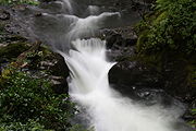
Afon Dulas
Encyclopedia

River
A river is a natural watercourse, usually freshwater, flowing towards an ocean, a lake, a sea, or another river. In a few cases, a river simply flows into the ground or dries up completely before reaching another body of water. Small rivers may also be called by several other names, including...
forming the border between the counties of Gwynedd
Gwynedd
Gwynedd is a county in north-west Wales, named after the old Kingdom of Gwynedd. Although the second biggest in terms of geographical area, it is also one of the most sparsely populated...
and Powys
Powys
Powys is a local-government county and preserved county in Wales.-Geography:Powys covers the historic counties of Montgomeryshire and Radnorshire, most of Brecknockshire , and a small part of Denbighshire — an area of 5,179 km², making it the largest county in Wales by land area.It is...
in Wales
Wales
Wales is a country that is part of the United Kingdom and the island of Great Britain, bordered by England to its east and the Atlantic Ocean and Irish Sea to its west. It has a population of three million, and a total area of 20,779 km²...
.
Prior to local government reorganisation it formed the boundary between Sir Meirionnydd/Merionethshire
Merionethshire
Merionethshire is one of thirteen historic counties of Wales, a vice county and a former administrative county.The administrative county of Merioneth, created under the Local Government Act 1888, was abolished under the Local Government Act 1972 on April 1, 1974...
and Sir Drefaldwyn/Montgomeryshire
Montgomeryshire
Montgomeryshire, also known as Maldwyn is one of thirteen historic counties and a former administrative county of Wales. Montgomeryshire is still used as a vice-county for wildlife recording...
.
Route
It rises from a source in the hills above AberllefenniAberllefenni
Aberllefenni is a village in the south of Gwynedd, Wales. It lies in the valley of the Afon Dulas.Part of the ancient county of Merionethshire, it is the location of Foel Grochan, a slate quarry which together with Hen Chwarel and Ceunant Ddu formed the Aberllefenni Slate Quarry, which extracted...
and passes through Corris
Corris
Corris is a village in the south of Snowdonia in the Welsh county of Gwynedd. Although the Snowdonia National Park covers much of the area around Corris, the village is not within the park. The name is possibly derived from the English word "quarries", and the extensive slate quarries that surround...
, Esgairgeiliog
Esgairgeiliog
Esgairgeiliog is a village in the valley of the Afon Dulas in Powys, Wales. From 1536 until 1974 the village lay in the historic county of Montgomeryshire ....
and Pantperthog
Pantperthog
Pantperthog is a hamlet in southern Gwynedd in Wales, 2 miles north of Machynlleth and 14 miles southeast of Dolgellau. Nearby is the former Llwyngwern quarry, which is now the Centre for Alternative Technology...
before joining the Afon Dyfi at Ffridd Gate
Ffridd Gate
Ffridd Gate was a station on the Corris Railway in Wales, serving the hamlet of the same name close to where the Afon Dulas meets the Afon Dyfi and the village of Llanwrin. Close by was the railway's bridge over the Dyfi, originally a wooden trestle construction and later a three-span steel bridge...
near Machynlleth
Machynlleth
Machynlleth is a market town in Powys, Wales. It is in the Dyfi Valley at the intersection of the A487 and the A489 roads.Machynlleth was the seat of Owain Glyndŵr's Welsh Parliament in 1404, and as such claims to be the "ancient capital of Wales". However, it has never held any official...
.
Roads and Railways in the Dulas valley
- The A487 trunk road follows the valley from Ffridd Gate to Corris
- The Roman road Sarn HelenSarn Helenright|thumb|250px|A section of Sarn Helen near Betws-y-coed.Sarn Helen was a Roman road in Wales, running from Aberconwy in the north to Carmarthen in the south.It was some 160 miles in length...
probably followed the valley from Aberllefenni to Ffridd Gate - The Corris RailwayCorris RailwayThe Corris Railway is a narrow gauge preserved railway based in Corris on the border between Merionethshire and Montgomeryshire in Mid-Wales....
ran through the valley from Aberllefenni to Ffridd Gate
Tributaries
- Nant Ralltgoed (also known as Nant Ceiswyn)
- Afon Llefenni
- Afon Deri (formerly known as Afon Corris)
- Nant y Goedwig
- Afon Glesyrch
- Nant y Cadian
- Nant y Darren
South Dulas
Another river also called the Afon Dulas joins the Dyfi from the south, upstream of its confluenceConfluence
Confluence, in geography, describes the meeting of two or more bodies of water.Confluence may also refer to:* Confluence , a property of term rewriting systems...
with the North Dulas. Locally this is referred to as the South Dulas. It rises in Glaslyn, below the slopes of Foel Fadian, and passes the hamlet
Hamlet (place)
A hamlet is usually a rural settlement which is too small to be considered a village, though sometimes the word is used for a different sort of community. Historically, when a hamlet became large enough to justify building a church, it was then classified as a village...
of Forge
Forge, Powys
Forge is a village in the county of Powys, Wales near to Machynlleth. It lies on the southern Afon Dulas on the mountain road to Dylife and Llanidloes.- External links :*...
and Plas Dolguog before joining the Dyfi.

