
A660 road
Encyclopedia
The A660 is a major road
in West Yorkshire
, England
that runs from Leeds
to Burley-in-Wharfedale where it meets the A65
. (The A65 also starts in Leeds and runs parallel to, and south of, the A660. It continues to Ilkley
, Skipton
, Settle
and Kendal
as a main trans-Pennine
route.) The A660 is approximately 10 miles (16 km) long, and crosses the watershed from Airedale
to lower Wharfedale
. For most of its length the road is in the metropolitan district of the City of Leeds
; the last 0.4 mile (0.643736 km) is in City of Bradford
district.
, officially at the junction of Woodhouse Lane and Claypit Lane. The northbound carriageway passes Leeds Metropolitan University
's "civic quarter" campus, crosses the A58(M) (Leeds Inner Ring Road
), which is in a cutting, and passes the University of Leeds
with its landmark tower. The southbound carriageway is separated, at one stage by several terraced streets. The carriageways combine before crossing Woodhouse Moor
to Hyde Park
. The road passes the buildings of Leeds Girls' High School
and climbs to Headingley
, passing St Michael's Church
and many shops and bars including the Arndale Centre
. Shortly after the church, a plaque shows the site of the original oak
tree which gave its name to the wapentake of Skyrack
("Shire oak"): this is reflected in two pub names and nearby Shire Oak Road. The road continues through Far Headingley
and West Park
.
This stretch of the A660 was the route of the first tram service in Leeds (to Far Headingley) and is still a major bus corridor, with several peak hour bus lane
s. It suffers from high congestion, and there were historic plans to create a Headingley bypass. Line 2 of the proposed Leeds Supertram
was to be on this road, as is the "North Route" proposed in 2009 for New Generation Transport trolleybus service.
Many students live near the road, and its many licensed premises host the Otley Run
pub crawl.
The road has several names in this section: Woodhouse Lane from Claypit Lane to Hyde Park (but Blenheim Walk for the separated southbound carriageway), Headingley Lane between Hyde Park and St Michael's church, Headingley, and Otley Road beyond this point.
- officially Leeds Outer Ring Road) at Lawnswood
, and then passes the western part of Adel
. At Golden Acre Park
the road crosses the Leeds Country Way
footpath, which uses the underpass taking pedestrians from the car park to the park. The road passes east of the main part of Bramhope
village, and the next major intersection is the A658 Bradford
to Harrogate
road: Pool Bank is a steep hill leading north-east from this junction down to Pool-in-Wharfedale
. The road skirts the northern slopes of The Chevin
before bypassing Otley
to the south along the line of the former Otley and Ilkley Joint Railway (opened 1865, closed 1967). At the end of the Otley bypass the road crosses the A6038 (Otley to Bradford
), and then follows the River Wharfe
before joining the A65
at the roundabout at the start of the Burley-in-Wharfedale bypass.
About 0.4 mile (0.643736 km) before its end, the road crosses into City of Bradford
metropolitan district, having been in the City of Leeds
district for the rest of its length. The road is only separated from the county of North Yorkshire
by a few yards and the width of the river Wharfe, which here forms the county boundary.
The road is known as Otley Road until Golden Acre Park, then Leeds Road until the start of the Otley bypass.
and Cookridge
and over the top of The Chevin
, while the road from Leeds to Headingley was only a country lane. The Leeds-Otley Turnpike Trust was established in 1755, and improved the road from Leeds to Headingley and thence to Cookridge to join the existing road. There were toll bars in Woodhouse Lane and at Otley, and in 1775 a third toll house was built in Headingley village. In 1836 the trustees commissioned George Hayward to design a new route to bypass the steep slopes of The Chevin. The necessary Act of Parliament was passed in 1837, and the new stretch of road was opened in 1842, following today's route along the north side of the hill. Tolls on the road were abolished in January 1867, following the Leeds Improvement Act of 1866.
The first suburban horse-drawn bus
service in Leeds was that to Far Headingley along this road, started in 1838, providing five services daily. The first horse-drawn tram
in Leeds followed, in 1871. Fittingly, the number 1 bus service operated by First Leeds
still runs on a route which includes the A660 from the city centre past Headingley and Lawnswood before turning off towards Holt Park
.
Road
A road is a thoroughfare, route, or way on land between two places, which typically has been paved or otherwise improved to allow travel by some conveyance, including a horse, cart, or motor vehicle. Roads consist of one, or sometimes two, roadways each with one or more lanes and also any...
in West Yorkshire
West Yorkshire
West Yorkshire is a metropolitan county within the Yorkshire and the Humber region of England with a population of 2.2 million. West Yorkshire came into existence as a metropolitan county in 1974 after the passage of the Local Government Act 1972....
, England
England
England is a country that is part of the United Kingdom. It shares land borders with Scotland to the north and Wales to the west; the Irish Sea is to the north west, the Celtic Sea to the south west, with the North Sea to the east and the English Channel to the south separating it from continental...
that runs from Leeds
Leeds
Leeds is a city and metropolitan borough in West Yorkshire, England. In 2001 Leeds' main urban subdivision had a population of 443,247, while the entire city has a population of 798,800 , making it the 30th-most populous city in the European Union.Leeds is the cultural, financial and commercial...
to Burley-in-Wharfedale where it meets the A65
A65 road
The A65 is a major road in England. It runs north west from Leeds in Yorkshire via Kirkstall, Horsforth, Yeadon, Guiseley, Ilkley and Skipton, passes west of Settle, then continues through Ingleton and Kirkby Lonsdale before terminating at Kendal in Cumbria....
. (The A65 also starts in Leeds and runs parallel to, and south of, the A660. It continues to Ilkley
Ilkley
Ilkley is a spa town and civil parish in West Yorkshire, in the north of England. Ilkley civil parish includes the adjacent village of Ben Rhydding and is a ward within the metropolitan borough of Bradford. Approximately north of Bradford, the town lies mainly on the south bank of the River Wharfe...
, Skipton
Skipton
Skipton is a market town and civil parish within the Craven district of North Yorkshire, England. It is located along the course of both the Leeds and Liverpool Canal and the River Aire, on the south side of the Yorkshire Dales, northwest of Bradford and west of York...
, Settle
Settle
Settle is a small market town and civil parish within the Craven district of North Yorkshire, England. It is served by the Settle railway station, which is located near the town centre, and Giggleswick railway station which is a mile away. It is from Leeds Bradford Airport...
and Kendal
Kendal
Kendal, anciently known as Kirkby in Kendal or Kirkby Kendal, is a market town and civil parish within the South Lakeland District of Cumbria, England...
as a main trans-Pennine
Pennines
The Pennines are a low-rising mountain range, separating the North West of England from Yorkshire and the North East.Often described as the "backbone of England", they form a more-or-less continuous range stretching from the Peak District in Derbyshire, around the northern and eastern edges of...
route.) The A660 is approximately 10 miles (16 km) long, and crosses the watershed from Airedale
Airedale
Airedale is a geographic area in Yorkshire, England, corresponding to the river valley of the River Aire . The valley stretches from the river's origin in Malham which is in the Yorkshire Dales, down past Keighley and Bingley, through Leeds and Castleford and on to join the Humber...
to lower Wharfedale
Wharfedale
Wharfedale is one of the Yorkshire Dales in England. It is the valley of the River Wharfe. Towns and villages in Wharfedale include Buckden, Kettlewell, Conistone, Grassington, Hebden, Ilkley, Burley-in-Wharfedale, Otley, Pool-in-Wharfedale, Arthington, Collingham, and Wetherby...
. For most of its length the road is in the metropolitan district of the City of Leeds
City of Leeds
The City of Leeds is a local government district of West Yorkshire, England, governed by Leeds City Council, with the status of a city and metropolitan borough. The metropolitan district includes Leeds and the towns of Farsley, Garforth, Guiseley, Horsforth, Morley, Otley, Pudsey, Rothwell,...
; the last 0.4 mile (0.643736 km) is in City of Bradford
City of Bradford
The City of Bradford is a local government district of West Yorkshire, England with the status of a city and metropolitan borough. It is named after its largest settlement, Bradford, but covers a far larger area which includes the towns of Keighley, Shipley, Bingley, Ilkley, Haworth, Silsden and...
district.
Leeds city centre to Leeds Ring Road
The A660 starts in Leeds city centreLeeds City Centre
Leeds city centre is the central business district of Leeds, England. It is within the Leeds Central parliamentary constituency, represented by Hilary Benn as MP since a by-election in 1999...
, officially at the junction of Woodhouse Lane and Claypit Lane. The northbound carriageway passes Leeds Metropolitan University
Leeds Metropolitan University
Leeds Metropolitan University is a British University with three campuses. Two are situated in Leeds, West Yorkshire, England while the third is situated in Bhopal, India...
's "civic quarter" campus, crosses the A58(M) (Leeds Inner Ring Road
Leeds Inner Ring Road
The Leeds Inner Ring Road is part-motorway and part-A roads in Leeds, West Yorkshire, England, which forms a ring road around the city centre. It has six different road numbers that are all sections of longer roads...
), which is in a cutting, and passes the University of Leeds
University of Leeds
The University of Leeds is a British Redbrick university located in the city of Leeds, West Yorkshire, England...
with its landmark tower. The southbound carriageway is separated, at one stage by several terraced streets. The carriageways combine before crossing Woodhouse Moor
Woodhouse Moor
Woodhouse Moor is an open space approximately one mile from Leeds city centre, West Yorkshire, England. Today it consists of 3 parts: a formal park, Woodhouse Moor , of around 26 hectares in area on the west of Woodhouse Lane , and two other open areas on the east of it...
to Hyde Park
Hyde Park, Leeds
Hyde Park is an inner-city area of north-west Leeds, West Yorkshire, England, situated between the University of Leeds and Headingley.It is mainly in the Hyde Park & Woodhouse ward, though some areas of what is often considered to be Hyde Park lie within the Headingley Ward . The boundary is...
. The road passes the buildings of Leeds Girls' High School
Leeds Girls' High School
Leeds Girls' High School was an independent, selective, fee paying school for girls aged 3–18 located in Headingley, Leeds, West Yorkshire, England...
and climbs to Headingley
Headingley
Headingley is a suburb of Leeds in West Yorkshire, England. It is approximately two miles out of the city centre, to the north west along the A660 road...
, passing St Michael's Church
St Michael and All Angels Church, Headingley
Headingley Parish Church or the Parish Church of St Michael and All Angels in Headingley, a suburban area of the city of Leeds, West Yorkshire, England is a large Victorian Church of England parish church in the centre of the parish on Otley Road...
and many shops and bars including the Arndale Centre
Arndale Centres
Arndale Centres were the first "American-style" malls to be built in the United Kingdom. In total twenty-two Arndales have been built in the UK, and two in Australia...
. Shortly after the church, a plaque shows the site of the original oak
Oak
An oak is a tree or shrub in the genus Quercus , of which about 600 species exist. "Oak" may also appear in the names of species in related genera, notably Lithocarpus...
tree which gave its name to the wapentake of Skyrack
Skyrack
Skyrack was a wapentake of the West Riding of Yorkshire, England. It was split into upper and lower divisions and centred on Leeds. The Lower Division included the parishes of Aberford, Bardsey, Barwick-in-Elmet, Kippax, Thorner, Whitkirk and part of Harewood, while the Upper Division included...
("Shire oak"): this is reflected in two pub names and nearby Shire Oak Road. The road continues through Far Headingley
Far Headingley
Far Headingley is an area of Leeds, West Yorkshire, England approximately 3 miles north of the city centre. The parish of Far Headingley was created in 1868....
and West Park
West Park, Leeds
West Park is a suburb of north-west Leeds, West Yorkshire, England, north of Headingley. It is a mixed area of private suburban housing and suburban council estates. The name derives from its main park containing playing fields together with a conservation area of grassy meadow ending in woodland...
.
This stretch of the A660 was the route of the first tram service in Leeds (to Far Headingley) and is still a major bus corridor, with several peak hour bus lane
Bus lane
A bus lane or bus only lane is a lane restricted to buses, and generally used to speed up public transport that would be otherwise held up by traffic congestion...
s. It suffers from high congestion, and there were historic plans to create a Headingley bypass. Line 2 of the proposed Leeds Supertram
Leeds Supertram
The Leeds Supertram was a proposed light rail/tram system in Leeds and West Yorkshire in England.-Initial proposals:Proposals for the reinstatement of trams or a light rail system in Leeds which were withdrawn in 1959 have been ongoing since the 1970s with various plans for varying light rail...
was to be on this road, as is the "North Route" proposed in 2009 for New Generation Transport trolleybus service.
Many students live near the road, and its many licensed premises host the Otley Run
Otley Run
The Otley Run is a pub crawl in Leeds, West Yorkshire. The route follows the A660, also known as Otley Road at the point the pub crawl commonly begins...
pub crawl.
The road has several names in this section: Woodhouse Lane from Claypit Lane to Hyde Park (but Blenheim Walk for the separated southbound carriageway), Headingley Lane between Hyde Park and St Michael's church, Headingley, and Otley Road beyond this point.
Leeds Ring Road to A65
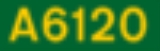
The A660 crosses the A6120 (Leeds Ring RoadLeeds Outer Ring Road
The Leeds Outer Ring Road is a main road that runs around most of the perimeter of the city of Leeds, West Yorkshire, England. The ring road is approximately long and consists of single and dual carriageways....
- officially Leeds Outer Ring Road) at Lawnswood
Lawnswood
Lawnswood is a small suburb in the north west of the city of Leeds in West Yorkshire, England. As such it is north north east of the West Yorkshire Urban Area.- Location :It is bordered by West Park, Adel, Ireland Wood and Holt Park...
, and then passes the western part of Adel
Adel, Leeds
Adel is a suburb in North Leeds, West Yorkshire, England. It is situated between Cookridge, Holt Park, Weetwood and Alwoodley. To the north are the villages of Arthington and Bramhope and the market town of Otley...
. At Golden Acre Park
Golden Acre Park
Golden Acre Park is a public park between Adel and Bramhope, Leeds, West Yorkshire, England , administered by Leeds City Council. It is on the A660 Otley Road and covers an area of ....
the road crosses the Leeds Country Way
Leeds Country Way
The Leeds Country Way is a circular long-distance footpath of 62 miles around Leeds, West Yorkshire, England. It is never more than 7 miles from Leeds City Square, but is mainly rural with extensive views in the outlying areas of the Leeds metropolitan district...
footpath, which uses the underpass taking pedestrians from the car park to the park. The road passes east of the main part of Bramhope
Bramhope
Bramhope is a village and civil parish in the City of Leeds metropolitan borough, West Yorkshire, England, north of Holt Park and north east of Cookridge....
village, and the next major intersection is the A658 Bradford
Bradford
Bradford lies at the heart of the City of Bradford, a metropolitan borough of West Yorkshire, in Northern England. It is situated in the foothills of the Pennines, west of Leeds, and northwest of Wakefield. Bradford became a municipal borough in 1847, and received its charter as a city in 1897...
to Harrogate
Harrogate
Harrogate is a spa town in North Yorkshire, England. The town is a tourist destination and its visitor attractions include its spa waters, RHS Harlow Carr gardens, and Betty's Tea Rooms. From the town one can explore the nearby Yorkshire Dales national park. Harrogate originated in the 17th...
road: Pool Bank is a steep hill leading north-east from this junction down to Pool-in-Wharfedale
Pool-in-Wharfedale
Pool in Wharfedale is a village and civil parish in the Lower Wharfedale area, 10 miles north of Leeds city centre and 2 miles east of Otley. It is in the City of Leeds metropolitan borough, West Yorkshire and within the historic boundaries of the West Riding of Yorkshire. It is in the LS21 ...
. The road skirts the northern slopes of The Chevin
The Chevin
The Chevin is the name given to the ridge on the south side of Wharfedale in Leeds, West Yorkshire, England, overlooking the market town of Otley.-History and features:...
before bypassing Otley
Otley
-Transport:The main roads through the town are the A660 to the south east, which connects Otley to Bramhope, Adel and Leeds city centre, and the A65 to the west, which goes to Ilkley and Skipton. The A6038 heads to Guiseley, Shipley and Bradford, connecting with the A65...
to the south along the line of the former Otley and Ilkley Joint Railway (opened 1865, closed 1967). At the end of the Otley bypass the road crosses the A6038 (Otley to Bradford
Bradford
Bradford lies at the heart of the City of Bradford, a metropolitan borough of West Yorkshire, in Northern England. It is situated in the foothills of the Pennines, west of Leeds, and northwest of Wakefield. Bradford became a municipal borough in 1847, and received its charter as a city in 1897...
), and then follows the River Wharfe
River Wharfe
The River Wharfe is a river in Yorkshire, England. For much of its length it is the county boundary between West Yorkshire and North Yorkshire. The name Wharfe is Celtic and means "twisting, winding".The valley of the River Wharfe is known as Wharfedale...
before joining the A65
A65 road
The A65 is a major road in England. It runs north west from Leeds in Yorkshire via Kirkstall, Horsforth, Yeadon, Guiseley, Ilkley and Skipton, passes west of Settle, then continues through Ingleton and Kirkby Lonsdale before terminating at Kendal in Cumbria....
at the roundabout at the start of the Burley-in-Wharfedale bypass.
About 0.4 mile (0.643736 km) before its end, the road crosses into City of Bradford
City of Bradford
The City of Bradford is a local government district of West Yorkshire, England with the status of a city and metropolitan borough. It is named after its largest settlement, Bradford, but covers a far larger area which includes the towns of Keighley, Shipley, Bingley, Ilkley, Haworth, Silsden and...
metropolitan district, having been in the City of Leeds
City of Leeds
The City of Leeds is a local government district of West Yorkshire, England, governed by Leeds City Council, with the status of a city and metropolitan borough. The metropolitan district includes Leeds and the towns of Farsley, Garforth, Guiseley, Horsforth, Morley, Otley, Pudsey, Rothwell,...
district for the rest of its length. The road is only separated from the county of North Yorkshire
North Yorkshire
North Yorkshire is a non-metropolitan or shire county located in the Yorkshire and the Humber region of England, and a ceremonial county primarily in that region but partly in North East England. Created in 1974 by the Local Government Act 1972 it covers an area of , making it the largest...
by a few yards and the width of the river Wharfe, which here forms the county boundary.
The road is known as Otley Road until Golden Acre Park, then Leeds Road until the start of the Otley bypass.
History
In the early 18th century the main road from Leeds to Otley ran via BurleyBurley, Leeds
Burley is a suburb of north-west Leeds, West Yorkshire, England, characterised by the red brick terraced housing, much of which was built in the period 1899 - 1903 and green spaces. Sometimes called 'The Cardigan Triangle , it stretches north from the main Kirkstall Road, towards Hyde Park and...
and Cookridge
Cookridge
Cookridge is a suburb of north-west Leeds, West Yorkshire, England. It is a mixture of suburban, twentieth-century private housing and a very small amount of council housing bordering Tinshill. It is in the Adel and Wharfedale ward of City of Leeds metropolitan district, and the Leeds North West...
and over the top of The Chevin
The Chevin
The Chevin is the name given to the ridge on the south side of Wharfedale in Leeds, West Yorkshire, England, overlooking the market town of Otley.-History and features:...
, while the road from Leeds to Headingley was only a country lane. The Leeds-Otley Turnpike Trust was established in 1755, and improved the road from Leeds to Headingley and thence to Cookridge to join the existing road. There were toll bars in Woodhouse Lane and at Otley, and in 1775 a third toll house was built in Headingley village. In 1836 the trustees commissioned George Hayward to design a new route to bypass the steep slopes of The Chevin. The necessary Act of Parliament was passed in 1837, and the new stretch of road was opened in 1842, following today's route along the north side of the hill. Tolls on the road were abolished in January 1867, following the Leeds Improvement Act of 1866.
The first suburban horse-drawn bus
Bus
A bus is a road vehicle designed to carry passengers. Buses can have a capacity as high as 300 passengers. The most common type of bus is the single-decker bus, with larger loads carried by double-decker buses and articulated buses, and smaller loads carried by midibuses and minibuses; coaches are...
service in Leeds was that to Far Headingley along this road, started in 1838, providing five services daily. The first horse-drawn tram
Horsecar
A horsecar or horse-drawn tram is an animal-powered streetcar or tram.These early forms of public transport developed out of industrial haulage routes that had long been in existence, and from the omnibus routes that first ran on public streets in the 1820s, using the newly improved iron or steel...
in Leeds followed, in 1871. Fittingly, the number 1 bus service operated by First Leeds
First Leeds
First Leeds is one of the bus companies serving the area of West Yorkshire, England. It forms part of FirstGroup, a company operating transport services across the British Isles and in North America...
still runs on a route which includes the A660 from the city centre past Headingley and Lawnswood before turning off towards Holt Park
Holt Park
Holt Park is a medium-sized low-rise 1970s housing estate in the northwest suburbs of Leeds, West Yorkshire, England. It is approximately from the Leeds city centre situated between Tinshill, Cookridge and Adel, and is at the edge of the Leeds metropolitan urban fringe, bordering the green belt...
.