

A127 road
Encyclopedia
The A127, also known as the Southend Arterial Road, is one of the trunk road
s in England
linking London
with Southend-on-Sea
, the other being the A13. It is a dual carriageway
for its entire length, rare on a trunk road since the only others are the A14 and the A282
, and is known as the Southend Arterial Road except for part of its length in Southend-on-Sea. It is also streetlit for its whole length despite its majority coverage through rural land.
The A127 starts as a turning off the A12 at Gallows Corner
in the London Borough of Havering
. Traffic heading towards London goes over a flyover and joins the A12 traffic which merges onto the slip-road from the roundabout below, which is where the A127 ends. Traffic heading towards Southend also uses the flyover as well as slip roads. Its first significant junction is a crossroads after 1/2 mi (Squirrel
s Heath) with Squirrels Heath Road and Ardleigh Green
Road. There are traffic lights here, but after that, there are no traffic lights or roundabouts until it enters Southend-on-Sea, though there are a few side turnings. Major junctions follow the layout similar to motorways, being served by high-level or low-level roundabouts accessed via slip roads.
4 miles (6.4 km) after Gallows Corner the A127 crosses the M25 motorway
at M25 Junction 29 - the start of slip-roads on the A127, and then immediately crosses into Essex
. After a couple of minor side road exits, the next major junction is with the A128
Brentwood exit at the Halfway House (pub) near West Horndon
, 3 miles (4.8 km) east of the M25
.
It continues through southern Essex and into the Basildon district. The next junction is 2 miles (3.2 km) east of the Halfway House, for the Dunton (Ford centre) and Laindon exit.
1 miles (1.6 km) further on there is a bizarre junction called the Fortune of War. Originally this site was a fully fledged roundabout with a couple of exits for local routes around Laindon, with a Happy Eater and the Fortune of War pub (where the junction name comes from) adjacent to the roundabout. Some years ago, Essex County Council tried to improve safety on the route by filling in the middle of the road so the junction was a 'half' roundabout on either side. This has arguably made the junction more dangerous rather than less, with many lorries from further afield not understanding the junction and overturning. There have been numerous campaigns to ditch the roundabout completely and straighten the road. However the county council says it cannot afford to do this, mainly because a large number of utilities are sited in the middle of the junction, which would all have to be moved. The landscape of the junction has also changed, with the Happy Eater long since demolished and rebuilt as a McDonalds. Even the Fortune of War pub has now been demolished and replaced with housing, although the loss of the pub has had no effect on the junction name. As of 2007, the Fortune of War junction had a 40 mi/h Gatso Camera on the east and west bound approach to this junction although during 2008 these were decommissioned. Towards the end of October 2009 these were recommissioned.
After the Fortune of War, the first of the Basildon exits appears immediately, for the A176 to Basildon town centre and hospital, and Billericay
. After a couple of exits to Crays Hill, the next junction is over 2 miles (3.2 km) on for the A132 Basildon
and Wickford
exit. London bound there is an exit for the Mayflower Retail Park just past the A132, so traffic Southend bound needs to use the roundabout to head the other way briefly to the Mayflower exit.
 2 miles (3.2 km) on Southend bound is the junction with the A1245 (old A130) and new A130 Chelmsford
/Canvey Island
exit. Indeed the new A130 bridge over the A127 just before this exit is one of only two non-junction bridges on the entire stretch of road (the other being between the Fortune of War and A176, a minor road to Steeple View). 2 miles (3.2 km) further on is the A129 exit to Rayleigh
and Hadleigh
(Rayleigh Weir underpass, built 4 December 1989 to early 1992), which is often the start of congestion in the evenings into Southend. After this, the road soon enters into Southend-on-Sea.
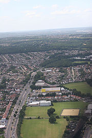
In Southend, at the Kent Elms junction with the A1015 Rayleigh Road, there are traffic lights. The A127 changes its name to Prince Avenue. There is a roundabout (the first since Gallows Corner) and a turn-off for a shopping centre(Tesco). The next roundabout is Cuckoo Corner. The exits to the north and east are both the A1159
, to London Southend Airport
and Thorpe Bay
respectively. However, the A127 turns south and becomes Victoria Avenue.
The A127 terminates in the centre of Southend-on-Sea at a roundabout junction with the A13. Southend Victoria Station
adjoins this roundabout.
comprising Priory Crescent and upgrade the Cuckoo Corner junction connecting it to the A127. The road scheme has faced controversy due to its location over the Royal Saxon tomb in Prittlewell
grave site and environmental loss and has been the site of an anti-road protest
camp known as Camp Bling
.
Trunk road
A trunk road, trunk highway, or strategic road is a major road—usually connecting two or more cities, ports, airports, and other things.—which is the recommended route for long-distance and freight traffic...
s in England
England
England is a country that is part of the United Kingdom. It shares land borders with Scotland to the north and Wales to the west; the Irish Sea is to the north west, the Celtic Sea to the south west, with the North Sea to the east and the English Channel to the south separating it from continental...
linking London
London
London is the capital city of :England and the :United Kingdom, the largest metropolitan area in the United Kingdom, and the largest urban zone in the European Union by most measures. Located on the River Thames, London has been a major settlement for two millennia, its history going back to its...
with Southend-on-Sea
Southend-on-Sea
Southend-on-Sea is a unitary authority area, town, and seaside resort in Essex, England. The district has Borough status, and comprises the towns of Chalkwell, Eastwood, Leigh-on-Sea, North Shoebury, Prittlewell, Shoeburyness, Southchurch, Thorpe Bay, and Westcliff-on-Sea. The district is situated...
, the other being the A13. It is a dual carriageway
Dual carriageway
A dual carriageway is a class of highway with two carriageways for traffic travelling in opposite directions separated by a central reservation...
for its entire length, rare on a trunk road since the only others are the A14 and the A282
A282 road
The A282 is a road that includes the Dartford Crossing across the River Thames between Essex and Kent in England. It forms part of the London Orbital connecting junctions 2 and 31 of the M25, and a part of the unsigned Euroroute E15. It has junctions numbered to fit inside the sequence of the M25...
, and is known as the Southend Arterial Road except for part of its length in Southend-on-Sea. It is also streetlit for its whole length despite its majority coverage through rural land.
The A127 starts as a turning off the A12 at Gallows Corner
Gallows Corner
Gallows Corner is an area and major road junction in the London Borough of Havering near Romford.The junction is a large roundabout with five exits and a flyover...
in the London Borough of Havering
London Borough of Havering
The London Borough of Havering is a London borough in North East London, England and forms part of Outer London. The principal town in Havering is Romford and the other main communities are Hornchurch, Upminster and Rainham. The borough is mainly characterised by suburban development with large...
. Traffic heading towards London goes over a flyover and joins the A12 traffic which merges onto the slip-road from the roundabout below, which is where the A127 ends. Traffic heading towards Southend also uses the flyover as well as slip roads. Its first significant junction is a crossroads after 1/2 mi (Squirrel
Squirrel
Squirrels belong to a large family of small or medium-sized rodents called the Sciuridae. The family includes tree squirrels, ground squirrels, chipmunks, marmots , flying squirrels, and prairie dogs. Squirrels are indigenous to the Americas, Eurasia, and Africa and have been introduced to Australia...
s Heath) with Squirrels Heath Road and Ardleigh Green
Ardleigh Green
Ardleigh Green is a place in the London Borough of Havering, east London, England and part of the Hornchurch post town. It is a suburban development....
Road. There are traffic lights here, but after that, there are no traffic lights or roundabouts until it enters Southend-on-Sea, though there are a few side turnings. Major junctions follow the layout similar to motorways, being served by high-level or low-level roundabouts accessed via slip roads.
4 miles (6.4 km) after Gallows Corner the A127 crosses the M25 motorway
M25 motorway
The M25 motorway, or London Orbital, is a orbital motorway that almost encircles Greater London, England, in the United Kingdom. The motorway was first mooted early in the 20th century. A few sections, based on the now abandoned London Ringways plan, were constructed in the early 1970s and it ...
at M25 Junction 29 - the start of slip-roads on the A127, and then immediately crosses into Essex
Essex
Essex is a ceremonial and non-metropolitan county in the East region of England, and one of the home counties. It is located to the northeast of Greater London. It borders with Cambridgeshire and Suffolk to the north, Hertfordshire to the west, Kent to the South and London to the south west...
. After a couple of minor side road exits, the next major junction is with the A128
A128 road
The A128 is an A-road in Essex, England.The road is approximately long and it runs from Orsett, at its southern origin, to Chipping Ongar at its north end....
Brentwood exit at the Halfway House (pub) near West Horndon
West Horndon
West Horndon is a village in the south of the Brentwood borough of Essex on the boundary with Thurrock and in the East of England. It is located 20 miles east north-east of Charing Cross in London....
, 3 miles (4.8 km) east of the M25
M25 motorway
The M25 motorway, or London Orbital, is a orbital motorway that almost encircles Greater London, England, in the United Kingdom. The motorway was first mooted early in the 20th century. A few sections, based on the now abandoned London Ringways plan, were constructed in the early 1970s and it ...
.
It continues through southern Essex and into the Basildon district. The next junction is 2 miles (3.2 km) east of the Halfway House, for the Dunton (Ford centre) and Laindon exit.
1 miles (1.6 km) further on there is a bizarre junction called the Fortune of War. Originally this site was a fully fledged roundabout with a couple of exits for local routes around Laindon, with a Happy Eater and the Fortune of War pub (where the junction name comes from) adjacent to the roundabout. Some years ago, Essex County Council tried to improve safety on the route by filling in the middle of the road so the junction was a 'half' roundabout on either side. This has arguably made the junction more dangerous rather than less, with many lorries from further afield not understanding the junction and overturning. There have been numerous campaigns to ditch the roundabout completely and straighten the road. However the county council says it cannot afford to do this, mainly because a large number of utilities are sited in the middle of the junction, which would all have to be moved. The landscape of the junction has also changed, with the Happy Eater long since demolished and rebuilt as a McDonalds. Even the Fortune of War pub has now been demolished and replaced with housing, although the loss of the pub has had no effect on the junction name. As of 2007, the Fortune of War junction had a 40 mi/h Gatso Camera on the east and west bound approach to this junction although during 2008 these were decommissioned. Towards the end of October 2009 these were recommissioned.
After the Fortune of War, the first of the Basildon exits appears immediately, for the A176 to Basildon town centre and hospital, and Billericay
Billericay
Billericay is a town and civil parish in the Basildon borough of Essex, England. It lies within the London Basin, has a population of 40,000, and constitutes a commuter town east of central London. The town has three secondary schools and a variety of open spaces...
. After a couple of exits to Crays Hill, the next junction is over 2 miles (3.2 km) on for the A132 Basildon
Basildon
Basildon is a town located in the Basildon District of the county of Essex, England.It lies east of Central London and south of the county town of Chelmsford...
and Wickford
Wickford
Wickford is a town in the south of the English county of Essex, with a population of more than 32,500. Located approximately 30 miles east of London, it falls within the District of Basildon along with Basildon, Billericay, Laindon and Pitsea....
exit. London bound there is an exit for the Mayflower Retail Park just past the A132, so traffic Southend bound needs to use the roundabout to head the other way briefly to the Mayflower exit.
Chelmsford
Chelmsford is the county town of Essex, England and the principal settlement of the borough of Chelmsford. It is located in the London commuter belt, approximately northeast of Charing Cross, London, and approximately the same distance from the once provincial Roman capital at Colchester...
/Canvey Island
Canvey Island
Canvey Island is a civil parish and reclaimed island in the Thames estuary in England. It is separated from the mainland of south Essex by a network of creeks...
exit. Indeed the new A130 bridge over the A127 just before this exit is one of only two non-junction bridges on the entire stretch of road (the other being between the Fortune of War and A176, a minor road to Steeple View). 2 miles (3.2 km) further on is the A129 exit to Rayleigh
Rayleigh, Essex
Rayleigh is a market town and civil parish in the District of Rochford in Essex, England, located between Chelmsford and Southend-on-Sea. It lies to the east of central London. It has a population of 30,196, having expanded rapidly in the 1960s.-Toponymy:...
and Hadleigh
Hadleigh, Essex
Hadleigh is a town in southeast Essex, England, on the A13 between Benfleet and Leigh-on-Sea with a population of about 18,300.-History:Hadleigh is known for its castle, and the country park that surrounds it. The castle has been a romantic ruin for a few hundred years, but parts of two towers are...
(Rayleigh Weir underpass, built 4 December 1989 to early 1992), which is often the start of congestion in the evenings into Southend. After this, the road soon enters into Southend-on-Sea.
In Southend, at the Kent Elms junction with the A1015 Rayleigh Road, there are traffic lights. The A127 changes its name to Prince Avenue. There is a roundabout (the first since Gallows Corner) and a turn-off for a shopping centre(Tesco). The next roundabout is Cuckoo Corner. The exits to the north and east are both the A1159
A1159 road
The A1159 road is a short road skirting the north of Southend-on-Sea from Prittlewell to Southchurch, in Essex, England.-A127/A1159 Cuckoo Corner & Priory Crescent:...
, to London Southend Airport
London Southend Airport
London Southend Airport or Southend Airport is a regional airport in the district of Rochford within Essex, England.During the 1960s, Southend was the third-busiest airport in the United Kingdom. It remained London's third-busiest airport in terms of passengers handled until the end of the 1970s,...
and Thorpe Bay
Thorpe Bay
Thorpe Bay is an affluent area within the Borough of Southend-on-Sea in Essex, England, situated on the Thames Estuary.Thorpe Bay is situated within the Southend ward of Thorpe. It is around 4 miles to the east of Southend. Originally the area was called Thorpe, but was renamed Thorpe Bay after its...
respectively. However, the A127 turns south and becomes Victoria Avenue.
The A127 terminates in the centre of Southend-on-Sea at a roundabout junction with the A13. Southend Victoria Station
Southend Victoria railway station
Southend Victoria is one of two major railway stations in the town of Southend-on-Sea in Essex, England. The station is the terminus of the Shenfield to Southend Line, which is a branch of the Great Eastern Main Line...
adjoins this roundabout.
A127/A1159 Cuckoo Corner & Priory Crescent
In 2000 plans were announced to dual an 800 m stretch of the A1159A1159 road
The A1159 road is a short road skirting the north of Southend-on-Sea from Prittlewell to Southchurch, in Essex, England.-A127/A1159 Cuckoo Corner & Priory Crescent:...
comprising Priory Crescent and upgrade the Cuckoo Corner junction connecting it to the A127. The road scheme has faced controversy due to its location over the Royal Saxon tomb in Prittlewell
Royal saxon tomb in Prittlewell
The Royal Saxon tomb in Prittlewell is a high-status Anglo-Saxon tomb excavated at Prittlewell, north of Southend-on-Sea, in the English county of Essex....
grave site and environmental loss and has been the site of an anti-road protest
Road protest (UK)
Road protest in the United Kingdom usually occurs as a reaction to a stated intention by the empowered authorities to build a new road, or to modify an existing road. Protests may also be made by those wishing to see new roads built or improvements made to existing roads. Motivations for protests...
camp known as Camp Bling
Camp Bling
Camp Bling, the long running UK based road protest camp was set up in Southend-on-Sea in Essex during September 2005 to obstruct a £25m plan to widen the Priory Crescent section of the A1159 road over the Royal Saxon tomb in Prittlewell...
.