
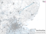
A11 road
Encyclopedia
The A11 is a major road
in England
. It runs roughly north east from London
to Norwich
, Norfolk
, although after the M11
opened in the 1970s and then the A12 extension in 1999, a lengthy section has been downgraded between the suburbs of east London
and the north-west corner of the county of Essex
. It also multiplexes/overlaps with the A14 on the Newmarket bypass.
in the City of London
, next to Bank tube station, and went eastwards along Cornhill and Leadenhall Street
, past Aldgate Pump
and along Aldgate. All this part has been declassified and is now a minor road. Thus the A11 now starts at Aldgate
, just inside the eastern boundary of the City of London
. The first stretch is Aldgate High Street, passing south of Aldgate tube station
. Traffic is one way round the Aldgate one-way system.
and the East End of London
. It becomes Whitechapel High Street
(containing Aldgate East tube station
), again part of the Aldgate one-way system. The A11 passes through Whitechapel
, past Whitechapel tube station
and the Royal London Hospital
. It becomes Mile End Road at the eastern end of Whitechapel Road
, at Mile End Gate, the former toll gate for the turnpike, passing Stepney Green tube station
, with Stepney
to the south, and then Mile End tube station
. Next, it becomes Bow Road
, passing Bow Road tube station
and Bow Church DLR station
.
There is a dual carriageway flyover over the Bow Interchange roundabout, a junction with the A12. However, at the end of the flyover, the A11 crosses into the London Borough of Newham
and becomes a western extension to the A118
. Following the opening of the A12 extension in 1999, the A11 was re-numbered to make it seem a less important road and encourage traffic to use the new dual carriageway between there and Leytonstone
. This is the western limit of the downgraded section. The A11 number won't reappear until Stump Cross in deepest Essex
(see below).
as it crosses the valley of the River Lea (Originally, there was a strait or narrow ford here, which gave its name to Stratford
). This dual carriageway section ends in a one-way system marking Stratford town centre. The eastbound road, Great Eastern Road, passes Stratford station
. The westbound road is called Broadway and The Grove; the latter road runs north-south. At the end of the one-way system, The Grove becomes two-way, still going north. The old A11 then becomes Leytonstone
Road; Maryland railway station
is on the corner where the name change occurs. Meanwhile, the A118 heads eastward along its route towards Ilford
and Romford
. The A112 also joins the one-way system, heading north-south.
into the London Borough of Waltham Forest
and becomes High Road Leytonstone, passing under the Gospel Oak to Barking Line
.
and briefly becomes a southern extension to the A113 before turning into the A1199 (a duplicate designation, given that there is another A1199 in Islington
), and is called Hollybush Hill, Woodford Road and High Road Woodford Green
. It crosses over the A406
at Gates Corner (named after a Ford car showroom, which was turned into residential flats in 2006), but since the A406 was widened when the M11 was constructed there are no slip roads for interchange and the old A11 passes over the top. It merges with the A104 Woodford New Road by the Statue of Winston Churchill
and becomes the A104 High Road Woodford Green
. North, the road was A11 until the M11
opened in the 1970s, triggering the downgrading of the A11 between Woodford and Stump Cross (see below). Just before leaving London for Essex
, the A104 becomes Epping
New Road.
, following the mainly straight course of the Epping New Road turnpike constructed during the second quarter of the nineteenth century. It then reaches the Wake Arms Roundabout and becomes the B1393. Just after leaving the forest, it crosses the M25 motorway
(here lowered into a cut-and-cover tunnel), then continuing through Epping
. The B1393 ends at junction 7 of the M11, and the route of the A11 goes along the A414
through the eastern suburbs of Harlow
, having been rerouted slightly to the west at the end of the 1950s in order to avoid passing through Potter Street. The road then becomes the A1184 and goes through Sawbridgeworth
: through the rest of the Essex stretch between Harlow and Stump Cross the road follows a more traditionally English course, characterized by bends of varying and sometimes uneven radii, with just one straight mile (1.6 km) (to the south of Littlebury
) along the north Essex stretch.
Just south of Bishop's Stortford
, the A1184 turns sharp left to become part of the Bishop's Stortford bypass, but the route of the A11 becomes the B1383 and goes through the town and through Stansted Mountfitchet
and Quendon
. It crosses the M11 and passes Audley End. The B1383 ends at 9A (Stump Cross), the end of a spur that comes off the M11 at Junction 9, near Great Chesterford
.
Junction 9A, and the A11 is now a trunk road
. It roughly follows the route of a Roman road
for the remainder of its length.
The A11 formerly went through Newmarket; that stretch is now the A1304. The Newmarket bypass, opened to traffic in July 1975, is a dual carriageway. The western end is the A11, but most of its length is a multiplex/overlap with the A14. The A11 re-appears north-east of Newmarket, and remains a dual carriageway until Mildenhall, Suffolk
. The road bypasses Mildenhall before entering Norfolk in the Thetford Forest
, passing the 113 feet (34.4 m) tall Elveden War Memorial.
. The road continues, bypassing Thetford, Attleborough
and Wymondham
, although up until recently it ran through the centre of Thetford, causing heavy traffic on the route. It also passes the Snetterton Motor Racing Circuit
. On entering Norwich, it becomes single carriageway again and is called Newmarket Road. It terminates at the St Stephens Street roundabout
near the city centre.
Various sections of the A11 between the junction the M11 in Cambridgeshire and Norwich have recently been upgraded to dual carriageway
. The Roudham Heath to Attleborough section was dualled in 2003
and the Attleborough bypass was dualed in 2007.
A single 16 km stretch of single carriageway now remains, between the Fiveways roundabout near Barton Mills and the start of the Thetford bypass to the south of Thetford.
, bypassing Elveden to the North and joining the western end of the Thetford
Bypass are well advanced. Draft Orders together with Environmental Statement were published in Autumn 2008 however dates for the pre-inquiry and the public inquiry have yet to be announced. The Labour government's Secretary of State for Transport
announced the scheme would be bought forward by 18 months to 2010 with an open date of 2013 in November 2008 in response to the Financial crisis of 2007-2008. Supporters expressed concern in September 2010 that the scheme would be cancelled as part of the coalition government's
comprehensive spending review
noting that the report from the public inquiry had not yet been signed off by the Department for Transport.
The Highways Agency
has published an official map of the proposed scheme and a Google overlay map is also available. The original cost estimate was £30 million rising to £60 million in March 2007
and then to £113-£157 million by August 2008.
The project has received strong support from local business groups and local government
and is expected to reduce journey times by 3 minutes off-peak and up to 25 minutes at peak times. Environmental campaign groups believe that in a time of economic downturn it would be better to invest in local public transport rather than on costly road schemes.
On 20th October 2010, the government gave the green light, indicating that the works will continue.
Road
A road is a thoroughfare, route, or way on land between two places, which typically has been paved or otherwise improved to allow travel by some conveyance, including a horse, cart, or motor vehicle. Roads consist of one, or sometimes two, roadways each with one or more lanes and also any...
in England
England
England is a country that is part of the United Kingdom. It shares land borders with Scotland to the north and Wales to the west; the Irish Sea is to the north west, the Celtic Sea to the south west, with the North Sea to the east and the English Channel to the south separating it from continental...
. It runs roughly north east from London
London
London is the capital city of :England and the :United Kingdom, the largest metropolitan area in the United Kingdom, and the largest urban zone in the European Union by most measures. Located on the River Thames, London has been a major settlement for two millennia, its history going back to its...
to Norwich
Norwich
Norwich is a city in England. It is the regional administrative centre and county town of Norfolk. During the 11th century, Norwich was the largest city in England after London, and one of the most important places in the kingdom...
, Norfolk
Norfolk
Norfolk is a low-lying county in the East of England. It has borders with Lincolnshire to the west, Cambridgeshire to the west and southwest and Suffolk to the south. Its northern and eastern boundaries are the North Sea coast and to the north-west the county is bordered by The Wash. The county...
, although after the M11
M11 motorway
The M11 motorway in England is a major road running approximately north from the North Circular Road in South Woodford in north-east London to the A14, north-west of Cambridge.-Route:...
opened in the 1970s and then the A12 extension in 1999, a lengthy section has been downgraded between the suburbs of east London
London
London is the capital city of :England and the :United Kingdom, the largest metropolitan area in the United Kingdom, and the largest urban zone in the European Union by most measures. Located on the River Thames, London has been a major settlement for two millennia, its history going back to its...
and the north-west corner of the county of Essex
Essex
Essex is a ceremonial and non-metropolitan county in the East region of England, and one of the home counties. It is located to the northeast of Greater London. It borders with Cambridgeshire and Suffolk to the north, Hertfordshire to the west, Kent to the South and London to the south west...
. It also multiplexes/overlaps with the A14 on the Newmarket bypass.
City of London
Originally, the A11 started at the Bank of EnglandBank of England
The Bank of England is the central bank of the United Kingdom and the model on which most modern central banks have been based. Established in 1694, it is the second oldest central bank in the world...
in the City of London
City of London
The City of London is a small area within Greater London, England. It is the historic core of London around which the modern conurbation grew and has held city status since time immemorial. The City’s boundaries have remained almost unchanged since the Middle Ages, and it is now only a tiny part of...
, next to Bank tube station, and went eastwards along Cornhill and Leadenhall Street
Leadenhall Street
Leadenhall Street is a street in the City of London, formerly part of the A11. It runs east from Cornhill to Aldgate, and west vice-versa. Aldgate Pump is at the junction with Aldgate...
, past Aldgate Pump
Aldgate Pump
Aldgate Pump is an historic water pump in the City of London, at the junction of Aldgate High Street , Fenchurch Street and Leadenhall Street. The pump marks the start of the A13 road to Shoeburyness, and is a Grade II listed structure. As a well, it was mentioned during the reign of King John...
and along Aldgate. All this part has been declassified and is now a minor road. Thus the A11 now starts at Aldgate
Aldgate
Aldgate was the eastern most gateway through London Wall leading from the City of London to Whitechapel and the east end of London. Aldgate gives its name to a ward of the City...
, just inside the eastern boundary of the City of London
City of London
The City of London is a small area within Greater London, England. It is the historic core of London around which the modern conurbation grew and has held city status since time immemorial. The City’s boundaries have remained almost unchanged since the Middle Ages, and it is now only a tiny part of...
. The first stretch is Aldgate High Street, passing south of Aldgate tube station
Aldgate tube station
Aldgate tube station is a London Underground station located at Aldgate in the City of London.The station is on the Circle Line between Tower Hill and Liverpool Street. It is also the eastern terminus of the Metropolitan Line...
. Traffic is one way round the Aldgate one-way system.
Tower Hamlets
East of Aldgate station, the A11 enters the London Borough of Tower HamletsLondon Borough of Tower Hamlets
The London Borough of Tower Hamlets is a London borough to the east of the City of London and north of the River Thames. It is in the eastern part of London and covers much of the traditional East End. It also includes much of the redeveloped Docklands region of London, including West India Docks...
and the East End of London
East End of London
The East End of London, also known simply as the East End, is the area of London, England, United Kingdom, east of the medieval walled City of London and north of the River Thames. Although not defined by universally accepted formal boundaries, the River Lea can be considered another boundary...
. It becomes Whitechapel High Street
Whitechapel High Street
Whitechapel High Street is a road in Whitechapel in the East End of London, connecting Aldgate High Street with Whitechapel Road. Now part of the A11 it was anciently part of the Roman road from London to Colchester...
(containing Aldgate East tube station
Aldgate East tube station
Aldgate East is a London Underground station located between Aldgate and Whitechapel in the London Borough of Tower Hamlets.The station is in Travelcard Zone 1...
), again part of the Aldgate one-way system. The A11 passes through Whitechapel
Whitechapel
Whitechapel is a built-up inner city district in the London Borough of Tower Hamlets, London, England. It is located east of Charing Cross and roughly bounded by the Bishopsgate thoroughfare on the west, Fashion Street on the north, Brady Street and Cavell Street on the east and The Highway on the...
, past Whitechapel tube station
Whitechapel tube station
Whitechapel is a London Underground and London Overground station on Whitechapel Road in the Whitechapel neighbourhood of the London Borough of Tower Hamlets in east London, England. The station is located on the east–west tracks shared by the District line and Hammersmith and City line and is on...
and the Royal London Hospital
Royal London Hospital
The Royal London Hospital was founded in September 1740 and was originally named The London Infirmary. The name changed to The London Hospital in 1748 and then to The Royal London Hospital on its 250th anniversary in 1990. The first patients were treated at a house in Featherstone Street,...
. It becomes Mile End Road at the eastern end of Whitechapel Road
Whitechapel Road
Whitechapel Road is a major arterial road in the East End of London, England. It connects Whitechapel High Street to the west with Mile End Road to the east and forms part of the A11 road. It is a main shopping street in the Whitechapel area of Tower Hamlets and has a street market...
, at Mile End Gate, the former toll gate for the turnpike, passing Stepney Green tube station
Stepney Green tube station
Stepney Green is a London Underground station on the District and Hammersmith and City lines, located on the junction of Globe Road and Mile End Road in the Stepney area of east London, United Kingdom.-History:...
, with Stepney
Stepney
Stepney is a district of the London Borough of Tower Hamlets in London's East End that grew out of a medieval village around St Dunstan's church and the 15th century ribbon development of Mile End Road...
to the south, and then Mile End tube station
Mile End tube station
Mile End is a London Underground station in Tower Hamlets, East London, served by the Hammersmith & City, District and Central Lines. It is in Travelcard Zone 2.-History:...
. Next, it becomes Bow Road
Bow Road
Bow Road is a thoroughfare in Bow, Tower Hamlets, London, England. The road forms part of the A11, running from Aldgate to Norwich in Norfolk. To the west the road becomes Mile End Road, and to the east at the Bow Interchange roundabout, there is a junction with the A12.The College of Technology...
, passing Bow Road tube station
Bow Road tube station
Bow Road tube station is on the District and Hammersmith & City lines of the London Underground. It is on Bow Road in Bow, east London, about 300 metres from Bow Church DLR station and is in fare zone 2...
and Bow Church DLR station
Bow Church DLR station
Bow Church station is a station on the Docklands Light Railway on Bow Road, in the Bow neighbourhood of east London. The station is located on the DLR's Stratford branch, between Devons Road and Pudding Mill Lane stations and is in Travelcard Zone 2. It is within 300 m walking distance of Bow...
.
There is a dual carriageway flyover over the Bow Interchange roundabout, a junction with the A12. However, at the end of the flyover, the A11 crosses into the London Borough of Newham
London Borough of Newham
The London Borough of Newham is a London borough formed from the towns of West Ham and East Ham, within East London.It is situated east of the City of London, and is north of the River Thames. According to 2006 estimates, Newham has one of the highest ethnic minority populations of all the...
and becomes a western extension to the A118
A118 road
The A118 is a road in east London, England which links Bow with Gallows Corner, east of Romford. The section from Stratford to Gallows Corner formed the original route of the A12 until the designation was transferred to the Eastern Avenue soon after the latter opened in 1925...
. Following the opening of the A12 extension in 1999, the A11 was re-numbered to make it seem a less important road and encourage traffic to use the new dual carriageway between there and Leytonstone
Leytonstone
Leytonstone is an area of east London and part of the London Borough of Waltham Forest. It is a high density suburban area, located seven miles north east of Charing Cross in the ceremonial county of Greater London and the historic county of Essex...
. This is the western limit of the downgraded section. The A11 number won't reappear until Stump Cross in deepest Essex
Essex
Essex is a ceremonial and non-metropolitan county in the East region of England, and one of the home counties. It is located to the northeast of Greater London. It borders with Cambridgeshire and Suffolk to the north, Hertfordshire to the west, Kent to the South and London to the south west...
(see below).
Newham (former A11 section)
The A118 briefly becomes a dual carriagewayDual carriageway
A dual carriageway is a class of highway with two carriageways for traffic travelling in opposite directions separated by a central reservation...
as it crosses the valley of the River Lea (Originally, there was a strait or narrow ford here, which gave its name to Stratford
Stratford, London
Stratford is a place in the London Borough of Newham, England. It is located east northeast of Charing Cross and is one of the major centres identified in the London Plan. It was historically an agrarian settlement in the ancient parish of West Ham, which transformed into an industrial suburb...
). This dual carriageway section ends in a one-way system marking Stratford town centre. The eastbound road, Great Eastern Road, passes Stratford station
Stratford station
Stratford station is a large multilevel railway station in Stratford, east London. The station is served by the National Rail services National Express East Anglia, London Overground and c2c, by London Underground's Central and Jubilee lines, and by the Docklands Light Railway . Stratford is in...
. The westbound road is called Broadway and The Grove; the latter road runs north-south. At the end of the one-way system, The Grove becomes two-way, still going north. The old A11 then becomes Leytonstone
Leytonstone
Leytonstone is an area of east London and part of the London Borough of Waltham Forest. It is a high density suburban area, located seven miles north east of Charing Cross in the ceremonial county of Greater London and the historic county of Essex...
Road; Maryland railway station
Maryland railway station
Maryland railway station is located in Maryland, an area of Stratford, in the London Borough of Newham in east London, England. It was originally known as Maryland Point, and is just east of Stratford station in Travelcard Zone 3, on the Great Eastern Main Line. It was first opened on 6 January...
is on the corner where the name change occurs. Meanwhile, the A118 heads eastward along its route towards Ilford
Ilford
Ilford is a large cosmopolitan town in East London, England and the administrative headquarters of the London Borough of Redbridge. It is located northeast of Charing Cross and is one of the major metropolitan centres identified in the London Plan. It forms a significant commercial and retail...
and Romford
Romford
Romford is a large suburban town in north east London, England and the administrative headquarters of the London Borough of Havering. It is located northeast of Charing Cross and is one of the major metropolitan centres identified in the London Plan...
. The A112 also joins the one-way system, heading north-south.
Waltham Forest (former A11 section)
North of Maryland, the old A11 crosses from the London Borough of NewhamLondon Borough of Newham
The London Borough of Newham is a London borough formed from the towns of West Ham and East Ham, within East London.It is situated east of the City of London, and is north of the River Thames. According to 2006 estimates, Newham has one of the highest ethnic minority populations of all the...
into the London Borough of Waltham Forest
London Borough of Waltham Forest
The London Borough of Waltham Forest is in northeast London, England. Officially, it forms part of Outer London as it borders Essex. However, it can be seen that the NE London boundary does not extend far compared to elsewhere in the city...
and becomes High Road Leytonstone, passing under the Gospel Oak to Barking Line
Gospel Oak to Barking line
The Gospel Oak – Barking Line is a railway line in north and east London which connects Gospel Oak in North London and Barking in East London as part of the London Overground network. It is sometimes known as the Goblin , although this is a nickname rather than an official title...
.
Redbridge (former A11 section)
Once past the Green Man Interchange, the former A11 route enters the London Borough of RedbridgeLondon Borough of Redbridge
The London Borough of Redbridge is a London borough in outer north-east London. Its administrative headquarters is at Redbridge Town Hall in Ilford. The local authority is Redbridge London Borough Council.-Etymology:...
and briefly becomes a southern extension to the A113 before turning into the A1199 (a duplicate designation, given that there is another A1199 in Islington
Islington
Islington is a neighbourhood in Greater London, England and forms the central district of the London Borough of Islington. It is a district of Inner London, spanning from Islington High Street to Highbury Fields, encompassing the area around the busy Upper Street...
), and is called Hollybush Hill, Woodford Road and High Road Woodford Green
Woodford Green
Woodford Green, formerly in the county of Essex, is part of the North East London suburb of Woodford, on the edge of Epping Forest, mostly within the London Borough of Redbridge with a small part on the western side of the green within the London Borough of Waltham Forest .-History:Woodford Green...
. It crosses over the A406
A406 road
The A406 or the North Circular Road is a road which crosses North London, UK, linking West and East London. It, together with the South Circular Road, forms a ring road through the inner part of Outer London...
at Gates Corner (named after a Ford car showroom, which was turned into residential flats in 2006), but since the A406 was widened when the M11 was constructed there are no slip roads for interchange and the old A11 passes over the top. It merges with the A104 Woodford New Road by the Statue of Winston Churchill
Winston Churchill
Sir Winston Leonard Spencer-Churchill, was a predominantly Conservative British politician and statesman known for his leadership of the United Kingdom during the Second World War. He is widely regarded as one of the greatest wartime leaders of the century and served as Prime Minister twice...
and becomes the A104 High Road Woodford Green
Woodford Green
Woodford Green, formerly in the county of Essex, is part of the North East London suburb of Woodford, on the edge of Epping Forest, mostly within the London Borough of Redbridge with a small part on the western side of the green within the London Borough of Waltham Forest .-History:Woodford Green...
. North, the road was A11 until the M11
M11 motorway
The M11 motorway in England is a major road running approximately north from the North Circular Road in South Woodford in north-east London to the A14, north-west of Cambridge.-Route:...
opened in the 1970s, triggering the downgrading of the A11 between Woodford and Stump Cross (see below). Just before leaving London for Essex
Essex
Essex is a ceremonial and non-metropolitan county in the East region of England, and one of the home counties. It is located to the northeast of Greater London. It borders with Cambridgeshire and Suffolk to the north, Hertfordshire to the west, Kent to the South and London to the south west...
, the A104 becomes Epping
Epping
Epping is a small market town and civil parish in the Epping Forest district of the County of Essex, England. It is located north-east of Loughton, south of Harlow and north-west of Brentwood....
New Road.
Essex (former A11 section)
Shortly after entering Essex, the A104 enters Epping ForestEpping Forest
Epping Forest is an area of ancient woodland in south-east England, straddling the border between north-east Greater London and Essex. It is a former royal forest, and is managed by the City of London Corporation....
, following the mainly straight course of the Epping New Road turnpike constructed during the second quarter of the nineteenth century. It then reaches the Wake Arms Roundabout and becomes the B1393. Just after leaving the forest, it crosses the M25 motorway
M25 motorway
The M25 motorway, or London Orbital, is a orbital motorway that almost encircles Greater London, England, in the United Kingdom. The motorway was first mooted early in the 20th century. A few sections, based on the now abandoned London Ringways plan, were constructed in the early 1970s and it ...
(here lowered into a cut-and-cover tunnel), then continuing through Epping
Epping
Epping is a small market town and civil parish in the Epping Forest district of the County of Essex, England. It is located north-east of Loughton, south of Harlow and north-west of Brentwood....
. The B1393 ends at junction 7 of the M11, and the route of the A11 goes along the A414
A414 road
The A414 is a major road in England. It runs from the A41 at a junction west of Hemel Hempstead in Hertfordshire, through the town to junction 8 of the M1 motorway at Buncefield, and running parallel to the M1 until junction 7, heading south of St Albans, east through Hatfield, Hertford, then...
through the eastern suburbs of Harlow
Harlow
Harlow is a new town and local government district in Essex, England. It is located in the west of the county and on the border with Hertfordshire, on the Stort Valley, The town is near the M11 motorway and forms part of the London commuter belt.The district has a current population of 78,889...
, having been rerouted slightly to the west at the end of the 1950s in order to avoid passing through Potter Street. The road then becomes the A1184 and goes through Sawbridgeworth
Sawbridgeworth
Sawbridgeworth is a small, mainly residential, town and also a civil parish in Hertfordshire, England.- Location :Sawbridgeworth is four miles south of Bishop's Stortford, twelve miles east of Hertford and nine miles north of Epping. It lies on the A1184 and has a railway station that links to...
: through the rest of the Essex stretch between Harlow and Stump Cross the road follows a more traditionally English course, characterized by bends of varying and sometimes uneven radii, with just one straight mile (1.6 km) (to the south of Littlebury
Littlebury
Littlebury is a small village in north-west Essex. It has a population of around 600 which includes the two hamlets of Littlebury Green and Catmere End...
) along the north Essex stretch.
Just south of Bishop's Stortford
Bishop's Stortford
Bishop's Stortford is a historic market town and civil parish in the district of East Hertfordshire in the county of Hertfordshire in England. It is situated just west of the M11 motorway, on the county boundary with Essex and is the closest large town to London Stansted Airport and part of the...
, the A1184 turns sharp left to become part of the Bishop's Stortford bypass, but the route of the A11 becomes the B1383 and goes through the town and through Stansted Mountfitchet
Stansted Mountfitchet
Stansted Mountfitchet is a village and civil parish in the county of Essex, England, near the Hertfordshire border, north of London. According to the 2001 census it had a population of 5,533. The village is served by Stansted Mountfitchet railway station....
and Quendon
Quendon
Quendon is a linear village in the English county of Essex. Quendon is located on the B1383 between Saffron Walden and Bishop's Stortford. The trunk road status was lost due to the opening of the parallel M11 motorway. Quendon is part of Quendon and Rickling civil parish and the district of...
. It crosses the M11 and passes Audley End. The B1383 ends at 9A (Stump Cross), the end of a spur that comes off the M11 at Junction 9, near Great Chesterford
Great Chesterford
Great Chesterford is a medium sized village and civil parish in the Uttlesford district of Essex, England. It is located north of Bishop's Stortford, south of Cambridge and about north of London.- History :...
.
Cambridgeshire and Suffolk
The road enters Cambridgeshire, with the road number A11 finally re-appearing at M11M11 motorway
The M11 motorway in England is a major road running approximately north from the North Circular Road in South Woodford in north-east London to the A14, north-west of Cambridge.-Route:...
Junction 9A, and the A11 is now a trunk road
Trunk road
A trunk road, trunk highway, or strategic road is a major road—usually connecting two or more cities, ports, airports, and other things.—which is the recommended route for long-distance and freight traffic...
. It roughly follows the route of a Roman road
Roman road
The Roman roads were a vital part of the development of the Roman state, from about 500 BC through the expansion during the Roman Republic and the Roman Empire. Roman roads enabled the Romans to move armies and trade goods and to communicate. The Roman road system spanned more than 400,000 km...
for the remainder of its length.
The A11 formerly went through Newmarket; that stretch is now the A1304. The Newmarket bypass, opened to traffic in July 1975, is a dual carriageway. The western end is the A11, but most of its length is a multiplex/overlap with the A14. The A11 re-appears north-east of Newmarket, and remains a dual carriageway until Mildenhall, Suffolk
Mildenhall, Suffolk
Mildenhall is a small market town and civil parish in Suffolk, England. It is run by Forest Heath District Council and has a population of 9,906 people. The town is near the A11 and is located north-west of county town, Ipswich. The large Royal Air Force base, RAF Mildenhall as well as RAF...
. The road bypasses Mildenhall before entering Norfolk in the Thetford Forest
Thetford Forest
Thetford Forest is the largest lowland pine forest in Britain, Thetford Forest Park is located in a region straddling the north of Suffolk and the south of Norfolk in England...
, passing the 113 feet (34.4 m) tall Elveden War Memorial.
Norfolk
The A11 is then single carriageway to ThetfordThetford
Thetford is a market town and civil parish in the Breckland district of Norfolk, England. It is on the A11 road between Norwich and London, just south of Thetford Forest. The civil parish, covering an area of , has a population of 21,588.-History:...
. The road continues, bypassing Thetford, Attleborough
Attleborough
Attleborough is a market town and civil parish in Norfolk, England situated between Norwich and Thetford. The parish falls within the district of Breckland and has an area of 21.90 km² with a Mainline to both Norwich and Cambridge....
and Wymondham
Wymondham
Wymondham is a historic market town and civil parish in the English county of Norfolk. It lies 9.5 miles to the south west of the city of Norwich, on the A11 road to Thetford and London.- Before The Great Fire :...
, although up until recently it ran through the centre of Thetford, causing heavy traffic on the route. It also passes the Snetterton Motor Racing Circuit
Snetterton Motor Racing Circuit
Snetterton Motor Racing Circuit is a motor racing circuit in Norfolk, England. Owned by MotorSport Vision, it is situated on the A11 road some 20 km north-east of the town of Thetford and 30 km south-west of the city of Norwich...
. On entering Norwich, it becomes single carriageway again and is called Newmarket Road. It terminates at the St Stephens Street roundabout
Roundabout
A roundabout is the name for a road junction in which traffic moves in one direction around a central island. The word dates from the early 20th century. Roundabouts are common in many countries around the world...
near the city centre.
Various sections of the A11 between the junction the M11 in Cambridgeshire and Norwich have recently been upgraded to dual carriageway
Dual carriageway
A dual carriageway is a class of highway with two carriageways for traffic travelling in opposite directions separated by a central reservation...
. The Roudham Heath to Attleborough section was dualled in 2003
and the Attleborough bypass was dualed in 2007.
A single 16 km stretch of single carriageway now remains, between the Fiveways roundabout near Barton Mills and the start of the Thetford bypass to the south of Thetford.
A11 Fiveways - Thetford Improvement
Proposals to dual 14.8 km of the road between the Fiveways Roundabout at Barton MillsBarton Mills
Barton Mills is a village and civil parish in the Forest Heath district of Suffolk, England. The village is on the south bank of the River Lark...
, bypassing Elveden to the North and joining the western end of the Thetford
Thetford
Thetford is a market town and civil parish in the Breckland district of Norfolk, England. It is on the A11 road between Norwich and London, just south of Thetford Forest. The civil parish, covering an area of , has a population of 21,588.-History:...
Bypass are well advanced. Draft Orders together with Environmental Statement were published in Autumn 2008 however dates for the pre-inquiry and the public inquiry have yet to be announced. The Labour government's Secretary of State for Transport
Secretary of State for Transport
The Secretary of State for Transport is the member of the cabinet responsible for the British Department for Transport. The role has had a high turnover as new appointments are blamed for the failures of decades of their predecessors...
announced the scheme would be bought forward by 18 months to 2010 with an open date of 2013 in November 2008 in response to the Financial crisis of 2007-2008. Supporters expressed concern in September 2010 that the scheme would be cancelled as part of the coalition government's
Cameron Ministry
David Cameron is Prime Minister of the United Kingdom, after being invited by Queen Elizabeth II to form a new government after the resignation as Prime Minister of Gordon Brown on 11 May 2010. Leading a coalition government formed by the Conservative Party and the Liberal Democrats, the coalition...
comprehensive spending review
Spending Review (United Kingdom)
A Spending Review or occasionally Comprehensive Spending Review is a governmental process in the United Kingdom carried out by HM Treasury to set firm aditure limits and, through public service agreements, define the key improvements that the public can expect from these resources.Spending Reviews...
noting that the report from the public inquiry had not yet been signed off by the Department for Transport.
The Highways Agency
Highways Agency
The Highways Agency is an executive agency, part of the Department for Transport in England. It has responsibility for managing the core road network in England...
has published an official map of the proposed scheme and a Google overlay map is also available. The original cost estimate was £30 million rising to £60 million in March 2007
and then to £113-£157 million by August 2008.
The project has received strong support from local business groups and local government
and is expected to reduce journey times by 3 minutes off-peak and up to 25 minutes at peak times. Environmental campaign groups believe that in a time of economic downturn it would be better to invest in local public transport rather than on costly road schemes.
On 20th October 2010, the government gave the green light, indicating that the works will continue.