
2002-03 South-West Indian Ocean cyclone season
Encyclopedia
The 2002-03 South-West Indian Ocean
cyclone season was an annual event of tropical cyclone
formation. It started on November 15, 2002 and ended on April 30, 2003. For Mauritius
and the Seychelles
, the season continued until May 15. These dates conventionally delimit the period of each year when most tropical cyclones form in the basin, which is west of 90°E
and south of the Equator
. Tropical cyclones in this basin are monitored by the Regional Specialised Meteorological Centre in Réunion
.
. The disturbance was located about 80 nmi (148.2 km) ENE of Diego Garcia
and was accompanied by an LLCC and deep convection. Development was poor by the next Tropical Weather Outlook. The disturbance remained disorganized and was considered no longer a threat or further development by September 4. However, on that day, at 1241 UTC, a QuickScat showed a weak circulation near Diego Garcia and on September 5, the JTWC released an interim Tropical Weather Outlook to upgrade its potential to fair. Infrared imagery and a mid-level analysis showed a well-organized mid-level circulation. However, no evidence of an LLCC was found. The MeteoFrance RSMC in La Reunion
also began issuing warnings on the disturbance with 30 mph winds. La Reunion upgraded the disturbance into Tropical Depression 1S on September 6. 1S peaked at 35 mph (55 km/h) winds on September 6. La Reunion and the Joint Typhoon Warning Center released their final warnings on September 8, 100 WNW of the Seychelles.
Winds up to 78 mi/h were recorded in Praslin, which suggested that 1S may have been stronger than forecast. Almost 10% of the 75,000 people in the Seychelles were directly affected. 375 families were also forced to seek refuge. Flooding was major in Grand Anse, Anse Kerlan, Baie St Anne, Cote
D'or and Mont Plaisir, which had many villages and settlements underwater. Many hectares of cultivated land were destroyed.
.
.
Between December 26 and 27, Mauritius
was under cyclone alert two, on a scale ranging from one to four with four being the highest. Heavy rains, thunderstorms, and high winds were anticipated across the island. Due to the change in Cyclone Crystal's track, the impact from the storm was significantly less than anticipated. The highest rainfall was recorded in the southern portion of the island at 58.8 mm (2.3 in). Despite the proximity of the storm, no rainfall was recorded in northern areas of Mauritius. The highest winds were recorded at the Bain Boeuf station located in the northern portion of the island at 90 km/h (55 mph). Southern areas recorded gusts up to 80 km/h (40 mph). Authorities in Mauritius reported no damage; however, minor damage to poorly constructed buildings was likely.
.
.
.
.
.
. A total of nineteen people were killed. In the city of Vilanculos, over 90% of houses were unroofed. Many roads in the region were washed out by Japhet's rains. Japhet was the strongest cyclone ever to form in the Mozambique Channel on record.
.
upgraded it to a depression 2 days later. The cyclone strengthened into Tropical Storm Manou. The name Manou was contributed by Madagascar
. After weakening, it restrengthened as it approached Madagascar. It strengthened into a cyclone as it neared the island. It turned and paralleled the course while drifting south. Land interaction and cooler waters weakened the cyclone, and Manou had dissipated by May 10.
Cyclone Manou caused death and destruction on Madagascar. Almost 90% of buildings in Vatomandry
were destroyed and over 20000 people left homeless. Infrastructure was ruined, with power poles being knocked down and rice crops being flooded out. In Brickaville
and Andevorento, almost all houses were destroyed. A total of 70 people, with 19 missing, were killed by Manou.
, then the Sub-regional Tropical Cyclone Advisory Centre in Madagascar
assigns the appropriate name to the storm. If a tropical disturbance reaches moderate tropical storm status between 55°E
and 90°E
, then the Sub-regional Tropical Cyclone Advisory Centre in Mauritius
assigns the appropriate name to the storm. A new annual list is used every year so no names are retired.
Indian Ocean
The Indian Ocean is the third largest of the world's oceanic divisions, covering approximately 20% of the water on the Earth's surface. It is bounded on the north by the Indian Subcontinent and Arabian Peninsula ; on the west by eastern Africa; on the east by Indochina, the Sunda Islands, and...
cyclone season was an annual event of tropical cyclone
Tropical cyclone
A tropical cyclone is a storm system characterized by a large low-pressure center and numerous thunderstorms that produce strong winds and heavy rain. Tropical cyclones strengthen when water evaporated from the ocean is released as the saturated air rises, resulting in condensation of water vapor...
formation. It started on November 15, 2002 and ended on April 30, 2003. For Mauritius
Mauritius
Mauritius , officially the Republic of Mauritius is an island nation off the southeast coast of the African continent in the southwest Indian Ocean, about east of Madagascar...
and the Seychelles
Seychelles
Seychelles , officially the Republic of Seychelles , is an island country spanning an archipelago of 115 islands in the Indian Ocean, some east of mainland Africa, northeast of the island of Madagascar....
, the season continued until May 15. These dates conventionally delimit the period of each year when most tropical cyclones form in the basin, which is west of 90°E
90th meridian east
The meridian 90° east of Greenwich is a line of longitude that extends from the North Pole across the Arctic Ocean, Asia, the Indian Ocean, the Southern Ocean, and Antarctica to the South Pole.The Ninety East Ridge is named after the meridian....
and south of the Equator
Equator
An equator is the intersection of a sphere's surface with the plane perpendicular to the sphere's axis of rotation and containing the sphere's center of mass....
. Tropical cyclones in this basin are monitored by the Regional Specialised Meteorological Centre in Réunion
Réunion
Réunion is a French island with a population of about 800,000 located in the Indian Ocean, east of Madagascar, about south west of Mauritius, the nearest island.Administratively, Réunion is one of the overseas departments of France...
.
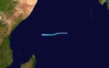
Tropical Depression 01
The first report of a tropical disturbance was released on August 27 in a Tropical Weather Outlook by the Joint Typhoon Warning CenterJoint Typhoon Warning Center
The Joint Typhoon Warning Center is a joint United States Navy – United States Air Force task force located at the Naval Maritime Forecast Center in Pearl Harbor, Hawaii...
. The disturbance was located about 80 nmi (148.2 km) ENE of Diego Garcia
Diego Garcia
Diego Garcia is a tropical, footprint-shaped coral atoll located south of the equator in the central Indian Ocean at 7 degrees, 26 minutes south latitude. It is part of the British Indian Ocean Territory [BIOT] and is positioned at 72°23' east longitude....
and was accompanied by an LLCC and deep convection. Development was poor by the next Tropical Weather Outlook. The disturbance remained disorganized and was considered no longer a threat or further development by September 4. However, on that day, at 1241 UTC, a QuickScat showed a weak circulation near Diego Garcia and on September 5, the JTWC released an interim Tropical Weather Outlook to upgrade its potential to fair. Infrared imagery and a mid-level analysis showed a well-organized mid-level circulation. However, no evidence of an LLCC was found. The MeteoFrance RSMC in La Reunion
La Reunion
La Reunion may refer to:* La Reunion , a communal settlement near present-day Dallas, Texas*La Réunion, Lot-et-Garonne, a town in the Lot-et-Garonne department of France*Réunion, an island in the Indian Ocean east of Madagascar...
also began issuing warnings on the disturbance with 30 mph winds. La Reunion upgraded the disturbance into Tropical Depression 1S on September 6. 1S peaked at 35 mph (55 km/h) winds on September 6. La Reunion and the Joint Typhoon Warning Center released their final warnings on September 8, 100 WNW of the Seychelles.
Winds up to 78 mi/h were recorded in Praslin, which suggested that 1S may have been stronger than forecast. Almost 10% of the 75,000 people in the Seychelles were directly affected. 375 families were also forced to seek refuge. Flooding was major in Grand Anse, Anse Kerlan, Baie St Anne, Cote
D'or and Mont Plaisir, which had many villages and settlements underwater. Many hectares of cultivated land were destroyed.
Tropical Depression Atang
Formed on November 4 and dissipated on November 13. Atang was never classified as a tropical storm by Meteo France or Mauritius, but was named because it posed a threat to the island of Agalega. The name Atang was contributed by BotswanaBotswana
Botswana, officially the Republic of Botswana , is a landlocked country located in Southern Africa. The citizens are referred to as "Batswana" . Formerly the British protectorate of Bechuanaland, Botswana adopted its new name after becoming independent within the Commonwealth on 30 September 1966...
.
Tropical Cyclone Boura
Formed on November 15 and dissipated on November 23. The name Boura was contributed by Comoros Islands.Tropical Cyclone Crystal
Formed on December 22 and dissipated on December 30. The name Crystal was contributed by MauritiusMauritius
Mauritius , officially the Republic of Mauritius is an island nation off the southeast coast of the African continent in the southwest Indian Ocean, about east of Madagascar...
.
Between December 26 and 27, Mauritius
Mauritius
Mauritius , officially the Republic of Mauritius is an island nation off the southeast coast of the African continent in the southwest Indian Ocean, about east of Madagascar...
was under cyclone alert two, on a scale ranging from one to four with four being the highest. Heavy rains, thunderstorms, and high winds were anticipated across the island. Due to the change in Cyclone Crystal's track, the impact from the storm was significantly less than anticipated. The highest rainfall was recorded in the southern portion of the island at 58.8 mm (2.3 in). Despite the proximity of the storm, no rainfall was recorded in northern areas of Mauritius. The highest winds were recorded at the Bain Boeuf station located in the northern portion of the island at 90 km/h (55 mph). Southern areas recorded gusts up to 80 km/h (40 mph). Authorities in Mauritius reported no damage; however, minor damage to poorly constructed buildings was likely.
Tropical Depression 05
Formed on December 25 and then moved east into Perth's area of responsibility on December 27. Dissipated on January 4.Severe Tropical Storm Delfina
Cyclone Delfina made landfall in southern Nampula Province in Mozambique on December 31, 2002. Delfina then moved west-northwestward towards Malawi and became stationary over the country. Heavy flooding from the resulting rains killed 47 people in Mozambique and 7 in Malawi.Severe Tropical Storm Ebula
Formed on January 7 and dissipated on January 13. Name was contributed by SwazilandSwaziland
Swaziland, officially the Kingdom of Swaziland , and sometimes called Ngwane or Swatini, is a landlocked country in Southern Africa, bordered to the north, south and west by South Africa, and to the east by Mozambique...
.
Moderate Tropical Storm Fari
Formed on January 23 and dissipated on February 1. Name was contributed by ZimbabweZimbabwe
Zimbabwe is a landlocked country located in the southern part of the African continent, between the Zambezi and Limpopo rivers. It is bordered by South Africa to the south, Botswana to the southwest, Zambia and a tip of Namibia to the northwest and Mozambique to the east. Zimbabwe has three...
.
Intense Tropical Cyclone Gerry
Formed on February 8 and dissipated on February 17. Name was contributed by KenyaKenya
Kenya , officially known as the Republic of Kenya, is a country in East Africa that lies on the equator, with the Indian Ocean to its south-east...
.
Tropical Cyclone Hape
Formed on February 9 and dissipated on February 16. Name was contributed by LesothoLesotho
Lesotho , officially the Kingdom of Lesotho, is a landlocked country and enclave, surrounded by the Republic of South Africa. It is just over in size with a population of approximately 2,067,000. Its capital and largest city is Maseru. Lesotho is a member of the Commonwealth of Nations. The name...
.
Moderate Tropical Storm Isha
Formed on February 11 and dissipated on February 14. Name was contributed by the SeychellesSeychelles
Seychelles , officially the Republic of Seychelles , is an island country spanning an archipelago of 115 islands in the Indian Ocean, some east of mainland Africa, northeast of the island of Madagascar....
.
Intense Tropical Cyclone Japhet
Cyclone Japhet formed on February 25 west of Madagascar. It headed west, and then south, and strengthened rapidly into a category 4 storm with 135 mi/h winds and 927 milibars of pressure. It weakened as it headed northwest, and made landfall on March 3 in the country of Mozambique with winds of 110 miles per hour (49.2 m/s) The name Japhet was contributed by MalawiMalawi
The Republic of Malawi is a landlocked country in southeast Africa that was formerly known as Nyasaland. It is bordered by Zambia to the northwest, Tanzania to the northeast, and Mozambique on the east, south and west. The country is separated from Tanzania and Mozambique by Lake Malawi. Its size...
. A total of nineteen people were killed. In the city of Vilanculos, over 90% of houses were unroofed. Many roads in the region were washed out by Japhet's rains. Japhet was the strongest cyclone ever to form in the Mozambique Channel on record.
Intense Tropical Cyclone Kalunde
One of the most severe cyclones for the S. Indian basin, Cyclone Kalunde side-swiped Rodrigues Island, on March 12 causing significant damage but no deaths.Sub-tropical Disturbance Luma
Formed on April 6 and dissipated on April 12. Name was contributed by SwazilandSwaziland
Swaziland, officially the Kingdom of Swaziland , and sometimes called Ngwane or Swatini, is a landlocked country in Southern Africa, bordered to the north, south and west by South Africa, and to the east by Mozambique...
.
Tropical Cyclone Manou
Late in the season, an area of disturbed weather formed Tropical Disturbance 16 on May 2. Météo-FranceMétéo-France
Météo-France is the French national meteorological service.The organisation was established by decree in June 1993 and is a department of the Ministry of Transportation. It is headquartered in Paris but many domestic operations have been decentralised to Toulouse...
upgraded it to a depression 2 days later. The cyclone strengthened into Tropical Storm Manou. The name Manou was contributed by Madagascar
Madagascar
The Republic of Madagascar is an island country located in the Indian Ocean off the southeastern coast of Africa...
. After weakening, it restrengthened as it approached Madagascar. It strengthened into a cyclone as it neared the island. It turned and paralleled the course while drifting south. Land interaction and cooler waters weakened the cyclone, and Manou had dissipated by May 10.
Cyclone Manou caused death and destruction on Madagascar. Almost 90% of buildings in Vatomandry
Vatomandry
Vatomandry is a city in Vatomandry District, Atsinanana Region, Madagascar. It is located at around ....
were destroyed and over 20000 people left homeless. Infrastructure was ruined, with power poles being knocked down and rice crops being flooded out. In Brickaville
Brickaville
Brickaville is a city in Atsinanana Region, Madagascar. It is located at around . Brickaville, also known as Ampasimanolotra, is located on the road linking Toamasina to Antananarivo. Its main industries revolve around sugar....
and Andevorento, almost all houses were destroyed. A total of 70 people, with 19 missing, were killed by Manou.
Storm names
A tropical disturbance is named when it reaches moderate tropical storm strength. If a tropical disturbance reaches moderate tropical storm status west of 55°E55th meridian east
The meridian 55° east of Greenwich is a line of longitude that extends from the North Pole across the Arctic Ocean, Europe, Asia, the Indian Ocean, the Southern Ocean, and Antarctica to the South Pole....
, then the Sub-regional Tropical Cyclone Advisory Centre in Madagascar
Madagascar
The Republic of Madagascar is an island country located in the Indian Ocean off the southeastern coast of Africa...
assigns the appropriate name to the storm. If a tropical disturbance reaches moderate tropical storm status between 55°E
55th meridian east
The meridian 55° east of Greenwich is a line of longitude that extends from the North Pole across the Arctic Ocean, Europe, Asia, the Indian Ocean, the Southern Ocean, and Antarctica to the South Pole....
and 90°E
90th meridian east
The meridian 90° east of Greenwich is a line of longitude that extends from the North Pole across the Arctic Ocean, Asia, the Indian Ocean, the Southern Ocean, and Antarctica to the South Pole.The Ninety East Ridge is named after the meridian....
, then the Sub-regional Tropical Cyclone Advisory Centre in Mauritius
Mauritius
Mauritius , officially the Republic of Mauritius is an island nation off the southeast coast of the African continent in the southwest Indian Ocean, about east of Madagascar...
assigns the appropriate name to the storm. A new annual list is used every year so no names are retired.
|
|
See also
- List of Southern Hemisphere tropical cyclone seasons
- Atlantic hurricane seasons: 20022002 Atlantic hurricane seasonThe 2002 Atlantic hurricane season was an average Atlantic hurricane season, officially starting on June 1, 2002 and ending on November 30, dates which conventionally limit the period of each year when tropical cyclones in the Atlantic Ocean tend to form...
, 20032003 Atlantic hurricane seasonThe 2003 Atlantic hurricane season was an active Atlantic hurricane season with tropical activity before and after the official bounds of the season – the first such occurrence in 50 years. The season produced 21 tropical cyclones, of which 16 developed into named storms; seven... - Pacific hurricane seasons: 20022002 Pacific hurricane seasonThe 2002 Pacific hurricane season was an event in tropical cyclone meteorology. The most notable storm that year was Hurricane Kenna, which reached Category 5 on the Saffir-Simpson Hurricane Scale. It made landfall near Puerto Vallarta, in the Mexican state of Jalisco, on October 25...
, 20032003 Pacific hurricane seasonThe 2003 Pacific hurricane season produced an unusually large number of tropical cyclones which affected Mexico. The most notable cyclones the year were Hurricanes Ignacio and Marty, which killed 2 and 12 people in Mexico, respectively, and were collectively responsible for about... - Pacific typhoon seasons: 20022002 Pacific typhoon seasonA Tropical Cyclone Formation Alert was issued on July 19 for a Tropical Disturbance that was located east of the international Date Line. The Next day the Disturbance crossed the international date line and was classified as a Tropical Depression by the JMA. The JMA then upgraded the depression to...
, 20032003 Pacific typhoon seasonThe 2003 Pacific typhoon season has no official bounds; it ran year-round in 2003, but most tropical cyclones tend to form in the northwestern Pacific Ocean between May and November... - North Indian Ocean cyclone seasons: 20022002 North Indian Ocean cyclone seasonThe 2002 North Indian Ocean cyclone season had no bounds, but cyclones tend to form between April and December, with peaks in May and November. These dates conventionally delimit the period of each year when most tropical cyclones form in the northern Indian Ocean.-Season summary:Four tropical...
, 20032003 North Indian Ocean cyclone seasonThe 2003 North Indian Ocean cyclone season had no bounds, but cyclones tend to form between April and December, with peaks in May and November. These dates conventionally delimit the period of each year when most tropical cyclones form in the northern Indian Ocean.-Season summary:Three tropical...