
1944 Atlantic hurricane season
Encyclopedia
The 1944 Atlantic hurricane season officially began on June 16, 1944, and lasted until October 31, 1944. These dates conventionally delimit the period of each year when most tropical cyclone
s form in the Atlantic basin
.
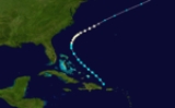
The 1944 season
was near average. A Category 1 hurricane hit North Carolina
. A Category 3 hit Jamaica
. Another Category 3 hit Florida
late in the season. A Category 1 hurricane and a tropical storm hit Mexico
. Another tropical storm hit Grand Isle, Louisiana
.
off the Georgia
coast and became a hurricane shortly thereafter. The storm passed between the US and Bermuda
and became extratropical as it entered the north Atlantic.
on July 24. It continued through the Caribbean Sea
, and dissipated on July 28 over the Western Caribbean. The storm caused some damage on southern Hispaniola, but no deaths were reported.
on August 2, and continued northeastward until dissipation on August 4. The hurricane caused $2 million in damage (1944 dollars) but no deaths.
on August 16. It passed through the islands, and steadily intensified to a major hurricane as it passed through the Caribbean. The major hurricane struck eastern Jamaica
on August 20, causing major damage to crops from flooding. It continued westward across the Caribbean, hitting the eastern Yucatán Peninsula
on August 22. Hurricane Four moved across the Bay of Campeche, and hit the Mexican
port of Tuxpan, Veracruz, on August 24 just before dissipating. The hurricane caused several million dollars in damage, and left 216 people dead.
on August 22, causing little damage after it dissipated on the 22rd.
on September 10. It dissipated the next day, after causing minor damage in Mobile, Alabama
.
that traveled up the Eastern Seaboard
as a Category 2, sweeping the beaches, sinking ships, and throwing wave watchers into the sea. The entire coastline from Cape Lookout, North Carolina to Cape Cod
were raked with hurricane-force winds. The hurricane caused several millions of dollars in damage, as well as 390 deaths.
on September 20. The hurricane turned southward in the Bay of Campeche
, making landfall near Campeche, Campeche
, on September 22. The hurricane dissipated later that day, after resulting in extensive damage from flooding as well as 200-300 fatalities.
.
in early October. The storm turned north with peak winds of 45 mi/h. It never got any stronger. After moving north for a little ways, the storm turned away from the islands and dissipated causing nothing but rain showers.
at this intensity on October 18, and continued northeastward where it made landfall on Sarasota, Florida
on October 19. The hurricane continued northeastward over the southeast United States, and became extratropical on October 21. The hurricane caused $100 million in damage (1944 dollars), as well as 300 casualties.
Tropical cyclone
A tropical cyclone is a storm system characterized by a large low-pressure center and numerous thunderstorms that produce strong winds and heavy rain. Tropical cyclones strengthen when water evaporated from the ocean is released as the saturated air rises, resulting in condensation of water vapor...
s form in the Atlantic basin
Atlantic Basin
The Atlantic Basin is the Atlantic Ocean.Atlantic Basin may also refer to:* Atlantic Basin Iron Works, an ironworks that operated in Brooklyn, New York, in the early to mid-20th century...
.
The 1944 season
Atlantic hurricane season
The Atlantic hurricane season is the period in a year when hurricanes usually form in the Atlantic Ocean. Tropical cyclones in the North Atlantic are called hurricanes, tropical storms, or tropical depressions. In addition, there have been several storms over the years that have not been fully...
was near average. A Category 1 hurricane hit North Carolina
North Carolina
North Carolina is a state located in the southeastern United States. The state borders South Carolina and Georgia to the south, Tennessee to the west and Virginia to the north. North Carolina contains 100 counties. Its capital is Raleigh, and its largest city is Charlotte...
. A Category 3 hit Jamaica
Jamaica
Jamaica is an island nation of the Greater Antilles, in length, up to in width and 10,990 square kilometres in area. It is situated in the Caribbean Sea, about south of Cuba, and west of Hispaniola, the island harbouring the nation-states Haiti and the Dominican Republic...
. Another Category 3 hit Florida
Florida
Florida is a state in the southeastern United States, located on the nation's Atlantic and Gulf coasts. It is bordered to the west by the Gulf of Mexico, to the north by Alabama and Georgia and to the east by the Atlantic Ocean. With a population of 18,801,310 as measured by the 2010 census, it...
late in the season. A Category 1 hurricane and a tropical storm hit Mexico
Mexico
The United Mexican States , commonly known as Mexico , is a federal constitutional republic in North America. It is bordered on the north by the United States; on the south and west by the Pacific Ocean; on the southeast by Guatemala, Belize, and the Caribbean Sea; and on the east by the Gulf of...
. Another tropical storm hit Grand Isle, Louisiana
Grand Isle, Louisiana
Grand Isle is a town in Jefferson Parish, Louisiana, located on a barrier island of the same name in the Gulf of Mexico. The island is at the mouth of Barataria Bay where it meets the gulf. As of the 2000 census, the town population was 1,541; during summers, the population sometimes increases to...
.
Hurricane One
The first storm of the season formed on July 13 and moved northwest, paralleling the Bahamas, slowly strengthening. It recurved once in the Gulf StreamGulf Stream
The Gulf Stream, together with its northern extension towards Europe, the North Atlantic Drift, is a powerful, warm, and swift Atlantic ocean current that originates at the tip of Florida, and follows the eastern coastlines of the United States and Newfoundland before crossing the Atlantic Ocean...
off the Georgia
Georgia (U.S. state)
Georgia is a state located in the southeastern United States. It was established in 1732, the last of the original Thirteen Colonies. The state is named after King George II of Great Britain. Georgia was the fourth state to ratify the United States Constitution, on January 2, 1788...
coast and became a hurricane shortly thereafter. The storm passed between the US and Bermuda
Bermuda
Bermuda is a British overseas territory in the North Atlantic Ocean. Located off the east coast of the United States, its nearest landmass is Cape Hatteras, North Carolina, about to the west-northwest. It is about south of Halifax, Nova Scotia, Canada, and northeast of Miami, Florida...
and became extratropical as it entered the north Atlantic.
Tropical Storm Two
A tropical storm moved through the Lesser AntillesLesser Antilles
The Lesser Antilles are a long, partly volcanic island arc in the Western Hemisphere. Most of its islands form the eastern boundary of the Caribbean Sea with the Atlantic Ocean, with the remainder located in the southern Caribbean just north of South America...
on July 24. It continued through the Caribbean Sea
Caribbean Sea
The Caribbean Sea is a sea of the Atlantic Ocean located in the tropics of the Western hemisphere. It is bounded by Mexico and Central America to the west and southwest, to the north by the Greater Antilles, and to the east by the Lesser Antilles....
, and dissipated on July 28 over the Western Caribbean. The storm caused some damage on southern Hispaniola, but no deaths were reported.
Hurricane Three
On July 30, a tropical storm was located in the eastern Bahamas. It moved northwestward, becoming a hurricane the next day. The hurricane moved inland over southern North CarolinaNorth Carolina
North Carolina is a state located in the southeastern United States. The state borders South Carolina and Georgia to the south, Tennessee to the west and Virginia to the north. North Carolina contains 100 counties. Its capital is Raleigh, and its largest city is Charlotte...
on August 2, and continued northeastward until dissipation on August 4. The hurricane caused $2 million in damage (1944 dollars) but no deaths.
Hurricane Four
A small tropical storm existed east of BarbadosBarbados
Barbados is an island country in the Lesser Antilles. It is in length and as much as in width, amounting to . It is situated in the western area of the North Atlantic and 100 kilometres east of the Windward Islands and the Caribbean Sea; therein, it is about east of the islands of Saint...
on August 16. It passed through the islands, and steadily intensified to a major hurricane as it passed through the Caribbean. The major hurricane struck eastern Jamaica
Jamaica
Jamaica is an island nation of the Greater Antilles, in length, up to in width and 10,990 square kilometres in area. It is situated in the Caribbean Sea, about south of Cuba, and west of Hispaniola, the island harbouring the nation-states Haiti and the Dominican Republic...
on August 20, causing major damage to crops from flooding. It continued westward across the Caribbean, hitting the eastern Yucatán Peninsula
Yucatán Peninsula
The Yucatán Peninsula, in southeastern Mexico, separates the Caribbean Sea from the Gulf of Mexico, with the northern coastline on the Yucatán Channel...
on August 22. Hurricane Four moved across the Bay of Campeche, and hit the Mexican
Mexico
The United Mexican States , commonly known as Mexico , is a federal constitutional republic in North America. It is bordered on the north by the United States; on the south and west by the Pacific Ocean; on the southeast by Guatemala, Belize, and the Caribbean Sea; and on the east by the Gulf of...
port of Tuxpan, Veracruz, on August 24 just before dissipating. The hurricane caused several million dollars in damage, and left 216 people dead.
Tropical Storm Five
A tropical storm hit northeastern MexicoMexico
The United Mexican States , commonly known as Mexico , is a federal constitutional republic in North America. It is bordered on the north by the United States; on the south and west by the Pacific Ocean; on the southeast by Guatemala, Belize, and the Caribbean Sea; and on the east by the Gulf of...
on August 22, causing little damage after it dissipated on the 22rd.
Tropical Storm Six
A tropical storm hit southeastern LouisianaLouisiana
Louisiana is a state located in the southern region of the United States of America. Its capital is Baton Rouge and largest city is New Orleans. Louisiana is the only state in the U.S. with political subdivisions termed parishes, which are local governments equivalent to counties...
on September 10. It dissipated the next day, after causing minor damage in Mobile, Alabama
Mobile, Alabama
Mobile is the third most populous city in the Southern US state of Alabama and is the county seat of Mobile County. It is located on the Mobile River and the central Gulf Coast of the United States. The population within the city limits was 195,111 during the 2010 census. It is the largest...
.
Hurricane Seven
The most notable hurricane of the season was the Great Atlantic Hurricane (sometimes referred to as the Great American Hurricane), an intense Cape Verde-type hurricaneCape Verde-type hurricane
A Cape Verde-type hurricane is an Atlantic hurricane that develops near the Cape Verde islands, off the west coast of Africa. The average hurricane season has about two Cape Verde-type hurricanes, which are usually the largest and most intense storms of the season because they often have plenty of...
that traveled up the Eastern Seaboard
East Coast of the United States
The East Coast of the United States, also known as the Eastern Seaboard, refers to the easternmost coastal states in the United States, which touch the Atlantic Ocean and stretch up to Canada. The term includes the U.S...
as a Category 2, sweeping the beaches, sinking ships, and throwing wave watchers into the sea. The entire coastline from Cape Lookout, North Carolina to Cape Cod
Cape Cod
Cape Cod, often referred to locally as simply the Cape, is a cape in the easternmost portion of the state of Massachusetts, in the Northeastern United States...
were raked with hurricane-force winds. The hurricane caused several millions of dollars in damage, as well as 390 deaths.
Hurricane Eight
A tropical wave developed into a tropical storm in the western Caribbean Sea on September 19. It became a hurricane later that day, and hit the Yucatán PeninsulaYucatán Peninsula
The Yucatán Peninsula, in southeastern Mexico, separates the Caribbean Sea from the Gulf of Mexico, with the northern coastline on the Yucatán Channel...
on September 20. The hurricane turned southward in the Bay of Campeche
Bay of Campeche
The Bay of Campeche is the southern bight of the Gulf of Mexico. It is surrounded on three sides by the Mexican states of Campeche, Tabasco and Veracruz. It was named by Francisco Hernández de Córdoba and Antonio de Alaminos during their expedition in 1517...
, making landfall near Campeche, Campeche
Campeche, Campeche
San Francisco de Campeche is the capital city of the Mexican state of Campeche, located at,...
, on September 22. The hurricane dissipated later that day, after resulting in extensive damage from flooding as well as 200-300 fatalities.
Hurricane Nine
A tropical disturbance from the Cape Verde region developed into a tropical storm in the south-central Atlantic on September 21. The storm made a broad turn to the north and slowly strengthened. It became a hurricane while well east of Bermuda and continued its journey north. The storm was briefly a Category 2 hurricane with winds of 100 mi/h before weakening in the cooler waters of the north Atlantic. The storm was able, however, to maintain hurricane status until it became extratropical in the far north Atlantic south of GreenlandGreenland
Greenland is an autonomous country within the Kingdom of Denmark, located between the Arctic and Atlantic Oceans, east of the Canadian Arctic Archipelago. Though physiographically a part of the continent of North America, Greenland has been politically and culturally associated with Europe for...
.
Tropical Storm Ten
The tenth storm was a weak tropical storm that formed to the immediate northeast of BarbadosBarbados
Barbados is an island country in the Lesser Antilles. It is in length and as much as in width, amounting to . It is situated in the western area of the North Atlantic and 100 kilometres east of the Windward Islands and the Caribbean Sea; therein, it is about east of the islands of Saint...
in early October. The storm turned north with peak winds of 45 mi/h. It never got any stronger. After moving north for a little ways, the storm turned away from the islands and dissipated causing nothing but rain showers.
Hurricane Eleven
A tropical storm formed in the western Caribbean Sea on October 12. It headed northward, becoming a hurricane the next day. It drifted westward, followed by another northward turn where it reached major hurricane strength. It crossed CubaCuba
The Republic of Cuba is an island nation in the Caribbean. The nation of Cuba consists of the main island of Cuba, the Isla de la Juventud, and several archipelagos. Havana is the largest city in Cuba and the country's capital. Santiago de Cuba is the second largest city...
at this intensity on October 18, and continued northeastward where it made landfall on Sarasota, Florida
Sarasota, Florida
Sarasota is a city located in Sarasota County on the southwestern coast of the U.S. state of Florida. It is south of the Tampa Bay Area and north of Fort Myers...
on October 19. The hurricane continued northeastward over the southeast United States, and became extratropical on October 21. The hurricane caused $100 million in damage (1944 dollars), as well as 300 casualties.
See also
- List of tropical cyclones
- List of Atlantic hurricane seasons