
1899 Atlantic hurricane season
Encyclopedia
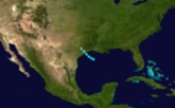
The 1899 Atlantic hurricane season ran through the summer and the first half of fall in 1899. The season was average, with 9 tropical storms, of which 5 became hurricanes and only two became major hurricanes.
The most notable storm was Hurricane San Ciriaco, which caused more than 3,000 fatalities. Hurricane San Ciriaco also lasted almost a month. The hurricane was tied with Hurricane Ginger for the longest on record.
as a 40 mph (55 km/h) tropical storm. It made landfall in Texas at that strength on June 27, quickly weakened to a tropical depression and then dissipated.
on July 28, 1899. It moved northwestward, weakening to a tropical storm. It turned more northward over the Gulf of Mexico
, and reached a peak intensity with maximum sustained winds at 100 mph (155 km/h). On August 1, it made landfall in Florida Panhandle
near Apalachicola, Florida
doing much damage. The town of Carrabelle
was nearly leveled and the town of McIntyre, Florida was leveled. The greatest damage occurred on Dog Island where over 15 large ships were destroyed. The hurricane dissipated shortly thereafter, resulting in six casualties and $575,000 in damage (1899 USD).
, formed on August 3, 1899 half-way between Africa and South America in the Atlantic. It continued westward, striking the Lesser Antilles
and made landfall in Puerto Rico
as a 150 mi/h Category 4 hurricane, on August 8, 1899 the namesday of San Ciriaco
. The hurricane was tied with Hurricane Ginger
for the longest on record, lasting for 31 days, 28 of which it was tropical.
at Category 1 strength with 80 mph (129 km/h) winds. It then swerved through the Bahamas as a Category 2 hurricane with 100 mi/h winds. It then moved north-northwest out into the Atlantic, where it continued to linger until finally dissipating on September 8, 1899.
as a strong hurricane. The pressure fell to 939 mbar (hPa; 27.73 inHg) at that island by 2 a.m. on September 13, 1899 (Beware the Hurricane, Tucker) and was their worst storm since 1839. The system moved northward and clipped Newfoundland as it was becoming an extratropical storm on September 15, 1899.
on October 2, 1899. It curved around Cuba and hit Gainesville, Florida
as a tropical storm with 45 mph (72 km/h) winds. It then continued out into sea, and hit the eastern-most edge of Canada. It then moved out and dissipated on October 8, 1899.
, on October 26, 1899. The continued north and hit Cuba as an 80 mph (129 km/h) Category 1 hurricane, then South Carolina with 90 mph (145 km/h) winds. It became extratropical on November 1, after causing moderate damage.
, on November 7, 1899. It moved north to hit Cuba, but dissipated on November 10 before causing any damage to land.
The most notable storm was Hurricane San Ciriaco, which caused more than 3,000 fatalities. Hurricane San Ciriaco also lasted almost a month. The hurricane was tied with Hurricane Ginger for the longest on record.
Tropical Storm One
The first tropical storm of the season was first detected in the Northern Gulf of MexicoGulf of Mexico
The Gulf of Mexico is a partially landlocked ocean basin largely surrounded by the North American continent and the island of Cuba. It is bounded on the northeast, north and northwest by the Gulf Coast of the United States, on the southwest and south by Mexico, and on the southeast by Cuba. In...
as a 40 mph (55 km/h) tropical storm. It made landfall in Texas at that strength on June 27, quickly weakened to a tropical depression and then dissipated.
Hurricane Two
A hurricane hit southern HispaniolaHispaniola
Hispaniola is a major island in the Caribbean, containing the two sovereign states of the Dominican Republic and Haiti. The island is located between the islands of Cuba to the west and Puerto Rico to the east, within the hurricane belt...
on July 28, 1899. It moved northwestward, weakening to a tropical storm. It turned more northward over the Gulf of Mexico
Gulf of Mexico
The Gulf of Mexico is a partially landlocked ocean basin largely surrounded by the North American continent and the island of Cuba. It is bounded on the northeast, north and northwest by the Gulf Coast of the United States, on the southwest and south by Mexico, and on the southeast by Cuba. In...
, and reached a peak intensity with maximum sustained winds at 100 mph (155 km/h). On August 1, it made landfall in Florida Panhandle
Florida Panhandle
The Florida Panhandle, an informal, unofficial term for the northwestern part of Florida, is a strip of land roughly 200 miles long and 50 to 100 miles wide , lying between Alabama on the north and the west, Georgia also on the north, and the Gulf of Mexico to the south. Its eastern boundary is...
near Apalachicola, Florida
Apalachicola, Florida
Apalachicola is a city in Franklin County, Florida, on US 98 about southwest of Tallahassee. The population was 2,334 at the 2000 census. The 2005 census estimated the city's population at 2,340...
doing much damage. The town of Carrabelle
Carrabelle, Florida
Carrabelle is a city in Franklin County, Florida, United States. The population was 1,303 at the 2000 census. According to the U.S Census estimates of 2009, the city had a population of 1,231.-Location:...
was nearly leveled and the town of McIntyre, Florida was leveled. The greatest damage occurred on Dog Island where over 15 large ships were destroyed. The hurricane dissipated shortly thereafter, resulting in six casualties and $575,000 in damage (1899 USD).
Hurricane Three
The next storm, known as Hurricane San Ciriaco1899 Hurricane San Ciriaco
1899 San Ciriaco hurricane, also known as the 1899 Puerto Rico Hurricane, was the longest-lived Atlantic hurricane and the eleventh deadliest tropical cyclone in the basin. It was an intense and long-lived Atlantic Cape Verde-type hurricane which crossed Puerto Rico over the two day period August 8...
, formed on August 3, 1899 half-way between Africa and South America in the Atlantic. It continued westward, striking the Lesser Antilles
Lesser Antilles
The Lesser Antilles are a long, partly volcanic island arc in the Western Hemisphere. Most of its islands form the eastern boundary of the Caribbean Sea with the Atlantic Ocean, with the remainder located in the southern Caribbean just north of South America...
and made landfall in Puerto Rico
Puerto Rico
Puerto Rico , officially the Commonwealth of Puerto Rico , is an unincorporated territory of the United States, located in the northeastern Caribbean, east of the Dominican Republic and west of both the United States Virgin Islands and the British Virgin Islands.Puerto Rico comprises an...
as a 150 mi/h Category 4 hurricane, on August 8, 1899 the namesday of San Ciriaco
Saint Cyriacus
Cyriacus, or Cyriac, is a Christian martyr who was killed in the persecution of Diocletian. He is one of twenty-seven saints, most of them martyrs, who bear this name, of whom only seven are honoured by a specific mention of their names in the Roman Martyrology.-Life:Of the Saint Cyriacus who,...
. The hurricane was tied with Hurricane Ginger
Hurricane Ginger
Hurricane Ginger was the second-longest lasting Atlantic hurricane on record. The eighth tropical cyclone and fifth hurricane of the 1971 Atlantic hurricane season, Ginger spent 27.25 days as a tropical cyclone, lasting from September 6 to October 3...
for the longest on record, lasting for 31 days, 28 of which it was tropical.
Hurricane Four
Another storm formed to the east of the Lesser Antilles on August 29, 1899. It went west through the Lessers, curved upwards, and struck HaitiHaiti
Haiti , officially the Republic of Haiti , is a Caribbean country. It occupies the western, smaller portion of the island of Hispaniola, in the Greater Antillean archipelago, which it shares with the Dominican Republic. Ayiti was the indigenous Taíno or Amerindian name for the island...
at Category 1 strength with 80 mph (129 km/h) winds. It then swerved through the Bahamas as a Category 2 hurricane with 100 mi/h winds. It then moved north-northwest out into the Atlantic, where it continued to linger until finally dissipating on September 8, 1899.
Hurricane Five
The next storm formed in half-way between Africa and South America on September 3, 1899. It turned west-northwest and got up to Category 3 strength with 115 mph (185 km/h) winds without striking any land. Near the Bahamas, it turned north-northeast and passed over BermudaBermuda
Bermuda is a British overseas territory in the North Atlantic Ocean. Located off the east coast of the United States, its nearest landmass is Cape Hatteras, North Carolina, about to the west-northwest. It is about south of Halifax, Nova Scotia, Canada, and northeast of Miami, Florida...
as a strong hurricane. The pressure fell to 939 mbar (hPa; 27.73 inHg) at that island by 2 a.m. on September 13, 1899 (Beware the Hurricane, Tucker) and was their worst storm since 1839. The system moved northward and clipped Newfoundland as it was becoming an extratropical storm on September 15, 1899.
Tropical Storm Six
A storm formed to the south of CubaCuba
The Republic of Cuba is an island nation in the Caribbean. The nation of Cuba consists of the main island of Cuba, the Isla de la Juventud, and several archipelagos. Havana is the largest city in Cuba and the country's capital. Santiago de Cuba is the second largest city...
on October 2, 1899. It curved around Cuba and hit Gainesville, Florida
Gainesville, Florida
Gainesville is the largest city in, and the county seat of, Alachua County, Florida, United States as well as the principal city of the Gainesville, Florida Metropolitan Statistical Area . The preliminary 2010 Census population count for Gainesville is 124,354. Gainesville is home to the sixth...
as a tropical storm with 45 mph (72 km/h) winds. It then continued out into sea, and hit the eastern-most edge of Canada. It then moved out and dissipated on October 8, 1899.
Tropical Storm Seven
A tropical storm existed from October 10 to October 14 in the open Tropical Atlantic, reaching a peak intensity of 45 mi/h winds.Hurricane Eight
A storm formed north of PanamaPanama
Panama , officially the Republic of Panama , is the southernmost country of Central America. Situated on the isthmus connecting North and South America, it is bordered by Costa Rica to the northwest, Colombia to the southeast, the Caribbean Sea to the north and the Pacific Ocean to the south. The...
, on October 26, 1899. The continued north and hit Cuba as an 80 mph (129 km/h) Category 1 hurricane, then South Carolina with 90 mph (145 km/h) winds. It became extratropical on November 1, after causing moderate damage.
Tropical Storm Nine
Another storm formed north of PanamaPanama
Panama , officially the Republic of Panama , is the southernmost country of Central America. Situated on the isthmus connecting North and South America, it is bordered by Costa Rica to the northwest, Colombia to the southeast, the Caribbean Sea to the north and the Pacific Ocean to the south. The...
, on November 7, 1899. It moved north to hit Cuba, but dissipated on November 10 before causing any damage to land.
See also
- List of Atlantic hurricane seasons
- List of tropical cyclones