
Águas Lindas de Goiás
Encyclopedia
| Águas Lindas de Goiás | |
|---|---|
| State | Goiás Goiás Goiás is a state of Brazil, located in the central part of the country. The name Goiás comes from the name of an indigenous community... |
| Area: | 278.0 km² |
| Elevation: | 1,080 m above sea level |
| Postcode (CEP): | 72910-000 |
| IBGE statistical microregion: | Entorno de Brasília |
| Became a city: | 1997 |
| Mayor: | José Pereira Soares |
| Distance to Goiânia Goiânia -Climate:The city has a tropical wet and dry climate with an average temperature of . There's a wet season, from October to April, and a dry one, from May to September. Annual rainfall is around 1,520 mm.... : |
193 km. |
| Website: | none |
| Coordinates: | 15°46′16"S 48°14′55"W |

City
A city is a relatively large and permanent settlement. Although there is no agreement on how a city is distinguished from a town within general English language meanings, many cities have a particular administrative, legal, or historical status based on local law.For example, in the U.S...
and municipality
Municipality
A municipality is essentially an urban administrative division having corporate status and usually powers of self-government. It can also be used to mean the governing body of a municipality. A municipality is a general-purpose administrative subdivision, as opposed to a special-purpose district...
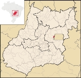
located in central Goiás
Goiás
Goiás is a state of Brazil, located in the central part of the country. The name Goiás comes from the name of an indigenous community...
, Brazil
Brazil
Brazil , officially the Federative Republic of Brazil , is the largest country in South America. It is the world's fifth largest country, both by geographical area and by population with over 192 million people...
. It is the fifth largest city in the state and one of the fastest growing cities in Brazil.
Location
Águas Lindas is 193 km. from the state capital of GoiâniaGoiânia
-Climate:The city has a tropical wet and dry climate with an average temperature of . There's a wet season, from October to April, and a dry one, from May to September. Annual rainfall is around 1,520 mm....
. Highway connections with Goiânia
Goiânia
-Climate:The city has a tropical wet and dry climate with an average temperature of . There's a wet season, from October to April, and a dry one, from May to September. Annual rainfall is around 1,520 mm....
are made by BR-153 / Anápolis
Anápolis
Anápolis is the third largest city in the State of Goiás in Brazil. It lies in the center of a rich agricultural region and has become a leader in food processing and pharmaceutical plants.-Location and population:...
/ BR-414 / Cocalzinho de Goiás
Cocalzinho de Goiás
Cocalzinho de Goiás is a small town and municipality in central Goiás state, Brazil.-Location and Geography:Cocalzinho, as it is known by the inhabitants, is located in the micro-region of Entorno de Brasília, on highway BR-414, almost at the junction with highway BR-070...
/ BR-070. For the complete list see
It has borders with Santo Antônio do Descoberto
Santo Antônio do Descoberto
Santo Antônio do Descoberto is a small city and municipality in central Goiás state, Brazil. It is a suburb of Brasília that was a sleepy country hamlet until the population exploded in the 1970s due to the construction of the national capital...
, Cocalzinho de Goiás
Cocalzinho de Goiás
Cocalzinho de Goiás is a small town and municipality in central Goiás state, Brazil.-Location and Geography:Cocalzinho, as it is known by the inhabitants, is located in the micro-region of Entorno de Brasília, on highway BR-414, almost at the junction with highway BR-070...
, and Brasília
Brasília
Brasília is the capital city of Brazil. The name is commonly spelled Brasilia in English. The city and its District are located in the Central-West region of the country, along a plateau known as Planalto Central. It has a population of about 2,557,000 as of the 2008 IBGE estimate, making it the...
. It is located west of Brasília and borders on the boundary of the Federal District. It is part of the Entorno de Brasília micro-region, which has over 960,000 inhabitants.
Demographics
- Population: 131,884 (IBGE 2007)
- Population in 2000: 105,746
- Population density: 689.78 inhab/km² (2007)
- Urban and Rural Population: || 131,541 / 343
- Population growth rate 2000/2007: 3.21%
The economy
The city has no major industries but has a variety of small commercial enterprises ranging from small offices, bars, grocery stores and larger supermarkets. Small industries manufacture furniture, sewage pipes, bicycles, sweets and toys. The informal economy is very strong and many people have stalls in fairs either in the city or in neighboring cities.- Industrial establishments: 62
- Commercial retail establishments: 686
- Financial institutions: Banco Itaú SA (2), Banco do Brasil S.A., Caixa Econômica Federal
Due to the small territory and the urban characteristics there were no agricultural products registered with the IBGE.
The existence of Águas Lindas is recent, being dismembered in 1997 from the municipality of Santo Antônio do Descoberto
Santo Antônio do Descoberto
Santo Antônio do Descoberto is a small city and municipality in central Goiás state, Brazil. It is a suburb of Brasília that was a sleepy country hamlet until the population exploded in the 1970s due to the construction of the national capital...
. In 1996 the population of what was just a district was already 61,478. By 2000 it had increased to 105,000.
Its only reason for existence is Brasília and the need for lower class and lower middle class residents of that city or migrants from rural areas to find affordable housing. The infrastructures are precarious as evidenced by the existence of only one hospital for a city of over 100,000 people, only four bank branches, and only one post office. The per capita income is low and most of the inhabitants take buses every day to work in Brasília
Brasília
Brasília is the capital city of Brazil. The name is commonly spelled Brasilia in English. The city and its District are located in the Central-West region of the country, along a plateau known as Planalto Central. It has a population of about 2,557,000 as of the 2008 IBGE estimate, making it the...
.
- Schools: 74
- Teachers: 1,030
- Students: 43,150
- Higher education: Faculdade Brasil Central - FBC; Universidade Estadual de Goiás - UEG.
- Hospitals: 1 (2007)
- Hospital beds: 68
- Infant mortality rate: 24.95 (2000)
- Literacy rate: 88.1 (2000)
- Municipal Human Development IndexHuman Development IndexThe Human Development Index is a composite statistic used to rank countries by level of "human development" and separate "very high human development", "high human development", "medium human development", and "low human development" countries...
in 2000: 0.717 - State ranking: 180 (out of 242 municipalities)
- National ranking: 2677 (out of 5507 municipalities)