

Worcestershire Way
Encyclopedia
The Worcestershire Way is a waymarked long-distance trail
located within the county
of Worcestershire
, England
. It runs 31 miles (49.9 km) from Bewdley
to Great Malvern
.
. The route and its length were modified in 2004 and it now runs wholly within Worcestershire.
Town of Bewdley
running south to Ribbesford
, the route then heads to Heightington
before passing through woodland on narrow winding lanes down to Abberley
Hill. From Abberley Hill the route goes south and up the steep Walsgrove Hill with views over the Teme Valley before continuing south to Ankerdine Hill and the Suckley Hills. From the Suckely Hills the Worcestershire Way heads south-east finishing in Great Malvern
. The route over the northern Malvern Hills
is waymarked with stone direction markers which can be difficult to find.
in Ribbesford
, Abberley Clock Tower
, Witley Court
, Birchwood Common (where Sir Edward Elgar
composed much of his music), the Malvern Hills
and St. Ann's Well
.
Ribbesford Circular Trail
The Abberley Circular Walk
The Martley Circular Walk
Walks on the Northern Malvern Hills
in the north - which in turn links to the Staffordshire Way
- and with the Cotswold Way
in the South.
Long-distance trail
Long-distance trails are the longer recreational trails mainly through rural areas, used for non-motorised recreational travelling ....
located within the county
County
A county is a jurisdiction of local government in certain modern nations. Historically in mainland Europe, the original French term, comté, and its equivalents in other languages denoted a jurisdiction under the sovereignty of a count A county is a jurisdiction of local government in certain...
of Worcestershire
Worcestershire
Worcestershire is a non-metropolitan county, established in antiquity, located in the West Midlands region of England. For Eurostat purposes it is a NUTS 3 region and is one of three counties that comprise the "Herefordshire, Worcestershire and Warwickshire" NUTS 2 region...
, England
England
England is a country that is part of the United Kingdom. It shares land borders with Scotland to the north and Wales to the west; the Irish Sea is to the north west, the Celtic Sea to the south west, with the North Sea to the east and the English Channel to the south separating it from continental...
. It runs 31 miles (49.9 km) from Bewdley
Bewdley
Bewdley is a town and civil parish in the Wyre Forest District of Worcestershire, England, along the Severn Valley a few miles to the west of Kidderminster...
to Great Malvern
Great Malvern
Great Malvern is an area of Malvern, Worcestershire, England. It is the historical centre of the town, and the location of the headquarters buildings of the of Malvern Town Council, the governing body of the Malvern civil parish, and Malvern Hills District council of the county of...
.
History
When launched back in 1989 the Worcestershire Way was 48 miles (77.2 km) long and ran partly into HerefordshireHerefordshire
Herefordshire is a historic and ceremonial county in the West Midlands region of England. For Eurostat purposes it is a NUTS 3 region and is one of three counties that comprise the "Herefordshire, Worcestershire and Gloucestershire" NUTS 2 region. It also forms a unitary district known as the...
. The route and its length were modified in 2004 and it now runs wholly within Worcestershire.
The route
The Worcestershire Way begins at the GeorgianGeorgian era
The Georgian era is a period of British history which takes its name from, and is normally defined as spanning the reigns of, the first four Hanoverian kings of Great Britain : George I, George II, George III and George IV...
Town of Bewdley
Bewdley
Bewdley is a town and civil parish in the Wyre Forest District of Worcestershire, England, along the Severn Valley a few miles to the west of Kidderminster...
running south to Ribbesford
Ribbesford
Ribbesford is a village and civil parish in the Wyre Forest District of Worcestershire, England. At the 2001 census it had a population of 237....
, the route then heads to Heightington
Heightington
Heightington is a small village in Worcestershire, England. It lies a little to the south-west of Bewdley and a little to the west of Stourport-on-Severn. Its best known landmark is the 13th century St Giles' Church....
before passing through woodland on narrow winding lanes down to Abberley
Abberley
Abberley is a picturesque village in north west Worcestershire, England. It is situated on the northern slopes of Abberley Hill , between the River Severn and River Teme. The village had a population of 830 in 2001.-Location:...
Hill. From Abberley Hill the route goes south and up the steep Walsgrove Hill with views over the Teme Valley before continuing south to Ankerdine Hill and the Suckley Hills. From the Suckely Hills the Worcestershire Way heads south-east finishing in Great Malvern
Great Malvern
Great Malvern is an area of Malvern, Worcestershire, England. It is the historical centre of the town, and the location of the headquarters buildings of the of Malvern Town Council, the governing body of the Malvern civil parish, and Malvern Hills District council of the county of...
. The route over the northern Malvern Hills
Malvern Hills
The Malvern Hills are a range of hills in the English counties of Worcestershire, Herefordshire and a small area of northern Gloucestershire, dominating the surrounding countryside and the towns and villages of the district of Malvern...
is waymarked with stone direction markers which can be difficult to find.
Places of interest
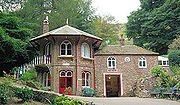
The Worcestershire Way passes numerous places of interest, including St Leonard's churchRibbesford
Ribbesford is a village and civil parish in the Wyre Forest District of Worcestershire, England. At the 2001 census it had a population of 237....
in Ribbesford
Ribbesford
Ribbesford is a village and civil parish in the Wyre Forest District of Worcestershire, England. At the 2001 census it had a population of 237....
, Abberley Clock Tower
Abberley Hall
Abberley Hall is a country house in the north-west of the county of Worcestershire, England. The present Italianate house is the work of Samuel Daukes and dates from 1846-49. Since 1916 it has been occupied by Abberley Hall School. It is a Grade II* listed building...
, Witley Court
Witley Court
Witley Court in Worcestershire, England is a Grade 1 listed building and was once one of the great houses of the Midlands, but today it is a spectacular ruin after being devastated by fire in 1937. It was built by Thomas Foley in 1655 on the site of a former manor house near Great Witley...
, Birchwood Common (where Sir Edward Elgar
Edward Elgar
Sir Edward William Elgar, 1st Baronet OM, GCVO was an English composer, many of whose works have entered the British and international classical concert repertoire. Among his best-known compositions are orchestral works including the Enigma Variations, the Pomp and Circumstance Marches, concertos...
composed much of his music), the Malvern Hills
Malvern Hills
The Malvern Hills are a range of hills in the English counties of Worcestershire, Herefordshire and a small area of northern Gloucestershire, dominating the surrounding countryside and the towns and villages of the district of Malvern...
and St. Ann's Well
St. Ann's Well, Malvern
St. Ann's Well is set on the slopes of the Malvern Hills above Great Malvern. It is a popular site on a path leading up to the Worcestershire Beacon and lies on the final descent of the Worcestershire Way....
.
Circular walks
Official circular walks along the Worcestershire Way include:Ribbesford Circular Trail
The Abberley Circular Walk
The Martley Circular Walk
Walks on the Northern Malvern Hills
Connecting trails
The Way links with the North Worcestershire PathNorth Worcestershire Path
The North Worcestershire Path is a waymarked long-distance trail located within the historic Worcestershire in England. It runs from Bewdley to Major's Green, Birmingham-The route:...
in the north - which in turn links to the Staffordshire Way
Staffordshire Way
The Staffordshire Way is a long distance walk in Staffordshire, England. The path links with the Cheshire Gritstone Trail, the Heart of England Way and the North Worcestershire Path.- The route :...
- and with the Cotswold Way
Cotswold Way
The Cotswold Way is a long-distance footpath, running along the Cotswold Edge escarpment of the Cotswold Hills in England. It was officially inaugurated as a National Trail on 24 May 2007 and several new rights of way have been created.-History:...
in the South.
See also
- Long-distance footpaths in the United KingdomLong-distance footpaths in the United Kingdom-England and Wales: National Trails:National Trails are distinguished by being maintained by the National Trails organization . , there are fifteen such trails, one of which is not yet complete....