Wills Neck
Encyclopedia
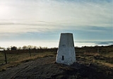
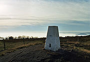
Wills Neck is the highest summit on the Quantock Hills
and one of the highest points in Somerset
, England
. Although only 1261 ft (384 m) high, it qualifies as one of England
's Marilyns
. It is situated about 8 miles (12.9 km) north west of the historic market town
of Taunton
.
 The name 'Wills Neck' is derived from the Saxon word for 'stranger' or 'foreigner'.
On a clear day it is possible to see Dartmoor
, Exmoor
, the Brecon Beacons
, the Mendips
and Blackdown Hills
. It is sometimes even possible to see Pilsdon Pen
, the highest point in Dorset
.
Quantock Hills
The Quantock Hills is a range of hills west of Bridgwater in Somerset, England. The Quantock Hills were England’s first Area of Outstanding Natural Beauty being designated in 1956 and consists of large amounts of heathland, oak woodlands, ancient parklands and agricultural land.The hills run from...
and one of the highest points in Somerset
Somerset
The ceremonial and non-metropolitan county of Somerset in South West England borders Bristol and Gloucestershire to the north, Wiltshire to the east, Dorset to the south-east, and Devon to the south-west. It is partly bounded to the north and west by the Bristol Channel and the estuary of the...
, England
England
England is a country that is part of the United Kingdom. It shares land borders with Scotland to the north and Wales to the west; the Irish Sea is to the north west, the Celtic Sea to the south west, with the North Sea to the east and the English Channel to the south separating it from continental...
. Although only 1261 ft (384 m) high, it qualifies as one of England
England
England is a country that is part of the United Kingdom. It shares land borders with Scotland to the north and Wales to the west; the Irish Sea is to the north west, the Celtic Sea to the south west, with the North Sea to the east and the English Channel to the south separating it from continental...
's Marilyns
Marilyn (hill)
A Marilyn is a mountain or hill in the United Kingdom, Republic of Ireland or Isle of Man with a relative height of at least 150 metres , regardless of absolute height or other merit...
. It is situated about 8 miles (12.9 km) north west of the historic market town
Market town
Market town or market right is a legal term, originating in the medieval period, for a European settlement that has the right to host markets, distinguishing it from a village and city...
of Taunton
Taunton
Taunton is the county town of Somerset, England. The town, including its suburbs, had an estimated population of 61,400 in 2001. It is the largest town in the shire county of Somerset....
.

On a clear day it is possible to see Dartmoor
Dartmoor
Dartmoor is an area of moorland in south Devon, England. Protected by National Park status, it covers .The granite upland dates from the Carboniferous period of geological history. The moorland is capped with many exposed granite hilltops known as tors, providing habitats for Dartmoor wildlife. The...
, Exmoor
Exmoor
Exmoor is an area of hilly open moorland in west Somerset and north Devon in South West England, named after the main river that flows out of the district, the River Exe. The moor has given its name to a National Park, which includes the Brendon Hills, the East Lyn Valley, the Vale of Porlock and ...
, the Brecon Beacons
Brecon Beacons
The Brecon Beacons is a mountain range in South Wales. In a narrow sense, the name refers to the range of popular peaks south of Brecon, including South Wales' highest mountain, Pen y Fan, and which together form the central section of the Brecon Beacons National Park...
, the Mendips
Mendip Hills
The Mendip Hills is a range of limestone hills to the south of Bristol and Bath in Somerset, England. Running east to west between Weston-super-Mare and Frome, the hills overlook the Somerset Levels to the south and the Avon Valley to the north...
and Blackdown Hills
Blackdown Hills
The Blackdown Hills are a range of hills along the Somerset-Devon border in south-western England, which were designated an Area of Outstanding Natural Beauty in 1991....
. It is sometimes even possible to see Pilsdon Pen
Pilsdon Pen
Pilsdon Pen is a 277 metre hill in West Dorset, England, situated five miles west of Beaminster at the north end of the Marshwood Vale. It is Dorset's second highest point and has panoramic views extending for many miles...
, the highest point in Dorset
Dorset
Dorset , is a county in South West England on the English Channel coast. The county town is Dorchester which is situated in the south. The Hampshire towns of Bournemouth and Christchurch joined the county with the reorganisation of local government in 1974...
.

