
.gif)
Virginia State Route 612 (Fairfax and Prince William Counties)
Encyclopedia

State highway
State highway, state road or state route can refer to one of three related concepts, two of them related to a state or provincial government in a country that is divided into states or provinces :#A...
in the U.S. state
U.S. state
A U.S. state is any one of the 50 federated states of the United States of America that share sovereignty with the federal government. Because of this shared sovereignty, an American is a citizen both of the federal entity and of his or her state of domicile. Four states use the official title of...
of Virginia
Virginia
The Commonwealth of Virginia , is a U.S. state on the Atlantic Coast of the Southern United States. Virginia is nicknamed the "Old Dominion" and sometimes the "Mother of Presidents" after the eight U.S. presidents born there...
, and traverses both Fairfax County
Fairfax County, Virginia
Fairfax County is a county in Virginia, in the United States. Per the 2010 Census, the population of the county is 1,081,726, making it the most populous jurisdiction in the Commonwealth of Virginia, with 13.5% of Virginia's population...
and Prince William County
Prince William County, Virginia
-National protected areas:* Featherstone National Wildlife Refuge* Manassas National Battlefield Park* Occoquan Bay National Wildlife Refuge* Prince William Forest Park-Government and politics:...
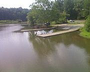
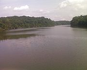
. The two counties are separated by water (at this point the separation is Bull Run
Bull Run (Occoquan River)
Bull Run is a free-flowing tributary stream of the Potomac River that originates from a spring in the Bull Run Mountains in Loudoun County, Virginia, and flows south to the Occoquan River...
), so SR 612 contains a bridge that is one of only eight crossings between the counties. Because of this, SR 612 is heavily-traveled during rush hour.
Route description
SR 612 uses five different names: Colchester Road, Yates Ford Road, Henderson Road, and Old Yates Ford Road in Fairfax County, and Yates Ford Road in Prince William County. There are also brief concurrencies with SR 645Virginia State Route 645 (Fairfax County)
Virginia Secondary Route 645 is a major secondary road completely within the bounds of western Fairfax County, Virginia. There are six portions, three of them being major, named Wall Road, Lees Corner Road, Stringfellow Road, Clifton Road, Main Street and Burke Lake Road...
(Clifton Road) and SR 641 (Chapel Road).
Colchester Road (Fairfax County)
SR 612 begins in Fairfax CountyFairfax County, Virginia
Fairfax County is a county in Virginia, in the United States. Per the 2010 Census, the population of the county is 1,081,726, making it the most populous jurisdiction in the Commonwealth of Virginia, with 13.5% of Virginia's population...
at an intersection with SR 620 (Braddock Road) at the Clifton
Clifton, Virginia
Clifton is a town in Fairfax County, Virginia, United States located away from Washington, D.C. In 2010, the population was 282.-Pre-Colonial era:...
/ Fairfax
Fairfax, Virginia
The City of Fairfax is an independent city forming an enclave within the confines of Fairfax County, in the Commonwealth of Virginia in the United States. Although politically independent of the surrounding county, the City is nevertheless the county seat....
border and travels through a long residential area
Residential area
A residential area is a land use in which housing predominates, as opposed to industrial and commercial areas.Housing may vary significantly between, and through, residential areas. These include single family housing, multi-family residential, or mobile homes. Zoning for residential use may permit...
consisting of single-family homes. It ends at an intersection with SR 641 (Chapel Road) on the Clifton / Fairfax Station
Fairfax Station, Virginia
Fairfax Station is a census-designated place in Fairfax County, Virginia, ZIP code 22039. The population as of the 2010 Census was 12,030. As a suburb of Washington, DC, it is a bedroom community for many who work in the federal government.-Averages:...
border. There is a portion of southern Colchester Road that is closed, so this segment is discontinuous. Colchester Road and all other Fairfax County portions of SR 612 are 2 lane roads.
Yates Ford Road (Fairfax County)
At this point SR 612 turns east and is concurrent with SR 641, Chapel Road. SR 612 then turns southwest on Yates Ford Road at the Clifton / Fairfax Station border and travels through another residential area consisting of single-family homes. It ends at an intersection with SR 645 (Clifton Road) in Clifton. This portion of SR 612 was designated a Virginia BywayVirginia Byway
A Virginia Byway is a scenic road designated by the U.S. state of Virginia as one that can introduce tourists to alternate destinations. According to the Virginia Department of Transportation , there are over 3,000 miles of scenic roads in Virginia, many of which have been designated as...
on May 3, 1997.
Henderson Road (Fairfax County)
At this point SR 612 turns west and is concurrent with SR 645, Clifton Road. SR 612 then turns south on Henderson Road in Clifton. This is the beginning of the SR 612 commuter route as, on Henderson Road, SR 612 overlaps with SR 643Virginia State Route 643 (Fairfax County)
Fairfax County Route 643 is a major secondary road in western Fairfax County, Virginia. This route is composed of three disconnected segments:*Henderson Road, which runs for 6.12 miles.*Old Ox Road*Lee Chapel Road and Burke Centre Parkway...
. It ends at a Y intersection with SR 612 / Old Yates Ford Road and SR 643 / Henderson Road in Clifton. On this section the speed limit is 35 mi/h.
In the morning rush hour when the majority of traffic is heading northbound along SR 612, much eastbound traffic turns right on SR 646, Maple Branch Road, while much westbound traffic stays on SR 612. The two roads become practically parallel, and both intersect with SR 645, Clifton Road, two blocks apart. In the evening rush hour, this traffic pattern is reversed.
Both the concurrency with SR 645 and the concurrency with SR 643 have been designated as Virginia Byway
Virginia Byway
A Virginia Byway is a scenic road designated by the U.S. state of Virginia as one that can introduce tourists to alternate destinations. According to the Virginia Department of Transportation , there are over 3,000 miles of scenic roads in Virginia, many of which have been designated as...
s. The SR 645 section was designated April 20, 1994, and Henderson Road was designated March 13, 2001.
Old Yates Ford Road (Fairfax County)
Old Yates Ford Road starts at the Y intersection mentioned above, and continues west toward the SR 612 Fairfax / Prince William Bridge. On this section the speed limit is 35 mi/h.Yates Ford Road (Prince William County)
When SR 612 empties from the bridge to Prince William County, the speed limit is raised to 40 mi/h. It stays 2 lanes until just before an intersection with SR 663 / Davis Ford Road Then it becomes a 5 lane undivided road, with a center turn lane and two thru lanes in each direction. Most traffic headed toward WoodbridgeWoodbridge, Virginia
-Demographics:As of the census of 2000, there were 31,941 people, 10,687 households, and 7,769 families residing in the CDP. The population density was 3,047.8 people per square mile . There were 11,026 housing units at an average density of 1,052.1/sq mi...
turns on SR 663, as that road joins SR 3000, the Prince William Parkway
Prince William Parkway
The Prince William Parkway is a road in Prince William County, Virginia. The road carries two designations. Between U.S. Route 1 in Woodbridge and Dumfries Road near Manassas it carries SR 3000...
, as it heads east. SR 612 terminates at an intersection with SR 3000. Turning left goes toward Woodbridge, while turning right goes toward Manassas
Manassas, Virginia
The City of Manassas is an independent city surrounded by Prince William County and the independent city of Manassas Park in the Commonwealth of Virginia in the United States. Its population was 37,821 as of 2010. Manassas also surrounds the county seat for Prince William County but that county...
. When Yates Ford Road is two lanes, the speed limit is 40 mi/h. When Yates Ford Road is wider, the speed limit is 45 mi/h.
Yates Ford
Reader: if you know the origin of Yates Ford or any other interesting information about it, please write about it in this article, and give a citation using the <ref> tag.Yates Ford Road was known as early as 1716, for there are records that, on December 7, 1716, Lady Catherine Fairfax granted Wansford Arrington 335 acres (1.4 km²). One of the boundaries was described as "land along Bull Run from just north of Yates Ford Road to south along Bull Run to a peninsula". A few years later, on September 12, 1730, Richard Kirtling, Jr. was granted 290 acres (1.2 km²) by Lord Thomas Fairfax
Thomas Fairfax, 6th Lord Fairfax of Cameron
Thomas Fairfax, 6th Lord Fairfax of Cameron was the son of Thomas Fairfax, 5th Lord Fairfax of Cameron and of Catherine, daughter of Thomas Culpeper, 2nd Baron Culpeper of Thoresway....
, and this land was described as running "from Popes Head Run to just north of Yates Ford Road".
Yates Ford also appears in Civil War history. According to Pennsylvania Cavalry. 3d Regt. William Brooke Rawle, Yates Ford was the scene of a battle (also known as the Battle of Occoquan). He describes Yates Ford as being "about a mile or so below the railroad bridge". Yates Ford can be found on the 1862 War Department Map, where its position is consistent with the present terminus of Birmingham Drive. http://www.davidrumsey.com/maps4020.html
The original Yates Ford appears to be between Yates Ford Road in Clifton, at Hemlock Regional Park, and Birmingham Drive on the Manassas Park / Prince William County
Prince William County, Virginia
-National protected areas:* Featherstone National Wildlife Refuge* Manassas National Battlefield Park* Occoquan Bay National Wildlife Refuge* Prince William Forest Park-Government and politics:...
border. Some of the old Yates Ford Road can still be seen on the Manassas side at the end of the easternmost end of Birmingham Drive, along the border of what is currently property owned by a rod and gun club, another property, and the river. The ford can also be found here by boating and repeatedly portaging along the river. Google Earth Desktop Application: Retrieved July 07, 2009
In 1997 the original 30-year-old bridge crossing Bull Run
Bull Run (Occoquan River)
Bull Run is a free-flowing tributary stream of the Potomac River that originates from a spring in the Bull Run Mountains in Loudoun County, Virginia, and flows south to the Occoquan River...
was replaced by the Virginia Department of Transportation
Virginia Department of Transportation
The Virginia Department of Transportation is the agency of state government responsible for transportation in the state of Virginia in the United States. Headquartered in Downtown Richmond, VDOT is responsible for building, maintaining, and operating the roads, bridges and tunnels in the...
.
There is another section of Yates Ford Road that is not a part of SR 612. It appears that this section is what led to the original Yates Ford before Hemlock Overlook Regional Park was created by the Northern Virginia Regional Park Authority
Northern Virginia Regional Park Authority
The Northern Virginia Regional Park Authority is an interjurisdictional organization that owns and operates more than 10,000 acres of woodlands, streams, parks, trails, nature reserves, countryside and historic sites in Northern Virginia in the United States. The Authority was organized in 1959...
. That section of Yates Ford Road is now a group of large single family homes that are nestled against the boundary of the park.
Colchester Road
Colchester Road was originally a road leading from western Fairfax County through the CliftonClifton, Virginia
Clifton is a town in Fairfax County, Virginia, United States located away from Washington, D.C. In 2010, the population was 282.-Pre-Colonial era:...
area to the seaport of Colchester
Colchester, Virginia
Colchester is an unincorporated town on the Occoquan River in Fairfax County, Virginia. Colchester is a former tobacco port established in 1753. The port town was located on the old post road and Thomas Mason operated a ferry across the Occoquan River here. In 1798, Mason built a bridge across the...
. Silt filled up the Occoquan River
Occoquan River
The Occoquan River is a tributary of the Potomac River in northern Virginia, in the mid-Atlantic region of the United States. The river is long, and its watershed covers about . It is formed by the confluence of Broad Run and Cedar Run in Prince William County; Bull Run enters it east-southeast of...
, making Colchester untenable as a seaport. The result for Colchester Road was that many different roads took its place, and the only part of Colchester Road left is the part in Fairfax
Fairfax, Virginia
The City of Fairfax is an independent city forming an enclave within the confines of Fairfax County, in the Commonwealth of Virginia in the United States. Although politically independent of the surrounding county, the City is nevertheless the county seat....
/ Clifton that is part of SR 612.
Major intersections
| County | Location | Mile | Destinations | Notes |
|---|---|---|---|---|
| Fairfax | Colchester Road | |||
| Clifton Clifton, Virginia Clifton is a town in Fairfax County, Virginia, United States located away from Washington, D.C. In 2010, the population was 282.-Pre-Colonial era:... / Fairfax Fairfax, Virginia The City of Fairfax is an independent city forming an enclave within the confines of Fairfax County, in the Commonwealth of Virginia in the United States. Although politically independent of the surrounding county, the City is nevertheless the county seat.... ZIP code boundary |
0.00 | SR 620 (Braddock Road) - Fairfax Fairfax, Virginia The City of Fairfax is an independent city forming an enclave within the confines of Fairfax County, in the Commonwealth of Virginia in the United States. Although politically independent of the surrounding county, the City is nevertheless the county seat.... , Centreville Centreville, Virginia Centreville is an unincorporated community in Fairfax County, Virginia, United States. Recognized by the U.S. Census Bureau as a Census Designated Place , the community population was 71,135 as of the 2010 census and is approximately west of Washington, DC.-Colonial Period:Beginning in the 1760s,... |
North terminus of SR 612 | |
| Clifton Clifton, Virginia Clifton is a town in Fairfax County, Virginia, United States located away from Washington, D.C. In 2010, the population was 282.-Pre-Colonial era:... / Fairfax Station Fairfax Station, Virginia Fairfax Station is a census-designated place in Fairfax County, Virginia, ZIP code 22039. The population as of the 2010 Census was 12,030. As a suburb of Washington, DC, it is a bedroom community for many who work in the federal government.-Averages:... |
2.54 | SR 660 (Fairfax Station Road) - Fairfax Station Fairfax Station, Virginia Fairfax Station is a census-designated place in Fairfax County, Virginia, ZIP code 22039. The population as of the 2010 Census was 12,030. As a suburb of Washington, DC, it is a bedroom community for many who work in the federal government.-Averages:... |
||
| 3.93 | SR 641 (Chapel Road) - Clifton Clifton, Virginia Clifton is a town in Fairfax County, Virginia, United States located away from Washington, D.C. In 2010, the population was 282.-Pre-Colonial era:... |
Start 0.34 mile (0.5471756 km) concurrency with SR 641 (Chapel Road) | ||
| Yates Ford Road | ||||
| Clifton Clifton, Virginia Clifton is a town in Fairfax County, Virginia, United States located away from Washington, D.C. In 2010, the population was 282.-Pre-Colonial era:... / Fairfax Station Fairfax Station, Virginia Fairfax Station is a census-designated place in Fairfax County, Virginia, ZIP code 22039. The population as of the 2010 Census was 12,030. As a suburb of Washington, DC, it is a bedroom community for many who work in the federal government.-Averages:... |
4.27 | SR 641 (Chapel Road) - Clifton Clifton, Virginia Clifton is a town in Fairfax County, Virginia, United States located away from Washington, D.C. In 2010, the population was 282.-Pre-Colonial era:... |
End 0.34 mile (0.5471756 km) concurrency with SR 641 (Chapel Road) | |
| Clifton Clifton, Virginia Clifton is a town in Fairfax County, Virginia, United States located away from Washington, D.C. In 2010, the population was 282.-Pre-Colonial era:... |
6.42 | SR 645 Virginia State Route 645 (Fairfax County) Virginia Secondary Route 645 is a major secondary road completely within the bounds of western Fairfax County, Virginia. There are six portions, three of them being major, named Wall Road, Lees Corner Road, Stringfellow Road, Clifton Road, Main Street and Burke Lake Road... (Clifton Road) - Clifton Clifton, Virginia Clifton is a town in Fairfax County, Virginia, United States located away from Washington, D.C. In 2010, the population was 282.-Pre-Colonial era:... , Burke Burke, Virginia -Demographics:As of the census of 2000, there were 57,737 people, 19,215 households, and 15,756 families residing in the community. Burke is the largest community in Virginia recognized by the Census Bureau, other than counties and incorporated cities . The population density was 5,008.0 people per... , Centreville Centreville, Virginia Centreville is an unincorporated community in Fairfax County, Virginia, United States. Recognized by the U.S. Census Bureau as a Census Designated Place , the community population was 71,135 as of the 2010 census and is approximately west of Washington, DC.-Colonial Period:Beginning in the 1760s,... |
Start 0.2 mile (0.321868 km) concurrency with SR 645 Virginia State Route 645 (Fairfax County) Virginia Secondary Route 645 is a major secondary road completely within the bounds of western Fairfax County, Virginia. There are six portions, three of them being major, named Wall Road, Lees Corner Road, Stringfellow Road, Clifton Road, Main Street and Burke Lake Road... (Clifton Road) |
|
| Henderson Road | ||||
| Clifton Clifton, Virginia Clifton is a town in Fairfax County, Virginia, United States located away from Washington, D.C. In 2010, the population was 282.-Pre-Colonial era:... |
6.62 | SR 645 Virginia State Route 645 (Fairfax County) Virginia Secondary Route 645 is a major secondary road completely within the bounds of western Fairfax County, Virginia. There are six portions, three of them being major, named Wall Road, Lees Corner Road, Stringfellow Road, Clifton Road, Main Street and Burke Lake Road... (Clifton Road) - Clifton Clifton, Virginia Clifton is a town in Fairfax County, Virginia, United States located away from Washington, D.C. In 2010, the population was 282.-Pre-Colonial era:... , Burke Burke, Virginia -Demographics:As of the census of 2000, there were 57,737 people, 19,215 households, and 15,756 families residing in the community. Burke is the largest community in Virginia recognized by the Census Bureau, other than counties and incorporated cities . The population density was 5,008.0 people per... , Centreville Centreville, Virginia Centreville is an unincorporated community in Fairfax County, Virginia, United States. Recognized by the U.S. Census Bureau as a Census Designated Place , the community population was 71,135 as of the 2010 census and is approximately west of Washington, DC.-Colonial Period:Beginning in the 1760s,... |
End 0.2 mile (0.321868 km) concurrency with SR 645 Virginia State Route 645 (Fairfax County) Virginia Secondary Route 645 is a major secondary road completely within the bounds of western Fairfax County, Virginia. There are six portions, three of them being major, named Wall Road, Lees Corner Road, Stringfellow Road, Clifton Road, Main Street and Burke Lake Road... (Clifton Road); start of the concurrency with SR 643 Virginia State Route 643 (Fairfax County) Fairfax County Route 643 is a major secondary road in western Fairfax County, Virginia. This route is composed of three disconnected segments:*Henderson Road, which runs for 6.12 miles.*Old Ox Road*Lee Chapel Road and Burke Centre Parkway... . |
|
| 8.22 | SR 643 Virginia State Route 643 (Fairfax County) Fairfax County Route 643 is a major secondary road in western Fairfax County, Virginia. This route is composed of three disconnected segments:*Henderson Road, which runs for 6.12 miles.*Old Ox Road*Lee Chapel Road and Burke Centre Parkway... (Henderson Road) - Clifton Clifton, Virginia Clifton is a town in Fairfax County, Virginia, United States located away from Washington, D.C. In 2010, the population was 282.-Pre-Colonial era:... |
End of the concurrency with SR 643 Virginia State Route 643 (Fairfax County) Fairfax County Route 643 is a major secondary road in western Fairfax County, Virginia. This route is composed of three disconnected segments:*Henderson Road, which runs for 6.12 miles.*Old Ox Road*Lee Chapel Road and Burke Centre Parkway... . |
||
| Old Yates Ford Road | ||||
| Clifton Clifton, Virginia Clifton is a town in Fairfax County, Virginia, United States located away from Washington, D.C. In 2010, the population was 282.-Pre-Colonial era:... |
8.22 | SR 643 Virginia State Route 643 (Fairfax County) Fairfax County Route 643 is a major secondary road in western Fairfax County, Virginia. This route is composed of three disconnected segments:*Henderson Road, which runs for 6.12 miles.*Old Ox Road*Lee Chapel Road and Burke Centre Parkway... (Henderson Road) - Clifton Clifton, Virginia Clifton is a town in Fairfax County, Virginia, United States located away from Washington, D.C. In 2010, the population was 282.-Pre-Colonial era:... |
||
| Prince William Prince William County, Virginia -National protected areas:* Featherstone National Wildlife Refuge* Manassas National Battlefield Park* Occoquan Bay National Wildlife Refuge* Prince William Forest Park-Government and politics:... |
Yates Ford Road | |||
| Manassas Manassas, Virginia The City of Manassas is an independent city surrounded by Prince William County and the independent city of Manassas Park in the Commonwealth of Virginia in the United States. Its population was 37,821 as of 2010. Manassas also surrounds the county seat for Prince William County but that county... |
10.32 | East is Davis Ford Road; west is Evans Ford Road | ||
| 11.41 |  SR 3000 (Prince William Parkway SR 3000 (Prince William ParkwayPrince William Parkway The Prince William Parkway is a road in Prince William County, Virginia. The road carries two designations. Between U.S. Route 1 in Woodbridge and Dumfries Road near Manassas it carries SR 3000... ) - Manassas Manassas, Virginia The City of Manassas is an independent city surrounded by Prince William County and the independent city of Manassas Park in the Commonwealth of Virginia in the United States. Its population was 37,821 as of 2010. Manassas also surrounds the county seat for Prince William County but that county... , Woodbridge Woodbridge, Virginia -Demographics:As of the census of 2000, there were 31,941 people, 10,687 households, and 7,769 families residing in the CDP. The population density was 3,047.8 people per square mile . There were 11,026 housing units at an average density of 1,052.1/sq mi... |
South terminus of SR 612. | ||