

Virginia State Route 5
Encyclopedia
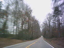
State Route 5 runs between the independent cities
of Richmond
and Williamsburg
in the U.S. state
of Virginia
. Between Charles City County
and James City County
, it crosses the Chickahominy River
via the Judith Stewart Dresser Bridge
, a fixed-span bridge which replaced historic Barrett's Ferry and the former drawbridge
.
. It passes through three of the original 8 shires created in the Colony of Virginia in 1634 by King Charles I
of England
. These are Henrico County
, Charles City County
, and James City County
.
are along the route. All are non-government-owned, and houses and/or grounds are generally open daily to visitors with various admission fees applicable. From west to east, these are the Shirley Plantation
, Edgewood Plantation, Berkeley Plantation
, Westover Plantation
, Evelynton Plantation
, Belle Air Plantation, Piney Grove at Southall's Plantation
, North Bend Plantation
and Sherwood Forest Plantation
.
for 18.5 miles (29.8 km) towards Richmond, and was numbered State Route 41. Three more miles (5 km) were added in 1924, 6.39 miles (10.28 km) were added in 1925, and the remaining 3.5 miles (5.6 km), taking it to the Richmond city limits, were added in 1927.
An extension to the east, heading north from Charles City to State Route 39 (now U.S. Route 60) at Providence Forge
, was added in 1926. However, this became State Route 413 in the 1928 renumbering, since a new alignment of SR 41, heading east from Charles City towards Williamsburg for eight miles (13 km), was added to the state highway system, as was a 4.5-mile (7.2 km) piece at the other end, heading west from State Route 510 (now State Route 31). A further 3.50 miles (5.63 km) from the west and 2.80 miles (4.51 km) from the east were added in 1930 and 1931, and, in 1932, the route was completed from Richmond to Williamsburg, with 3.00 miles (4.83 km) from the west and 1.70 miles (2.74 km) from the east.
 The road from State Route 32 (now U.S. Route 15) at Zion Crossroads
east to Oilville was added to the state highway system by 1923 as State Route 321. Extensiens east from Oilville were added for four miles (6 km) in 1924, six miles (10 km) in 1925, and 7.5 miles (12.1 km) in 1926. By 1927, SR 321 became an extension of SR 41 west from Richmond, and that year the former SR 321 was extended 3.5 miles (5.6 km), the rest of the way to Richmond.
SR 321/SR 41 was also extended west for 2.0 miles (3.2 km) in 1926, two more miles in 1927, and 5.4 miles (8.7 km) - the rest of the way to State Route 39 (now State Route 22) at Shadwell - in 1928.
In Richmond, SR 41 initially used Broad Street, a hairpin turn
through Chimborazo Park
, Fulton Street, Williamsburg Road, Hatcher Street, Newton Road, and New Osborne Turnpike.
State Route 39 from Shadwell west to Monterey, now U.S. Route 250, was part of the initial 1918 state highway system (numbered State Route 9 until 1923). It initially continued west from Monterey on present US 250, but by 1924 it used current State Route 84
west to West Virginia
. The road west from Monterey towards West Virginia Route 56 (now U.S. Route 250) for 7.86 miles (12.65 km) was added to the state highway system in 1930 and 1932 as State Route 835; the remaining mileage to the state line was added in 1933.
In the 1933 renumbering, State Routes 41 and 835 both became part of a new State Route 5, as did the piece of State Route 39 from Monterey to Shadwell. By 1935, the whole route west of Richmond became an extension of U.S. Route 250 into Virginia, truncating SR 5 to its present Richmond-Williamsburg route.
SR 5 was extended east along State Route 31 through Williamsburg to State Route 168 (now State Route 143) "to improve the service to travelers interchanging between Route 5 and Routes 60 and 168" in 1958. SR 31 has since been truncated to the SR 5 junction.
!County
!Location
!Mile
!Destinations
!Notes
|-
| rowspan="2" colspan="2" | City
of Richmond
| 0.00
|
| Western terminus; West end of concurrency with US 60
|-
| 0.30
|
| East end of concurrency with US 60
|-
| rowspan="2" | Henrico
| Varina
| 8.35
|
| Cloverleaf interchange
|-
| Richmond National
Battlefield Park
| 13.05
|
| West end of concurrency with SR 156
|-
| rowspan="2" | Charles City
| Kimages
| 19.11
|
| East end of concurrency with SR 156
|-
| Charles City
| 28.48
|
|
|-
| colspan="2" |
| 41.76
| colspan="3" style="text-align: center;" | Judith Stewart Dresser Bridge
over the Chickahominy River
|-
| James City
|
| 49.95
|
| West end of concurrency with SR 199
|-
| rowspan="6" colspan="2" | City
of Williamsburg
| 50.41
|
| East end of concurrency with SR 199
|-
| 52.34
|
| West end of concurrency with SR 132
|-
| 52.72
|
| East end of concurrency with SR 132
|-
| 53.78
|
| West end of Wrong-way concurrency with US 60
|-
| 54.34
|
| East end of Wrong-way concurrency with US 60
|-
| 54.96
|
| Eastern terminus
!Location
!Name
!Notes
|-
| City of Richmond
| E. Main Street
| Western terminus
|-
| rowspan="3" | Henrico County
| Old Osborne Turnpike
|
|-
| Osborne Turnpike
|
|-
| New Market Road
|
|-
| Charles City County
| rowspan="2" | John Tyler Memorial Highway
| rowspan="2" |
|-
| James City County
|-
| rowspan="8" | City of Williamsburg
| Virginia State Route 199
| Concurrency with SR 199
|-
| Jamestown Road
|
|-
| S. Boundary Street
|
|-
| W. Francis Street
|
|-
| Henry Street (South/North)
| Concurrency with SR 132
|-
| Lafayette Street
| Old SR 162 alignment
|-
| Page Street
|
|-
| Capitol Landing Road
| Eastern terminus
|}
Independent city
An independent city is a city that does not form part of another general-purpose local government entity. These type of cities should not be confused with city-states , which are fully sovereign cities that are not part of any other sovereign state.-Historical precursors:In the Holy Roman Empire,...
of Richmond
Richmond, Virginia
Richmond is the capital of the Commonwealth of Virginia, in the United States. It is an independent city and not part of any county. Richmond is the center of the Richmond Metropolitan Statistical Area and the Greater Richmond area...
and Williamsburg
Williamsburg, Virginia
Williamsburg is an independent city located on the Virginia Peninsula in the Hampton Roads metropolitan area of Virginia, USA. As of the 2010 Census, the city had an estimated population of 14,068. It is bordered by James City County and York County, and is an independent city...
in the U.S. state
U.S. state
A U.S. state is any one of the 50 federated states of the United States of America that share sovereignty with the federal government. Because of this shared sovereignty, an American is a citizen both of the federal entity and of his or her state of domicile. Four states use the official title of...
of Virginia
Virginia
The Commonwealth of Virginia , is a U.S. state on the Atlantic Coast of the Southern United States. Virginia is nicknamed the "Old Dominion" and sometimes the "Mother of Presidents" after the eight U.S. presidents born there...
. Between Charles City County
Charles City County, Virginia
As of the census of 2000, there were 6,926 people, 2,670 households, and 1,975 families residing in the county. The population density was 38 people per square mile . There were 2,895 housing units at an average density of 16 per square mile...
and James City County
James City County, Virginia
James City County is a county located on the Virginia Peninsula in the Hampton Roads metropolitan area of the Commonwealth of Virginia, a state of the United States. Its population was 67,009 , and it is often associated with Williamsburg, an independent city, and Jamestown which is within the...
, it crosses the Chickahominy River
Chickahominy River
The Chickahominy is an river in the eastern portion of the U.S. state of Virginia. The river rises about northwest of Richmond and flows southeast and south to the James River...
via the Judith Stewart Dresser Bridge
Judith Stewart Dresser Bridge
Judith Stewart Dresser Bridge is a fixed-span bridge which carries State Route 5 across the Chickahominy River between Charles City County and James City County in eastern Virginia. It connects popular tourism destinations of the James River Plantations with Colonial Williamsburg and Jamestown...
, a fixed-span bridge which replaced historic Barrett's Ferry and the former drawbridge
Drawbridge
A drawbridge is a type of movable bridge typically associated with the entrance of a castle surrounded by a moat. The term is often used to describe all different types of movable bridges, like bascule bridges and lift bridges.-Castle drawbridges:...
.
Description of route
For much of its distance, SR 5 generally parallels the north bank of the James RiverJames River (Virginia)
The James River is a river in the U.S. state of Virginia. It is long, extending to if one includes the Jackson River, the longer of its two source tributaries. The James River drains a catchment comprising . The watershed includes about 4% open water and an area with a population of 2.5 million...
. It passes through three of the original 8 shires created in the Colony of Virginia in 1634 by King Charles I
Charles I of England
Charles I was King of England, King of Scotland, and King of Ireland from 27 March 1625 until his execution in 1649. Charles engaged in a struggle for power with the Parliament of England, attempting to obtain royal revenue whilst Parliament sought to curb his Royal prerogative which Charles...
of England
England
England is a country that is part of the United Kingdom. It shares land borders with Scotland to the north and Wales to the west; the Irish Sea is to the north west, the Celtic Sea to the south west, with the North Sea to the east and the English Channel to the south separating it from continental...
. These are Henrico County
Henrico County, Virginia
Henrico is a county located in the Commonwealth of Virginia, a state of the United States. As of 2010, Henrico was home to 306,935 people. It is located in the Richmond-Petersburg region and is a portion of the Richmond Metropolitan Statistical Area...
, Charles City County
Charles City County, Virginia
As of the census of 2000, there were 6,926 people, 2,670 households, and 1,975 families residing in the county. The population density was 38 people per square mile . There were 2,895 housing units at an average density of 16 per square mile...
, and James City County
James City County, Virginia
James City County is a county located on the Virginia Peninsula in the Hampton Roads metropolitan area of the Commonwealth of Virginia, a state of the United States. Its population was 67,009 , and it is often associated with Williamsburg, an independent city, and Jamestown which is within the...
.
James River plantations
Some of the larger and older of the extant James River PlantationsJames River plantations
James River plantations were established in the Virginia Colony along the James River between the mouth at Hampton Roads and the head of navigation at the fall line where Richmond is today.- History :...
are along the route. All are non-government-owned, and houses and/or grounds are generally open daily to visitors with various admission fees applicable. From west to east, these are the Shirley Plantation
Shirley Plantation
Shirley Plantation is an estate located on the north bank of the James River in Charles City County, Virginia. It is located on State Route 5, a scenic byway which runs between the independent cities of Richmond and Williamsburg...
, Edgewood Plantation, Berkeley Plantation
Berkeley Plantation
Berkeley Plantation, one of the first great estates in America, comprises about on the banks of the James River on State Route 5 in Charles City County, Virginia. Berkeley Plantation was originally called Berkeley Hundred and named after one of its founders of the 1618 land grant, Richard Berkeley...
, Westover Plantation
Westover Plantation
Westover Plantation is located on the north bank of the James River in Charles City County, Virginia. It is located south of State Route 5, a scenic byway which runs between the independent cities of Richmond and Williamsburg...
, Evelynton Plantation
Evelynton Plantation
Evelynton Plantation is an estate located on the north bank of the James River in Charles City County, Virginia. It is located along State Route 5, a scenic byway which runs between the independent cities of Richmond and Williamsburg. Evelynton is listed on the National Register of Historic...
, Belle Air Plantation, Piney Grove at Southall's Plantation
Piney Grove at Southall's Plantation
Piney Grove at Southall's Plantation is a property listed on the National Register of Historic Places in Charles City County, Virginia. The scale and character of the collection of domestic architecture at this site recalls the vernacular architectural traditions of the eighteenth, nineteenth and...
, North Bend Plantation
North Bend Plantation
North Bend Plantation is an estate located on the north bank of the James River in Charles City County, Virginia. It is located along State Route 5, a scenic byway which runs between the independent cities of Richmond and Williamsburg.-History:...
and Sherwood Forest Plantation
Sherwood Forest Plantation
Sherwood Forest Plantation, also known as John Tyler House, is located on the north bank of the James River in Charles City County, Virginia. It is located on State Route 5, a scenic byway which runs between the independent cities of Richmond and Williamsburg...
.
History
The first piece of SR 5 was added to the state highway system in 1923, running west from Charles CityCharles City, Virginia
Charles City is a census-designated place in and the county seat of Charles City County, Virginia, United States. The population as of the 2010 Census was 133....
for 18.5 miles (29.8 km) towards Richmond, and was numbered State Route 41. Three more miles (5 km) were added in 1924, 6.39 miles (10.28 km) were added in 1925, and the remaining 3.5 miles (5.6 km), taking it to the Richmond city limits, were added in 1927.
An extension to the east, heading north from Charles City to State Route 39 (now U.S. Route 60) at Providence Forge
Providence Forge, Virginia
Providence Forge is an unincorporated community in New Kent County, Virginia, United States. It was one of the earliest settlements in the county and the site of a colonial iron forge that was destroyed by British General Banastre Tarleton during the American Revolutionary War.Nearby, the...
, was added in 1926. However, this became State Route 413 in the 1928 renumbering, since a new alignment of SR 41, heading east from Charles City towards Williamsburg for eight miles (13 km), was added to the state highway system, as was a 4.5-mile (7.2 km) piece at the other end, heading west from State Route 510 (now State Route 31). A further 3.50 miles (5.63 km) from the west and 2.80 miles (4.51 km) from the east were added in 1930 and 1931, and, in 1932, the route was completed from Richmond to Williamsburg, with 3.00 miles (4.83 km) from the west and 1.70 miles (2.74 km) from the east.
Zion Crossroads, Virginia
Zion Crossroads is an unincorporated community in Louisa and Fluvanna counties, Virginia, at the intersection of James Madison Highway and Three Notch Road . About 2½ miles north is Green Springs National Historic Landmark District, a U.S. National Historic Landmark...
east to Oilville was added to the state highway system by 1923 as State Route 321. Extensiens east from Oilville were added for four miles (6 km) in 1924, six miles (10 km) in 1925, and 7.5 miles (12.1 km) in 1926. By 1927, SR 321 became an extension of SR 41 west from Richmond, and that year the former SR 321 was extended 3.5 miles (5.6 km), the rest of the way to Richmond.
SR 321/SR 41 was also extended west for 2.0 miles (3.2 km) in 1926, two more miles in 1927, and 5.4 miles (8.7 km) - the rest of the way to State Route 39 (now State Route 22) at Shadwell - in 1928.
In Richmond, SR 41 initially used Broad Street, a hairpin turn
Hairpin turn
A hairpin turn , named for its resemblance to a hairpin/bobby pin, is a bend in a road with a very acute inner angle, making it necessary for an oncoming vehicle to turn almost 180° to continue on the road. Such turns in ramps and trails may be called switchbacks in American English, by analogy...
through Chimborazo Park
Chimborazo Park
Chimborazo Park is a park and historic land site in Richmond, Virginia, United States. Created in 1874, the park was the site of Chimborazo Hospital, one of the world's largest military hospitals.-Chimborazo Hospital:...
, Fulton Street, Williamsburg Road, Hatcher Street, Newton Road, and New Osborne Turnpike.
State Route 39 from Shadwell west to Monterey, now U.S. Route 250, was part of the initial 1918 state highway system (numbered State Route 9 until 1923). It initially continued west from Monterey on present US 250, but by 1924 it used current State Route 84
State Route 84 (Virginia)
Virginia State Route 84 is a primary state highway in the U.S. state of Virginia. Known as Mill Gap Road, the state highway runs from the West Virginia state line near Mill Gap, where the highway continues west as West Virginia Route 84 , east to U.S...
west to West Virginia
West Virginia
West Virginia is a state in the Appalachian and Southeastern regions of the United States, bordered by Virginia to the southeast, Kentucky to the southwest, Ohio to the northwest, Pennsylvania to the northeast and Maryland to the east...
. The road west from Monterey towards West Virginia Route 56 (now U.S. Route 250) for 7.86 miles (12.65 km) was added to the state highway system in 1930 and 1932 as State Route 835; the remaining mileage to the state line was added in 1933.
In the 1933 renumbering, State Routes 41 and 835 both became part of a new State Route 5, as did the piece of State Route 39 from Monterey to Shadwell. By 1935, the whole route west of Richmond became an extension of U.S. Route 250 into Virginia, truncating SR 5 to its present Richmond-Williamsburg route.
SR 5 was extended east along State Route 31 through Williamsburg to State Route 168 (now State Route 143) "to improve the service to travelers interchanging between Route 5 and Routes 60 and 168" in 1958. SR 31 has since been truncated to the SR 5 junction.
Major intersections
{| class=wikitable!County
!Location
!Mile
!Destinations
!Notes
|-
| rowspan="2" colspan="2" | City
Independent city
An independent city is a city that does not form part of another general-purpose local government entity. These type of cities should not be confused with city-states , which are fully sovereign cities that are not part of any other sovereign state.-Historical precursors:In the Holy Roman Empire,...
of Richmond
Richmond, Virginia
Richmond is the capital of the Commonwealth of Virginia, in the United States. It is an independent city and not part of any county. Richmond is the center of the Richmond Metropolitan Statistical Area and the Greater Richmond area...
| 0.00
|
| Western terminus; West end of concurrency with US 60
|-
| 0.30
|
| East end of concurrency with US 60
|-
| rowspan="2" | Henrico
Henrico County, Virginia
Henrico is a county located in the Commonwealth of Virginia, a state of the United States. As of 2010, Henrico was home to 306,935 people. It is located in the Richmond-Petersburg region and is a portion of the Richmond Metropolitan Statistical Area...
| Varina
Varina, Virginia
Varina is a former unincorporated town and current magisterial district in the easternmost portion of Henrico County, Virginia, United States....
| 8.35
|
| Cloverleaf interchange
|-
| Richmond National
Battlefield Park
Richmond National Battlefield Park
Richmond National Battlefield Park commemorates more than 30 American Civil War sites around Richmond, Virginia, which served as the capital of the Confederate States of America for the majority of the war...
| 13.05
|
| West end of concurrency with SR 156
|-
| rowspan="2" | Charles City
Charles City County, Virginia
As of the census of 2000, there were 6,926 people, 2,670 households, and 1,975 families residing in the county. The population density was 38 people per square mile . There were 2,895 housing units at an average density of 16 per square mile...
| Kimages
Kimages, Virginia
Kimages is an unincorporated community in Charles City County, Virginia, United States.-References:*...
| 19.11
|
| East end of concurrency with SR 156
|-
| Charles City
Charles City, Virginia
Charles City is a census-designated place in and the county seat of Charles City County, Virginia, United States. The population as of the 2010 Census was 133....
| 28.48
|
|
|-
| colspan="2" |
| 41.76
| colspan="3" style="text-align: center;" | Judith Stewart Dresser Bridge
Judith Stewart Dresser Bridge
Judith Stewart Dresser Bridge is a fixed-span bridge which carries State Route 5 across the Chickahominy River between Charles City County and James City County in eastern Virginia. It connects popular tourism destinations of the James River Plantations with Colonial Williamsburg and Jamestown...
over the Chickahominy River
Chickahominy River
The Chickahominy is an river in the eastern portion of the U.S. state of Virginia. The river rises about northwest of Richmond and flows southeast and south to the James River...
|-
| James City
James City County, Virginia
James City County is a county located on the Virginia Peninsula in the Hampton Roads metropolitan area of the Commonwealth of Virginia, a state of the United States. Its population was 67,009 , and it is often associated with Williamsburg, an independent city, and Jamestown which is within the...
|
| 49.95
|
| West end of concurrency with SR 199
|-
| rowspan="6" colspan="2" | City
Independent city
An independent city is a city that does not form part of another general-purpose local government entity. These type of cities should not be confused with city-states , which are fully sovereign cities that are not part of any other sovereign state.-Historical precursors:In the Holy Roman Empire,...
of Williamsburg
Williamsburg, Virginia
Williamsburg is an independent city located on the Virginia Peninsula in the Hampton Roads metropolitan area of Virginia, USA. As of the 2010 Census, the city had an estimated population of 14,068. It is bordered by James City County and York County, and is an independent city...
| 50.41
|
| East end of concurrency with SR 199
|-
| 52.34
|
| West end of concurrency with SR 132
|-
| 52.72
|
| East end of concurrency with SR 132
|-
| 53.78
|
| West end of Wrong-way concurrency with US 60
|-
| 54.34
|
| East end of Wrong-way concurrency with US 60
|-
| 54.96
|
| Eastern terminus
Road names
{| class=wikitable!Location
!Name
!Notes
|-
| City of Richmond
Richmond, Virginia
Richmond is the capital of the Commonwealth of Virginia, in the United States. It is an independent city and not part of any county. Richmond is the center of the Richmond Metropolitan Statistical Area and the Greater Richmond area...
| E. Main Street
| Western terminus
|-
| rowspan="3" | Henrico County
Henrico County, Virginia
Henrico is a county located in the Commonwealth of Virginia, a state of the United States. As of 2010, Henrico was home to 306,935 people. It is located in the Richmond-Petersburg region and is a portion of the Richmond Metropolitan Statistical Area...
| Old Osborne Turnpike
|
|-
| Osborne Turnpike
|
|-
| New Market Road
|
|-
| Charles City County
Charles City County, Virginia
As of the census of 2000, there were 6,926 people, 2,670 households, and 1,975 families residing in the county. The population density was 38 people per square mile . There were 2,895 housing units at an average density of 16 per square mile...
| rowspan="2" | John Tyler Memorial Highway
| rowspan="2" |
|-
| James City County
James City County, Virginia
James City County is a county located on the Virginia Peninsula in the Hampton Roads metropolitan area of the Commonwealth of Virginia, a state of the United States. Its population was 67,009 , and it is often associated with Williamsburg, an independent city, and Jamestown which is within the...
|-
| rowspan="8" | City of Williamsburg
Williamsburg, Virginia
Williamsburg is an independent city located on the Virginia Peninsula in the Hampton Roads metropolitan area of Virginia, USA. As of the 2010 Census, the city had an estimated population of 14,068. It is bordered by James City County and York County, and is an independent city...
| Virginia State Route 199
| Concurrency with SR 199
|-
| Jamestown Road
|
|-
| S. Boundary Street
|
|-
| W. Francis Street
|
|-
| Henry Street (South/North)
| Concurrency with SR 132
|-
| Lafayette Street
| Old SR 162 alignment
|-
| Page Street
|
|-
| Capitol Landing Road
| Eastern terminus
|}
See Also
Pocahontas Parkway- GranvilleGranville, VirginiaGranville is an unincorporated community in Charles City County, Virginia, United States.-References:*...
- KimagesKimages, VirginiaKimages is an unincorporated community in Charles City County, Virginia, United States.-References:*...
- New HopeNew Hope, Charles City County, VirginiaNew Hope is the name of an unincorporated community in Charles City County, Virginia, United States.-References:*...
- Sherwood ForestSherwood Forest, VirginiaSherwood Forest is an unincorporated community in Charles City County, Virginia, United States.-References:*...
(The home of 10th President John TylerJohn TylerJohn Tyler was the tenth President of the United States . A native of Virginia, Tyler served as a state legislator, governor, U.S. representative, and U.S. senator before being elected Vice President . He was the first to succeed to the office of President following the death of a predecessor...
) - Colonial WilliamsburgColonial WilliamsburgColonial Williamsburg is the private foundation representing the historic district of the city of Williamsburg, Virginia, USA. The district includes buildings dating from 1699 to 1780 which made colonial Virginia's capital. The capital straddled the boundary of the original shires of Virginia —...
- William and Mary College