

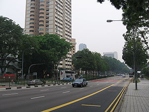
Victoria Street, Singapore
Encyclopedia
Street
A street is a paved public thoroughfare in a built environment. It is a public parcel of land adjoining buildings in an urban context, on which people may freely assemble, interact, and move about. A street can be as simple as a level patch of dirt, but is more often paved with a hard, durable...
located in the Central Area of Singapore
Singapore
Singapore , officially the Republic of Singapore, is a Southeast Asian city-state off the southern tip of the Malay Peninsula, north of the equator. An island country made up of 63 islands, it is separated from Malaysia by the Straits of Johor to its north and from Indonesia's Riau Islands by the...
. The street starts at Victoria Bridge at the end of Kallang Road
Kallang Road
Kallang Road is a major road in Singapore linking Sims Avenue/Geylang Road to Victoria Street, serving the area of Kallang....
, after the Immigration and Checkpoints Authority
Immigration and Checkpoints Authority
The Immigration and Checkpoints Authority is part of the Ministry of Home Affairs of the Singapore Government.-Overview:...
building, in the north and continues as Hill Street
Hill Street
Hill Street is a street in the downtown of Singapore starting from Eu Tong Sen Street and ending at Stamford Road, where the road becomes Victoria Street...
at its junction
Junction (road)
A road junction is a location where vehicular traffic going in different directions can proceed in a controlled manner designed to minimize accidents. In some cases, vehicles can change between different routes or directions of travel.-Origins:...
with Stamford Road
Stamford Road
Stamford Road is a one-way road in Singapore within the planning areas of Downtown Core and Museum. The road continues after the traffic light junction of Nicoll Highway, Esplanade Drive and Raffles Avenue towards Orchard Road. It then ends at the junction of Fort Canning Road, Bencoolen Street...
in the south. The street largely forms the boundary between the Downtown Core
Downtown Core
The Downtown Core is a 266-hectare urban planning area in the south of the city-state of Singapore. The Downtown Core surrounds the mouth of the Singapore River and southeastern portion of its watershed, and is part of the Central Area, Singapore's central business district...
and the Rochor and Museum Planning Area
Museum Planning Area
The Museum Planning Area is an urban planning area in the Central Region of Singapore. It is located in the area known as the Civic District. The area plays a "bridging role" between the Orchard Street area and the Downtown Core, which necessitates proper transport networks for vehicles,...
s.
Etymology and history
Both Victoria Street and Victoria Bridge were named after Queen Victoria of the United Kingdom (1819-1901). Victoria Bridge over Rochor RiverRochor River
Rochor River is a canalised river in Kallang of the Central Region in Singapore. The river is about 0.8 km in length....
was built in 1914 and took its name from Victoria Street.
The name of Victoria Street may have changed several times in the nineteenth century. On Lieutenant
Lieutenant
A lieutenant is a junior commissioned officer in many nations' armed forces. Typically, the rank of lieutenant in naval usage, while still a junior officer rank, is senior to the army rank...
Philip Jackson
Philip Jackson (surveyor)
Philip Jackson was a British Royal Navy lieutenant, who laid out the city plan for Singapore in 1822. He was a key person in Raffles plans for the settlement. The Elgin Bridge in Singapore was once named in his honour.-References:...
's plan of the town of Singapore
Jackson Plan
The Jackson Plan of 1822, also known as the "Plan of the Town of Singapore", was an urban plan for Singapore drawn up to maintain some order in the urban development of the fledgling but thriving colony founded just three years earlier...
, drawn in 1822, the street appears as "Rochor Street". However, in an 1836 map
Map
A map is a visual representation of an area—a symbolic depiction highlighting relationships between elements of that space such as objects, regions, and themes....
of the town drawn from a survey
Surveying
See Also: Public Land Survey SystemSurveying or land surveying is the technique, profession, and science of accurately determining the terrestrial or three-dimensional position of points and the distances and angles between them...
by George Drumgoole Coleman
George Drumgoole Coleman
George Drumgoole Coleman , also known as George Drumgold Coleman, was an Irish civil architect who played an instrumental role in the design and construction of much of the civil infrastructure in Singapore, after the island was founded by Sir Stamford Raffles in 1819.Born in Drogheda County Louth,...
, the street was marked out as "Marbro Street".
The Chinese
Chinese people
The term Chinese people may refer to any of the following:*People with Han Chinese ethnicity ....
called the street au bei chia lo, or "the back of horse
Horse
The horse is one of two extant subspecies of Equus ferus, or the wild horse. It is a single-hooved mammal belonging to the taxonomic family Equidae. The horse has evolved over the past 45 to 55 million years from a small multi-toed creature into the large, single-toed animal of today...
carriage
Carriage
A carriage is a wheeled vehicle for people, usually horse-drawn; litters and sedan chairs are excluded, since they are wheelless vehicles. The carriage is especially designed for private passenger use and for comfort or elegance, though some are also used to transport goods. It may be light,...
street", referring to the back of North Bridge Road
North Bridge Road
North Bridge Road is a road in Singapore north of Singapore River, that starts at the junction of Crawford Street and ends before Elgin Bridge, which the road becomes South Bridge Road. The road is one of the oldest roads in Singapore and was outlined in Raffles' 1822 Town Plan...
.
The Tamil
Tamil language
Tamil is a Dravidian language spoken predominantly by Tamil people of the Indian subcontinent. It has official status in the Indian state of Tamil Nadu and in the Indian union territory of Pondicherry. Tamil is also an official language of Sri Lanka and Singapore...
name for the street was kammangala puthu kuthu madei sadakku, கம்மங்களாம் புது கூத்துமேடை சடக்கு which meant "Street of Kampong Glam
Kampong Glam
Kampong Glam is a neighbourhood in Singapore. It is located north of the Singapore River, in the urban planning areas of Kallang and Rochor.-History:...
and the new Hindu
Hindu
Hindu refers to an identity associated with the philosophical, religious and cultural systems that are indigenous to the Indian subcontinent. As used in the Constitution of India, the word "Hindu" is also attributed to all persons professing any Indian religion...
theatre
Theater (structure)
A theater or theatre is a structure where theatrical works or plays are performed or other performances such as musical concerts may be produced. While a theater is not required for performance , a theater serves to define the performance and audience spaces...
", a reference to Kampong Glam and the Tamil cinema
Movie theater
A movie theater, cinema, movie house, picture theater, film theater is a venue, usually a building, for viewing motion pictures ....
. The India
India
India , officially the Republic of India , is a country in South Asia. It is the seventh-largest country by geographical area, the second-most populous country with over 1.2 billion people, and the most populous democracy in the world...
ns also called it boyan kampam போயான் கம்பம் or pal kampam பால் கம்பம்.
The Malay
Malay people
Malays are an ethnic group of Austronesian people predominantly inhabiting the Malay Peninsula, including the southernmost parts of Thailand, the east coast of Sumatra, the coast of Borneo, and the smaller islands which lie between these locations...
s refer to the street as kampong boyan lama, a reference to the old Bawean
Bawean
Bawean is an island of Indonesia located approximately 150 km north of Surabaya in the Java Sea, off the coast of Java. It is administered by Gresik Regency of East Java province. It is approximately 15 km in diameter and is circumnavigated by a single narrow road. Bawean is dominated by...
ese village
Village
A village is a clustered human settlement or community, larger than a hamlet with the population ranging from a few hundred to a few thousand , Though often located in rural areas, the term urban village is also applied to certain urban neighbourhoods, such as the West Village in Manhattan, New...
that was located in the area towards Rochor Road.
Landmarks
Victoria Street passes through the historic districts of Kampong Glam, Bugis and Bras Basah. Notable landmarkLandmark
This is a list of landmarks around the world.Landmarks may be split into two categories - natural phenomena and man-made features, like buildings, bridges, statues, public squares and so forth...
s along the road include (from north to south):
- Masjid MalabarMasjid MalabarMasjid Malabar is Singapore's only Malabar Muslim mosque. The mosque is located at the junction of Victoria Street and Jalan Sultan in the Kampong Glam district, in the Rochor Planning Area within the Central Area, Singapore's central business district...
- Victoria Street Wholesale Centre near Ophir RoadOphir RoadOphir Road is a road that starts after the junction of Sungei Road and Jalan Besar and ends after the Ophir Flyover leading towards East Coast Parkway to Ayer Rajah Expressway or Singapore Changi Airport. The road is located within the planning areas of Kallang, Downtown Core and Rochor...
and Arab StreetArab StreetArab Street is the name of a road and neighbourhood in Singapore. There are two explanations behind the name. The first one is that the area was owned by an Arab merchant, Syed Ali bin Mohamed Al Junied and that it was the site of an Arab kampong, hence the name Arab Street... - Bugis StreetBugis StreetBugis, in the city-state of Singapore, was renowned internationally from the 1950s to the 1980s for its nightly gathering of trans women, a phenomenon which made it one of Singapore's top tourist destinations during that period....
- Bugis JunctionBugis JunctionBugis Junction is an integrated development located at Victoria Street, Middle Road and North Bridge Road in Bugis, Downtown Core Planning Area in Singapore. The development consists of a shopping mall, an office tower and the InterContinental Singapore Hotel...
- National LibraryNational Library, SingaporeThe National Library in Singapore is located on an 11,304-square metre site between Bugis Junction and the Bras Basah Complex at 100, Victoria Street...
building - Nanyang Academy of Fine ArtsNanyang Academy of Fine ArtsNanyang Academy of Fine Arts is one of the oldest and most established tertiary arts institution in Singapore....
, Middle RoadMiddle Road, SingaporeMiddle Road is a road located in the Downtown Core and Rochor within the Central Area of Singapore. It starts from its junction with Selegie Road and ends at Beach Road. Middle Road was already in existence in early Singapore, appearing in George Drumgoole Coleman's Map of Singapore in 1836...
campus - Saint Joseph's ChurchSaint Joseph's ChurchSaint Joseph's Church is a Roman Catholic church in Singapore. It is located along Victoria Street in the Rochor Planning Area, within the Central Area of Singapore's central business district....
, a national monumentNational Monuments of SingaporeNational Monuments of Singapore are buildings and structures in Singapore that have been designated by the Preservation of Monuments Board as being of special historic, traditional, archaeological, architectural or artistic value.... - Bras Basah Complex
- Singapore Management UniversitySingapore Management UniversityThe Singapore Management University was officially incorporated on January 12, 2000, and was Singapore's first private university funded by the government...
, Administration building and Lee Kong Chian School of BusinessLee Kong Chian School of BusinessThe Lee Kong Chian School of Business is Singapore Management University's business school. Started in 2000, the school was the first to be established under the Singapore Management University's charter. It is a research-driven school, with a blend of education that focuses on academic research... - Cathedral of the Good ShepherdCathedral of the Good ShepherdThe Cathedral of the Good Shepherd is the oldest Roman Catholic church in Singapore. It is located in the Museum Planning Area within the Civic District and affords a welcome respite from the city....
, a national monument - Former CHIJConvent of the Holy Infant JesusThe Convent of the Holy Infant Jesus schools are a group of eleven all-girls Catholic schools in Singapore. The first CHIJ school in Singapore was established at Victoria Street in 1854, by nuns of the Sisters of the Holy Infant Jesus. Today, the group includes six primary schools, four secondary...
which has been turned into a popular entertainment venue called CHIJMESCHIJMESCHIJMES is a historic building complex in Singapore, which began life as a Catholic convent known as the Convent of the Holy Infant Jesus and convent quarters known as Caldwell House...
, now a national monument - IlumaIlumaIluma is a ten-story shopping mall which is managed and owned by Jack Investment Pte Ltd. The mall is located within the Bugis district of Singapore and opened its doors on March 28, 2009. With a budget of S$100 million, the country's first urban entertainment centre is targeted at the young...