
Utah State Route 262
Encyclopedia
State Route 262 is a highway completely within San Juan County
in southeastern Utah
that connects US-191 north of Bluff
to SR-162
in Montezuma Creek
.
, near the curve to the south-southwest. In 1961, the route was extended to just beyond its present end in the settlement of Montezuma Creek
, where the road to Aneth
(now SR-162) turns east, and in 1965 it was extended further to the Colorado
state line, connecting to SH 41 across the border. A road from Montezuma Creek west to US-191 at Bluff was added to the state highway system in 1986 as SR-163. At the time, Utah was considering making the road part of an extension of US-163 into Colorado, but plans fell through, leaving an overlap with US-191 and Route 163 near Bluff that became US-163 to the west and SR-163 to the east. To fix this issue, SR-163 was renumbered SR-162 in 2004, and the part of SR-262 east of Montezuma Creek also became SR-162.
San Juan County, Utah
As of the current census of 2010, there were 14,746 people and 4,505 households. The racial and ethnic composition of the population was 50.4% Native American, 45.8% white, 0.3% Asian, 0.2% African American and 2.3% reporting two or more races...
in southeastern Utah
Utah
Utah is a state in the Western United States. It was the 45th state to join the Union, on January 4, 1896. Approximately 80% of Utah's 2,763,885 people live along the Wasatch Front, centering on Salt Lake City. This leaves vast expanses of the state nearly uninhabited, making the population the...
that connects US-191 north of Bluff
Bluff, Utah
Bluff is a census-designated place in San Juan County, Utah, United States. The population was 320 at the 2000 census.-Geography:Bluff is located at , in the scenic and very sparsely populated southeastern Utah canyonlands of the Colorado Plateau.According to the United States Census Bureau, the...
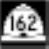
to SR-162
Utah State Route 162
State Route 162 is a state highway located in San Juan County, Utah. It begins at US-191 east of Bluff. It then follows the former alignment of SR-163 to Montezuma Creek. There, it intersects UT-262 at its southern terminus. Afterwards, it follows SR-262's former alignment past Aneth to the...
in Montezuma Creek
Montezuma Creek, Utah
Montezuma Creek is a census-designated place in San Juan County, Utah, United States. The population was 507 at the 2000 census, a large increase over the 1990 figure of 345.-Education:...
.
Route description
After its western terminus, SR-262 generally heads east until Indian Route 5099, where it turns south-southwest. Afterwards, the route turns east and then south for one last time before reaching the eastern terminus in Montezuma Creek.History
The State Road Commission created SR-262 in 1958, running from SR-47 (now US-191) north of Bluff east and south for 20.0 miles (32.2 km) to a point in the Aneth Oil Field about a mile (1.5 km) beyond the bridge over Montezuma CreekMontezuma Creek (San Juan River)
Montezuma Creek is a tributary of the San Juan River. The river is approximately long and is a seasonal river, becoming dry for several months of the year.-Location:...
, near the curve to the south-southwest. In 1961, the route was extended to just beyond its present end in the settlement of Montezuma Creek
Montezuma Creek, Utah
Montezuma Creek is a census-designated place in San Juan County, Utah, United States. The population was 507 at the 2000 census, a large increase over the 1990 figure of 345.-Education:...
, where the road to Aneth
Aneth, Utah
Aneth is a census-designated place in San Juan County, Utah, United States. The population was 598 at the 2000 census.-Geography:Aneth is located at ....
(now SR-162) turns east, and in 1965 it was extended further to the Colorado
Colorado
Colorado is a U.S. state that encompasses much of the Rocky Mountains as well as the northeastern portion of the Colorado Plateau and the western edge of the Great Plains...
state line, connecting to SH 41 across the border. A road from Montezuma Creek west to US-191 at Bluff was added to the state highway system in 1986 as SR-163. At the time, Utah was considering making the road part of an extension of US-163 into Colorado, but plans fell through, leaving an overlap with US-191 and Route 163 near Bluff that became US-163 to the west and SR-163 to the east. To fix this issue, SR-163 was renumbered SR-162 in 2004, and the part of SR-262 east of Montezuma Creek also became SR-162.