
Tuscarawas River
Encyclopedia
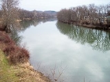
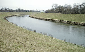
The Tuscarawas River is a principal tributary
of the Muskingum River
, 129.9 miles (209 km) long, in northeastern Ohio
in the United States
. Via the Muskingum and Ohio
Rivers, it is part of the watershed
of the Mississippi River
, draining an area of 2590 square miles (6,708.1 km²) on glaciated
and unglaciated portions of the Allegheny Plateau
.
It rises southwest of Hartville
in northern Stark County
, and initially flows westward, through Uniontown
into southern Summit County
, where it passes through the Portage Lakes
area south of Akron
, and the city of Barberton
. From Barberton the Tuscarawas flows generally southward through Stark and Tuscarawas Counties, through the communities of Clinton
, Canal Fulton
, Massillon
, Navarre
, Bolivar
, Zoar
, Dover
, and New Philadelphia
. South of New Philadelphia the river turns to the southwest and west, flowing past Tuscarawas
, Gnadenhutten
, Port Washington
, and Newcomerstown
into Coshocton County
, where it joins the Walhonding River
at the city of Coshocton
to form the Muskingum River. From Barberton downstream, the Ohio and Erie Canal
was constructed in parallel to the river in 1828-1830; usage began declining in the 1850s, and the canal was damaged beyond repair by flooding in 1913. Portions of the canal's towpath
route are maintained as a hiking and bicycling trail.
According to the Geographic Names Information System
, the Tuscarawas River has also been known historically by the names Little Muskingum River, Mashongam River, Tuscarawa River, and Tuskarawas Creek.
, the state of Ohio Environmental Protection Agency has recommended limits on the consumption of fish taken from the river, due to contamination by mercury
and PCBs
.
in Stark County near Bolivar. In Tuscarawas County, it collects Conotton Creek
southeast of Zoar; Sugar Creek
at Dover; and Stillwater Creek north of Tuscarawas. Nimishillen Creek
, a tributary of Sandy Creek, drains the city of Canton
.
's stream gauge
in Newcomerstown, the annual mean flow of the river between 1922 and 2005 was 2,591 ft³/s (73 m³/s). The highest recorded flow during the period was 46,800 ft³/s (1,325 m³/s) on January 26, 1937. The lowest recorded flow was 216 ft³/s (6 m³/s) on August 15, 1944.
At an upstream gauge in Massillon, the annual mean flow of the river between 1938 and 2005 was 466 ft³/s (13 m³/s). The highest recorded flow during the period was 10,700 ft³/s (303 m³/s) on July 5, 1969. The lowest recorded flow was 45 ft³/s (1.3 m³/s) on September 20, 1999.
references the Tuscarawas in their song "Carry Me, Ohio". Interestingly, the singer commits an error of geography when he sings, "Tuscarawas river flows into a great lake". Presumably he's telling us the river flows into Lake Erie, to the north. As the map demonstrates, the Tuscarawas never goes anywhere near Great Lake Erie.
Tributary
A tributary or affluent is a stream or river that flows into a main stem river or a lake. A tributary does not flow directly into a sea or ocean...
of the Muskingum River
Muskingum River
The Muskingum River is a tributary of the Ohio River, approximately 111 miles long, in southeastern Ohio in the United States. An important commercial route in the 19th century, it flows generally southward through the eastern hill country of Ohio...
, 129.9 miles (209 km) long, in northeastern Ohio
Ohio
Ohio is a Midwestern state in the United States. The 34th largest state by area in the U.S.,it is the 7th‑most populous with over 11.5 million residents, containing several major American cities and seven metropolitan areas with populations of 500,000 or more.The state's capital is Columbus...
in the United States
United States
The United States of America is a federal constitutional republic comprising fifty states and a federal district...
. Via the Muskingum and Ohio
Ohio River
The Ohio River is the largest tributary, by volume, of the Mississippi River. At the confluence, the Ohio is even bigger than the Mississippi and, thus, is hydrologically the main stream of the whole river system, including the Allegheny River further upstream...
Rivers, it is part of the watershed
Drainage basin
A drainage basin is an extent or an area of land where surface water from rain and melting snow or ice converges to a single point, usually the exit of the basin, where the waters join another waterbody, such as a river, lake, reservoir, estuary, wetland, sea, or ocean...
of the Mississippi River
Mississippi River
The Mississippi River is the largest river system in North America. Flowing entirely in the United States, this river rises in western Minnesota and meanders slowly southwards for to the Mississippi River Delta at the Gulf of Mexico. With its many tributaries, the Mississippi's watershed drains...
, draining an area of 2590 square miles (6,708.1 km²) on glaciated
Glacier
A glacier is a large persistent body of ice that forms where the accumulation of snow exceeds its ablation over many years, often centuries. At least 0.1 km² in area and 50 m thick, but often much larger, a glacier slowly deforms and flows due to stresses induced by its weight...
and unglaciated portions of the Allegheny Plateau
Allegheny Plateau
The Allegheny Plateau is a large dissected plateau area in western and central New York, northern and western Pennsylvania, northern and western West Virginia, and eastern Ohio...
.
It rises southwest of Hartville
Hartville, Ohio
Hartville is a village in Stark County, Ohio, United States. The population was 2,174 at the 2000 census. It is part of the Canton–Massillon Metropolitan Statistical Area....
in northern Stark County
Stark County, Ohio
Stark County is a county located in the U.S. state of Ohio. As of the 2010 census, the population was 375,586. It is included in the Canton-Massillon, Ohio Metropolitan Statistical Area....
, and initially flows westward, through Uniontown
Uniontown, Ohio
Uniontown is a census-designated place in Stark County, Ohio, United States. The population was 2,802 at the 2000 census. Uniontown was named #69 on CNN Money's list.Uniontown is part of the Canton–Massillon Metropolitan Statistical Area....
into southern Summit County
Summit County, Ohio
Summit County is an urban county located in the state of Ohio, United States. As of the 2000 census, the population was 542,899. In the 2010 Census the population was 541,781. Its county seat is Akron...
, where it passes through the Portage Lakes
Portage Lakes (Ohio)
The Portage Lakes are named after an old Indian portage path which connected the Cuyahoga River flowing north to Lake Erie and the Tuscarawas River, a tributary of the Muskingum River, which flows south to the Ohio River. This proved advantageous for the Indians and early settlers as navigation...
area south of Akron
Akron, Ohio
Akron , is the fifth largest city in the U.S. state of Ohio and the county seat of Summit County. It is located in the Great Lakes region approximately south of Lake Erie along the Little Cuyahoga River. As of the 2010 census, the city had a population of 199,110. The Akron Metropolitan...
, and the city of Barberton
Barberton, Ohio
As of the census of 2000, there were 27,899 people, 11,523 households, and 7,443 families residing in the city. The population density was 3,095.2 people per square mile . There were 12,163 housing units at an average density of 1,349.4 per square mile...
. From Barberton the Tuscarawas flows generally southward through Stark and Tuscarawas Counties, through the communities of Clinton
Clinton, Ohio
Clinton is a village in Summit County, Ohio, United States. The population was 1,337 at the 2000 census. It is part of the Akron Metropolitan Statistical Area.- History :...
, Canal Fulton
Canal Fulton, Ohio
Canal Fulton is a city in Stark County in the U.S. state of Ohio. The population was 5,479 at the 2010 census. It is part of the Canton–Massillon Metropolitan Statistical Area.-Geography:...
, Massillon
Massillon, Ohio
Massillon is a city located in Stark County in the U.S. state of Ohio, approximately 8 miles to the west of Canton, Ohio, 20 miles south of Akron, Ohio, and 50 miles south of Cleveland, Ohio. The population was 32,149 at the 2010 census....
, Navarre
Navarre, Ohio
Navarre is a village in Stark County, Ohio, United States. The population was 1,440 at the 2000 census...
, Bolivar
Bolivar, Ohio
Bolivar is a village in Tuscarawas County, Ohio, United States. The population was 894 at the 2000 census. Bolivar is also home to Fort Laurens, the only American Revolutionary War-era fort in what is now Ohio.-History:...
, Zoar
Zoar, Ohio
Zoar is a village in Tuscarawas County, Ohio, United States. The population was 193 at the 2000 census.-History:Zoar was founded by German religious dissenters called the Society of Separatists of Zoar in 1817. It was a communal society, with many German-style structures that have been restored and...
, Dover
Dover, Ohio
Dover is a city in Tuscarawas County, Ohio, United States. The population was 12,210 at the 2000 census.-History and features:Dover was originally part of a grant to Col. James Morrison of Kentucky, who had received it from the federal government for Revolutionary War services...
, and New Philadelphia
New Philadelphia, Ohio
New Philadelphia is a city in Tuscarawas County, Ohio, United States, 71 miles south of Cleveland on the Tuscarawas River. It was first incorporated in 1808. Coal and clay are found in the vicinity...
. South of New Philadelphia the river turns to the southwest and west, flowing past Tuscarawas
Tuscarawas, Ohio
Tuscarawas is a village in Tuscarawas County, Ohio, United States. The population was 934 at the 2000 census.-Geography:Tuscarawas is located at , along the Tuscarawas River....
, Gnadenhutten
Gnadenhutten, Ohio
Gnadenhutten is a village located on the Tuscarawas River in Tuscarawas County, Ohio, United States and is Ohio's oldest existing settlement. The population was 1,280 at the 2000 census....
, Port Washington
Port Washington, Ohio
Port Washington is a village in Tuscarawas County, Ohio, United States. The population was 552 at the 2000 census.-Geography:Port Washington is located at , along the Tuscarawas River....
, and Newcomerstown
Newcomerstown, Ohio
Newcomerstown is a village in Tuscarawas County, Ohio, United States, east-northeast of Columbus. In the late 1770s, this was the largest Lenape village on the Tuscarawas River, with 700 residents. Chief Newcomer was the leader of the western Lenape here, and they called the village...
into Coshocton County
Coshocton County, Ohio
Coshocton County is a county located in the state of Ohio, United States. As of the 2010 census, the population was 36,901. Its county seat is Coshocton. Its name comes from the Delaware Indian language and has been translated as "union of waters" or "black bear crossing".The Coshocton...
, where it joins the Walhonding River
Walhonding River
The Walhonding River is a principal tributary of the Muskingum River, 23.5 miles long, in east-central Ohio in the United States. Via the Muskingum and Ohio Rivers, it is part of the watershed of the Mississippi River. It drains an area of 2,252 square miles .The Walhonding flows for its entire...
at the city of Coshocton
Coshocton, Ohio
Coshocton is a city in and the county seat of Coshocton County, Ohio, United States. The population of the city was 11,682 at the 2000 census. The Walhonding River and the Tuscarawas River meet in Coshocton to form the Muskingum River....
to form the Muskingum River. From Barberton downstream, the Ohio and Erie Canal
Ohio and Erie Canal
The Ohio Canal or Ohio and Erie Canal was a canal constructed in the 1820s and early 1830s. It connected Akron, Summit County, with the Cuyahoga River near its mouth on Lake Erie in Cleveland, Cuyahoga County, and a few years later, with the Ohio River near Portsmouth, Scioto County, and then...
was constructed in parallel to the river in 1828-1830; usage began declining in the 1850s, and the canal was damaged beyond repair by flooding in 1913. Portions of the canal's towpath
Towpath
A towpath is a road or trail on the bank of a river, canal, or other inland waterway. The purpose of a towpath is to allow a land vehicle, beasts of burden, or a team of human pullers to tow a boat, often a barge...
route are maintained as a hiking and bicycling trail.
According to the Geographic Names Information System
Geographic Names Information System
The Geographic Names Information System is a database that contains name and locative information about more than two million physical and cultural features located throughout the United States of America and its territories. It is a type of gazetteer...
, the Tuscarawas River has also been known historically by the names Little Muskingum River, Mashongam River, Tuscarawa River, and Tuskarawas Creek.
, the state of Ohio Environmental Protection Agency has recommended limits on the consumption of fish taken from the river, due to contamination by mercury
Mercury (element)
Mercury is a chemical element with the symbol Hg and atomic number 80. It is also known as quicksilver or hydrargyrum...
and PCBs
Polychlorinated biphenyl
Polychlorinated biphenyls are a class of organic compounds with 2 to 10 chlorine atoms attached to biphenyl, which is a molecule composed of two benzene rings. The chemical formula for PCBs is C12H10-xClx...
.
Tributaries
The Tuscarawas River collects Chippewa Creek in Summit County near Clinton, and Sandy CreekSandy Creek (Ohio)
Sandy Creek is a tributary of the Tuscarawas River, 41.3 miles long, in northeastern Ohio in the United States. Via the Tuscarawas, Muskingum and Ohio Rivers, it is part of the watershed of the Mississippi River, draining an area of 503 square miles .Sandy Creek rises in Hanover Township,...
in Stark County near Bolivar. In Tuscarawas County, it collects Conotton Creek
Conotton Creek
Conotton Creek is a tributary of the Tuscarawas River, 38.7 miles long, in eastern Ohio in the United States. Via the Tuscarawas, Muskingum and Ohio Rivers, it is part of the watershed of the Mississippi River, draining an area of 286 square miles in Carroll, Harrison and Tuscarawas County,...
southeast of Zoar; Sugar Creek
Sugar Creek (Ohio)
Sugar Creek is a tributary of the Tuscarawas River in northeastern Ohio in the United States. It is 45 miles long. Via the Tuscarawas, Muskingum, and Ohio Rivers, it is part of the watershed of the Mississippi River, draining an area of 356 square miles on glaciated and unglaciated...
at Dover; and Stillwater Creek north of Tuscarawas. Nimishillen Creek
Nimishillen Creek
Nimishillen Creek is a tributary of Sandy Creek, 24.5 miles long, in northeastern Ohio in the United States. Via Sandy Creek and the Tuscarawas, Muskingum and Ohio Rivers, it is part of the watershed of the Mississippi River, draining an area of 187 square miles , including the city of...
, a tributary of Sandy Creek, drains the city of Canton
Canton, Ohio
Canton is the county seat of Stark County in northeastern Ohio, approximately south of Akron and south of Cleveland.The City of Caton is the largest incorporated area within the Canton-Massillon Metropolitan Statistical Area...
.
Flow rate
At the United States Geological SurveyUnited States Geological Survey
The United States Geological Survey is a scientific agency of the United States government. The scientists of the USGS study the landscape of the United States, its natural resources, and the natural hazards that threaten it. The organization has four major science disciplines, concerning biology,...
's stream gauge
Stream gauge
A stream gauge, stream gage or gauging station is a location used by hydrologists or environmental scientists to monitor and test terrestrial bodies of water. Hydrometric measurements of water surface elevation and/or volumetric discharge are generally taken and observations of biota may also be...
in Newcomerstown, the annual mean flow of the river between 1922 and 2005 was 2,591 ft³/s (73 m³/s). The highest recorded flow during the period was 46,800 ft³/s (1,325 m³/s) on January 26, 1937. The lowest recorded flow was 216 ft³/s (6 m³/s) on August 15, 1944.
At an upstream gauge in Massillon, the annual mean flow of the river between 1938 and 2005 was 466 ft³/s (13 m³/s). The highest recorded flow during the period was 10,700 ft³/s (303 m³/s) on July 5, 1969. The lowest recorded flow was 45 ft³/s (1.3 m³/s) on September 20, 1999.
In popular culture
The band Sun Kil MoonSun Kil Moon
Sun Kil Moon is a music project of singer-songwriter Mark Kozelek, best known for his previous band Red House Painters. Sun Kil Moon sees Kozelek undertake the writing, composing, singing, and guitar playing, accompanied by Tim Mooney and Anthony Koutsos on drums, and Geoff Stanfield on bass...
references the Tuscarawas in their song "Carry Me, Ohio". Interestingly, the singer commits an error of geography when he sings, "Tuscarawas river flows into a great lake". Presumably he's telling us the river flows into Lake Erie, to the north. As the map demonstrates, the Tuscarawas never goes anywhere near Great Lake Erie.
See also