

Transport in Colombia
Encyclopedia
Transport
Transport or transportation is the movement of people, cattle, animals and goods from one location to another. Modes of transport include air, rail, road, water, cable, pipeline, and space. The field can be divided into infrastructure, vehicles, and operations...
in Colombia
Colombia
Colombia, officially the Republic of Colombia , is a unitary constitutional republic comprising thirty-two departments. The country is located in northwestern South America, bordered to the east by Venezuela and Brazil; to the south by Ecuador and Peru; to the north by the Caribbean Sea; to the...
is regulated by the Ministry of Transport
Ministry of Transport (Colombia)
The Ministry of Transport is the national executive ministry of the Government of Colombia responsible for charge of regulating transportation in Colombia.- History :...
.
Road travel is the main means of transport; almost 70 percent of cargo is transported by road, as compared with 27 percent by railroad, 3 percent by internal waterways, and 1 percent by air. Nevertheless, Colombia has one of the lowest ratios of paved roads per inhabitant in Latin America. The country has well-developed air and waterway routes. The only means of transportation in 60 percent of the country is via waterways, but guerrilla groups control the waterways in the south and southeast.
Indigenous peoples influence
Indigenous peoples in Colombia
The indigenous peoples in Colombia comprise a large number of distinct ethnic groups who inhabited the country's present territory prior to its discovery by Europeans around 1500.-Origins:...
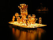
used and some continue to use the water ways as the way of transportation using raft
Raft
A raft is any flat structure for support or transportation over water. It is the most basic of boat design, characterized by the absence of a hull...
s and canoes.
Spanish influence
With the arrival of the Europeans the Spaniards broughtSpanish people
The Spanish are citizens of the Kingdom of Spain. Within Spain, there are also a number of vigorous nationalisms and regionalisms, reflecting the country's complex history....
the horse
Horse
The horse is one of two extant subspecies of Equus ferus, or the wild horse. It is a single-hooved mammal belonging to the taxonomic family Equidae. The horse has evolved over the past 45 to 55 million years from a small multi-toed creature into the large, single-toed animal of today...
s, mules and donkey (which developed into the Paso Fino
Paso Fino
The Paso Fino is a naturally gaited light horse breed dating back to horses imported to the Caribbean from Spain. Pasos are prized for their smooth, natural, four beat, lateral ambling gait and are used in many disciplines, but are especially popular for trail riding...
) used by them in ranching duties later in the Spanish colonization of the Americas
Spanish colonization of the Americas
Colonial expansion under the Spanish Empire was initiated by the Spanish conquistadores and developed by the Monarchy of Spain through its administrators and missionaries. The motivations for colonial expansion were trade and the spread of the Christian faith through indigenous conversions...
. Horses contributed greatly to the transport of the Spanish conquerors and colonizers. They also introduced the wheel, and brought wooden carts and carriages to facilitate their transport. The Spaniards also developed the first roads, rudimentary and most of these in the Caribbean region. Due to the rough terrain of Colombia
Geography of Colombia
The geography of Colombia is characterized by containing five main natural regions that present their own unique characteristics, from the Andes mountain range region shared with Ecuador and Venezuela; the Pacific Ocean coastal region shared with Panama and Ecuador; the Caribbean Sea coastal region...
communications between regions was difficult and affected the effectiveness of the central government creating isolation in some regions. Maritime navigation developed locally after Spain lifted its restrictions on ports within the Spanish Empire
Spanish Empire
The Spanish Empire comprised territories and colonies administered directly by Spain in Europe, in America, Africa, Asia and Oceania. It originated during the Age of Exploration and was therefore one of the first global empires. At the time of Habsburgs, Spain reached the peak of its world power....
inducing mercantilism. Spanish also transported African slaves and forcedly migrated many indigenous tribes throughout Colombia.
Post-independence
With the independence and the influences of the European Industrial RevolutionIndustrial Revolution
The Industrial Revolution was a period from the 18th to the 19th century where major changes in agriculture, manufacturing, mining, transportation, and technology had a profound effect on the social, economic and cultural conditions of the times...
the main way of transport in Colombia became the navigation mainly through the Magdalena River
Magdalena River
The Magdalena River is the principal river of Colombia, flowing northward about through the western half of the country. It takes its name from the biblical figure Mary Magdalene. It is navigable through much of its lower reaches, in spite of the shifting sand bars at the mouth of its delta, as...
which connected the capital city Bogotá
Bogotá
Bogotá, Distrito Capital , from 1991 to 2000 called Santa Fé de Bogotá, is the capital, and largest city, of Colombia. It is also designated by the national constitution as the capital of the department of Cundinamarca, even though the city of Bogotá now comprises an independent Capital district...
in inland Colombia, with Barranquilla
Barranquilla
Barranquilla is an industrial port city and municipality located in northern Colombia, near the Caribbean Sea. The capital of the Atlántico Department, it is the largest industrial city and port in the Colombian Caribbean region with a population of 1,148,506 as of 2005, which makes it Colombia's...
by the Caribbean sea
Caribbean Sea
The Caribbean Sea is a sea of the Atlantic Ocean located in the tropics of the Western hemisphere. It is bounded by Mexico and Central America to the west and southwest, to the north by the Greater Antilles, and to the east by the Lesser Antilles....
to the trade with the United States and Europe. This also brought a large wave of immigrants from European and Middle Eastern countries. The industrialization process and transportation in Colombia were affected by the internal civil wars that surged after the independence from Spain and that continued throughout the 19th and 20th centuries.
Standardization
During the late 19th century European and American companies introduced railways to carry to the ports the local production of raw materials intended for exports and also imports from Europe. Steam ships began carrying Colombians, immigrants and goods from Europe and the United States over the Magdalena RiverMagdalena River
The Magdalena River is the principal river of Colombia, flowing northward about through the western half of the country. It takes its name from the biblical figure Mary Magdalene. It is navigable through much of its lower reaches, in spite of the shifting sand bars at the mouth of its delta, as...
.
Rafael Reyes
Rafael Reyes Prieto was Chief of Staff of the Colombian National Army and President of Colombia .- Biographic data :...
under the name of Ministerio de Obras Públicas y Transporte or Ministry of Public Works and Transport with the main function of taking care of national assets issues, including mines, oil (fuel), patents and trade marks, railways, roads, bridges, national buildings and land without landowners.
In the early 20th century roads and highways maintenance and construction regulations were established. Rivers were cleaned, dragged and channeled and the navigational industry was organized. The Public works districts were created, as well as the Ferrocarriles Nacionales de Colombia (National Railways of Colombia). Among other major projects developed were the aqueduct of Bogotá
Bogotá
Bogotá, Distrito Capital , from 1991 to 2000 called Santa Fé de Bogotá, is the capital, and largest city, of Colombia. It is also designated by the national constitution as the capital of the department of Cundinamarca, even though the city of Bogotá now comprises an independent Capital district...
, La Regadera Dam and the Vitelma Water Treatment Plant. The Ministry also created the National Institute of Transit (from the Spanish Instituto Nacional de Tránsito), (INTRA) under the Transport and tariffs Directorate and was in charge of designing the first National roads plan with the support of many foreign multinational construction companies.
Aviation was born in Barranquilla
Barranquilla
Barranquilla is an industrial port city and municipality located in northern Colombia, near the Caribbean Sea. The capital of the Atlántico Department, it is the largest industrial city and port in the Colombian Caribbean region with a population of 1,148,506 as of 2005, which makes it Colombia's...
with the creation of SCADTA
SCADTA
The Colombian-German Air Transport Society , or SCADTA, was the world's second airline, and the first airline of the American continent, operating from 1919 until World War II. After the war, SCADTA merged with Colombian regional carrier Colombian Air Service , or SACO. Together, SCADTA and SACO...
in 1919 a joint venture between Colombians and Germans that delivered mail to the main cities of Colombia which later merged with SACO
SACO
The Colombian Air Service , or SACO, was an early Colombian airline. Founded in 1933, in 1940 SACO merged with the Colombo-German Air Transport Society ; the new company was named Airline of the American Continent...
to form Avianca
Avianca
Avianca S.A. is the flag carrier airline of Colombia since December 5, 1919 when it was initially registered under the name SCADTA. It is headquartered in Bogotá, D.C. with its hub at the El Dorado International Airport...
.
Railways
Colombia has 3034 kilometres (1,885.2 mi) of rail lines, 150 kilometres (93.2 mi) of which are gauge and 3154 kilometres (1,959.8 mi) of which are gauge. However, only 2611 kilometres (1,622.4 mi) of lines are still in use. Rail transport in Colombia remains underdeveloped. The national railroad system, once the country's main mode of transport for freight, has been neglected in favor of road development and now accounts for only about a quarter of freight transport. Passenger-rail use was suspended in 1992 and resumed at the end of the 1990s. However, fewer than 165,000 passenger journeys were made in 1999, as compared with more than 5 million in 1972, and the figure was only 160,130 in 2005. Short sections of railroad, mainly the Bogotá-Atlantic rim, are used to haul goods, mostly coal, to the Caribbean and Pacific ports. In 2005 a total of 27.5 million metric tons of cargo were transported by rail. Although the nation's rail network links seven of the country's 10 major cities, very little of it has been used regularly because of security concerns, lack of maintenance, and the power of the road transport union. During 2004–6, approximately 2,000 kilometers of the country's rail lines underwent refurbishment. This upgrade involved two main projects: the 1,484-kilometer line linking Bogotá to the Caribbean Coast and the 499-kilometer Pacific coastal network that links the industrial city of CaliCalì
Calì, also written in English as Cali, is an Italian surname, widespread mainly in the Ionian side of Sicily.For the surname Calì is assumed the origin of the Greek word kalos , or from its Sanskrit root kali, "time."The surname refers to:...
and the surrounding coffee-growing region
Colombian Coffee-Growers Axis
Colombian Coffee-Growers Axis , also known as Coffee Triangle is a part of the Colombian Paisa region which is famous for growing and production of a majority of the Colombian coffee, considered by some as the best coffee in the world. There are three departments in the area: Caldas, Quindío and...
to the port of Buenaventura
Buenaventura
-Myths and legends:*Buenaventura River , a legendary but non-existent river that was once believed to run from the Rocky Mountains to the Pacific Ocean in what is now the western United States-People:...
.
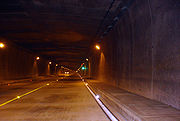
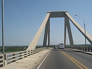
Roads
The three main north-south highways are the Caribbean, Eastern, and Central Trunk Highways (troncales). Estimates of the length of Colombia's road system in 2004 ranged from 115,000 kilometers to 145,000 kilometers, of which fewer than 15 percent were paved. However, according to 2005 data reported by the Colombian government, the road network totaled 163,000 kilometers, 68 percent of which were paved and in good condition. The increase may reflect some newly built roads. President Uribe has vowed to pave more than 2,500 kilometers of roads during his administration, and about 5,000 kilometers of new secondary roads were being built in the 2003–6 period. Despite serious terrain obstacles, almost three-quarters of all cross-border dry cargo is now transported by road, 105,251 metric tons in 2005.Highways are managed by the Colombian Ministry of Transport
Ministry of Transport (Colombia)
The Ministry of Transport is the national executive ministry of the Government of Colombia responsible for charge of regulating transportation in Colombia.- History :...
through the National Roads Institute. The security of the highways in Colombia is managed by the Highway Police
Highway Police (Colombia)
The Highway Police is the main body enforcing road regulations in Colombia to control land transportation and traffic, prevention of accidentality and crimes, similar to a highway patrol but with a nationwide area of operations.-History:During the presidency of Miguel Abadía Méndez in 1929 by...
unit of the Colombian National Police
Colombian National Police
The National Police of Colombia is the national police force of Colombia. Although the National Police is not part of the Military of Colombia , it constitutes along with them the "Public Force" and is also controlled by the Ministry of Defense. They are the largest police force in Colombia...
. Colombia is crossed by the Panamerican Highway.
Ports, waterways, and merchant marine
Seaports handle around 80 percent of international cargo. In 2005 a total of 105,251 metric tons of cargo were transported by water. Colombia's most important ocean terminals are Barranquilla, Cartagena, and Santa Marta on the Caribbean Coast and Buenaventura and Tumaco on the Pacific Coast. Exports mostly pass through the Caribbean ports of Cartagena and Santa Marta, while 65 percent of imports arrive at the port of Buenaventura. Other important ports and harbors are Bahía de Portete, Leticia, Puerto Bolívar, San Andrés, Santa Marta, and Turbo. Since privatization was implemented in 1993, the efficiency of port handling has increased greatly. There are plans to construct a deep-water port at Bahía Solano.The main inland waterways total about 18,200 kilometers, 11,000 kilometers of which are navigable by riverboats. A well-developed and important form of transport for both cargo and passengers, inland waterways transport approximately 3.8 million metric tons of freight and more than 5.5 million passengers annually. Main inland waterways are the Magdalena–Cauca River system, which is navigable for 1,500 kilometers; the Atrato, which is navigable for 687 kilometers; the Orinoco system of more than five navigable rivers, which total more than 4,000 kilometers of potential navigation (mainly through Venezuela); and the Amazonas system, which has four main rivers totaling 3,000 navigable kilometers (mainly through Brazil). The government is planning an ambitious program to more fully utilize the main rivers for transport. In addition, the navy's riverine brigade has been patrolling waterways more aggressively in order to establish safer river transport in the more remote areas in the south and east of the country that are controlled by rebel groups.
The merchant marine totals 17 ships (1,000 gross registered tons or more), including four bulk, 13 cargo, one container, one liquefied gas, and three petroleum tanker ships. Colombia also has seven ships registered in other countries (Antigua and Barbuda, two; Panama, five).
Aviation
Special Administrative Unit of Civil Aeronautics
The Special Administrative Unit of Civil Aeronautics is a government agency of the Colombian Ministry of Transport. It is the agency in charge of regulating civil aviation, the aviation industry, and of managing the Colombian airspace. Aerocivil is also in charge of managing and controlling all of...
. The customs/immigration issues are controlled by the Departamento Administrativo de Seguridad
Departamento Administrativo de Seguridad
The Administrative Department of Security was the Security Service agency of Colombia, also responsible for the immigration services. It was dissolved on 31 October 2011 as part of a wider Executive Reform, and it was superseded by the National Directorate of Intelligence, DNI.- Activities :Its...
(DAS).
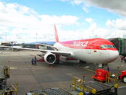
Colombia has well-developed air routes and an estimated total of 984 airports, 100 of which have paved runways, plus two heliports. Of the 74 main airports, 20 can accommodate jet aircraft. Two airports are more than 3,047 meters in length, nine are 2,438–3,047 meters, 39 are 1,524–2,437 meters, 38 are 914–1,523 meters, 12 are shorter than 914 meters, and 880 have unpaved runways. The government has been selling its stake in local airports in order to allow their privatization. The country has 40 regional airports, and the cities of Bogotá, Medellín, Cali, Barranquilla, Bucaramanga, Cartagena, Cucutá, Letícia, Pereira, San Andrés, and Santa Marta have international airports. Bogotá's El Dorado International Airport handles 350 million metric tons of cargo and 8 million passengers a year, making it the largest airport in Latin America in terms of cargo and the third largest in passenger numbers.
Urban transport
Urban transport systems have been developed in Bogotá and Medellín. Traffic congestion in Bogotá has been greatly exacerbated by the lack of rail transport. However, this problem has been alleviated somewhat by the development of the TransMilenioTransMilenio
TransMilenio is a bus rapid transit system that serves Bogotá, the capital of Colombia. The system opened to the public in December 2000, covering Av. Caracas and Calle 80...
Bus Rapid System and the restriction of vehicles through a daily, rotating ban
Pico y placa
Pico y placa is traffic congestion mitigation policy that was initially set in place in the year 2000 in Bogotá, Colombia by then mayor Enrique Peñalosa to help regulate traffic during rush hours. The system restricts vehicles with license plate numbers ending in certain digits from travelling...
on private cars depending on plate numbers. Bogotá's system consists of bus and minibus services managed by both private- and public-sector enterprises. Since 1995 Medellín has had a modern urban railway referred to as the Metro de Medellín
Metro de Medellín
The Medellín Metro is an urban train that crosses the Metropolitan Area of Medellín from North to South and from Centre to West. As one of the first experiences of modern mass transportation in Colombia and the only metro system in the country, the Medellín Metro is a product of the urban planning...
, which also connects with the cities of Itagüí, Envigado, and Bello. An elevated cable car system, Metrocable, was added in 2004 to link some of Medellín's poorer mountainous neighborhoods with the Metro de Medellín. A bus rapid-transit system called Transmetro, similar to Bogotá's TransMilenio, will begin operating in Barranquilla by late 2007. Cali's streets remain under construction as a new public-transit system called the Massive Integration of the West is being built.