

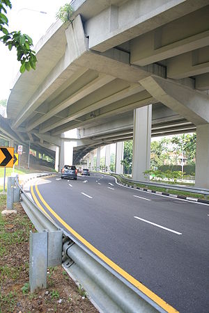
Thomson Road, Singapore
Encyclopedia

Road
A road is a thoroughfare, route, or way on land between two places, which typically has been paved or otherwise improved to allow travel by some conveyance, including a horse, cart, or motor vehicle. Roads consist of one, or sometimes two, roadways each with one or more lanes and also any...
linking Singapore
Singapore
Singapore , officially the Republic of Singapore, is a Southeast Asian city-state off the southern tip of the Malay Peninsula, north of the equator. An island country made up of 63 islands, it is separated from Malaysia by the Straits of Johor to its north and from Indonesia's Riau Islands by the...
's central business district
Central business district
A central business district is the commercial and often geographic heart of a city. In North America this part of a city is commonly referred to as "downtown" or "city center"...
with the northern suburban areas. Taking its name from John Turnbull Thomson
John Turnbull Thomson
John Turnbull Thomson was a British civil engineer and artist who played an instrumental role in the development of the early infrastructure of nineteenth century Singapore and New Zealand. -Biography:...
, a Scotsman
Scotland
Scotland is a country that is part of the United Kingdom. Occupying the northern third of the island of Great Britain, it shares a border with England to the south and is bounded by the North Sea to the east, the Atlantic Ocean to the north and west, and the North Channel and Irish Sea to the...
who was the Government Surveyor and Chief Engineer of the Straits Settlements
Straits Settlements
The Straits Settlements were a group of British territories located in Southeast Asia.Originally established in 1826 as part of the territories controlled by the British East India Company, the Straits Settlements came under direct British control as a crown colony on 1 April 1867...
from 1841 to 1853 and who helped build many roads into the interior of the island beyond the core of the city centre in the south.
Originally known as Seletar Road (the later of which is now the name of a small road off Yio Chu Kang Road in Seletar Hills Estate), it was known to the Chinese as Chia Chui Kang, literally meaning "freshwater stream" in reference to the Kallang River
Kallang River
The Kallang River flows for 10 kilometres from the Lower Peirce Reservoir to the coast at Nicoll Highway, making it the longest river in Singapore...
which crosses the road in its upper reaches near the traditional core area of present day Ang Mo Kio
Ang Mo Kio
Ang Mo Kio(宏茂桥) is a heartland new town located in north central Singapore, and is generally within the North-East Region. It contains many of the common features of the island nation's neighbourhoods, e.g. hawker centres, wet markets and HDB housing blocks. Singapore's Prime Minister, Lee Hsien...
. Thus, it was also known as Ang Kio Tau, meaning "head of the red bridge", the same bridge which may have given Ang Mo Kio its name. It also had a Tamil
Tamil language
Tamil is a Dravidian language spoken predominantly by Tamil people of the Indian subcontinent. It has official status in the Indian state of Tamil Nadu and in the Indian union territory of Pondicherry. Tamil is also an official language of Sri Lanka and Singapore...
name, Thanir Pilei Sadakku, literally meaning "water-pipe street".
Today, the road begins at a major road junction with Keng Lee Road, Kampong Java Road, Cavenagh Road and Norfolk Road, and leads northwards through the Novena
Novena, Singapore
Novena is a town in Singapore, and is within the Central Region. The area falls under the Novena Planning Area, an urban planning zone under the Urban Redevelopment Authority.It is served by the North South MRT Line at the Novena MRT Station....
residential area. It passes by Toa Payoh
Toa Payoh
Toa Payoh is a district located in the Central Region of Singapore. It commonly refers to the Housing and Development Board housing estate of Toa Payoh New Town, one of the earliest satellite public housing estates in Singapore....
before continuing on as Upper Thomson Road at the junction with Braddell Road
Outer Ring Road System
The Outer Ring Road System, or more commonly known as ORRS, is a network of major arterial roads in Singapore that forms a 'ring' along the towns outside the city. The ORRS is a semi-expressway, just like the West Coast Highway. Since 1994, roads along the ORRS have been upgraded in stages to...
and Lornie Road
Outer Ring Road System
The Outer Ring Road System, or more commonly known as ORRS, is a network of major arterial roads in Singapore that forms a 'ring' along the towns outside the city. The ORRS is a semi-expressway, just like the West Coast Highway. Since 1994, roads along the ORRS have been upgraded in stages to...
. It skims along the western edge of Bishan
Bishan
Bishan is a neighbourhood of the city-state of Singapore situated in the Central Region, measuring approximately three by three kilometres. Primarily a housing estate, Flats here are generally more expensive compared to other estates due to its location in the central region, which commands a...
and Ang Mo Kio
Ang Mo Kio
Ang Mo Kio(宏茂桥) is a heartland new town located in north central Singapore, and is generally within the North-East Region. It contains many of the common features of the island nation's neighbourhoods, e.g. hawker centres, wet markets and HDB housing blocks. Singapore's Prime Minister, Lee Hsien...
, then cuts through relatively undeveloped areas until it reaches the junction with Mandai Road
Mandai Road
Mandai Road is a heritage road located in Mandai in the northern area of Singapore. The road starts from Woodlands Road and ends at Upper Thomson Road. The road was built in 1855 in a jungle and appeared in the Franklin & Jackson Plan of Singapore as a river known as R. Mandi...
, where it continues northwards via Sembawang Road.
It is also the site of Saint Joseph Institution International, Ministry of Youth and many more.
This road also is affected with the North-South Expressway
North-South Expressway
The North–South Expressway is the longest expressway in Malaysia with the total length of running from Bukit Kayu Hitam in Kedah near the Malaysian-Thai border to Johor Bahru at the southern portion of Peninsular Malaysia and to Singapore...
construction.